Northshore Peak East Ridge Route in Lake Mead National Recreation Area

Lake Mead National Recreation Area, AZ · NV

Northshore Peak East Ridge Route

A short, exposed ridge scramble to fossil coral and lake views.

Length
2.6mi
Time
3hr
Elev. change
922ft
Difficulty
Challenging
  • High point 3,310 ft

Hear the audio tour

Northshore Summit: A Short Desert Panorama

Overview

About Northshore Peak East Ridge Route

Why go

  • Fossil corals on the summit block
  • Views across Lake Mead and several mountain ranges

Heads up

  • Off-trail route-finding from the road to the ridge
  • Exposed third-class scrambles with severe fall consequences

Map & elevation

The route

Loading the Lake Mead map
Full map
Elevation2,388–3,310 ft
TrailheadNorthshore Summit parking area, Northshore Road mile 20.636.22713, -114.62097
Keep this map with you offline in the Parkwolf app

Plan your hike

Before you go

Parking

Use the Northshore Summit parking area on Northshore Road at about mile 20.6. The East Ridge route starts by crossing the highway. This is within the park fee area; carry proof of admission. Accessible pit toilets are available, but there is no drinking water.

Safety

The approach is off-trail and the summit ridge has two short third-class downclimbs and one upclimb. Several exposed spots have severe or fatal fall consequences. There is no drinking water at the trailhead or along the route, and the open desert is hazardous in hot weather. Pet access is not established for this off-trail route; check with the park before bringing one.

4 active Lake Mead alerts

  • CautionHarmful algae bloom at Nelson’s Landing and Cottonwood CoveA harmful algae bloom has been confirmed in recent samples from Nelson’s Landing and Cottonwood Cove; avoid contact with water where algae is visible.Official details
  • CautionArizona Hot Springs bacteria advisoryLimit body contact with Arizona Hot Springs water: fecal bacteria in samples frequently reach high levels and can transmit human diseases.Official details
See all 4 alerts
A park ranger sits on a dash-mounted phone, talking, as Parkwolf’s Tour Guide plays “Army Cutworm Moths: A Grizzly Bear Buffet” on Grand Loop Road below Dunraven Pass in Yellowstone
Parkwolf Tour GuideThe highest, rockiest slopes around here are a summer buffet for grizzly bears.

Lake Mead Tour Guide

Your drive to Northshore Peak East Ridge Route, narrated.

Parkwolf is a GPS audio tour guide for Lake Mead National Recreation Area. As you drive, it chimes in with what’s ahead: hidden gems, upcoming stops, history, geology, and wildlife, right through your car’s speakers.

See the Lake Mead audio tour

Recorded for this trailhead

Northshore Summit: A Short Desert Panorama
0:00 / 0:26
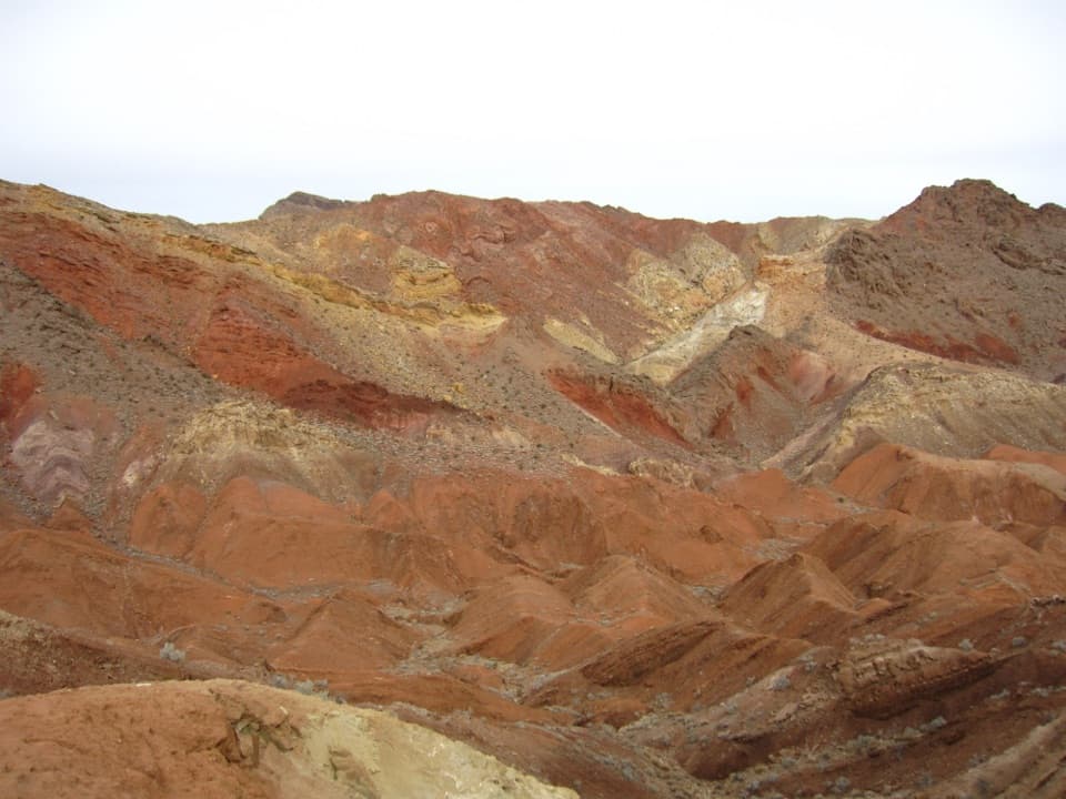
“You're coming up on Northshore Summit trailhead, a good choice for a short hike among the colored desert ridges. The loop is about six-tenths of a mile, but allow an hour for steep, loose ground and exposed summit edges.”

Plays as you drive up to this trailhead in the Parkwolf Lake Mead Tour Guide.

More stories near here in the app

  • The Flowers Waiting in the Soil
  • The Coot's Folding Feet
  • Razorback Wash: A One-Way Wilderness Hike
  • Mile 18.2: Hamblin Mountain
  • 153 audio storiesacross Lake Mead’s roads, triggered by GPS as you drive
  • Wildlife heatmapsfor Bighorn Sheep, Burro, Bald Eagle, and 13 more
  • Works offlinemaps, 42 trails, 70 places, and audio download before you lose signal
  • CarPlay readysimple controls built for the drive
★★★★★
“Fantastic app with many points of information… It’s great to just turn on while you’re driving and it gives you an audio tour of the national Park. We love it!!!!”
JMJamesApp Store review
Download Parkwolf on the App StoreGet Parkwolf on Google Play

4.7 from 8,600+ ratings

Trail guide

Hiking Northshore Peak East Ridge Route

What you’re taking onThe East Ridge is a 2.

The East Ridge is a 2.58-mile round-trip out-and-back from the Northshore Summit parking area to Northshore Peak. It crosses open desert, climbs a broad gully to the ridge, then follows an exposed crest to a 3,303-foot summit. This is an off-trail route, not a maintained path. Allow about three hours, with extra time to find your line and move carefully on steep rock. Choose it only if you’re comfortable route-finding and scrambling; the separate Northshore Summit Trail is a shorter, more straightforward one-mile round trip.

Find the east ridgeFrom the parking area, cross Northshore Road and climb the far roadcut.

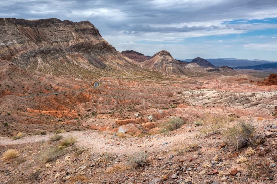
From the parking area, cross Northshore Road and climb the far roadcut. Head generally south across desert pavement, passing east of the small hill beside the highway. Washes can draw you toward the canyon west of the ridge toe; aim instead for the long, broad gully and the large cairn on the saddle. There is no continuous tread to follow on this approach, so use the route map and make sure you can identify the ridge before committing to it.

Three short scramblesFrom the cairn, climb steeply until the summit slopes ease.

From the cairn, climb steeply until the summit slopes ease. The final ridge has two short third-class downclimbs and one upclimb. A faint game trail on the south side can bypass the first downclimb, but it is easy to miss until you reach a knob above it. The moves are short, yet several spots have serious fall exposure: a slip on the wrong step can cause a fatal fall, and the scrambles themselves can cause injury. Turn around before the first downclimb if that terrain is outside your comfort zone.

A broad desert summitThe summit opens views across Lake Mead to Mount Wilson, west toward the Spring Mountains and…

The summit opens views across Lake Mead to Mount Wilson, west toward the Spring Mountains and Mount Charleston, east to the Virgin Mountains and Grand Wash Cliffs, and north toward the Sheep and Muddy Mountains. Look closely at the summit block: parts are carpeted with fossil corals. Leave them in place.

Start preparedThe parking area is in the park fee area; bring proof of admission.

The parking area is in the park fee area; bring proof of admission. Accessible pit toilets are at the trailhead, but there is no drinking water there or along the route. The open desert and exposed ridge make heat a serious factor, so plan for cooler hours in warm seasons. Park guidance allows leashed pets on hiking trails, but it does not clearly address this off-trail route; check before bringing a dog. The exposed scrambles are a poor fit for most pets.

Wildlife

Wildlife in Lake Mead

All Lake Mead wildlife maps

Sighting maps show where each species has been reported across Lake Mead. Wildlife moves, so no sighting is guaranteed.

Keep exploring

Near Northshore Peak East Ridge Route

See it all on the map

Trails that start nearby

Places near the trailhead

Parkwolf’s Lake Mead ranking

Top-rated trails in Lake Mead

All 42 trails
  1. 1Historic Railroad TrailEasy · 7.5 mi
  2. 2Anniversary Narrows TrailModerate · 5.8 mi
  3. 3Liberty Bell Arch TrailChallenging · 5.5 mi
  4. 4Arizona Hot Spring TrailChallenging · 5 mi
  5. 5Owl Canyon TrailModerate · 2.2 mi
  6. 6Fortification Hill TrailChallenging · 4 mi

Take Parkwolf to Lake Mead.

The audio tour guide for the drive, plus offline maps, trails, and wildlife heatmaps for when the signal drops.

4.7 from 8,600+ ratings

Download Parkwolf on the App StoreGet Parkwolf on Google Play