Parking
Start at the Sulphur Works parking area; the marked trailhead is on the north side near the restrooms.

Lassen Volcanic National Park, CA
A steep climb to two small lakes in a volcanic cirque.
Overview
Map & elevation
Plan your hike

The highest, rockiest slopes around here are a summer buffet for grizzly bears.
Lassen Volcanic Tour Guide
Parkwolf is a GPS audio tour guide for Lassen Volcanic National Park. As you drive, it chimes in with what’s ahead: hidden gems, upcoming stops, history, geology, and wildlife, right through your car’s speakers.
See the Lassen Volcanic audio tourRecorded for this trailhead
Sulphur Works: Boiling Mud Beside the Road“Sulphur Works is coming up, and this is the easy choice for seeing boiling mud without a hike. A paved, wheelchair-accessible sidewalk takes you past steam vents and yellow and orange mineral stains.”
Plays as you drive up to this trailhead in the Parkwolf Lassen Volcanic Tour Guide.
More stories near here in the app
“Fantastic app with many points of information… It’s great to just turn on while you’re driving and it gives you an audio tour of the national Park. We love it!!!!”


Trail guide
Ridge Lakes Trail is a 2.2-mile out-and-back from the Sulphur Works parking area to two small alpine lakes between Brokeoff Mountain and Mount Diller. It gains about 1,000 feet and reaches roughly 8,000 feet, so it feels strenuous despite its short mileage. Allow about 1.5 to 2 hours. Published totals range from 2.0 to 2.2 miles; plan for the longer figure. The marked start is on the north side of the parking area by the restrooms. The maintained hike ends at the lake basin; the rough cross-country climb beyond it is a separate outing.
The trail starts in open growth, with ferns, grasses and wildflowers, and early glimpses down toward Sulphur Works and Sulphur Creek. It climbs a ridge between two forks of West Sulphur Creek, then steepens through switchbacks in patches of forest and open slope. The path follows a ravine toward the basin. Lower open slopes are dotted with mule's ears, Indian paintbrush, lupine and ferns; red fir, western white pine and mountain hemlock shade parts of the climb. In the open sections, look back toward Brokeoff Mountain, Mount Diller and the Mill Creek drainage; on clear days, the Sierra Nevada is also visible. There is little level ground to recover on, so the return descent still takes care on the steep tread.
The destination is a pair of small lakes tucked into a basin between Brokeoff and Diller. The route reaches the lakes and turns back along the same corridor; it does not make a loop around the basin. The lakes sit in a glacial cirque, a bowl shaped by ice against the volcanic slopes. In some years, the water bodies remain joined into late summer. This is a compact destination, not a long lakeshore circuit, so leave time to pause before retracing the climb.
Sulphur Works, beside the trailhead, is a hydrothermal area near the old central vent of Mount Tehama. Water moving through hot rock returns to the surface as steam and bubbling mud. Brokeoff Mountain is the highest remaining fragment of the much larger volcanic edifice after glacial erosion. The hike connects that active-looking ground at its start with the older, ice-carved basin above.
Wildlife
 103 sightingsBlack BearMost seen around 7 PMSighting map
 44 sightingsBald EagleMost seen around 7 AMSighting map
 348 sightingsMule DeerMost seen around 7 PMSighting map
 17 sightingsSandhill CraneMost seen around 6 AMSighting map
 47 sightingsGreat Blue HeronMost seen around 7 AMSighting map
 12 sightingsGreat EgretMost seen around 7 AMSighting map
Sighting maps show where each species has been reported across Lassen Volcanic. Wildlife moves, so no sighting is guaranteed.
Keep exploring
 ModerateMill Creek Falls Trail3.7 mi · 2.8 hr · 0.8 mi awayA 75-foot waterfall rewards the repeated climbs.
 ChallengingBrokeoff Mountain Trail7.4 mi · 6 hr · 1.2 mi awayA steep summit climb with Lassen views and an ancient caldera.
 ModerateBumpass Hell Trail3 mi · 2 hr · 1.7 mi awayA steady first mile leads to a steaming basin boardwalk.
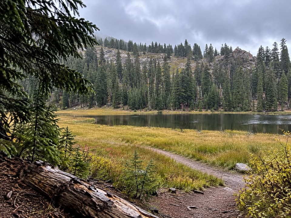 ModerateConard Meadows Shuttle Trail8 mi · 4.5 hr · 1.7 mi awayA shuttle links two lakes, Conard Meadows and a 75-foot waterfall.ChallengingTwin Meadows Shuttle Hike14.4 mi · 9 hr · 1.7 mi awayA faint, long downhill shuttle through high meadows and volcanic country.
 ChallengingLassen Peak Trail5 mi · 4.5 hr · 2.4 mi awayCinder slopes and ridge switchbacks reach a volcanic summit.
 EasyCrumbaugh Lake Trail2.6 mi · 1.5 hr · 2.8 mi awayTwo lakes, muted bubbles, and a meadow below Mount Conard.
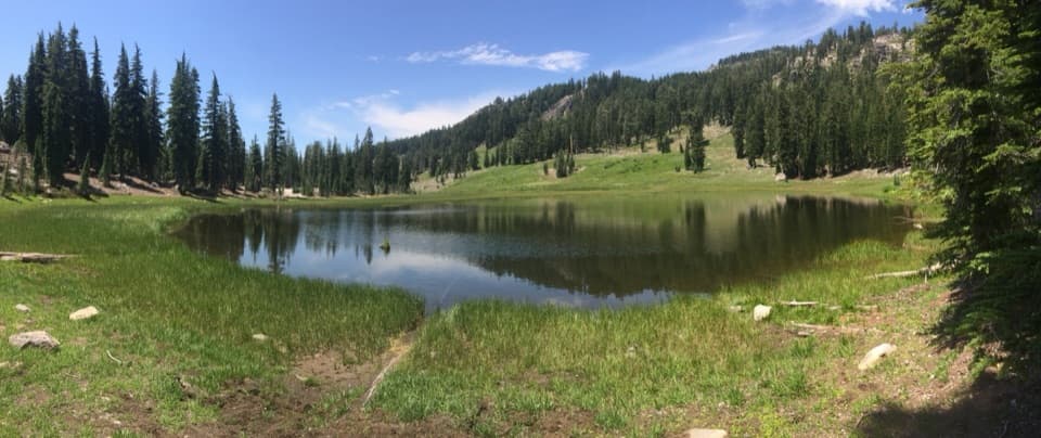 EasyCold Boiling Lake Trail1.6 mi · 54 min · 3.2 mi awayA short, mostly level walk to a lake that may still bubble.
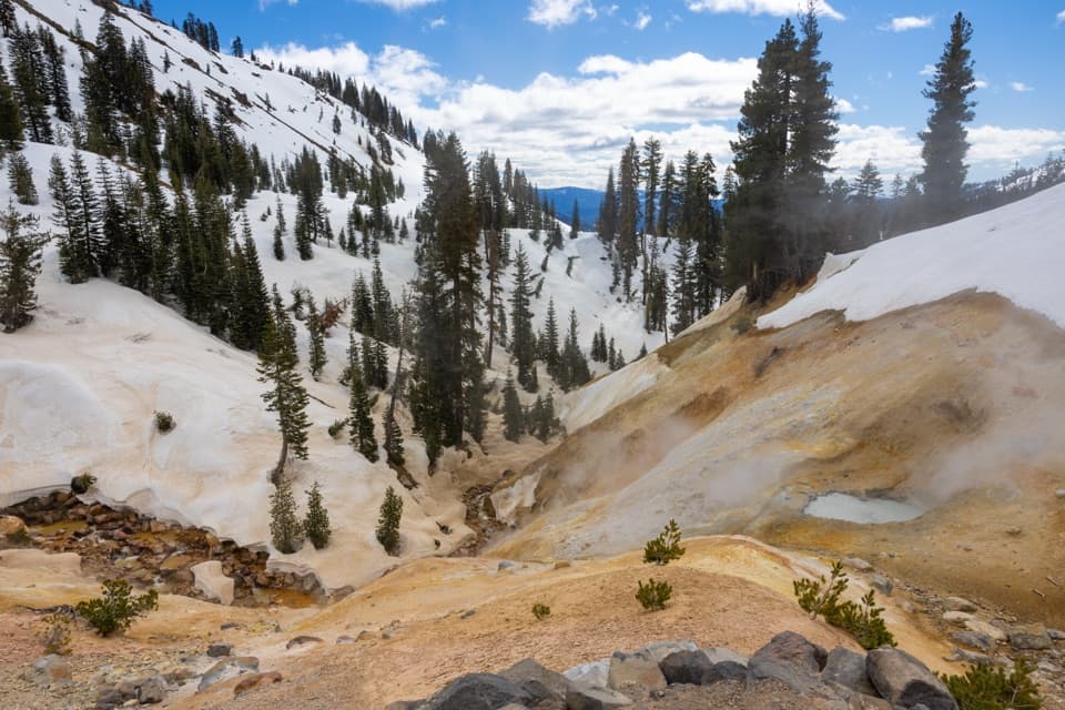 Sight · At the trailheadSulphur WorksColored mudpots and steam, just steps from the park highway.
 Food · 0.8 mi awayLassen Café & GiftA handy stop for sandwiches, espresso, and soft-serve.
 Visitor center · 0.8 mi awayKohm Yah-mah-nee Visitor CenterA 3-D geology map makes volcanic terrain clickSight · 0.8 mi awayRidge LakesTwo alpine lakes at the end of a short, steep climb.
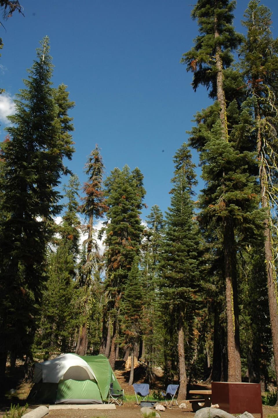 Campground · 0.8 mi awaySouthwest CampgroundWalk-in tents beside the visitor center; winter camping is vehicle-only.
 Scenic pullout · 0.9 mi awayDiamond Peak Scenic VistaA quick pullout for Lassen Peak and the creek valley.
 Entrance station · 0.9 mi awaySouthwest Entrance StationA quick first stop for passes and a park map.
 Scenic pullout · 0.9 mi awayLittle Hot Springs Valley OverlookBinoculars help reveal vents in the valley below.
Parkwolf’s Lassen Volcanic ranking

The audio tour guide for the drive, plus offline maps, trails, and wildlife heatmaps for when the signal drops.


