Parking
Start at Bumpass Hell Trailhead on Main Park Road; stage a second vehicle at Southwest Campground. The road shuttle between them is about 5.8 miles.
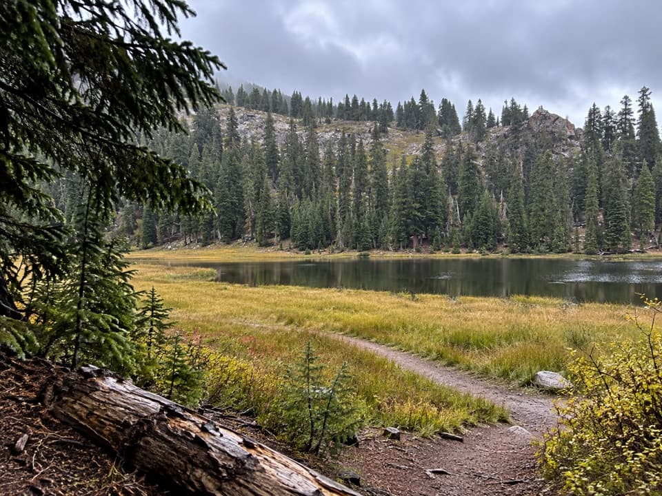
Lassen Volcanic National Park, CA
A shuttle links two lakes, Conard Meadows and a 75-foot waterfall.
Overview
Map & elevation
Plan your hike

The highest, rockiest slopes around here are a summer buffet for grizzly bears.
Lassen Volcanic Tour Guide
Parkwolf is a GPS audio tour guide for Lassen Volcanic National Park. As you drive, it chimes in with what’s ahead: hidden gems, upcoming stops, history, geology, and wildlife, right through your car’s speakers.
See the Lassen Volcanic audio tourRecorded for this area
Bumpass Hell and the Volcano Vista“You're approaching the Bumpass Hell trailhead, the starting point for Lassen's largest hydrothermal basin.”
Plays near this trailhead in the Parkwolf Lassen Volcanic Tour Guide.
More stories near here in the app
“Fantastic app with many points of information… It’s great to just turn on while you’re driving and it gives you an audio tour of the national Park. We love it!!!!”


Trail guide
Conard Meadows Shuttle Trail is an 8-mile, one-way point-to-point route from Bumpass Hell Trailhead to Southwest Campground. It links Bumpass Hell, Cold Boiling and Crumbaugh Lakes, Conard Meadows, and Mill Creek Falls. Allow about 4.5 hours on foot. The route trends downhill overall, but includes about 800 feet of climbing and a final rise after the falls. The hike map gives 8 miles; the mapped line in this record measures about 7.2, so treat the distance as approximate. Arrange a second vehicle at Southwest Campground before starting; the road shuttle between the ends is 5.8 miles on Main Park Road.
The first stretch follows the route through Bumpass Hell's hydrothermal basin. Stay on the established trail and boardwalk: thin ground crust can hide boiling, acidic water, and leaving the marked route is dangerous and unlawful. The trail through this basin is a summer-and-fall walk.
Cold Boiling Lake's name comes from gas bubbles rising near shore, but the activity is small and easy to miss. Grass and reeds edge the lake. From there the tread descends through forest and small flowered meadows to Crumbaugh Lake, then continues through more meadows below Mount Conard.
This is the open stretch to slow down for: tall grasses, wildflowers, and corn lilies spread across the meadow, with Mount Conard behind them. The park lists deer and birds among the wildlife visitors may spot along the corridor. When flowers are in bloom, frame Mount Conard across the grass for the clearest sense of the meadow's scale.
The trail drops steeply toward the falls, with dips and rises, narrow rocky sections, and creek crossings. Mill Creek Falls drops 75 feet where East Sulphur and Bumpass Creeks meet. Some viewpoints are partly screened by the surrounding slopes and trees, while the open hillside nearby looks toward Brokeoff Mountain and Mount Diller. After the falls, climb back toward the campground; the whole route isn't downhill.
Wildlife
 103 sightingsBlack BearMost seen around 7 PMSighting map
 44 sightingsBald EagleMost seen around 7 AMSighting map
 348 sightingsMule DeerMost seen around 7 PMSighting map
 17 sightingsSandhill CraneMost seen around 6 AMSighting map
 47 sightingsGreat Blue HeronMost seen around 7 AMSighting map
 12 sightingsGreat EgretMost seen around 7 AMSighting map
Sighting maps show where each species has been reported across Lassen Volcanic. Wildlife moves, so no sighting is guaranteed.
Keep exploring
 ChallengingTwin Meadows Shuttle Hike14.4 mi · 9 hr · At the trailheadA faint, long downhill shuttle through high meadows and volcanic country.ModerateBumpass Hell Trail3 mi · 2 hr · At the trailheadA steady first mile leads to a steaming basin boardwalk.
 ChallengingLassen Peak Trail5 mi · 4.5 hr · 0.7 mi awayCinder slopes and ridge switchbacks reach a volcanic summit.
 ChallengingRidge Lakes Trail2.2 mi · 1.8 hr · 1.7 mi awayA steep climb to two small lakes in a volcanic cirque.
 EasyCrumbaugh Lake Trail2.6 mi · 1.5 hr · 1.7 mi awayTwo lakes, muted bubbles, and a meadow below Mount Conard.
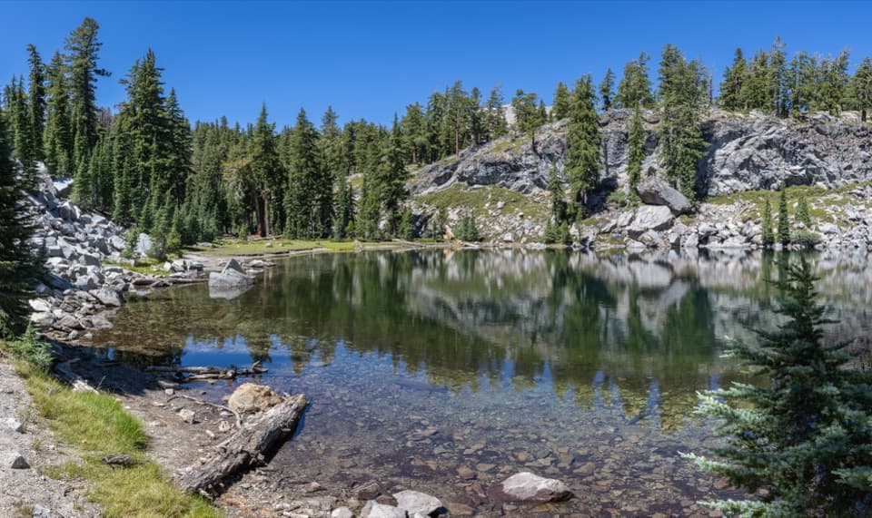 ModerateTerrace, Shadow, and Cliff Lakes Trail3.4 mi · 3 hr · 1.9 mi awayThree alpine lakes, a steep return, and Lassen Peak views.
 ModerateShadow Lake Shuttle Trail3.7 mi · 2.5 hr · 1.9 mi awayThree lakes, then a mostly downhill walk to Summit Lake
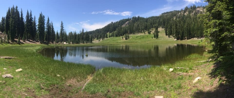 EasyCold Boiling Lake Trail1.6 mi · 54 min · 2 mi awayA short, mostly level walk to a lake that may still bubble.
 Scenic pullout · 0.1 mi awayBrokeoff Volcano VistaA glacial boulder below the rim of an ancient volcano.
 Sight · 0.2 mi awayEmerald LakeGreen water, rocky shore, and Lassen Peak in the same frame.
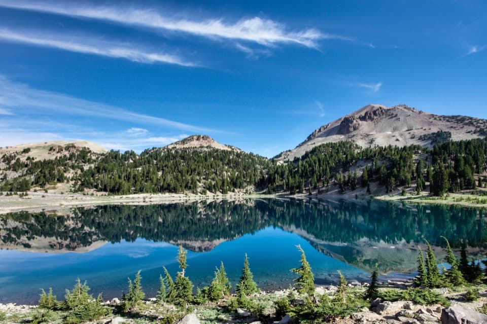 Sight · 0.3 mi awayLake HelenA blue alpine lake beneath Lassen Peak can stay icy into summer.
 Scenic pullout · 0.7 mi awayLassen Peak Scenic VistaA roadside portrait of Lassen Peak without the summit hike.
 Scenic pullout · 0.8 mi awayLittle Hot Springs Valley OverlookBinoculars help reveal vents in the valley below.
 Sight · 0.9 mi awayBumpass HellWalk boardwalks among bubbling pools and steaming vents in a 16-acre basin.
 Scenic pullout · 1.5 mi awayDiamond Peak Scenic VistaA quick pullout for Lassen Peak and the creek valley.
 Sight · 1.6 mi awayLassen PeakA strenuous summit climb on one of the world’s largest plug domes.
Parkwolf’s Lassen Volcanic ranking

The audio tour guide for the drive, plus offline maps, trails, and wildlife heatmaps for when the signal drops.



