Cinder Cone Trail in Lassen Volcanic National Park

#2 of 59 trails in Lassen Volcanic

Lassen Volcanic National Park, CA

Cinder Cone Trail

A steep cone climb, a rim loop, and the Painted Dunes

Photo: Wikimedia Commons
Length
4mi
Time
3hr
Elev. change
735ft
Difficulty
Challenging
  • No dogs
  • High point 6,864 ft

Hear the audio tour

Butte Lake and Cinder Cone

Overview

About Cinder Cone Trail

Why go

  • The summit joins the Painted Dunes, Fantastic Lava Beds and two volcanic peaks in one wide view.

Heads up

  • The loose, steep cinder climb is much harder than the shaded approach.

Map & elevation

The route

Loading the Lassen Volcanic map
Full map
Elevation6,129–6,864 ft
TrailheadCinder Cone Trailhead, Butte Lake Day Use Area40.56379, -121.30221
Keep this map with you offline in the Parkwolf app

Plan your hike

Before you go

Parking

Start at Cinder Cone Trailhead in the Butte Lake Day Use Area near the boat ramp. From Highway 44, follow the six-mile dirt-and-gravel Butte Lake Road; it is usually passable by passenger cars but can be dusty or rutted in midsummer. Parking is limited. A park pass or entrance-fee receipt is required. Restrooms are available; drinking water is seasonal with the adjacent campground. There is no food service or cell coverage in this remote area.

Safety

The final climb to the rim is steep on loose, sand-like cinders and exposed to sun; high-topped boots are advised. There is no water along the trail, and water at the nearby campground is seasonal. Stay on the marked path to avoid scarring the cinder landscape. Pets are prohibited on park trails.

1 active Lassen Volcanic alert

  • ClosureJuniper Lake campground and day-use area closedJuniper Lake Campground and day-use area are closed for maintenance and campground-improvement projects. - Potable water is unavailable in the campground.Official details
Lassen Volcanic alerts
A park ranger sits on a dash-mounted phone, talking, as Parkwolf’s Tour Guide plays “Army Cutworm Moths: A Grizzly Bear Buffet” on Grand Loop Road below Dunraven Pass in Yellowstone
Parkwolf Tour GuideThe highest, rockiest slopes around here are a summer buffet for grizzly bears.

Lassen Volcanic Tour Guide

Your drive to Cinder Cone Trail, narrated.

Parkwolf is a GPS audio tour guide for Lassen Volcanic National Park. As you drive, it chimes in with what’s ahead: hidden gems, upcoming stops, history, geology, and wildlife, right through your car’s speakers.

See the Lassen Volcanic audio tour

Recorded for this trailhead

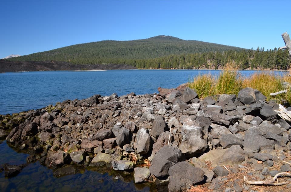
Butte Lake and Cinder Cone
0:00 / 0:35
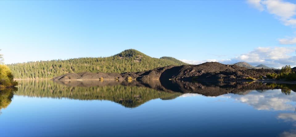
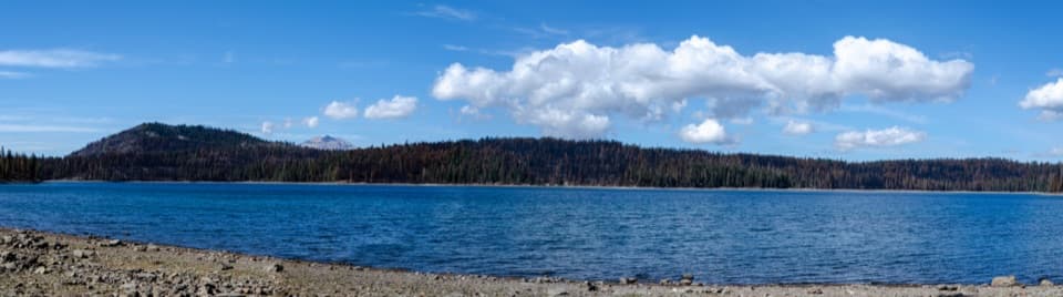
“You're nearing Butte Lake, where blue water meets rough black lava. Stop for a picnic, a swim, or a paddle in a canoe or kayak; motorboats aren't allowed.”

Plays as you drive up to this trailhead in the Parkwolf Lassen Volcanic Tour Guide.

More stories near here in the app

  • Lava That Built a Mountain
  • 45 audio storiesacross Lassen Volcanic’s roads, triggered by GPS as you drive
  • Wildlife heatmapsfor Black Bear, Bald Eagle, Mule Deer, and 13 more
  • Works offlinemaps, 59 trails, 56 places, and audio download before you lose signal
  • CarPlay readysimple controls built for the drive
★★★★★
“Fantastic app with many points of information… It’s great to just turn on while you’re driving and it gives you an audio tour of the national Park. We love it!!!!”
JMJamesApp Store review
Download Parkwolf on the App StoreGet Parkwolf on Google Play

4.7 from 8,600+ ratings

Trail guide

Hiking Cinder Cone Trail

Climb the cone, not just its baseCinder Cone Trail is a four-mile out-and-back from Butte Lake to the summit rim and back.

Cinder Cone Trail is a four-mile out-and-back from Butte Lake to the summit rim and back. Allow about three hours for 846 feet of elevation change, from roughly 6,061 feet at the trailhead to 6,907 feet at the top. The walk starts gently, but the final climb is steep on loose, sand-like cinders. If you want a shorter outing, the walk to the cone’s base and back is 2.4 miles; that skips the part that makes this hike unusual.

The approach follows an older roadFrom the boat-ramp day-use area, the route follows a forest trail beside the Fantastic Lava…

From the boat-ramp day-use area, the route follows a forest trail beside the Fantastic Lava Beds. This first stretch is mostly gradual, with Jeffrey pines giving intermittent shade and the rough, dark lava flow alongside. The cone appears as the trees thin. At about 1.2 miles, a fork at its base marks the start of the climb; the southward view here is the first look at the Painted Dunes. This approach follows a portion of the Nobles Emigrant Trail, one of the routes emigrants used to cross the area.

Up the loose cindersTake a pause in the pines before the climb.

Take a pause in the pines before the climb. The final ascent gains about 200 feet from the cone’s base, but it feels harder than that number suggests: your feet sink and slide on small, loose cinders, and the slope is exposed to sun. High-topped hiking boots are advised. Stay on the marked path; footprints off-trail leave scars in the fragile cinder surface.

Walk the rimThe mapped summit route reaches the top and circles the crater rim before turning back down the…

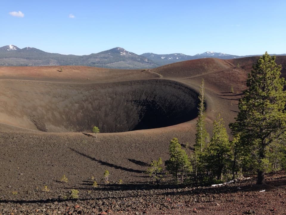
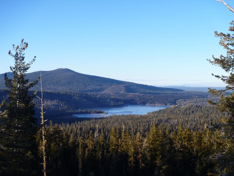
The mapped summit route reaches the top and circles the crater rim before turning back down the same climb and retracing the forest approach. From the rim, you can pick out Prospect Peak, Lassen Peak, Snag Lake, the Fantastic Lava Beds and the Painted Dunes. A separate path descends into the crater; that is an additional route choice, not part of the four-mile summit outing described here. The crater has a striking double rim, and you can see the contrast between its dark cinder slopes and the older forest below.

Why the dunes have colorCinder Cone is made of scoria, dark rock formed when gas-filled blobs of lava cooled in the air…

Cinder Cone is made of scoria, dark rock formed when gas-filled blobs of lava cooled in the air and fell back around the vent. There are actually two cones: the older one is almost buried by the larger, younger cone. Blocks of red, cemented scoria from that older cone were carried into the Painted Dunes by lava flows. The colored ash also fell onto still-hot lava, which oxidized it into the reds and grays visible from above.

A young volcano with an old storyThe cone and nearby lava look so fresh that early visitors thought eruptions had happened in…

The cone and nearby lava look so fresh that early visitors thought eruptions had happened in the 1850s. Later geologic and tree-ring evidence places the eruptive sequence around A.D. 1630–1670. The summit’s double-rimmed crater probably reflects changing eruptive activity late in the cone’s formation. The Nobles route below is part of the California National Historic Trail; it was one of two emigrant routes through what is now the park.

Make the Butte Lake drive workThe trailhead is in the remote Butte Lake Day Use Area, reached from Highway 44 by six miles of…

The trailhead is in the remote Butte Lake Day Use Area, reached from Highway 44 by six miles of dirt-and-gravel road. Passenger cars usually manage it, but the road can be dusty or rutted in midsummer, has limited parking, and is not maintained in winter. The hiking season is roughly June through November. A park pass or entrance-fee receipt is required. Restrooms are available; potable water depends on the adjacent campground being open, and there are no other services or cell coverage in the area. Dogs are not allowed on park trails.

Frame the Painted DunesFor a summit photo, include the red-and-gray dunes and the dark Fantastic Lava Beds together.

For a summit photo, include the red-and-gray dunes and the dark Fantastic Lava Beds together. Their contrast is the clearest picture of how the cone reshaped this landscape, and the view opens up from the rim without leaving the trail.

Wildlife

Wildlife in Lassen Volcanic

All Lassen Volcanic wildlife maps

Sighting maps show where each species has been reported across Lassen Volcanic. Wildlife moves, so no sighting is guaranteed.

Keep exploring

Near Cinder Cone Trail

See it all on the map

Trails that start nearby

Places near the trailhead

Parkwolf’s Lassen Volcanic ranking

Top-rated trails in Lassen Volcanic

All 59 trails
  1. 1Lassen Peak TrailChallenging · 5 mi
  2. 3Bumpass Hell TrailModerate · 3 mi
  3. 4Brokeoff Mountain TrailChallenging · 7.4 mi
  4. 5Kings Creek Falls TrailModerate · 2.8 mi
  5. 6Manzanita Lake LoopEasy · 1.8 mi
  6. 7Devils Kitchen TrailModerate · 4.2 mi

Take Parkwolf to Lassen Volcanic.

The audio tour guide for the drive, plus offline maps, trails, and wildlife heatmaps for when the signal drops.

4.7 from 8,600+ ratings

Download Parkwolf on the App StoreGet Parkwolf on Google Play