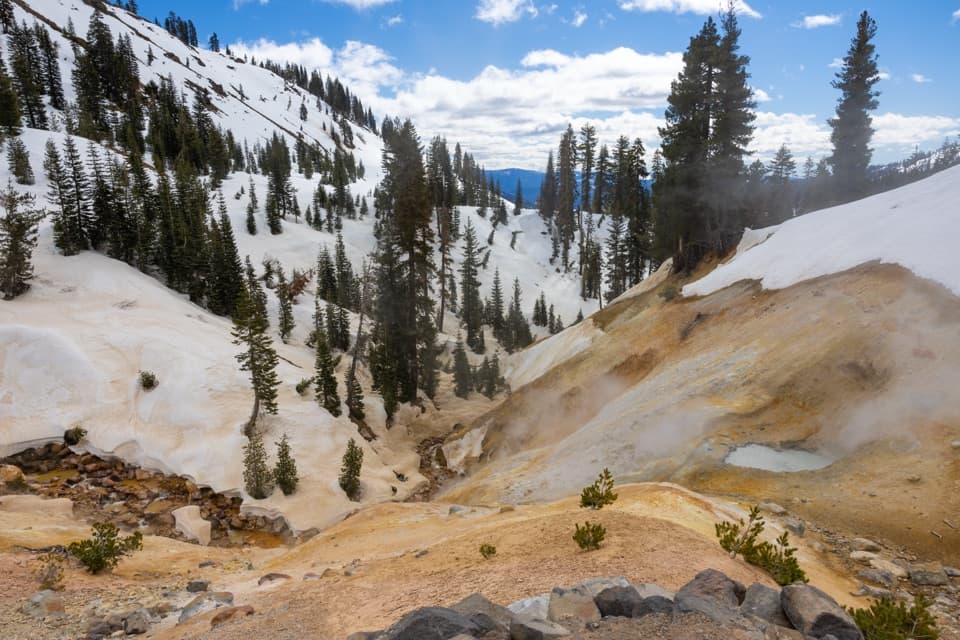
Brokeoff Mountain Trail in Lassen Volcanic National Park

#4 of 59 trails in Lassen Volcanic

Lassen Volcanic National Park, CA

Brokeoff Mountain Trail

A steep summit climb with Lassen views and an ancient caldera.

Photo: Wikimedia Commons
Length
7.4mi
Time
6hr
Elev. change
2,461ft
Difficulty
Challenging
  • No dogs
  • High point 9,117 ft

Hear the audio tour

Brokeoff Mountain: A Full-Day Climb

Overview

About Brokeoff Mountain Trail

Why go

  • A wide summit panorama into the old Brokeoff Volcano caldera.
  • The route changes from meadows and forest to exposed volcanic slopes.

Heads up

  • A sustained 2,600-foot climb at high elevation.
  • Limited parking and a steep, rugged upper trail.

Map & elevation

The route

Loading the Lassen Volcanic map
Full map
Elevation6,657–9,117 ft
TrailheadBrokeoff Mountain Trailhead40.43101, -121.53599
Keep this map with you offline in the Parkwolf app

Plan your hike

Before you go

Parking

Use the Brokeoff Mountain parking lot near the southwest entrance, then cross Lassen Peak Highway to the trail. Parking is limited. Park entrance fees apply, but the fee boundary at this particular lot is not clear; confirm before relying on it without a pass.

Safety

A strenuous high-elevation climb with steep, exposed upper terrain and loose volcanic sand. Snow can linger into mid-summer and sometimes August, obscuring the tread; snowmelt can also raise stream crossings. Check conditions before setting out.

1 active Lassen Volcanic alert

  • ClosureJuniper Lake campground and day-use area closedJuniper Lake Campground and day-use area are closed for maintenance and campground-improvement projects. - Potable water is unavailable in the campground.Official details
Lassen Volcanic alerts
A park ranger sits on a dash-mounted phone, talking, as Parkwolf’s Tour Guide plays “Army Cutworm Moths: A Grizzly Bear Buffet” on Grand Loop Road below Dunraven Pass in Yellowstone
Parkwolf Tour GuideThe highest, rockiest slopes around here are a summer buffet for grizzly bears.

Lassen Volcanic Tour Guide

Your drive to Brokeoff Mountain Trail, narrated.

Parkwolf is a GPS audio tour guide for Lassen Volcanic National Park. As you drive, it chimes in with what’s ahead: hidden gems, upcoming stops, history, geology, and wildlife, right through your car’s speakers.

See the Lassen Volcanic audio tour

Recorded for this trailhead

Brokeoff Mountain: A Full-Day Climb
0:00 / 0:25
“You're approaching the Brokeoff Mountain trailhead, where a strenuous climb earns views of Lassen Peak and Mount Shasta.”

Plays as you drive up to this trailhead in the Parkwolf Lassen Volcanic Tour Guide.

More stories near here in the app

  • Kohm Yah-mah-nee Visitor Center and Café
  • Sulphur Works: Boiling Mud Beside the Road
  • Diamond Peak Scenic Vista: Valley Views and Eagles
  • Little Hot Springs Valley: Vents and Spring Grass
  • 45 audio storiesacross Lassen Volcanic’s roads, triggered by GPS as you drive
  • Wildlife heatmapsfor Black Bear, Bald Eagle, Mule Deer, and 13 more
  • Works offlinemaps, 59 trails, 56 places, and audio download before you lose signal
  • CarPlay readysimple controls built for the drive
★★★★★
“Fantastic app with many points of information… It’s great to just turn on while you’re driving and it gives you an audio tour of the national Park. We love it!!!!”
JMJamesApp Store review
Download Parkwolf on the App StoreGet Parkwolf on Google Play

4.7 from 8,600+ ratings

Trail guide

Hiking Brokeoff Mountain Trail

A real summit half-dayBrokeoff Mountain Trail is a strenuous 7.

Brokeoff Mountain Trail is a strenuous 7.4-mile out-and-back from the parking lot near Lassen Volcanic’s southwest entrance to the 9,235-foot summit. Allow about six hours. The trail climbs roughly 2,600 feet from the 6,635-foot start, and the air gets thin near the top. This is a sustained mountain climb, not a quick viewpoint walk. If you have half a day and want a big peak hike, the payoff is a wide view into the old Brokeoff Volcano caldera and a ring of northern California summits.

From the highway into the forestThe path begins across Lassen Peak Highway from the parking area.

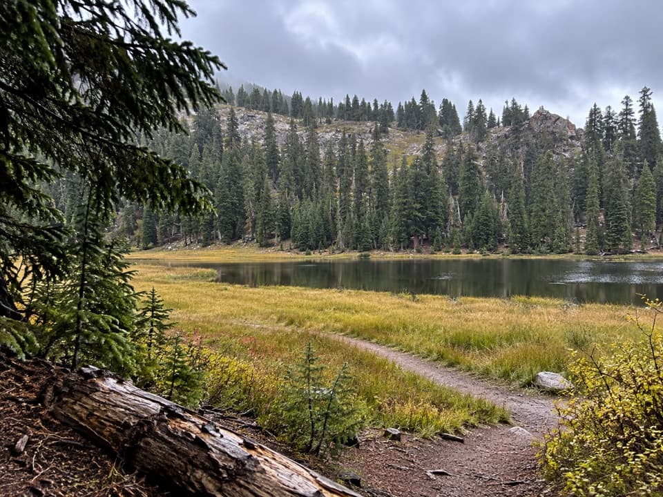
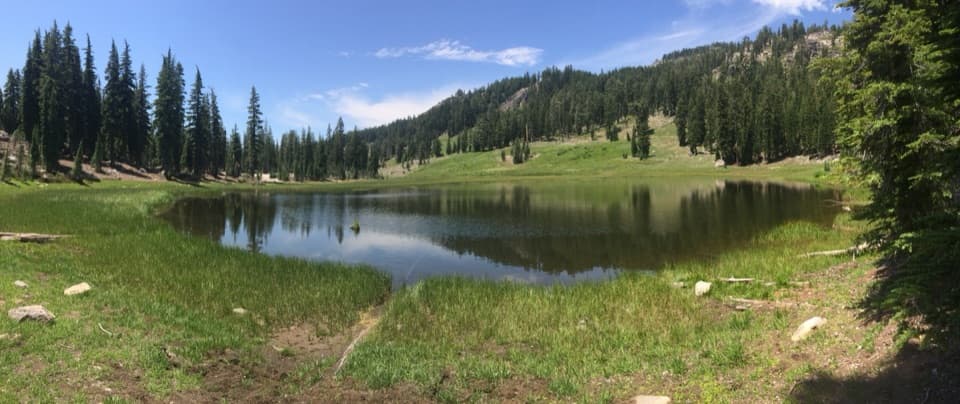
The path begins across Lassen Peak Highway from the parking area. For about two miles it gains steadily through open meadows and forest, with creeks and wetter ground along the lower slopes. The trees change as you climb: thicker forest gives way to scattered mountain hemlock, then the open upper mountain. The change in scenery is a good reason to take your time rather than charging straight for the summit.

The last climbThe steepest work comes late, as the trail leaves the trees for rugged volcanic ground.

The steepest work comes late, as the trail leaves the trees for rugged volcanic ground. Expect rocky outcrops and loose volcanic sand, with little shelter once you are above timberline. Stay on the path, especially where snow covers or hides the tread; cutting across soft slopes can turn a hard climb into a slow, awkward one. Before the final half-mile, the west side opens to Mount Shasta. The final switchback leads to the summit.

Look around from the topThe summit view takes in Lassen Peak, Mount Conard, Chaos Crags, Mount Diller, Mount Shasta,…

The summit view takes in Lassen Peak, Mount Conard, Chaos Crags, Mount Diller, Mount Shasta, and the surrounding high country. Brokeoff Mountain is the remnant of the much larger Brokeoff Volcano, also called Mount Tehama, and the summit gives you a clear look into its old caldera. For a photograph, keep some of the broken ridge in the foreground with Lassen Peak beyond it; a lone distant peak loses the scale of the old volcano’s rim.

Flowers, birds, and deerThe lower meadows flower earlier than the summit slopes: lower-elevation blooms peak around…

The lower meadows flower earlier than the summit slopes: lower-elevation blooms peak around July, while flowers near the top tend to peak around mid-August. The route crosses several vegetation zones, so the climb can pass from creekside greenery to sparse high-elevation plants in one outing. Deer are common, and juncos, chickadees, western tanagers, and flycatchers are among the birds seen in the area.

Make the access workUse the Brokeoff Mountain parking lot near the southwest entrance and cross the highway to the…

Use the Brokeoff Mountain parking lot near the southwest entrance and cross the highway to the trail. Parking is limited. Park entrance fees apply, but available information does not settle whether this specific lot is inside the fee boundary, so confirm before relying on it without a pass. There are no food or water stops identified along the hike; bring enough for a strenuous six-hour outing. The Kohm Yah-mah-nee Visitor Center is a separate stop with restrooms and water. Dogs are not allowed on park trails. Snow often lingers into mid-summer, sometimes into August, so check conditions before setting out.

Wildlife

Wildlife in Lassen Volcanic

All Lassen Volcanic wildlife maps

Sighting maps show where each species has been reported across Lassen Volcanic. Wildlife moves, so no sighting is guaranteed.

Keep exploring

Near Brokeoff Mountain Trail

See it all on the map

Trails that start nearby

Places near the trailhead

Parkwolf’s Lassen Volcanic ranking

Top-rated trails in Lassen Volcanic

All 59 trails
  1. 1Lassen Peak TrailChallenging · 5 mi
  2. 2Cinder Cone TrailChallenging · 4 mi
  3. 3Bumpass Hell TrailModerate · 3 mi
  4. 5Kings Creek Falls TrailModerate · 2.8 mi
  5. 6Manzanita Lake LoopEasy · 1.8 mi
  6. 7Devils Kitchen TrailModerate · 4.2 mi

Take Parkwolf to Lassen Volcanic.

The audio tour guide for the drive, plus offline maps, trails, and wildlife heatmaps for when the signal drops.

4.7 from 8,600+ ratings

Download Parkwolf on the App StoreGet Parkwolf on Google Play