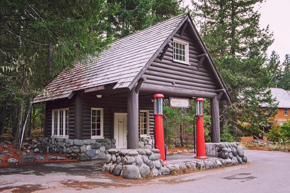
Nisqually Entrance in Mount Rainier National Park

Entrance station · Mount Rainier National Park

Nisqually Entrance

A cedar-log gateway with a century of park history.

Photo: Wikimedia Commons
Type
Entrance station
Nearest trail
2.9 mi
Audio stories
3 nearby

Hear the audio tour

Nisqually Entrance: The Cedar-Log Gateway

Overview

About Nisqually Entrance

Why stop

  • The rough-hewn arch makes a memorable park arrival.

Heads up

  • Entrance lines can slow the drive into the park.

Map

Where it is

Loading the Mount Rainier map
Full map
Entrance stationNisqually Entrance46.74101, -121.91661
Keep this map with you offline in the Parkwolf app

Plan your stop

Before you go

7 active Mount Rainier alerts

  • ClosureWildfire closures in the northern parkGrand Park 2 and Wonderland Complex fire closures affect trails, backcountry camps, and Sunrise access; stay out of closed areas.Official details
  • ClosureSR 165 bridge closed: no public access to Carbon River or Mowich LakeThe SR 165 Carbon River/Fairfax Bridge is closed to vehicles, bicycles, and pedestrians; there is no public access or alternate route to Carbon River or Mowich Lake.Official details
See all 7 alerts
A park ranger sits on a dash-mounted phone, talking, as Parkwolf’s Tour Guide plays “Army Cutworm Moths: A Grizzly Bear Buffet” on Grand Loop Road below Dunraven Pass in Yellowstone
Parkwolf Tour GuideThe highest, rockiest slopes around here are a summer buffet for grizzly bears.

Mount Rainier Tour Guide

Your drive to Nisqually Entrance, narrated.

Parkwolf is a GPS audio tour guide for Mount Rainier National Park. As you drive, it chimes in with what’s ahead: hidden gems, upcoming stops, history, geology, and wildlife, right through your car’s speakers.

See the Mount Rainier audio tour

Recorded for this place

Nisqually Entrance: The Cedar-Log Gateway
0:00 / 0:28
“You're approaching Nisqually Entrance, the southwest gateway toward Longmire and Paradise. At the fee booths, you can pick up a park map and newspaper if you'd like help planning your stops.”

Plays as you drive up to Nisqually Entrance in the Parkwolf Mount Rainier Tour Guide.

More stories near here in the app

  • Trees Above a Vanished Log
  • Ski Troops at Paradise
  • When Cars Were an Experiment
  • Kautz Creek: A Short Walk Through a Flood-Shaped Valley
  • 77 audio storiesacross Mount Rainier’s roads, triggered by GPS as you drive
  • Wildlife heatmapsfor Mountain Goat, Black Bear, Wolverine, and 13 more
  • Works offlinemaps, 99 trails, 87 places, and audio download before you lose signal
  • CarPlay readysimple controls built for the drive
★★★★★
“Fantastic app with many points of information… It’s great to just turn on while you’re driving and it gives you an audio tour of the national Park. We love it!!!!”
JMJamesApp Store review
Download Parkwolf on the App StoreGet Parkwolf on Google Play

4.7 from 8,600+ ratings

Guide

More about Nisqually Entrance

Start with the gatewayNisqually Entrance is Mount Rainier’s southwest gateway, a log arch and staffed fee station on…

Nisqually Entrance is Mount Rainier’s southwest gateway, a log arch and staffed fee station on SR 706 east of Ashford. It is the year-round way into Longmire and the park’s main approach to Paradise, so most visitors pass through on the way to somewhere else. Rangers at the booths collect the entrance fee and provide park information, a map, and the park newspaper. This is the park’s busiest entrance, and lines can build; arriving early gives you the best chance of moving through without a long wait.

Plan for the road beyondSR 706 from Nisqually to Longmire generally stays open through winter except in extreme weather.

SR 706 from Nisqually to Longmire generally stays open through winter except in extreme weather. Beyond Longmire, the road to Paradise closes overnight in winter, so a late arrival at the entrance does not guarantee a continuous drive up. For navigation, use 39000 State Route 706 E in Ashford; the park headquarters address routes somewhere else.

A gateway rebuilt over timeThe first log portal went up in 1911 after the Interior Department called for a rustic entrance.

The first log portal went up in 1911 after the Interior Department called for a rustic entrance. Four cedar-log columns, each nearly four feet across, supported beams over the road with 18½ feet of clearance. The arch standing today was built in 1973 as a reconstruction of the 1930s replacement of that original, then restored in 2005. Its rough-hewn logs are a good example of National Park Service Rustic design, which used natural materials to blend structures into their setting.

The entrance’s earlier lifeThe wider Nisqually entrance area served as park headquarters and the first ranger station…

The wider Nisqually entrance area served as park headquarters and the first ranger station until 1917. Nearby, the Oscar Brown Cabin dates to 1908 and is the oldest remaining government structure in the park; it served as a ranger residence and check-in station until 1926. The arch is the visitor-facing landmark, but the entrance area carries the story of the park’s earliest operations.

Frame the whole portalFor a photo, include the full timber opening, the park sign, and the curve of road beneath it;…

For a photo, include the full timber opening, the park sign, and the curve of road beneath it; a tight crop loses the sense of arrival. This is an active entrance road, so only stop where it is safe and permitted rather than pausing in a lane.

Wildlife

Wildlife in Mount Rainier

All Mount Rainier wildlife maps

Sighting maps show where each species has been reported across Mount Rainier. Wildlife moves, so no sighting is guaranteed.

Keep exploring

Near Nisqually Entrance

See it all on the map

Trails nearby

More stops nearby

Parkwolf’s Mount Rainier ranking

Top sights in Mount Rainier

All 87 places
  1. 1Reflection LakesSight
  2. 2Myrtle FallsSight
  3. 3Panorama PointSight
  4. 4Narada FallsSight
  5. 5Tipsoo LakeSight
  6. 6Sunrise Point OverlookSight

Take Parkwolf to Mount Rainier.

The audio tour guide for the drive, plus offline maps, trails, and wildlife heatmaps for when the signal drops.

4.7 from 8,600+ ratings

Download Parkwolf on the App StoreGet Parkwolf on Google Play