Kautz Creek Nature Trail in Mount Rainier National Park

Mount Rainier National Park, WA

Kautz Creek Nature Trail

A short boardwalk turns a mudflow scar into a forest story.

Photo: National Park Service
Length
0.2mi
Time
18min
Elevation
Flat
Difficulty
Easy
  • Loop
  • No dogs
  • High point 2,416 ft

Hear the audio tour

Kautz Creek: A Short Walk Through a Flood-Shaped Valley

Overview

About Kautz Creek Nature Trail

Why go

  • An easy boardwalk with clear flood and forest-recovery exhibits
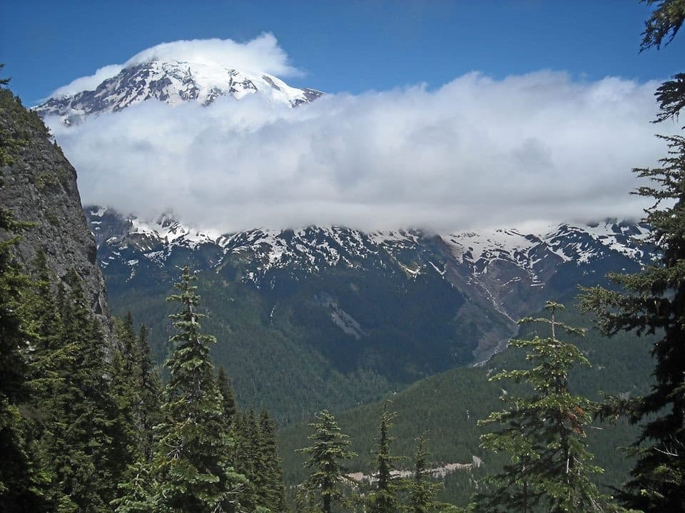
  • Mount Rainier overlook a few minutes from the parking area

Heads up

  • You must cross the park road at the start
  • Very short if you want a longer hike

Map & elevation

The route

Loading the Mount Rainier map
Full map
Elevation2,409–2,416 ft
TrailheadKautz Creek parking area46.73598, -121.85583
Keep this map with you offline in the Parkwolf app

Plan your hike

Before you go

Parking

Use the Kautz Creek parking area on Nisqually–Longmire Road, about three miles southeast of Nisqually Entrance and three miles west of Longmire. Cross the road at the marked crosswalk to reach the boardwalk. The park lists vault restrooms, benches, and picnic tables at the area.

Safety

Cross Nisqually–Longmire Road at the marked crosswalk. Debris flows and glacial outburst floods can occur without warning; after an earthquake or prolonged rumbling, move quickly at least 100 feet above the riverbed.

7 active Mount Rainier alerts

  • ClosureWildfire closures in the northern parkGrand Park 2 and Wonderland Complex fire closures affect trails, backcountry camps, and Sunrise access; stay out of closed areas.Official details
  • ClosureSR 165 bridge closed: no public access to Carbon River or Mowich LakeThe SR 165 Carbon River/Fairfax Bridge is closed to vehicles, bicycles, and pedestrians; there is no public access or alternate route to Carbon River or Mowich Lake.Official details
See all 7 alerts
A park ranger sits on a dash-mounted phone, talking, as Parkwolf’s Tour Guide plays “Army Cutworm Moths: A Grizzly Bear Buffet” on Grand Loop Road below Dunraven Pass in Yellowstone
Parkwolf Tour GuideThe highest, rockiest slopes around here are a summer buffet for grizzly bears.

Mount Rainier Tour Guide

Your drive to Kautz Creek Nature Trail, narrated.

Parkwolf is a GPS audio tour guide for Mount Rainier National Park. As you drive, it chimes in with what’s ahead: hidden gems, upcoming stops, history, geology, and wildlife, right through your car’s speakers.

See the Mount Rainier audio tour

Recorded for this trailhead

Kautz Creek: A Short Walk Through a Flood-Shaped Valley
0:00 / 0:34
“Kautz Creek is ahead, a quick stop where you can see how violently water has reshaped this valley.”

Plays as you drive up to this trailhead in the Parkwolf Mount Rainier Tour Guide.

More stories near here in the app

  • Twin Firs: A Short Walk Among Old Trees
  • Why Iron Mike Runs Rusty
  • Trees Above a Vanished Log
  • Ski Troops at Paradise
  • 77 audio storiesacross Mount Rainier’s roads, triggered by GPS as you drive
  • Wildlife heatmapsfor Mountain Goat, Black Bear, Wolverine, and 13 more
  • Works offlinemaps, 99 trails, 87 places, and audio download before you lose signal
  • CarPlay readysimple controls built for the drive
★★★★★
“Fantastic app with many points of information… It’s great to just turn on while you’re driving and it gives you an audio tour of the national Park. We love it!!!!”
JMJamesApp Store review
Download Parkwolf on the App StoreGet Parkwolf on Google Play

4.7 from 8,600+ ratings

Trail guide

Hiking Kautz Creek Nature Trail

A quick boardwalk walkKautz Creek Nature Trail is a very short out-and-back from the Kautz Creek parking area: cross…

Kautz Creek Nature Trail is a very short out-and-back from the Kautz Creek parking area: cross Nisqually–Longmire Road at the marked crosswalk, then follow a mostly flat boardwalk to an overlook of Mount Rainier. Allow about 0.15 mile round trip and 15–20 minutes if you stop at the exhibits. The park describes the boardwalk as approximately 0.10 mile long but does not say whether that includes the return; the mapped parking-to-overlook line measures about 0.073 mile each way. This is the interpretive nature walk, not the strenuous Kautz Creek backcountry route to Indian Henry’s Hunting Ground.

Cross the road and take your timeThe walkway is 5.5 feet wide and has two sloped sections.

The walkway is 5.5 feet wide and has two sloped sections. Start in the Kautz Creek parking area, use the marked crosswalk, and return by the same route after reading the waysides. It is a brief stop rather than a half-day hike. Pets are not allowed on Mount Rainier trails.

How the creek keeps changingThe panels explain how floods and glacier-fed debris flows reshape Kautz Creek, then leave a…

The panels explain how floods and glacier-fed debris flows reshape Kautz Creek, then leave a scar for vegetation to slowly fill. The creek shifted channels during the 2006 floods: the former channel lies west of the parking area, while the current creek crosses the road to its east. At the overlook, look across the rocky creek bed and recovering forest toward Mount Rainier. Debris flows and glacial outburst floods can happen without warning here; after an earthquake or prolonged rumbling, move quickly to ground at least 100 feet above the riverbed.

Wildlife

Wildlife in Mount Rainier

All Mount Rainier wildlife maps

Sighting maps show where each species has been reported across Mount Rainier. Wildlife moves, so no sighting is guaranteed.

Keep exploring

Near Kautz Creek Nature Trail

See it all on the map

Trails that start nearby

Places near the trailhead

Parkwolf’s Mount Rainier ranking

Top-rated trails in Mount Rainier

All 99 trails
  1. 1Wonderland TrailChallenging · 93 mi
  2. 2Skyline Trail LoopChallenging · 5.5 mi
  3. 3Mount Fremont Lookout TrailModerate · 5.6 mi
  4. 4Burroughs Mountain TrailModerate · 6.2 mi
  5. 5Summerland TrailModerate · 8.4 mi
  6. 6Naches Peak Loop TrailModerate · 3.5 mi

Take Parkwolf to Mount Rainier.

The audio tour guide for the drive, plus offline maps, trails, and wildlife heatmaps for when the signal drops.

4.7 from 8,600+ ratings

Download Parkwolf on the App StoreGet Parkwolf on Google Play