Doubtful Lake Trail in North Cascades National Park

North Cascades National Park, WA

Doubtful Lake Trail

An alpine lake spur tucked below Sahale Arm's glacier.

Photo: Public Domain
Length
9.7mi
Time
7.5hr
Elev. change
2,411ft
Difficulty
Challenging
  • No dogs
  • High point 6,030 ft
  • #33 of 88 in North Cascades

Hear the audio tour

Cascade Pass and Sahale Arm

Overview

About Doubtful Lake Trail

Why go

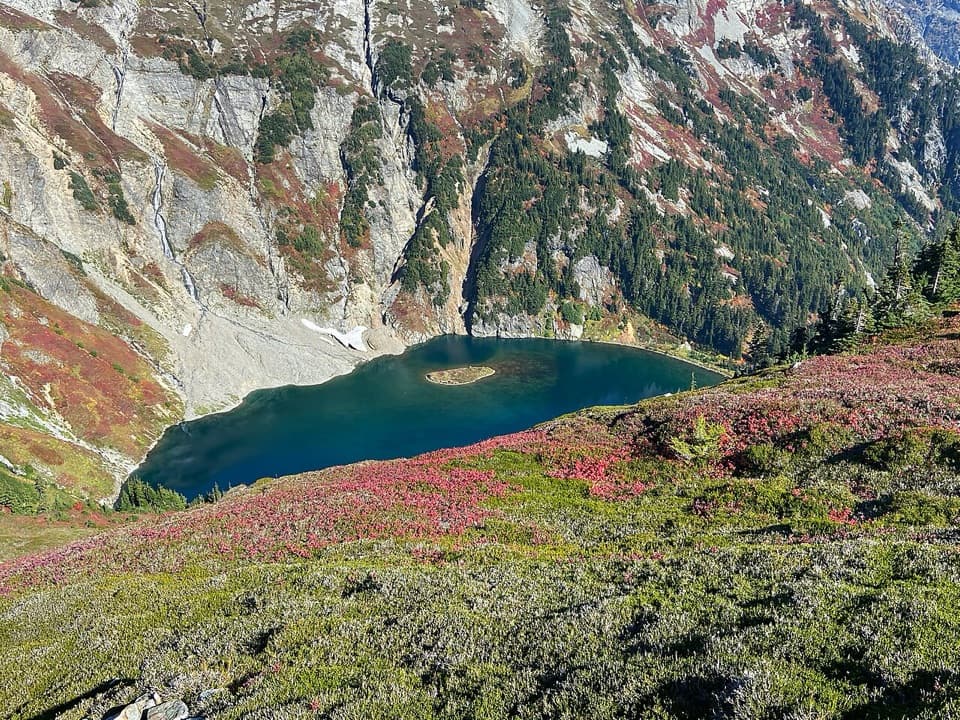
  • Reaches a striking island lake beneath Sahale Mountain.
  • Early-summer lilies, fall blueberries and marmots on the approach.

Heads up

  • A steep, demanding climb back from the lake.
  • The short lake spur has less route detail than the main pass trail.

Map & elevation

The route

Loading the North Cascades map
Full map
Elevation3,619–6,030 ft
TrailheadCascade Pass Trailhead48.47550, -121.07500
Keep this map with you offline in the Parkwolf app

Plan your hike

Before you go

Parking

Cascade Pass Trailhead, at the end of Cascade River Road, 23.1 miles from Marblemount. The first third is paved; the rest is gravel, with narrow and steep stretches near the end. The lot can fill on summer weekends. Check current road status before driving in.

Safety

The full hike climbs about 3,000 feet and includes a steep drop to the lake that must be climbed again on the return. Snow can linger on steep sections into July; the National Park Service warns an ice axe may be needed. Pets are prohibited. Overnight stays require a backcountry permit, and camping is allowed only at designated sites, not at Cascade Pass or Doubtful Lake.

7 active North Cascades alerts

  • ClosureWildfire closures and Stehekin fire advisoryWildfire-related closures remain in effect; stay out of all closed trails, camps, and areas.Official details
  • CautionCampfires banned across the park complexCampfires and other ash-producing fires are banned throughout the North Cascades National Park Service Complex.Official details
See all 7 alerts
A park ranger sits on a dash-mounted phone, talking, as Parkwolf’s Tour Guide plays “Army Cutworm Moths: A Grizzly Bear Buffet” on Grand Loop Road below Dunraven Pass in Yellowstone
Parkwolf Tour GuideThe highest, rockiest slopes around here are a summer buffet for grizzly bears.

North Cascades Tour Guide

Your drive to Doubtful Lake Trail, narrated.

Parkwolf is a GPS audio tour guide for North Cascades National Park. As you drive, it chimes in with what’s ahead: hidden gems, upcoming stops, history, geology, and wildlife, right through your car’s speakers.

See the North Cascades audio tour

Recorded for this trailhead

Cascade Pass and Sahale Arm
0:00 / 0:28
“You're approaching the Cascade Pass trailhead, where a steady forest climb leads to open meadows and glacier views.”

Plays as you drive up to this trailhead in the Parkwolf North Cascades Tour Guide.

More stories near here in the app

  • An Otter Underwater
  • Campfires Beneath the Ash
  • Reading a Hare's Tracks
  • A Nursery for the Mountains
  • 83 audio storiesacross North Cascades’s roads, triggered by GPS as you drive
  • Wildlife heatmapsfor Mountain Goat, Black Bear, Mule Deer, and 10 more
  • Works offlinemaps, 88 trails, 76 places, and audio download before you lose signal
  • CarPlay readysimple controls built for the drive
★★★★★
“Fantastic app with many points of information… It’s great to just turn on while you’re driving and it gives you an audio tour of the national Park. We love it!!!!”
JMJamesApp Store review
Download Parkwolf on the App StoreGet Parkwolf on Google Play

4.7 from 8,600+ ratings

Trail guide

Hiking Doubtful Lake Trail

Is this your hike?Doubtful Lake Trail is a 9.

Doubtful Lake Trail is a 9.7-mile out-and-back from Cascade Pass Trailhead, over Cascade Pass and up Sahale Arm before a steep half-mile drop to the lake. Allow about seven to eight hours and expect roughly 3,000 feet of total climbing. This is a hard day for hikers comfortable with sustained uphill walking and a steep return climb. The payoff is a dark alpine lake, a small island and a high cirque below Sahale Mountain. If you want the pass without the extra climb and descent, Cascade Pass alone is about 7.4 miles round trip.

From forest to Cascade PassThe first two miles climb through cool forest on switchbacks.

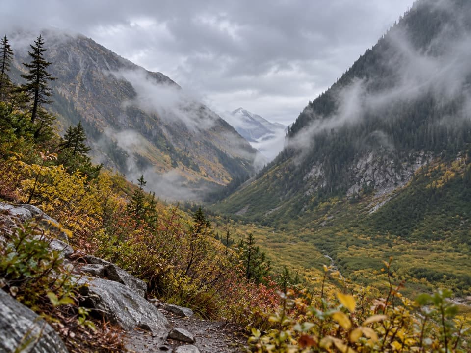
The first two miles climb through cool forest on switchbacks. Around mile three, the trees give way to meadows and the grade eases toward Cascade Pass, 3.7 miles from the trailhead. The pass opens views toward Eldorado, Johannesburg, Magic, Mixup and McGregor. Indigenous travelers used this crossing through the Cascades; fur trader Alexander Ross passed through in 1811, followed later by prospectors.

Up the Sahale ArmFrom the pass, take Sahale Arm north.

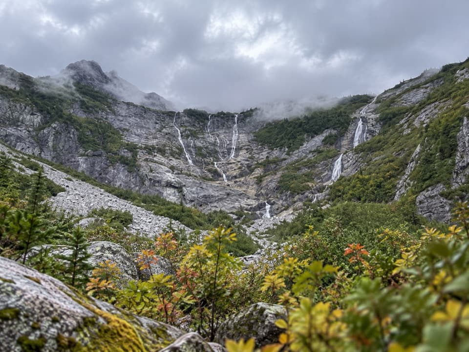
From the pass, take Sahale Arm north. The path climbs steeply through subalpine meadow and talus. About three-quarters of a mile later, it crests a rounded shoulder near 6,000 feet, where Sahale Mountain and its glacier come into view. The glacier sends bright meltwater ribbons down the slope toward the lake. The lake is hidden at first, then appears in peeks from the arm. Glacier lilies follow the snowmelt in early summer; mountain blueberries color the meadows in fall, and marmots are often about.

Down to the lakeThe lake spur leaves the arm about 0.

The lake spur leaves the arm about 0.8 mile beyond Cascade Pass, then drops roughly 700 feet in about half a mile to the shore. That short stretch is the steepest part of the day, and you'll climb it again on the way back. At the water, look for the little island below the gray cirque. The spur is less well described than the main pass trail, so be conservative if snow or poor visibility makes the line hard to read.

Access and rulesCascade River Road runs 23.

Cascade River Road runs 23.1 miles from Marblemount to the trailhead; its first third is paved, then it becomes gravel, with narrow and steep sections near the end. The road usually opens by late June, or early July in heavy-snow years. The shared trailhead can be busy on summer weekends. Pets aren't allowed. Overnight stays require a backcountry permit and camping is limited to designated sites; there is no camping at Cascade Pass or Doubtful Lake. Snow can linger on steep sections into July, when an ice axe may be needed.

Wildlife

Wildlife in North Cascades

All North Cascades wildlife maps

Sighting maps show where each species has been reported across North Cascades. Wildlife moves, so no sighting is guaranteed.

Parkwolf’s North Cascades ranking

Top-rated trails in North Cascades

All 88 trails
  1. 1Sahale Arm TrailChallenging · 11.8 mi
  2. 2Cascade Pass TrailModerate · 7.4 mi
  3. 3Heather–Maple Pass LoopChallenging · 7.2 mi
  4. 4Hidden Lake TrailChallenging · 9 mi
  5. 5Copper Ridge / Chilliwack River LoopChallenging · 33.5 mi
  6. 6Thunder Knob TrailModerate · 3.8 mi

Take Parkwolf to North Cascades.

The audio tour guide for the drive, plus offline maps, trails, and wildlife heatmaps for when the signal drops.

4.7 from 8,600+ ratings

Download Parkwolf on the App StoreGet Parkwolf on Google Play