Hidden Lake Trail in North Cascades National Park

#4 of 88 trails in North Cascades

North Cascades National Park, WA

Hidden Lake Trail

A steep climb to a tiny lookout above a hidden alpine lake.

Photo: Wikimedia Commons
Length
9mi
Time
8hr
Elev. change
3,346ft
Difficulty
Challenging
  • Dogs allowed
  • High point 6,749 ft

Hear the audio tour

Hidden Lake Lookout: Road Access

Overview

About Hidden Lake Trail

Why go

  • A striking progression from forest to flower meadows and bare alpine rock.
  • A historic summit lookout with broad North Cascades views.
  • The saddle gives an unforgettable first look at Hidden Lake.

Heads up

  • A sustained, steep climb with rough, hard-to-follow upper terrain.
  • The narrow access road and small lot call for a capable vehicle and careful parking.
  • Reaching the lake shore requires a separate, steep boulder scramble.

Map & elevation

The route

Loading the North Cascades map
Full map
Elevation3,402–6,749 ft
TrailheadHidden Lake Trailhead48.51419, -121.22192
Keep this map with you offline in the Parkwolf app

Plan your hike

Before you go

Parking

From Marblemount, take State Route 20 to mile 106 and cross the Skagit River bridge onto Cascade River Road. After 10.2 miles, turn left onto Sibley Creek Road (Forest Road 1540) and continue 4.5 miles to the small Hidden Lake Trailhead lot. The narrow gravel road is steep, rough and rutted, with few pullouts; high-clearance four-wheel drive is strongly recommended. Leave room for other vehicles to turn and exit.

Safety

Expect a hard sustained climb. Meadow tread is prone to slumps and mudslides; upper sections can disappear among talus and lingering snow, with cairns and route-finding needed. Snow may remain into late summer, and early-season travel to the lookout can require an ice axe and climbing experience. The lake shore is an unmaintained, steep half-mile boulder scramble from the saddle. No toilet is available at the trailhead and drinking water is not readily available. Leashed pets must turn back at the park boundary before the lake descent.

7 active North Cascades alerts

  • ClosureHidden Lake Road closed by washoutMentions this trailSibley Creek/Hidden Lake Road (USFS Road 1540) is closed because a large washout about two miles up the road blocks vehicle access to the Hidden Lake Trailhead.Official details
  • ClosureWildfire closures and Stehekin fire advisoryWildfire-related closures remain in effect; stay out of all closed trails, camps, and areas.Official details
See all 7 alerts
A park ranger sits on a dash-mounted phone, talking, as Parkwolf’s Tour Guide plays “Army Cutworm Moths: A Grizzly Bear Buffet” on Grand Loop Road below Dunraven Pass in Yellowstone
Parkwolf Tour GuideThe highest, rockiest slopes around here are a summer buffet for grizzly bears.

North Cascades Tour Guide

Your drive to Hidden Lake Trail, narrated.

Parkwolf is a GPS audio tour guide for North Cascades National Park. As you drive, it chimes in with what’s ahead: hidden gems, upcoming stops, history, geology, and wildlife, right through your car’s speakers.

See the North Cascades audio tour

Recorded for this trailhead

Hidden Lake Lookout: Road Access
0:00 / 0:33
“You're nearing the access road for Hidden Lake Lookout. Sibley Creek Road continues to the trailhead on rough, steep gravel, with high-clearance four-wheel drive strongly recommended.”

Plays as you drive up to this trailhead in the Parkwolf North Cascades Tour Guide.

More stories near here in the app

  • A Beaver's Cutting Edge
  • Hunting by Echo
  • A Woodpecker’s Sap Wells
  • Where the Cliff Comes Apart
  • 83 audio storiesacross North Cascades’s roads, triggered by GPS as you drive
  • Wildlife heatmapsfor Mountain Goat, Black Bear, Mule Deer, and 10 more
  • Works offlinemaps, 88 trails, 76 places, and audio download before you lose signal
  • CarPlay readysimple controls built for the drive
★★★★★
“Fantastic app with many points of information… It’s great to just turn on while you’re driving and it gives you an audio tour of the national Park. We love it!!!!”
JMJamesApp Store review
Download Parkwolf on the App StoreGet Parkwolf on Google Play

4.7 from 8,600+ ratings

Trail guide

Hiking Hidden Lake Trail

A full day above Hidden LakeHidden Lake Trail 745 is a steep out-and-back from the end of Sibley Creek Road to the historic…

Hidden Lake Trail #745 is a steep out-and-back from the end of Sibley Creek Road to the historic lookout on Hidden Lake Peak. Published totals range from 8 to 9 miles round trip; the mapped trail corridor measures about 3.9 miles one way, so plan for the longer figure. Reported climbing also varies, from about 2,900 to 3,300 feet. Allow around eight hours with breaks. The reward is a real change of scenery: forest, flower meadows, high granite slopes, then a small lookout above the lake. The standard route ends at the lookout; reaching the lake shore takes a separate, off-trail boulder scramble below the saddle.

Sort out the access firstFrom Marblemount, follow State Route 20 to mile 106 and cross the Skagit River bridge onto…

From Marblemount, follow State Route 20 to mile 106 and cross the Skagit River bridge onto Cascade River Road. After 10.2 miles, turn left onto Sibley Creek Road, Forest Road 1540, and continue 4.5 miles to the small trailhead lot. The gravel road is narrow, steep and rough, with washboards, ruts and few pullouts; a high-clearance four-wheel-drive vehicle is strongly recommended. Leave enough space for other vehicles to turn and get out. There is no toilet at the trailhead, and drinking water is not readily available, so bring what you need from the start.

Through the forest and meadowsThe first mile climbs through forest, with runoff streams crossing or following the tread,…

The first mile climbs through forest, with runoff streams crossing or following the tread, before the trail crosses Sibley Creek. It then switchbacks up open avalanche slopes and flower meadows. This is the greenest part of the hike: look for cow parsnip, false hellebore and fireweed in season. The tread here has a history of slumps and mudslides, so stay on the main path rather than cutting through the flowers. A second, higher creek crossing opens a backward view toward Mount Baker.

The high traverseAfter the second crossing, the grade eases for a while as the path winds among angular granite…

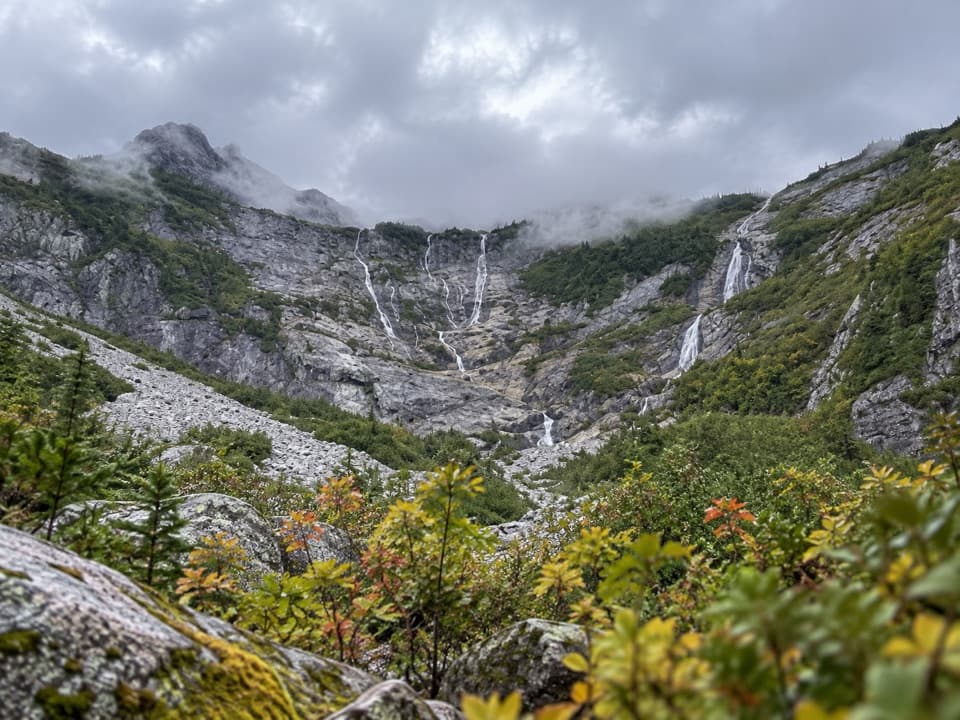
After the second crossing, the grade eases for a while as the path winds among angular granite slabs, subalpine fir, heather and huckleberry. Little creeklets thread the slope, and the skyline opens to peaks including Mount Baker, Mount Shuksan and Eldorado. The meadow display is strongest in early summer; huckleberries ripen later. Near the summit, the trail turns into bare rock and a snow-holding gully. Sections of tread can disappear among rock and lingering snow, so keep track of cairns and visible trail. Snow can last into late summer; in early season, reaching the lookout may call for an ice axe, climbing experience and confident route-finding.

Stop at the saddle or continueAt roughly 6,500 to 6,600 feet, the saddle gives the first view of deep-blue Hidden Lake,…

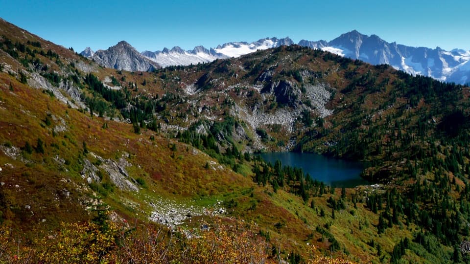
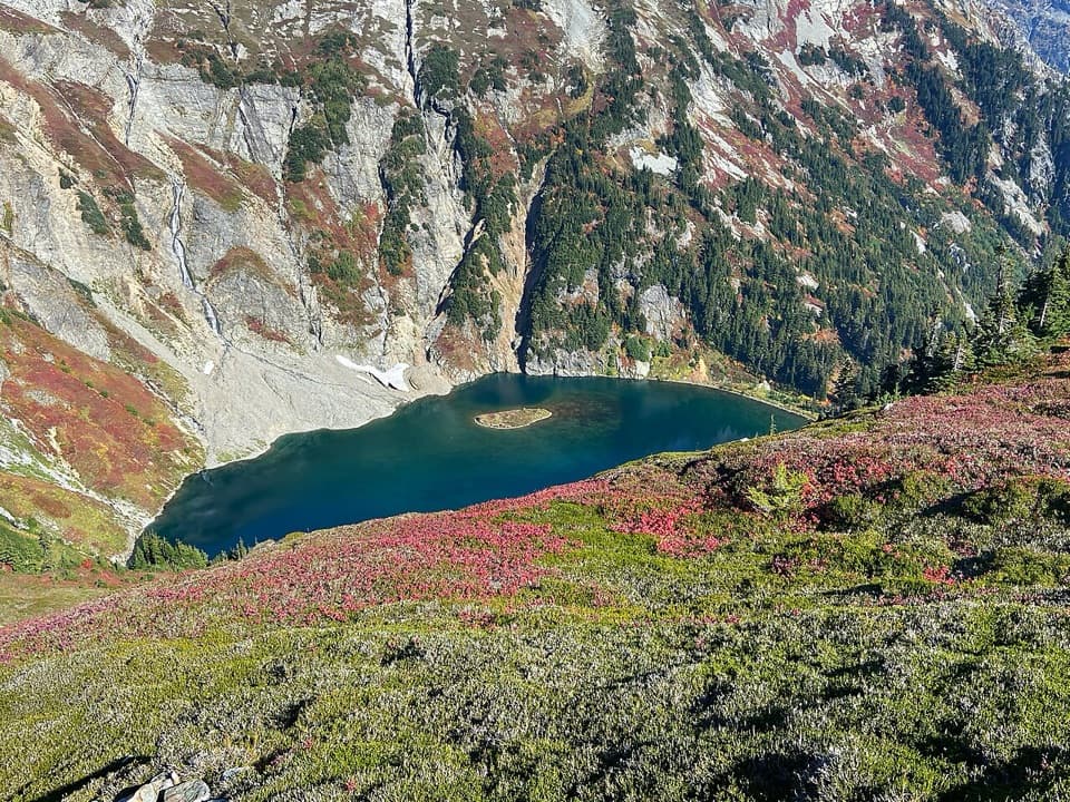
At roughly 6,500 to 6,600 feet, the saddle gives the first view of deep-blue Hidden Lake, tucked below the ridge, with Forbidden, Boston and Sahale peaks and Quien Sabe Glacier beyond. The lake can still have ice well into summer. The shore is a separate, steep half-mile boulder scramble each way with no trail; it is not part of the standard hike, and turning around at the saddle is a sensible choice. Pets may accompany hikers on leash to the lookout, but must not continue past the park boundary down toward the lake. An overnight stay on the park side requires a backcountry permit.

The lookoutFrom the saddle, the lookout is about another half mile and 300 feet up a narrow, rocky path…

From the saddle, the lookout is about another half mile and 300 feet up a narrow, rocky path marked by blazes and cairns. Take your time on the broken slope; the cabin sits on a granite pinnacle and the trail is informal near the top. Built in 1931, it was retired from fire service decades ago and remains open to visitors through volunteer stewardship. Its wide summit view is the payoff for the climb; from the saddle, include the lake below with the peaks behind it, or at the top frame the small cabin against the surrounding ridges. The cabin is also used overnight on a first-come basis, so hikers planning to stay should be ready to share it.

Wildlife

Wildlife in North Cascades

All North Cascades wildlife maps

Sighting maps show where each species has been reported across North Cascades. Wildlife moves, so no sighting is guaranteed.

Parkwolf’s North Cascades ranking

Top-rated trails in North Cascades

All 88 trails
  1. 1Sahale Arm TrailChallenging · 11.8 mi
  2. 2Cascade Pass TrailModerate · 7.4 mi
  3. 3Heather–Maple Pass LoopChallenging · 7.2 mi
  4. 5Copper Ridge / Chilliwack River LoopChallenging · 33.5 mi
  5. 6Thunder Knob TrailModerate · 3.8 mi
  6. 7Trail of the Cedars Nature WalkEasy · 0.5 mi

Take Parkwolf to North Cascades.

The audio tour guide for the drive, plus offline maps, trails, and wildlife heatmaps for when the signal drops.

4.7 from 8,600+ ratings

Download Parkwolf on the App StoreGet Parkwolf on Google Play