Parking
Parking is available in Newhalem near the end of Main Street, across from the Gorge Inn; cross the foot suspension bridge to reach the loop. A second access is from the service road east of Loop C at Newhalem Creek Campground.
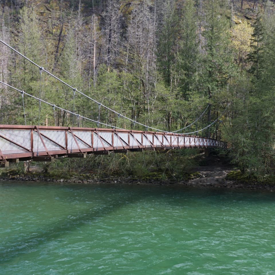
#7 of 88 trails in North Cascades
North Cascades National Park, WA
Cross the suspension bridge for an easy old-growth river loop.
Overview
Map & elevation
Plan your hike

The highest, rockiest slopes around here are a summer buffet for grizzly bears.
North Cascades Tour Guide
Parkwolf is a GPS audio tour guide for North Cascades National Park. As you drive, it chimes in with what’s ahead: hidden gems, upcoming stops, history, geology, and wildlife, right through your car’s speakers.
See the North Cascades audio tourRecorded for this trailhead
Historic Newhalem: Fudge, a Steam Engine and Cedars“You're coming up on historic Newhalem, a company town built for the Skagit hydroelectric project. Make this a stop for a treat and a wander.”
Plays as you drive up to this trailhead in the Parkwolf North Cascades Tour Guide.
More stories near here in the app
“Fantastic app with many points of information… It’s great to just turn on while you’re driving and it gives you an audio tour of the national Park. We love it!!!!”


Trail guide
Trail of the Cedars Nature Walk is an easy, roughly half-mile loop through old-growth forest beside the Skagit River. Cross the suspension bridge from Newhalem, follow the river-side path to the Newhalem Creek Powerhouse, then return on the inner forest path. Allow about 30 minutes if you stop at the interpretive signs. The park’s trail inventory lists a shorter 0.3-mile loop; this map follows the fuller bridge-to-powerhouse loop described in its family-hike directions.
Take the river-side path first, then turn back toward the bridge on the other side of the loop. The gravel tread is easy walking, with benches and interpretive stops. This is a small nature walk, not a mountain hike; the payoff is the change from riverbank to deep shade and back.
The towering western red cedars are the reason to slow down. The older trees escaped logging before the park was established, and signs point out plants and animals along the route. As the path rounds the loop, the canopy opens among snags left by the 2015 Goodell Creek Fire, a sharp contrast with the shaded grove.
The town-side approach is at the end of Main Street in Newhalem, where you cross the foot suspension bridge to the trail. The park also lists access from the service road east of Loop C in Newhalem Creek Campground. The bridge can bounce; wheelchair users may want assistance crossing even though the loop itself is described as wheelchair-friendly. Pets are not allowed on park trails; service animals are permitted.
Wildlife
 101 sightingsMountain GoatMost seen around 6 PMSighting map
 70 sightingsBlack BearMost seen around 8 PMSighting map
 20 sightingsMule DeerMost seen around 7 PMSighting map
 77 sightingsSooty GrouseMost seen around 6 AMSighting map
 23 sightingsWhite-tailed PtarmiganMost seen around 6 PMSighting map
 75 sightingsWestern ToadMost seen around 8 PMSighting map
Sighting maps show where each species has been reported across North Cascades. Wildlife moves, so no sighting is guaranteed.
Keep exploring
 EasyLadder Creek Falls Trail0.5 mi · 30 min · 0.3 mi awayA half-mile waterfall loop with a hydroelectric past.
 EasyRock Shelter Trail0.6 mi · 30 min · 0.4 mi awayA short accessible walk to a 1,400-year-old hunting camp.
 EasyLower Newhalem Creek Trail0.6 mi · 30 min · 0.5 mi awayCreekside walk to a cedar glade still finding its way back.
 EasyTo Know a Tree Nature Trail1 mi · 45 min · 0.7 mi awayTree signs turn this easy riverside walk into a small nature lesson.
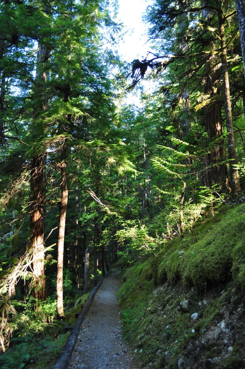 EasyRiver Loop Trail1.8 mi · 45 min · 1 mi awayA forest loop to a gravel bar with broad Skagit River views.
 EasySterling Munro Trail0.2 mi · 12 min · 1 mi awayA brief wooden walk opens onto a Picket Range viewpoint.
 EasyGorge Overlook Trail0.5 mi · 45 min · 2.6 mi awayA short loop with a lake, a dam and a waterfall view.
 ChallengingThornton Lakes Trail9.1 mi · 6 hr · 3.8 mi awayA proper alpine lake waits beyond the long forest climb.
 Sight · 0.1 mi awayGorge InnA 1925 cookhouse puts the Skagit dams' human story on display.
 Store · 0.1 mi awaySkagit General StoreA working 1922 company store with fudge and camp supplies.
 Visitor center · 0.1 mi awaySkagit Information CenterHydroelectric history and local help on the road through Newhalem.
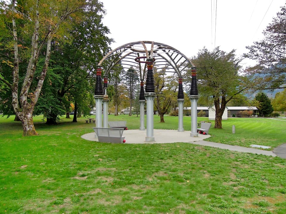 Sight · 0.1 mi awayTemple of PowerA gazebo built from hardware that once helped power Seattle.
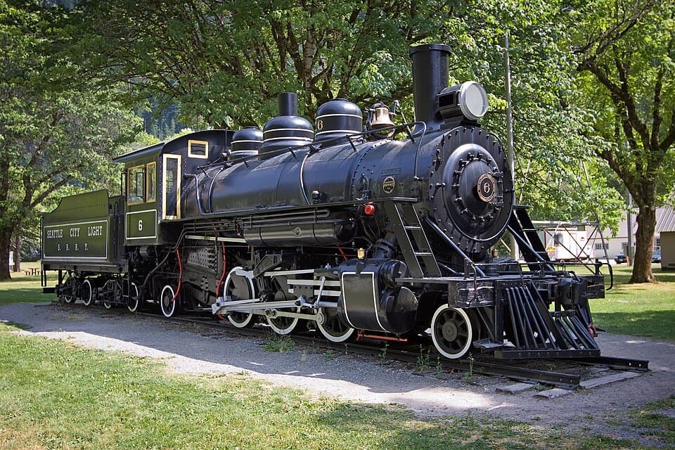 Sight · 0.1 mi awayOld Number Six LocomotiveClimb into an old steam engine and ring its brass bell.
 Sight · 0.2 mi awayNewhalem Creek PowerhouseA 1921 powerhouse that helped build Newhalem and Gorge Dam.
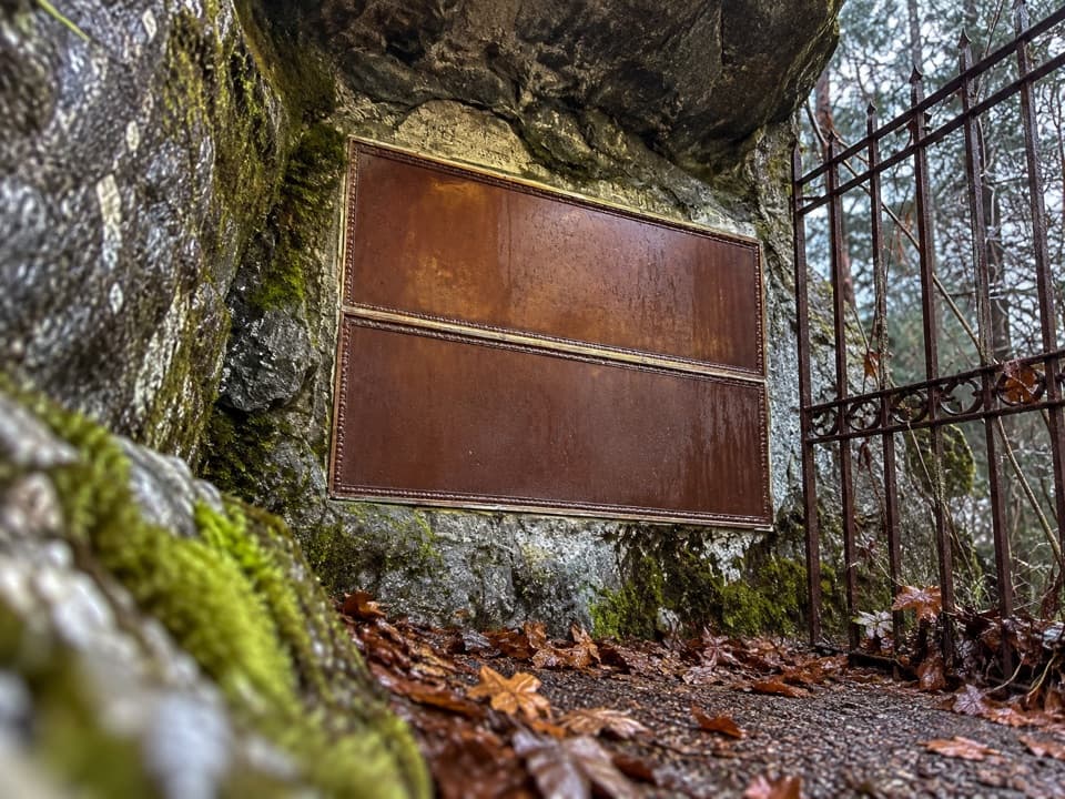 Sight · 0.3 mi awayRoss CryptA short memorial to J.D. Ross, the man behind Seattle’s Skagit Project.
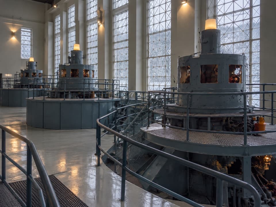 Sight · 0.4 mi awayGorge Powerhouse Visitor GallerySee the Skagit Project’s generators from inside the powerhouse.
Parkwolf’s North Cascades ranking

The audio tour guide for the drive, plus offline maps, trails, and wildlife heatmaps for when the signal drops.




