Beggar's Bridge in North York Moors National Park

Sight · North York Moors National Park

Beggar's Bridge

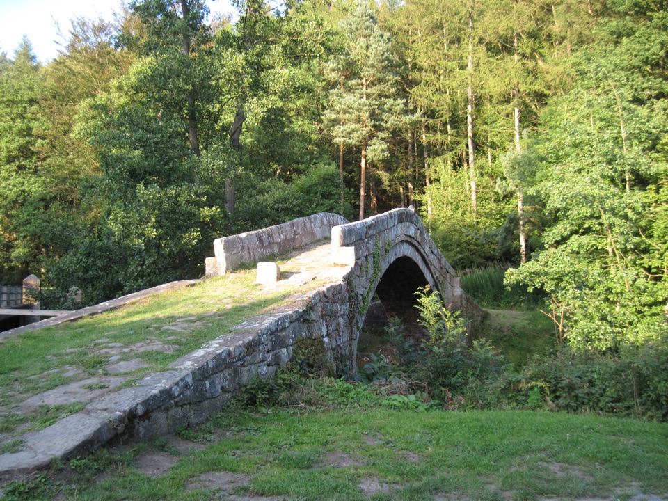
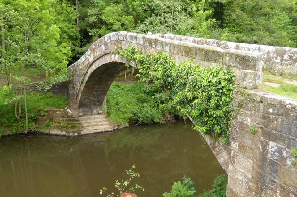
High-arched 1619 packhorse bridge with a lovers' legend beside the Esk

Photo: Wikimedia Commons
Type
Sight
Nearest trail
0.1 km
Audio stories
8 nearby
  • Parking
  • Restrooms

Hear the audio tour

Beggar's Bridge at Glaisdale

Overview

About Beggar's Bridge

Why stop

  • Graceful stone arch over the River Esk
  • Memorable waypoint on valley walks

Heads up

  • Partly hidden between modern road and railway bridges
  • Uneven, narrow crossing beside the water
A short but rewarding historic pause at the eastern end of Glaisdale, where a steep single-arched stone bridge leaps the River Esk in a wooded valley. It works best as a five minute look plus photographs, or as a waypoint on a longer walk, rather than as a destination in its own right.
Parkwolf’s verdictWhy stop

Map

Where it is

Loading the North York Moors map
Full map
SightBeggar's Bridge54.43866, -0.79214
Keep this map with you offline in the Parkwolf app

Plan your stop

Before you go

Best time to go

Daylight is essential to read the stonework and the datestone, and the wooded setting keeps the bridge in shade for much of the day. Early morning or late afternoon gives softer light on the sandstone and fewer people on the crossing. Late spring and summer bring the greenest valley; autumn adds colour, while winter and after heavy rain show the river at its most dramatic but the stone at its most slippery.


Approach and parking

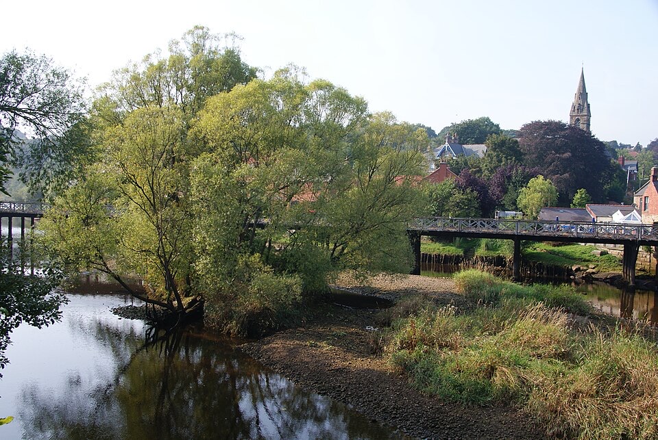
The bridge sits tucked between a modern road bridge and a railway bridge, close to Glaisdale station, so it is easy to drive past without noticing it. Signed public parking is a short walk away, roughly a few hundred metres to the west and southwest near the railway arches; spaces at the station itself may be intended for rail passengers, so use the signed public areas instead. There is a toilet building near the station, a little way northeast of the bridge, and a free car park near Egton Bridge station at the other end of the popular walk. Facilities are not at the bridge itself.

8 active North York Moors alerts

  • ClosureHawnby Bridleway 110 closurePublic Bridleway 25.122/110/1 in Hawnby is closed to pedestrians, cyclists and equestrians because its bridge is unsafe. - The closure is between grid references SE 5309 9073 and SE 5335 9097.Official details
  • ClosureWest Ayton Footpath 1 closurePublic Footpath 1 in West Ayton (Forge Valley) is temporarily closed because its boardwalk is unsafe. - The closure is between SE 9860 8494 and SE 9839 8712.Official details
See all 8 alerts
A park ranger sits on a dash-mounted phone, talking, as Parkwolf’s Tour Guide plays “Army Cutworm Moths: A Grizzly Bear Buffet” on Grand Loop Road below Dunraven Pass in Yellowstone
Parkwolf Tour GuideThe highest, rockiest slopes around here are a summer buffet for grizzly bears.

North York Moors Tour Guide

Your drive to Beggar's Bridge, narrated.

Parkwolf is a GPS audio tour guide for North York Moors National Park. As you drive, it chimes in with what’s ahead: hidden gems, upcoming stops, history, geology, and wildlife, right through your car’s speakers.

Recorded for this place

Beggar's Bridge at Glaisdale
0:00 / 0:28
“You're approaching Beggar's Bridge at Glaisdale, a narrow sandstone arch tucked between the road and railway bridges. A date stone shows sixteen nineteen.”

Plays as you drive up to Beggar's Bridge in the Parkwolf North York Moors Tour Guide.

More stories near here in the app

  • Glaisdale Village
  • The Mayfly's Hidden Years
  • The Esk's Tiny Passengers
  • The Church Built After Secrecy
  • 298 audio storiesacross North York Moors’s roads, triggered by GPS as you drive
  • Wildlife heatmapsfor Eurasian Otter, Red Deer, Grey Seal, and 13 more
  • Works offlinemaps, 126 trails, 65 places, and audio download before you lose signal
  • CarPlay readysimple controls built for the drive
★★★★★
“Fantastic app with many points of information… It’s great to just turn on while you’re driving and it gives you an audio tour of the national Park. We love it!!!!”
JMJamesApp Store review
Download Parkwolf on the App StoreGet Parkwolf on Google Play

4.7 from 8,600+ ratings

Guide

More about Beggar's Bridge

What to seeThe high, narrow arch in sandstone, spanning roughly 15m (about 48ft), with a flagstone deck…
  • The high, narrow arch in sandstone, spanning roughly 15m (about 48ft), with a flagstone deck only about 2m wide and low parapets around 0.75m high.
  • The carved "1619" and "TF" datestone on the downstream, south-facing side, best read from the riverbank.
  • Corbels beneath the arch, most likely left from timber scaffolding used during construction.
  • Cobbled ramps at each end, built for packhorses rather than carts, and open at the sides.
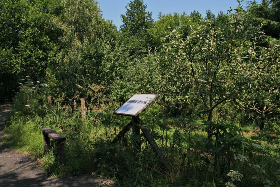
  • An explanatory board on site fills in the story if you arrive without background.
History and legendThe bridge is a 17th-century structure, a Scheduled Monument and Grade II listed, and may reuse…

The bridge is a **17th-century structure, a Scheduled Monument and Grade II* listed, and may reuse stonework from a medieval bridge that had collapsed by 1577. It is credited to Thomas Ferres, said to have begun as the poor son of an Egton farmer and later to have become Sheriff and Mayor of Hull. The local legend** tells that flood water stopped him crossing to say goodbye to Agnes Richardson before he went to sea; he made his fortune, returned to marry her, and built the bridge so future lovers would not be parted by the river.

Walking from herePublic footpaths and bridleways run through the valley, and both the Esk Valley Walk and a…

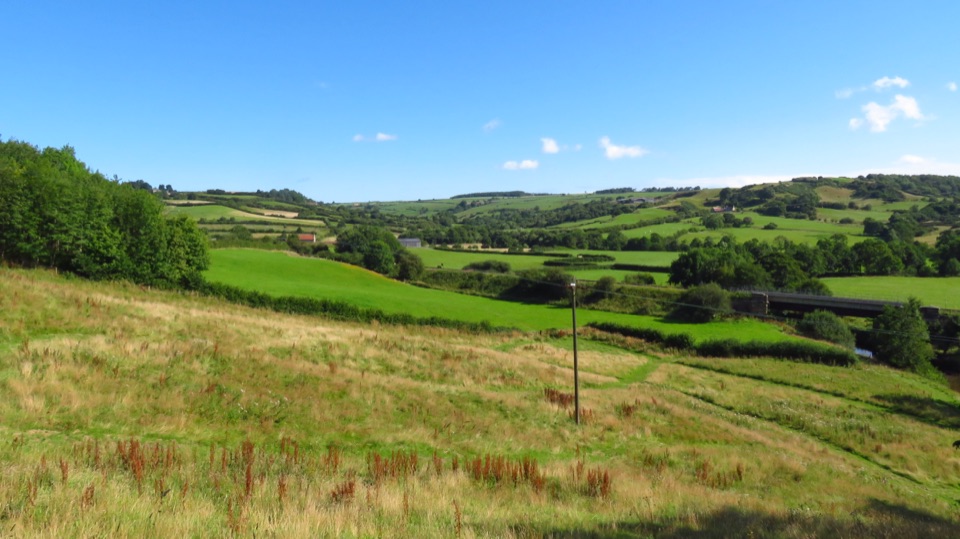
Public footpaths and bridleways run through the valley, and both the Esk Valley Walk and a coast to coast route pass nearby. The classic outing is a circular walk of about five miles between Glaisdale and Egton Bridge, usually 2.5 to 3.5 hours, moderate in effort, mixing quiet lanes with rougher paths. Part of the route follows the Monks' Trod, an old line of stone slabs laid through East Arnecliff Wood.

River and wildlifeThe Esk here supports salmon and rare freshwater pearl mussels, and the valley is known for…

The Esk here supports salmon and rare freshwater pearl mussels, and the valley is known for otters, kingfishers, herons and dippers, with mayflies over the water in season. Stand quietly on the bank rather than the deck for the best chance of seeing anything.

Honest drawbacksSmall and quickly seen, and partly hidden by the neighbouring road and rail bridges, so…
  • Small and quickly seen, and partly hidden by the neighbouring road and rail bridges, so photographs take some positioning.
  • Uneven cobbles and worn stone, often damp under trees, and the crossing is narrow so walkers have to give way to each other.
  • The ramps have no side barriers and the river is immediately below, which needs care with children and dogs.
  • No shelter or services at the bridge, so plan around the village for anything else. Sturdy footwear helps, both here and on the onward paths.

Wildlife

Wildlife in North York Moors

All North York Moors wildlife maps

Sighting maps show where each species has been reported across North York Moors. Wildlife moves, so no sighting is guaranteed.

Keep exploring

Near Beggar's Bridge

See it all on the map

Trails nearby

More stops nearby

Parkwolf’s North York Moors ranking

Top sights in North York Moors

All 65 places
  1. 1North Yorkshire Moors RailwaySight
  2. 2Roseberry ToppingSight
  3. 3Rievaulx AbbeySight
  4. 4Robin Hood's Bay and BeachSight
  5. 5Hole of HorcumSight
  6. 6Goathland StationSight

Take Parkwolf to North York Moors.

The audio tour guide for the drive, plus offline maps, trails, and wildlife heatmaps for when the signal drops.

4.7 from 8,600+ ratings

Download Parkwolf on the App StoreGet Parkwolf on Google Play