Robin Hood's Bay and Beach in North York Moors National Park

#4 of 55 sights in North York Moors

Sight · North York Moors National Park

Robin Hood's Bay and Beach

Cobbled smugglers' village tumbling to Jurassic rock scaurs and rockpools

Photo: Wikimedia Commons
Type
Sight
Nearest trail
0.3 km
Audio stories
4 nearby
  • Parking
  • Restrooms

Hear the audio tour

Robin Hood's Bay

Overview

About Robin Hood's Bay and Beach

Why stop

  • Village lanes, shore, cliffs and Jurassic rock platforms in one stop
  • Low-tide rockpools and scaurs make the beach rewarding to explore

Heads up

  • Steep uphill return from the shore
  • Tides, slippery rock and peak-season crowds need planning
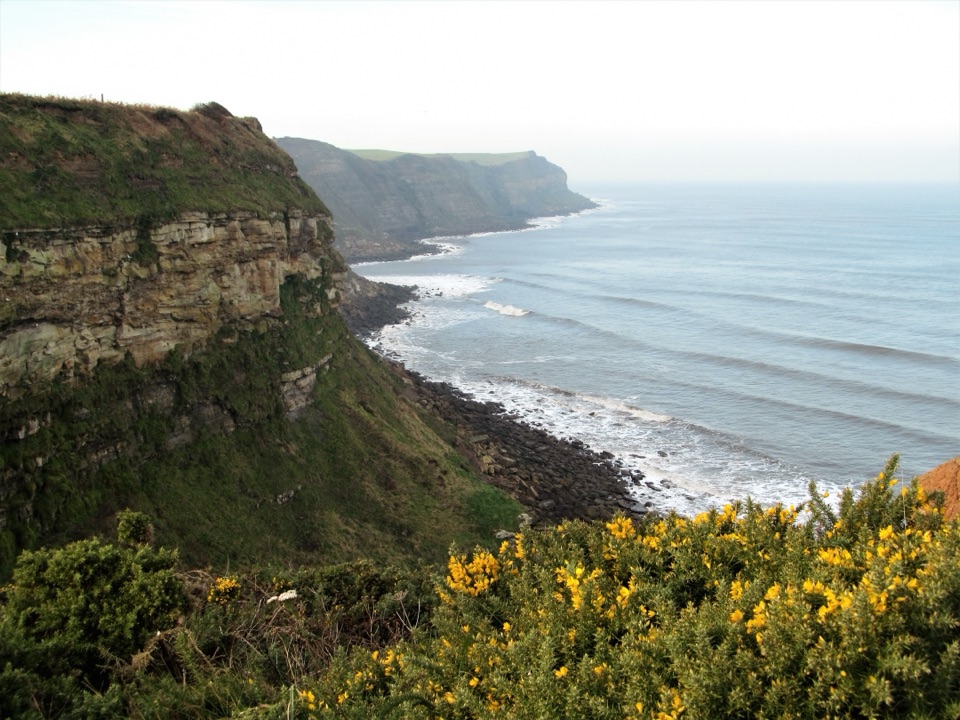
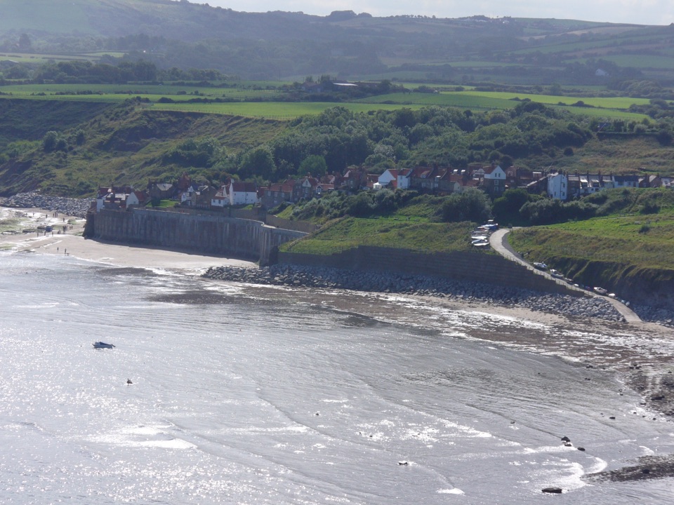
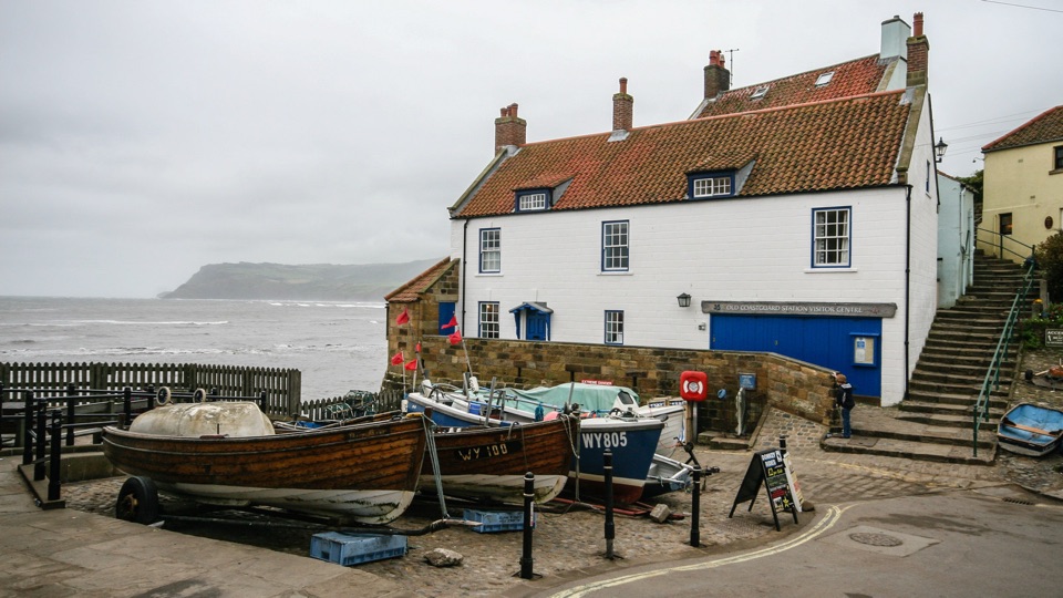
A tight knot of stone cottages and narrow alleyways drops steeply from the clifftop to the sea, ending at the Dock, where a slipway, seawall and a scatter of small boats meet the bay. Once a fishing stronghold, the village was also one of the busiest smuggling spots on the north-east coast in the 1700s, and tales of linked cellars and underground passages are still part of the local story. The plaque on the Dock slipway marking the end of the Coast to Coast route gives the shoreline a quiet sense of arrival, whether or not you walked here.
Parkwolf’s verdictWhy this place stands out

Map

Where it is

Loading the North York Moors map
Full map
SightRobin Hood's Bay and Beach54.43322, -0.53447
Keep this map with you offline in the Parkwolf app

Plan your stop

Before you go

Best time to go

Low tide is the single most important factor, and a low tide in early morning or on a weekday gives both the widest shore and a calmer village. Clear light shows the curve of the bay and the layered cliffs at their best, and the rock patterns read most strongly when the sun is low. Warm, bright weekends and school holidays bring the biggest crowds, and the upper car parks can fill.


Tide and safety planning

The bay changes completely between tides, so check tide times before you go down and keep a clear margin for the walk back. Boggle Hole lies about a mile south along the shore and is cut off from the beach for around three hours either side of high water, with the clifftop Cleveland Way as the safe alternative. Wet rock, weed and pools make the platform slippery, so wear grippy footwear, and stay well away from the base of steep cliffs. If you look for fossils, search loose material on the beach, take only a few pieces, keep hammering to a minimum and leave wildlife undisturbed.

8 active North York Moors alerts

  • ClosureHawnby Bridleway 110 closurePublic Bridleway 25.122/110/1 in Hawnby is closed to pedestrians, cyclists and equestrians because its bridge is unsafe. - The closure is between grid references SE 5309 9073 and SE 5335 9097.Official details
  • ClosureWest Ayton Footpath 1 closurePublic Footpath 1 in West Ayton (Forge Valley) is temporarily closed because its boardwalk is unsafe. - The closure is between SE 9860 8494 and SE 9839 8712.Official details
See all 8 alerts
A park ranger sits on a dash-mounted phone, talking, as Parkwolf’s Tour Guide plays “Army Cutworm Moths: A Grizzly Bear Buffet” on Grand Loop Road below Dunraven Pass in Yellowstone
Parkwolf Tour GuideThe highest, rockiest slopes around here are a summer buffet for grizzly bears.

North York Moors Tour Guide

Your drive to Robin Hood's Bay and Beach, narrated.

Parkwolf is a GPS audio tour guide for North York Moors National Park. As you drive, it chimes in with what’s ahead: hidden gems, upcoming stops, history, geology, and wildlife, right through your car’s speakers.

Recorded for this place

Robin Hood's Bay
0:00 / 0:38
“Up ahead is Robin Hood's Bay, where a tight knot of cottages and narrow alleys tumbles steeply down to the sea.”

Plays as you drive up to Robin Hood's Bay and Beach in the Parkwolf North York Moors Tour Guide.

More stories near here in the app

  • An Ammonite Is a Clock
  • The Lifeboat That Came by Road
  • How Bay Town Hid Its Cargo
  • The Crab with Swimming Paddles
  • 298 audio storiesacross North York Moors’s roads, triggered by GPS as you drive
  • Wildlife heatmapsfor Eurasian Otter, Red Deer, Grey Seal, and 13 more
  • Works offlinemaps, 126 trails, 65 places, and audio download before you lose signal
  • CarPlay readysimple controls built for the drive
★★★★★
“Fantastic app with many points of information… It’s great to just turn on while you’re driving and it gives you an audio tour of the national Park. We love it!!!!”
JMJamesApp Store review
Download Parkwolf on the App StoreGet Parkwolf on Google Play

4.7 from 8,600+ ratings

Guide

More about Robin Hood's Bay and Beach

The shore and its geologyAt low tide the bay opens into a broad wave-cut rock platform of Jurassic rock roughly 200…

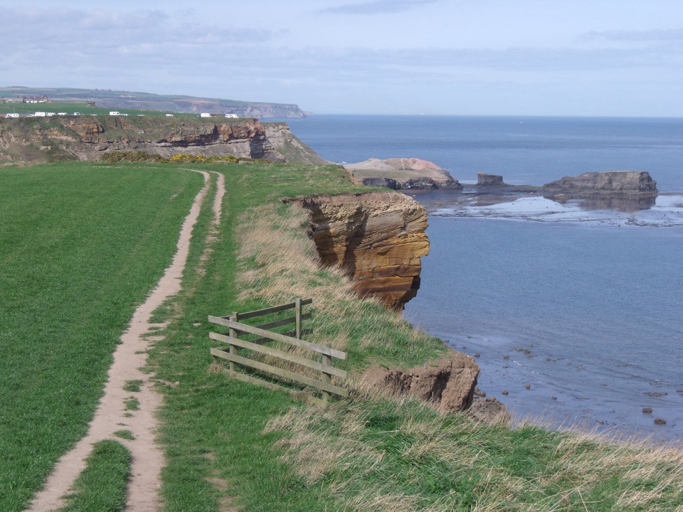
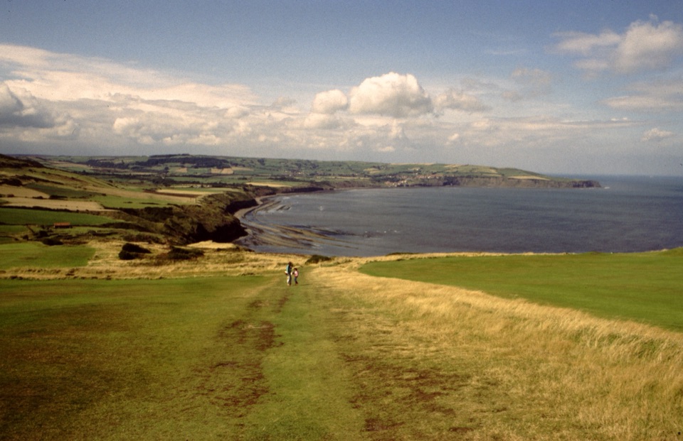
At low tide the bay opens into a broad wave-cut rock platform of Jurassic rock roughly 200 million years old. Alternating soft and hard layers erode at different rates, leaving the curving ridged reefs known locally as scaurs, which sweep out in great arcs below the cliffs. There are sandy patches, but the character here is rock, pool and reef. It is a rewarding stretch for amateur geology and beach-combing, and rockpools often hold small crabs and other shore life. Kittiwakes work the cliffs, and dolphins are sometimes seen offshore, though nothing is guaranteed.

How to approach a visitPark in the upper village at Bank Top or Station Road, then walk down.
  • Park in the upper village at Bank Top or Station Road, then walk down. Do not drive on past the small roundabout by the Victoria Hotel: there is no public parking below and vehicle access is awkward.
  • Walk down through the alleys rather than rushing, then out onto the Dock and slipway before stepping onto the shore.
  • Time the shore for low tide, ideally setting out at least an hour before, so the scaurs and pools are fully exposed.
  • Arriving by X93 or X94 bus, the Cinder Track from Whitby or the Cleveland Way avoids the parking scramble entirely.
  • EV charging is at the Bank Top car park in the upper village, not near the beach.
Honest drawbacksThe return climb is steep and sustained.
  • The return climb is steep and sustained. Everything you enjoy at sea level has to be walked back uphill, and the lanes and steps are narrow and uneven.
  • The shore is rough going. Rock ledges, pools and weed are slippery, and tide timing needs real attention rather than a casual glance.
  • It is a popular, compact village. Alleys and the slipway area can feel busy in peak season, which changes the mood of what is otherwise a quiet working coastline.
  • Allow two to three hours at least, and longer if you plan to explore the reefs or walk south along the shore.

Wildlife

Wildlife in North York Moors

All North York Moors wildlife maps

Sighting maps show where each species has been reported across North York Moors. Wildlife moves, so no sighting is guaranteed.

Keep exploring

Near Robin Hood's Bay and Beach

See it all on the map

Trails nearby

More stops nearby

Parkwolf’s North York Moors ranking

Top sights in North York Moors

All 65 places
  1. 1North Yorkshire Moors RailwaySight
  2. 2Roseberry ToppingSight
  3. 3Rievaulx AbbeySight
  4. 5Hole of HorcumSight
  5. 6Goathland StationSight
  6. 7Whitby AbbeySight

Take Parkwolf to North York Moors.

The audio tour guide for the drive, plus offline maps, trails, and wildlife heatmaps for when the signal drops.

4.7 from 8,600+ ratings

Download Parkwolf on the App StoreGet Parkwolf on Google Play