Ravenscar in North York Moors National Park

Sight · North York Moors National Park

Ravenscar

The town that never was, high above Robin Hood's Bay

Photo: Wikimedia Commons
Type
Sight
Nearest trail
0.4 km
Audio stories
2 nearby
  • Trailhead
  • Scenic viewpoint
  • Parking
  • Restrooms
  • #27 of 55 sights

Hear the audio tour

Ravenscar

Overview

About Ravenscar

Why stop

  • Panoramic views across Robin Hood’s Bay

Heads up

  • Steep, rocky descent to the beach
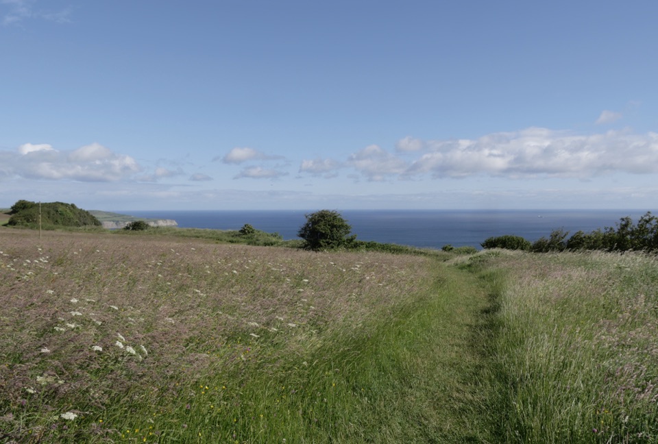
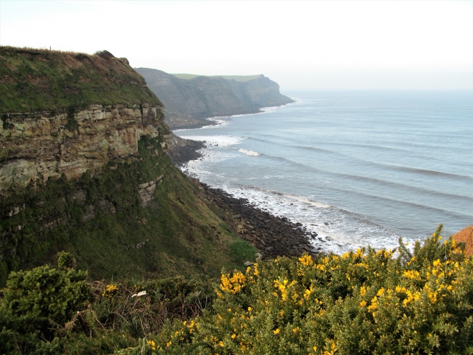
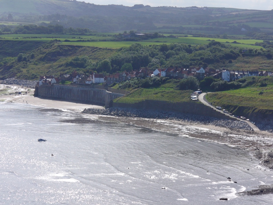
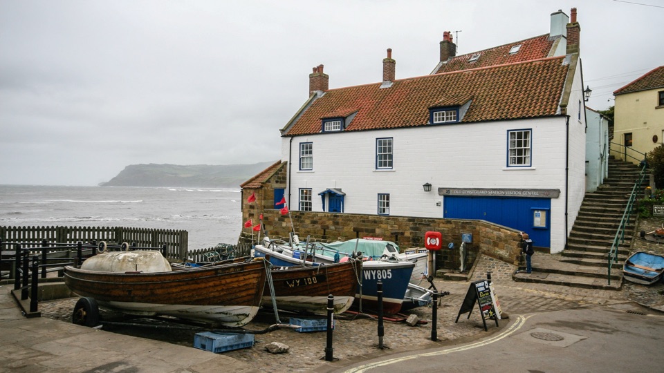
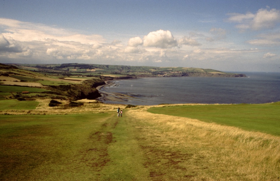
Ravenscar sits on the cliff top at the southern end of Robin Hood's Bay, and the view along the whole sweep of the bay is the main reason to come. It is also the town that never was: a Victorian speculation, laid out as a seaside resort that never filled in around its grand hotel. What you find instead is a quiet scatter of houses, a hotel, tea rooms and a visitor centre at the edge of the moor, with industrial ruins in the fields below.
Parkwolf’s verdictWhy stop

Map

Where it is

Loading the North York Moors map
Full map
SightRavenscar54.39758, -0.49307
Keep this map with you offline in the Parkwolf app

Plan your stop

Before you go

Best time to go

Late spring and early autumn are the sweet spot: long light, flowers or bracken colour, and far fewer people than the honeypot villages down the coast. Late afternoon and evening light works best for the bay view, since you are looking north and west along the cliffs. Services here are seasonal, so out of the main season expect the village to be very quiet with little open. Winter days can be spectacular and completely deserted.


8 active North York Moors alerts

  • ClosureRavenscar Footpaths 10 and 11 closureMentions this placePublic Footpaths 10 and 11 at Staintondale (Old Peak near Ravenscar) are temporarily closed under a Temporary Closure Order. - The closures run through 17 March 2027.Official details
  • ClosureHawnby Bridleway 110 closurePublic Bridleway 25.122/110/1 in Hawnby is closed to pedestrians, cyclists and equestrians because its bridge is unsafe. - The closure is between grid references SE 5309 9073 and SE 5335 9097.Official details
See all 8 alerts
A park ranger sits on a dash-mounted phone, talking, as Parkwolf’s Tour Guide plays “Army Cutworm Moths: A Grizzly Bear Buffet” on Grand Loop Road below Dunraven Pass in Yellowstone
Parkwolf Tour GuideThe highest, rockiest slopes around here are a summer buffet for grizzly bears.

North York Moors Tour Guide

Your drive to Ravenscar, narrated.

Parkwolf is a GPS audio tour guide for North York Moors National Park. As you drive, it chimes in with what’s ahead: hidden gems, upcoming stops, history, geology, and wildlife, right through your car’s speakers.

Recorded for this place

Ravenscar
0:00 / 0:33
“You're approaching Ravenscar, high on the headland above the full sweep of Robin Hood's Bay. From the cliff-top path, frame the bay's long curve; this is the view that earns the stop.”

Plays as you drive up to Ravenscar in the Parkwolf North York Moors Tour Guide.

More stories near here in the app

  • The Forest Below the Waves
  • The Name Built for a Town
  • The Radar That Watched the Sea
  • The Crab with Swimming Paddles
  • 298 audio storiesacross North York Moors’s roads, triggered by GPS as you drive
  • Wildlife heatmapsfor Eurasian Otter, Red Deer, Grey Seal, and 13 more
  • Works offlinemaps, 126 trails, 65 places, and audio download before you lose signal
  • CarPlay readysimple controls built for the drive
★★★★★
“Fantastic app with many points of information… It’s great to just turn on while you’re driving and it gives you an audio tour of the national Park. We love it!!!!”
JMJamesApp Store review
Download Parkwolf on the App StoreGet Parkwolf on Google Play

4.7 from 8,600+ ratings

Guide

More about Ravenscar

What makes it differentMost of the Yorkshire coast sells you a harbour.

Most of the Yorkshire coast sells you a harbour. Ravenscar sells you height, space and unfinished history. Once known as Peak, it was the site of one of Britain's earliest chemical industries, where alum was worked from locally quarried shale until synthetic production killed the trade and the last works on this coast closed in 1871. The Peak Alum Works site below the village is interpreted with information boards and is unusually easy to read on the ground.

What to see and doRavens View loop from the visitor centre: about 2.
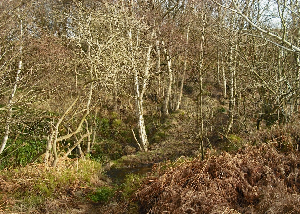
  • Ravens View loop from the visitor centre: about 2.3 miles, roughly 45 minutes to an hour and a half, with even surfaces and gentle inclines, a freshwater pond with a viewing platform, Bluebell Wood, the alum works, abandoned brickworks and a disused Victorian railway bridge. Trampers can be hired here and dogs are welcome.
  • The Cleveland Way passes through, and the Cinder Track, following the old coastal railway, gives a level, traffic free route for walkers and cyclists.
  • Robin Hood's Bay on foot and back is the classic bigger day out, close to 9 miles and four hours or more if you return along the cliffs.
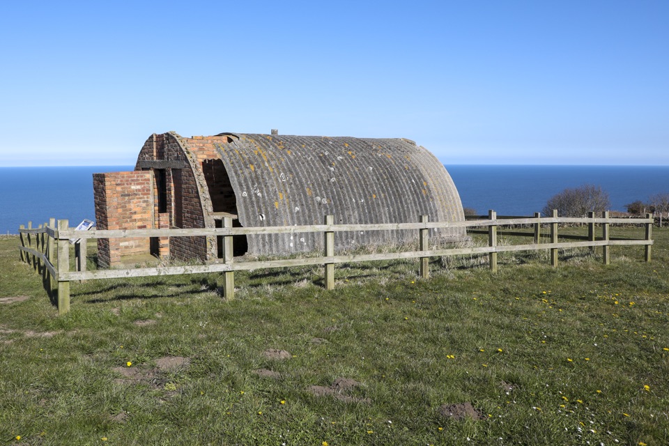
  • The visitor centre has a cafe, indoor seating, an outdoor picnic area, cycle parking and EV charging, with public toilets across the road that include wheelchair access. Remains of a World War Two radar station sit on the moor side of the village.
WildlifeSeals are often visible on the rocks below, best picked out with binoculars from a bench on the…

Seals are often visible on the rocks below, best picked out with binoculars from a bench on the cliff top rather than by approaching them on the shore. Summer brings wildflowers along the old railway line and the alum works grassland, and the cliffs and moor edge are good for casual birdwatching.

What to bring, and the drawbacksSturdy footwear and windproof layers.
  • Sturdy footwear and windproof layers. This is an exposed cliff top and it is noticeably colder and breezier than the sheltered bays.
  • Binoculars for seals and the far side of the bay.
  • Park on the free roadside parking in the village; the approach is signposted from the main coast road.
  • Be honest with yourself about the beach. It is reached by a long, steep descent and is rocky rather than sandy, best at low tide, and the climb back is the real work of the day.
  • Do not come expecting a resort. There are very few facilities, no proper village centre and limited shelter if the weather turns. Surfaces away from the main loop are rough, muddy and uneven in places.

Wildlife

Wildlife in North York Moors

All North York Moors wildlife maps

Sighting maps show where each species has been reported across North York Moors. Wildlife moves, so no sighting is guaranteed.

Keep exploring

Near Ravenscar

See it all on the map

Trails nearby

More stops nearby

Parkwolf’s North York Moors ranking

Top sights in North York Moors

All 65 places
  1. 1North Yorkshire Moors RailwaySight
  2. 2Roseberry ToppingSight
  3. 3Rievaulx AbbeySight
  4. 4Robin Hood's Bay and BeachSight
  5. 5Hole of HorcumSight
  6. 6Goathland StationSight

Take Parkwolf to North York Moors.

The audio tour guide for the drive, plus offline maps, trails, and wildlife heatmaps for when the signal drops.

4.7 from 8,600+ ratings

Download Parkwolf on the App StoreGet Parkwolf on Google Play