Devils Punchbowl in Olympic National Park

Sight · Olympic National Park

Devils Punchbowl

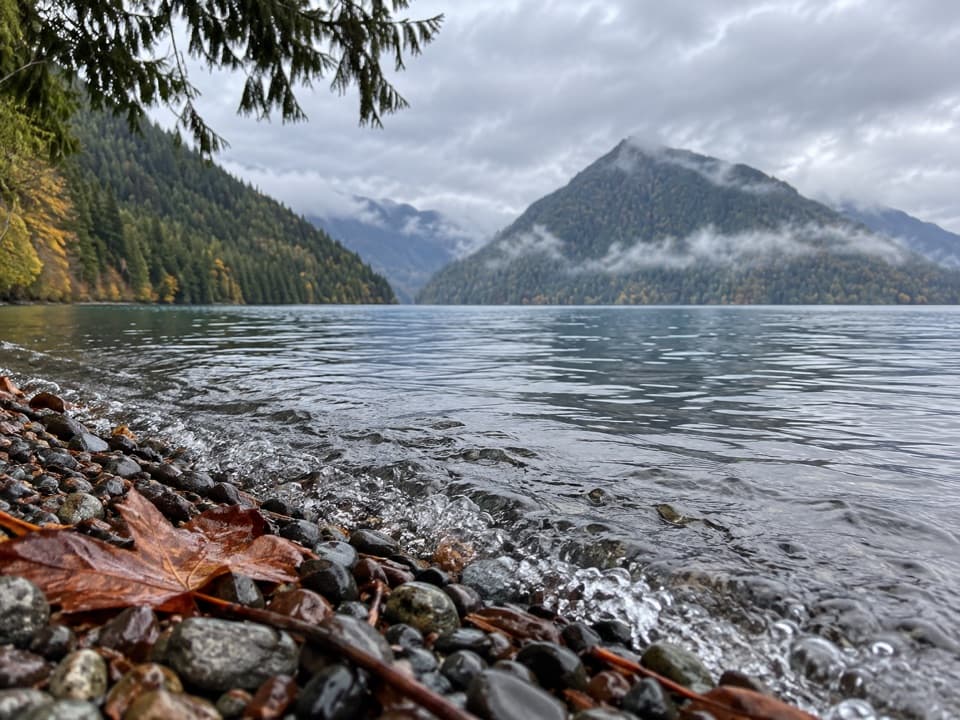
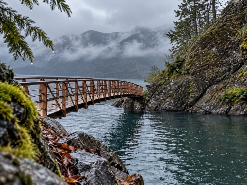
A clear-water cove framed by a curved footbridge.

Type
Sight
Nearest trail
1 mi
Audio stories
6 nearby
  • Trailhead
  • Parking
  • Restrooms
  • Scenic viewpoint
  • #20 of 50 sights

Hear the audio tour

Devils Punchbowl: Beyond the Paved Trail

Overview

About Devils Punchbowl

Why stop

  • A curved bridge over remarkably clear blue-green water

Heads up

  • The narrow, rocky last spur ends at a tight, often busy cove

Map

Where it is

Loading the Olympic map
Full map
SightDevils Punchbowl48.08304, -123.78782
Keep this map with you offline in the Parkwolf app

Plan your stop

Before you go

Make the access work

East Beach Road leaves US 101 for the north-shore trail access. The East Beach trailhead has parking and a vault toilet; parking can fill, especially later in the morning and on weekends. There is no food stop at the cove. Lake Crescent Lodge and Log Cabin Resort have seasonal restaurants elsewhere around the lake.

6 active Olympic alerts

  • CautionUS 101 Hoh River Bridge reduced to one laneUS 101 at the Hoh River Bridge is restricted to one lane of alternating traffic; obey the signals and 25 mph speed limit.Official details
  • ClosureStaircase wilderness trails and campsites remain closedWilderness trails and campsites around Staircase remain closed during recovery from the Bear Gulch Fire; the developed Staircase area, including the Rapids Loop, campground, and ranger station, is…Official details
See all 6 alerts
A park ranger sits on a dash-mounted phone, talking, as Parkwolf’s Tour Guide plays “Army Cutworm Moths: A Grizzly Bear Buffet” on Grand Loop Road below Dunraven Pass in Yellowstone
Parkwolf Tour GuideThe highest, rockiest slopes around here are a summer buffet for grizzly bears.

Olympic Tour Guide

Your drive to Devils Punchbowl, narrated.

Parkwolf is a GPS audio tour guide for Olympic National Park. As you drive, it chimes in with what’s ahead: hidden gems, upcoming stops, history, geology, and wildlife, right through your car’s speakers.

See the Olympic audio tour

Recorded for this place

Devils Punchbowl: Beyond the Paved Trail
0:00 / 0:25
“You’re nearing the Spruce Railroad trailhead for Devils Punchbowl, a blue-green cove crossed by a curved footbridge. It’s about a mile each way, mostly on pavement, but the final spur is steep, narrow, and rocky.”

Plays as you drive up to Devils Punchbowl in the Parkwolf Olympic Tour Guide.

More stories near here in the app

  • Log Cabin Resort: Lunch and Lake Time
  • Lake Crescent Scenic Pull-Off
  • Why a Snake Flicks Its Tongue
  • Marymere Falls and Barnes Point
  • 204 audio storiesacross Olympic’s roads, triggered by GPS as you drive
  • Wildlife heatmapsfor Olympic Marmot, Humpback Whale, Grey Whale, and 13 more
  • Works offlinemaps, 148 trails, 94 places, and audio download before you lose signal
  • CarPlay readysimple controls built for the drive
★★★★★
“Fantastic app with many points of information… It’s great to just turn on while you’re driving and it gives you an audio tour of the national Park. We love it!!!!”
JMJamesApp Store review
Download Parkwolf on the App StoreGet Parkwolf on Google Play

4.7 from 8,600+ ratings

Guide

More about Devils Punchbowl

The cove and footbridgeDevils Punchbowl is a small cove on Lake Crescent’s north shore, wrapped by a curved footbridge…

Devils Punchbowl is a small cove on Lake Crescent’s north shore, wrapped by a curved footbridge along the Spruce Railroad Trail. The paved old railroad grade makes most of the approach straightforward, but the final spur is narrow and rough, and the cove has little room when busy. From the East Beach trailhead, allow about a mile each way. Arrive earlier for easier parking and more space by the water. For the signature view, frame the bridge curving over the blue-green cove.

The last stretchNear the first railroad tunnel, a roughly 0.

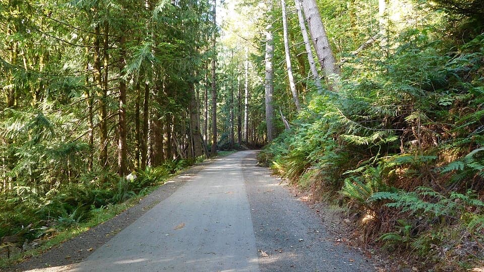
Near the first railroad tunnel, a roughly 0.1-mile spur branches from the paved trail to the bridge. It is steep, rocky and rooted. The smoother grade is the easier, wheelchair-accessible part; the final spur is not accessible. Bikes share the main trail, and leashed dogs are allowed. Distances vary with the trailhead you choose.

A small, busy swimming coveMany visitors come to swim, and some jump from the rocks.

Many visitors come to swim, and some jump from the rocks. Lake Crescent is cold and exceptionally deep, so this is not a shallow wading spot. The bridge and cove are compact, which is part of their appeal and the reason they can feel crowded later in the morning or on weekends.

Why the water stays clearLake Crescent was carved by glaciers and reaches 624 feet deep.

Lake Crescent was carved by glaciers and reaches 624 feet deep. Its low nitrogen levels support little phytoplankton, helping light travel through the water; visibility can reach 60 feet in some places. Reflected light gives the lake its blue-green cast.

A landslide and two troutAbout 7,000 years ago, a landslide separated Lake Crescent from Lake Sutherland.

About 7,000 years ago, a landslide separated Lake Crescent from Lake Sutherland. The isolation helped produce two trout populations found nowhere else: Beardslee and Crescenti trout.

Wildlife

Wildlife in Olympic

All Olympic wildlife maps

Sighting maps show where each species has been reported across Olympic. Wildlife moves, so no sighting is guaranteed.

Keep exploring

Near Devils Punchbowl

See it all on the map

Trails nearby

More stops nearby

Parkwolf’s Olympic ranking

Top sights in Olympic

All 94 places
  1. 1Hurricane RidgeSight
  2. 2Ruby BeachBeach
  3. 3Rialto BeachBeach
  4. 4Sol Duc FallsSight
  5. 5Marymere FallsSight
  6. 6Second BeachBeach

Take Parkwolf to Olympic.

The audio tour guide for the drive, plus offline maps, trails, and wildlife heatmaps for when the signal drops.

4.7 from 8,600+ ratings

Download Parkwolf on the App StoreGet Parkwolf on Google Play