Sam's River Loop Trail in Olympic National Park

Olympic National Park, WA

Sam's River Loop Trail

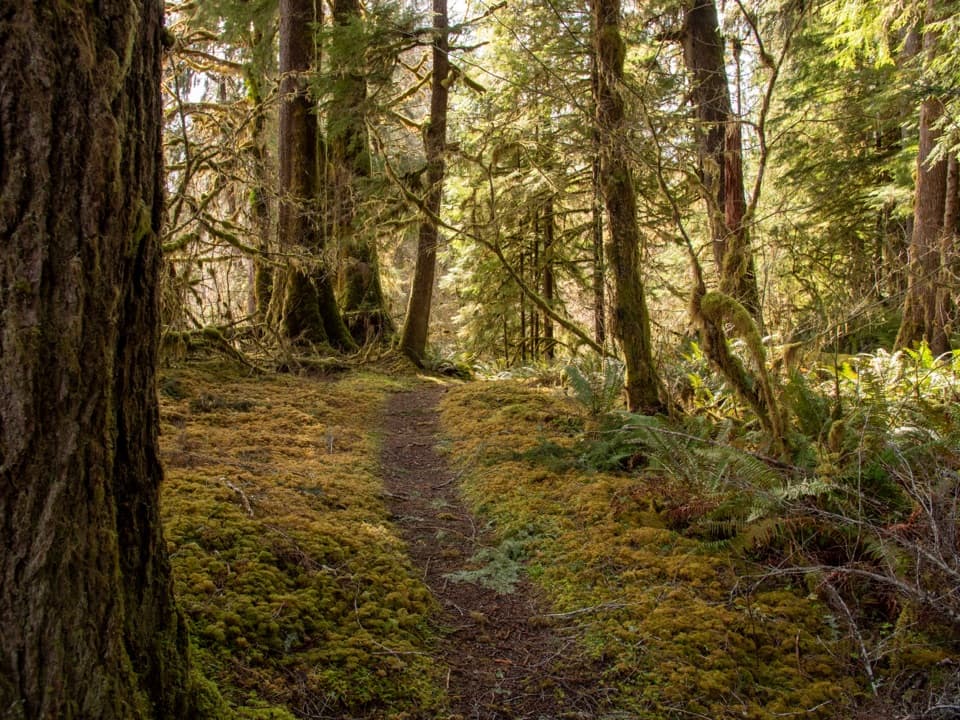
A flat rainforest loop with a river view and a homestead meadow.

Photo: National Park Service
Length
2.8mi
Time
1.8hr
Elevation
Flat
Difficulty
Easy
  • Loop
  • No dogs
  • High point 307 ft

Hear the audio tour

Sam's River Loop: Forest and an Old Homestead

Overview

About Sam's River Loop Trail

Why go

  • River views, mossy forest, fern grove and homestead meadow in one short loop
  • Easy grade with only about 50 feet of gain

Heads up

  • Remote approach on narrow forestry roads with logging traffic
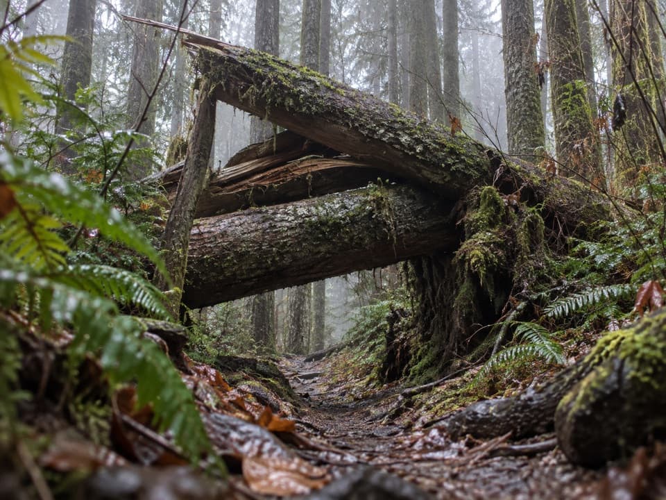
  • Stormfall and wet ground can make the primitive tread slow

Map & elevation

The route

Loading the Olympic map
Full map
Elevation268–307 ft
TrailheadSam's River Loop Trailhead at Ranger Station47.61631, -124.03194
Keep this map with you offline in the Parkwolf app

Plan your hike

Before you go

Parking

Use the Sam's River Loop Trailhead by the Queets Ranger Station, where there is room for several cars; the Queets Campground at the road end is another access point. The approach uses narrow neighboring forestry roads with active logging traffic and is unsuitable for trailers or large RVs.

Safety

Winter storms can leave fallen trees and other obstacles. The early dip can be muddy, and the alder section may be too wet in spring. Pets are prohibited on park trails.

6 active Olympic alerts

  • CautionUS 101 Hoh River Bridge reduced to one laneUS 101 at the Hoh River Bridge is restricted to one lane of alternating traffic; obey the signals and 25 mph speed limit.Official details
  • ClosureStaircase wilderness trails and campsites remain closedWilderness trails and campsites around Staircase remain closed during recovery from the Bear Gulch Fire; the developed Staircase area, including the Rapids Loop, campground, and ranger station, is…Official details
See all 6 alerts
A park ranger sits on a dash-mounted phone, talking, as Parkwolf’s Tour Guide plays “Army Cutworm Moths: A Grizzly Bear Buffet” on Grand Loop Road below Dunraven Pass in Yellowstone
Parkwolf Tour GuideThe highest, rockiest slopes around here are a summer buffet for grizzly bears.

Olympic Tour Guide

Your drive to Sam's River Loop Trail, narrated.

Parkwolf is a GPS audio tour guide for Olympic National Park. As you drive, it chimes in with what’s ahead: hidden gems, upcoming stops, history, geology, and wildlife, right through your car’s speakers.

See the Olympic audio tour

Recorded for this trailhead

Sam's River Loop: Forest and an Old Homestead
0:00 / 0:25
“Sam's River Loop trailhead is coming up, a good choice for exploring the Queets rainforest without a river ford.”

Plays as you drive up to this trailhead in the Parkwolf Olympic Tour Guide.

More stories near here in the app

  • Queets Campground: Beside the Salmon River
  • The Nursery Beneath the Gravel
  • How a Hollow Tree Stays Alive
  • When the Queets Rain Forest Burned
  • 204 audio storiesacross Olympic’s roads, triggered by GPS as you drive
  • Wildlife heatmapsfor Olympic Marmot, Humpback Whale, Grey Whale, and 13 more
  • Works offlinemaps, 148 trails, 94 places, and audio download before you lose signal
  • CarPlay readysimple controls built for the drive
★★★★★
“Fantastic app with many points of information… It’s great to just turn on while you’re driving and it gives you an audio tour of the national Park. We love it!!!!”
JMJamesApp Store review
Download Parkwolf on the App StoreGet Parkwolf on Google Play

4.7 from 8,600+ ratings

Trail guide

Hiking Sam's River Loop Trail

The easy Queets loopSam's River Loop is a flat 2.

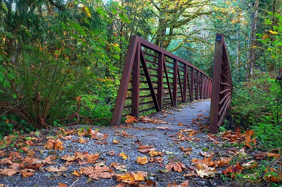
Sam's River Loop is a flat 2.8-mile circuit through temperate rainforest, with a short river opening, fern and alder forest, a former homestead meadow and small ponds. Allow about 1.5–2 hours. It is an easy walk with roughly 50 feet of climbing, and a gentler way to see the Queets valley than the separate 16.2-mile Queets River Trail. The loop does not include that trail's river ford. Expect a primitive track, not a manicured boardwalk.

Follow the loop at the riverFrom the ranger-station trailhead, the path enters a shaded corridor of spruce, hemlock and…

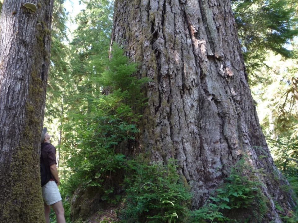
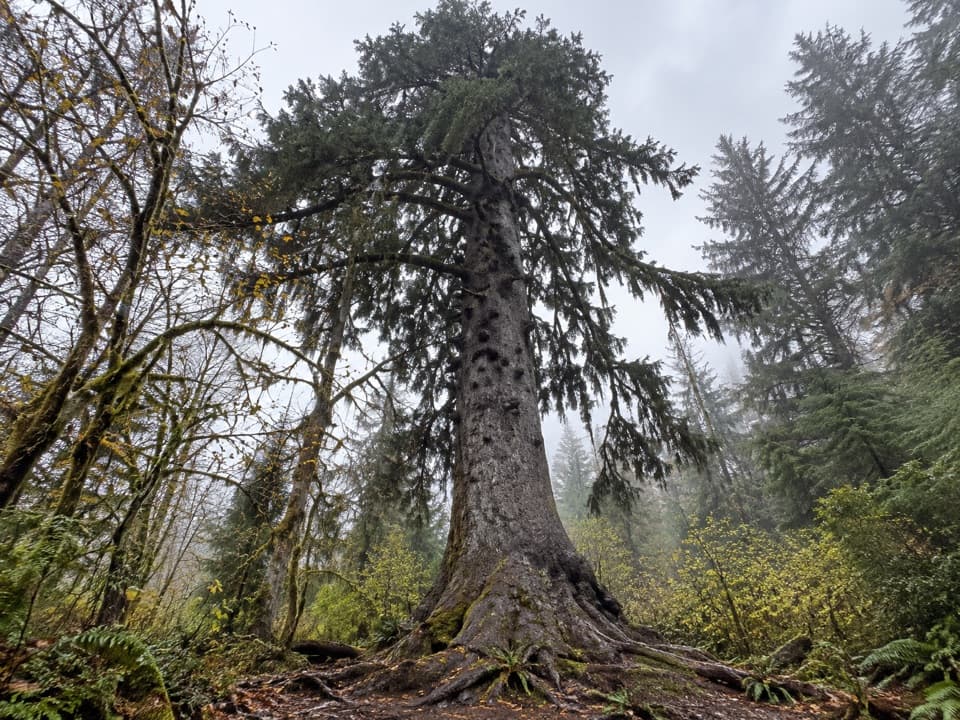
From the ranger-station trailhead, the path enters a shaded corridor of spruce, hemlock and sword fern. An early dip can be muddy. Around 0.3 mile, the trail reaches the Queets River and the view opens upriver toward Kloochman Rock. This is a brief river-side stretch, not a crossing. The route later follows the road by the campground before turning back into the forest. At the side paths, stay on the Sam's River Loop: one branch heads onto the Queets River Trail, while another drops toward gravel bars on the old Sam's River Trail.

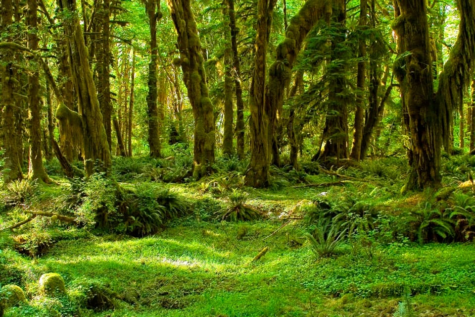
Ferns, alder and an old homesteadAfter the road, the forest changes into a bright fern gallery, then a mossy alder grove.

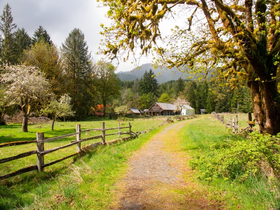
After the road, the forest changes into a bright fern gallery, then a mossy alder grove. In spring, this section can be too wet to cross comfortably. At about 2.3 miles, the trail reaches a field that was once a homestead. Apple trees and scattered boards are left among the grass. Several faint paths divide there; cross to the far corner, where the continuation becomes clear again. The return follows an old road grade past small ponds and back toward the ranger station.

A valley shaped by water and workThe Queets valley was carved by glaciers, but its human history is easy to spot on this walk.

The Queets valley was carved by glaciers, but its human history is easy to spot on this walk. Stumps along the river corridor mark past logging, while young spruce are reclaiming some of the river edge. The apple trees and boards in the meadow are remnants of early homesteads. This is a living salmon river too: five Pacific salmon species, including steelhead, spawn in its side channels, and their remains carry nutrients back into the forest. Area tribes continue a First Salmon Ceremony that honors the returning fish.

Getting there and knowing the limitsThe ranger station is unstaffed, and the loop also has access from the Queets Campground at the…

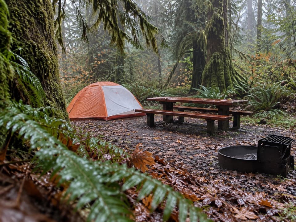
The ranger station is unstaffed, and the loop also has access from the Queets Campground at the end of Upper Queets Road. The approach follows narrow neighboring forestry roads with active logging traffic; trailers and large RVs are not a good fit. The campground has pit toilets but no potable water. Pets are not allowed on park trails. Storms can leave fallen trees and other obstacles on the tread, and the roads or campground may close at short notice in hazardous weather, so check conditions before setting out.

Wildlife

Wildlife in Olympic

All Olympic wildlife maps

Sighting maps show where each species has been reported across Olympic. Wildlife moves, so no sighting is guaranteed.

Parkwolf’s Olympic ranking

Top-rated trails in Olympic

All 148 trails
  1. 1Hall of Mosses TrailEasy · 0.8 mi
  2. 2Hurricane Hill TrailModerate · 3.3 mi
  3. 3Sol Duc Falls Nature TrailEasy · 1.6 mi
  4. 4High Divide Loop (Seven Lakes Basin)Challenging · 19 mi
  5. 5Hoh River TrailChallenging · 34.8 mi
  6. 6Shi Shi Beach and Point of Arches TrailModerate · 8 mi

Take Parkwolf to Olympic.

The audio tour guide for the drive, plus offline maps, trails, and wildlife heatmaps for when the signal drops.

4.7 from 8,600+ ratings

Download Parkwolf on the App StoreGet Parkwolf on Google Play