West Fork Dosewallips River Trail in Olympic National Park

Olympic National Park, WA

West Fork Dosewallips River Trail

A long river-valley climb to Anderson Pass and high meadows.

Length
18.2mi
Time
12hr
Elev. change
2,687ft
Difficulty
Challenging
  • No dogs
  • High point 4,534 ft
  • #50 of 148 in Olympic
Parkwolf audio tour204 stories across Olympic’s roads

Overview

About West Fork Dosewallips River Trail

Why go

  • Maintained valley tread reaches old forest, open meadows and a high pass.
  • Honeymoon Meadows offers a shorter turnaround before the pass.

Heads up

  • The Dose Forks route is 18.2 miles round trip; road-end access adds roughly 13 miles.
  • High water at Honeymoon Meadows can make the West Fork crossing hazardous.

Map & elevation

The route

Loading the Olympic map
Full map
Elevation1,847–4,534 ft
TrailheadDose Forks (West Fork junction)47.74374, -123.19300
Keep this map with you offline in the Parkwolf app

Plan your hike

Before you go

Parking

Dose Forks is the start of the named trail. Reach it on foot from the end of Dosewallips Road along the old road corridor and bypass, about 6.5 miles each way; the pass route is another 9.1 miles each way. No food or visitor services are available in the area. Parking capacity and vehicle fee were not confirmed.

Safety

The West Fork crossing at Honeymoon Meadows can be hazardous in spring or after heavy rain. High sections may hold snow in any season; snow travel requires an ice axe and self-arrest skills. Treat stream water and plan for very little water at Anderson Pass. Pets are prohibited on park trails.

6 active Olympic alerts

  • ClosureDosewallips Road closed to vehicles before campgroundMentions Dosewallips Road, referenced in this guideDosewallips Road is closed to vehicles because of a washout outside the park boundary, 6.5 miles from the campground; vehicles cannot reach the campground.Official details
  • CautionUS 101 Hoh River Bridge reduced to one laneUS 101 at the Hoh River Bridge is restricted to one lane of alternating traffic; obey the signals and 25 mph speed limit.Official details
See all 6 alerts
A park ranger sits on a dash-mounted phone, talking, as Parkwolf’s Tour Guide plays “Army Cutworm Moths: A Grizzly Bear Buffet” on Grand Loop Road below Dunraven Pass in Yellowstone
Parkwolf Tour GuideThe highest, rockiest slopes around here are a summer buffet for grizzly bears.

Olympic Tour Guide

Your drive to West Fork Dosewallips River Trail, narrated.

Parkwolf is a GPS audio tour guide for Olympic National Park. As you drive, it chimes in with what’s ahead: hidden gems, upcoming stops, history, geology, and wildlife, right through your car’s speakers.

See the Olympic audio tour
  • 204 audio storiesacross Olympic’s roads, triggered by GPS as you drive
  • Wildlife heatmapsfor Olympic Marmot, Humpback Whale, Grey Whale, and 13 more
  • Works offlinemaps, 148 trails, 94 places, and audio download before you lose signal
  • CarPlay readysimple controls built for the drive
★★★★★
“Fantastic app with many points of information… It’s great to just turn on while you’re driving and it gives you an audio tour of the national Park. We love it!!!!”
JMJamesApp Store review
Download Parkwolf on the App StoreGet Parkwolf on Google Play

4.7 from 8,600+ ratings

Trail guide

Hiking West Fork Dosewallips River Trail

The pass is the commitmentWest Fork Dosewallips River Trail is an out-and-back from Dose Forks to Anderson Pass: 9.

West Fork Dosewallips River Trail is an out-and-back from Dose Forks to Anderson Pass: 9.1 miles each way, or 18.2 miles round trip. The maintained route climbs through montane forest and river country into subalpine meadows, then reaches a high pass at 4,464 feet. Allow about 12 hours for the trail itself, including stops. The grade is described as moderate, but the distance, remoteness and high-country conditions make this a serious day. Dose Forks is the start of the named trail; reaching it from the end of Dosewallips Road adds about 6.5 miles each way. The full road-end route is roughly 32 miles round trip, so most visitors should plan an overnight rather than try to force it into one day.

Follow the West Fork uphillFrom Dose Forks, the trail follows the West Fork valley through montane forest.

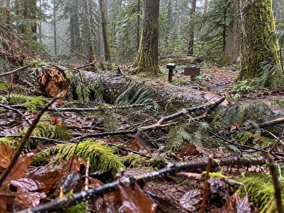
From Dose Forks, the trail follows the West Fork valley through montane forest. The forest is the first big part of the experience: the river stays close, the tread is maintained, and the route gradually trades the enclosed valley for higher, more open ground. This is a long climb, not a steep scramble, but the pass is far enough away that steady pacing matters. Backcountry camps at Dose Forks, Big Timber and Diamond Meadows make sense as overnight stops if you are carrying a pack.

The meadows and the crossingFarther up, the forest opens into broad subalpine meadows and mossy valley stretches.

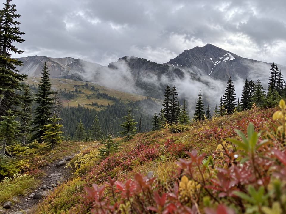
Farther up, the forest opens into broad subalpine meadows and mossy valley stretches. Honeymoon Meadows is the clearest change of scenery: open grass, a forest edge and mountain slopes give the route room to breathe before it climbs again. The West Fork crossing at Honeymoon can be hazardous in spring or after heavy rain. Take the water level seriously; this is not a crossing to rush because you are eager to reach the next camp.

If you want a shorter goal, Honeymoon Meadows is a substantial turnaround before the pass. The commonly listed Dose Forks out-and-back to that point is about 15.8 miles, so it is still a big hike. Anderson Pass adds more distance and a climb into higher country.

Anderson Pass and snowThe trail continues from the meadows to Anderson Pass at 4,464 feet.

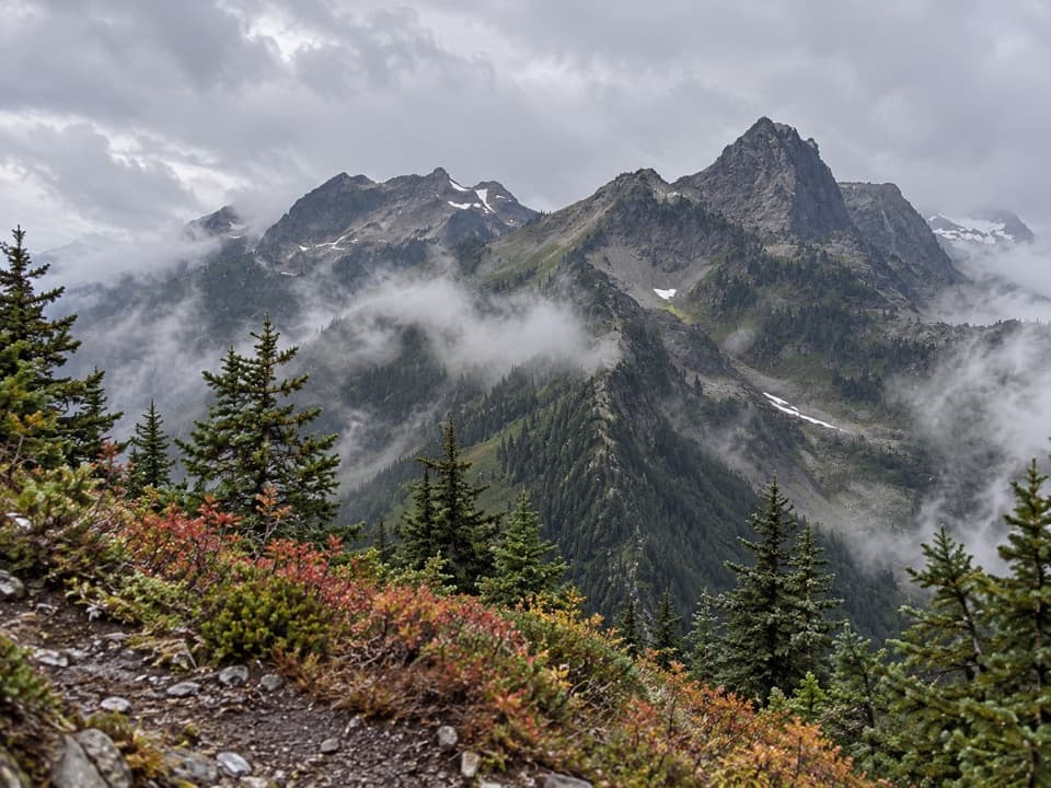
The trail continues from the meadows to Anderson Pass at 4,464 feet. High sections can hold snow in any season; the usual high-country window is early July through October, and snow travel calls for an ice axe and self-arrest skills. Carry a map and compass, since snow can hide the tread and make route-finding harder. There is very little water at the pass, so fill lower in the valley and treat water from streams.

Camps, permits and petsThis is wilderness, with no food or other services in the Dosewallips area.

This is wilderness, with no food or other services in the Dosewallips area. Camping requires a backcountry permit and bear canisters. Established camps are at Dose Forks, Big Timber, Diamond Meadows, Honeymoon Meadows, LaCrosse Pass Junction and Camp Siberia; pit toilets are at Big Timber, Diamond Meadows, Honeymoon Meadows and Camp Siberia. Pets are not allowed on park trails.

Look back across the valleyThe route passes ancient forest, river and glacier-shaped high country.

The route passes ancient forest, river and glacier-shaped high country. Large old-growth stands also provide habitat for threatened spotted owls, though a sighting is never something to count on. Honeymoon Meadows is the strongest place for a photo: include a little meadow growth in front, then keep the forest edge and rocky ridges in the frame so the open valley reads as more than a patch of grass.

Wildlife

Wildlife in Olympic

All Olympic wildlife maps

Sighting maps show where each species has been reported across Olympic. Wildlife moves, so no sighting is guaranteed.

Parkwolf’s Olympic ranking

Top-rated trails in Olympic

All 148 trails
  1. 1Hall of Mosses TrailEasy · 0.8 mi
  2. 2Hurricane Hill TrailModerate · 3.3 mi
  3. 3Sol Duc Falls Nature TrailEasy · 1.6 mi
  4. 4High Divide Loop (Seven Lakes Basin)Challenging · 19 mi
  5. 5Hoh River TrailChallenging · 34.8 mi
  6. 6Shi Shi Beach and Point of Arches TrailModerate · 8 mi

Take Parkwolf to Olympic.

The audio tour guide for the drive, plus offline maps, trails, and wildlife heatmaps for when the signal drops.

4.7 from 8,600+ ratings

Download Parkwolf on the App StoreGet Parkwolf on Google Play