Main Fork Dosewallips River Trail in Olympic National Park

Olympic National Park, WA

Main Fork Dosewallips River Trail

A river valley opens into meadows below a high pass.

Photo: Wikimedia Commons
Length
29.8mi
Time
20hr
Elev. change
4,134ft
Difficulty
Challenging
  • No dogs
  • High point 5,830 ft
  • #51 of 148 in Olympic
Parkwolf audio tour204 stories across Olympic’s roads

Overview

About Main Fork Dosewallips River Trail

Why go

  • A forested river valley gives way to open meadows and big pass views.
  • Several wilderness camps let backpackers break up the long approach.

Heads up

  • Nearly 30 miles round trip; plan for multiple days.
  • Snow can linger near the pass well into summer.

Map & elevation

The route

Loading the Olympic map
Full map
Elevation1,696–5,830 ft
TrailheadFormer Dose Ranger Station / Dosewallips Campground47.73760, -123.16430
Keep this map with you offline in the Parkwolf app

Plan your hike

Before you go

Parking

Roadside parking is at the present end of Dosewallips Road, just over 8 miles west of US 101. The named trail starts at the former Dose Ranger Station and campground, another 5.5 to 6.5 miles along the road-walk route because of the washout; published figures differ, so check current access before setting out. Parking at the road end is roadside, and a toilet there is not guaranteed.

Safety

The upper route can hold snow into summer, with a cornice near Hayden Pass; snow travel requires ice-axe and self-arrest skills. Treat stream water, especially silty Deception Creek. Overnight wilderness trips require a permit and bear canister.

6 active Olympic alerts

  • ClosureDosewallips Road closed to vehicles before campgroundMentions Dosewallips Road, referenced in this guideDosewallips Road is closed to vehicles because of a washout outside the park boundary, 6.5 miles from the campground; vehicles cannot reach the campground.Official details
  • CautionUS 101 Hoh River Bridge reduced to one laneUS 101 at the Hoh River Bridge is restricted to one lane of alternating traffic; obey the signals and 25 mph speed limit.Official details
See all 6 alerts
A park ranger sits on a dash-mounted phone, talking, as Parkwolf’s Tour Guide plays “Army Cutworm Moths: A Grizzly Bear Buffet” on Grand Loop Road below Dunraven Pass in Yellowstone
Parkwolf Tour GuideThe highest, rockiest slopes around here are a summer buffet for grizzly bears.

Olympic Tour Guide

Your drive to Main Fork Dosewallips River Trail, narrated.

Parkwolf is a GPS audio tour guide for Olympic National Park. As you drive, it chimes in with what’s ahead: hidden gems, upcoming stops, history, geology, and wildlife, right through your car’s speakers.

See the Olympic audio tour
  • 204 audio storiesacross Olympic’s roads, triggered by GPS as you drive
  • Wildlife heatmapsfor Olympic Marmot, Humpback Whale, Grey Whale, and 13 more
  • Works offlinemaps, 148 trails, 94 places, and audio download before you lose signal
  • CarPlay readysimple controls built for the drive
★★★★★
“Fantastic app with many points of information… It’s great to just turn on while you’re driving and it gives you an audio tour of the national Park. We love it!!!!”
JMJamesApp Store review
Download Parkwolf on the App StoreGet Parkwolf on Google Play

4.7 from 8,600+ ratings

Trail guide

Hiking Main Fork Dosewallips River Trail

Make room for a real backpacking tripThe Main Fork Dosewallips River Trail is a 29.

The Main Fork Dosewallips River Trail is a 29.8-mile out-and-back from the historic Dose Ranger Station to Hayden Pass, 14.9 miles each way. It starts with an easy river-valley approach, then climbs into broad meadows and a high pass at 5,847 feet. This is a multi-day wilderness trip for hikers comfortable with long days and changing terrain, not a casual day hike; plan on two or three days and use the camps along the route. Published climbing figures range from about 4,250 to 4,800 feet. At Dose Forks, 1.4 miles in, stay right for the Main Fork; the West Fork trail leaves to the left.

The river valleyFrom the old campground, a wide, gently graded tread winds through fir and hemlock forest, with…

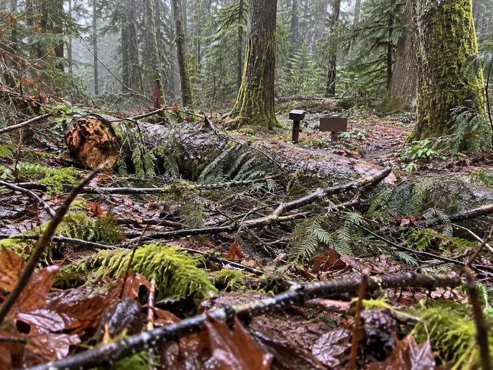
From the old campground, a wide, gently graded tread winds through fir and hemlock forest, with creeks, footlogs, moss and ferns along the way. The Terrace Loop branches off near the start. At 2.5 miles, stay left at the Constance Pass junction; the Main Fork then skirts above the roaring river. A short view of Calypso Falls opens near Upper Twin Creek. Rhododendrons add pink blooms in late spring.

Camps and the changing forestBurdick Creek, at about 5.5 miles, has one small tent site beside the trail.

Burdick Creek, at about 5.5 miles, has one small tent site beside the trail. Deception Creek at 7.8 miles is a larger camp; its water carries fine glacial sediment from Mystery Basin and can clog filters. Beyond it, the grade steepens toward Gray Wolf Junction at 9.2 miles, where the trail leaves the forest for open meadows. Waist-high plants can soak your legs after rain or dew, and rodent holes make it worth watching your footing. Mounts Mystery and Deception rise behind you.

Bear Camp, at 10.9 miles, has a few sites, a shared bear wire, privy and shelter beside fireweed. Dose Meadows at 12.6 miles has another camp but no shelter and sits at the Lost and Cameron Pass junction. It is a useful place to pause and look back toward Mount Fromme; the meadow sign and rocky ridge make a distinctive view.

The climb to Hayden PassPast Dose Meadows, cross the bridge at the headwaters of the Dosewallips, pass through more…

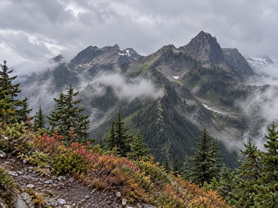
Past Dose Meadows, cross the bridge at the headwaters of the Dosewallips, pass through more forest, then follow switchbacks into the upper basin. The final climb narrows and steepens. A winter snow cornice can linger near the pass; Hayden Pass often does not melt out until mid-July, and snow may remain later. On snow-covered slopes, the park says ice-axe and self-arrest skills are necessary. At the 5,847-foot pass, Mount Olympus and the Bailey Range fill the western skyline, with Mount Anderson to the south.

Rules and preparationOvernight wilderness trips require a permit, and bear canisters are required.

Overnight wilderness trips require a permit, and bear canisters are required. Dogs are not allowed on the trail. There are no food services or potable-water taps on the route; treat stream water, and expect the camps to be basic. The long distance, sustained climb and seasonal snow make this a serious commitment even though the lower tread is broad and well graded.

Wildlife

Wildlife in Olympic

All Olympic wildlife maps

Sighting maps show where each species has been reported across Olympic. Wildlife moves, so no sighting is guaranteed.

Parkwolf’s Olympic ranking

Top-rated trails in Olympic

All 148 trails
  1. 1Hall of Mosses TrailEasy · 0.8 mi
  2. 2Hurricane Hill TrailModerate · 3.3 mi
  3. 3Sol Duc Falls Nature TrailEasy · 1.6 mi
  4. 4High Divide Loop (Seven Lakes Basin)Challenging · 19 mi
  5. 5Hoh River TrailChallenging · 34.8 mi
  6. 6Shi Shi Beach and Point of Arches TrailModerate · 8 mi

Take Parkwolf to Olympic.

The audio tour guide for the drive, plus offline maps, trails, and wildlife heatmaps for when the signal drops.

4.7 from 8,600+ ratings

Download Parkwolf on the App StoreGet Parkwolf on Google Play