Torside Reservoir in Peak District National Park

Sight · Peak District National Park

Torside Reservoir

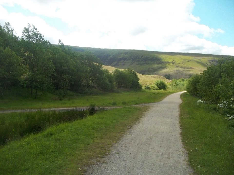
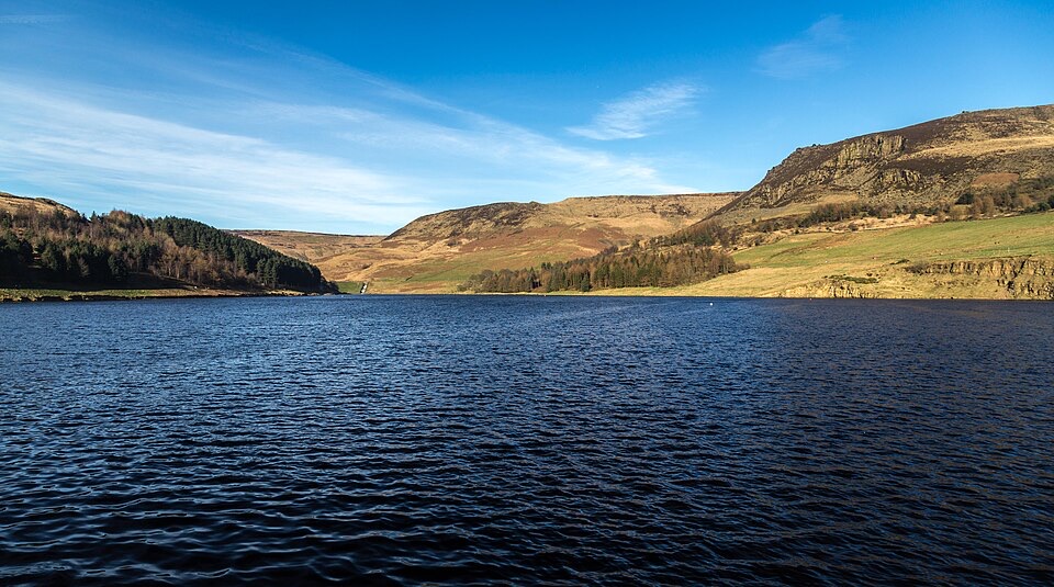
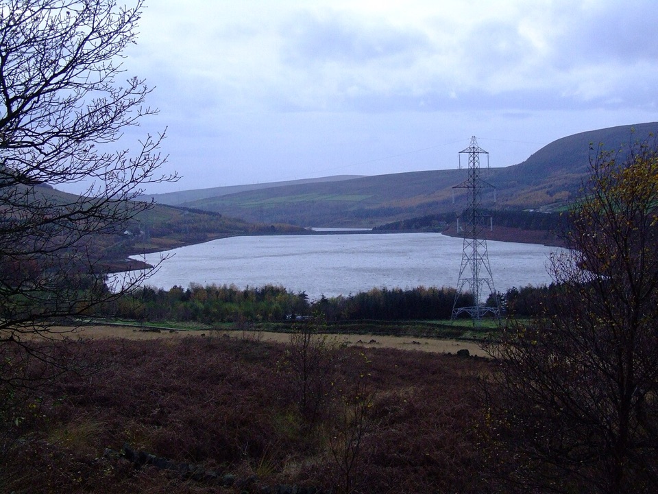
Moorland reservoir views from a flat, accessible old railway trail

Photo: Wikimedia Commons
Type
Sight
Nearest trail
0.4 km
Audio stories
4 nearby
  • Parking
  • Restrooms
  • Picnic tables
  • Scenic viewpoint

Hear the audio tour

Torside Reservoir and Longdendale Trail

Overview

About Torside Reservoir

Why stop

  • Traffic-free former railway trail with broad moorland reservoir views
  • Accessible viewing platform, ponds and picnic facilities at Torside

Heads up

  • Busy B6105 and lorries run close to the visitor experience
  • Surfaces become rougher and less continuous beyond the enhanced section
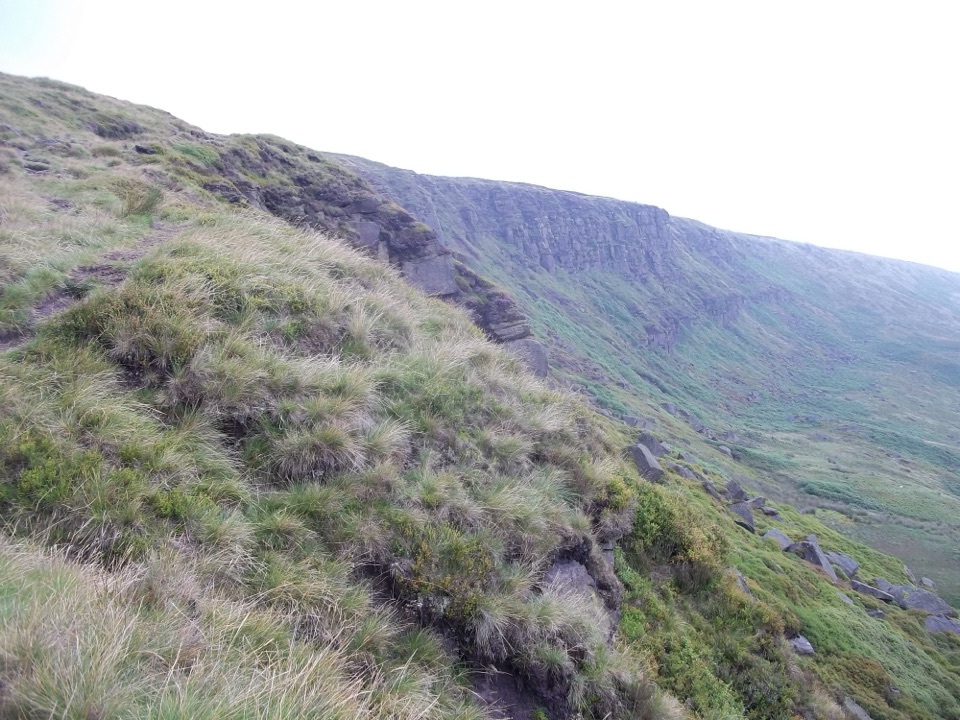
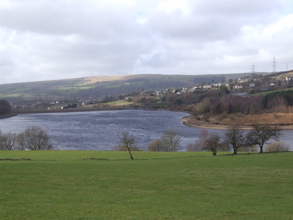
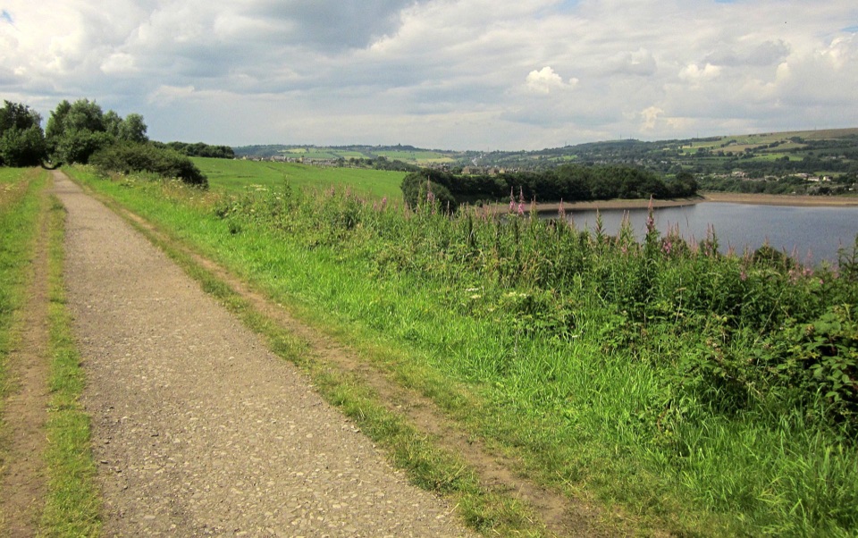
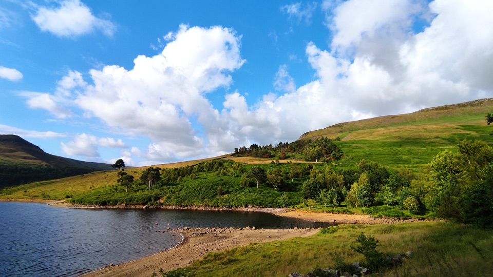
Torside is the easiest way to get close to the water in Upper Longdendale, a chain of reservoirs strung along a steep-sided moorland valley. The draw is the combination of big open views across the water to the surrounding moors and a level, traffic-free trail that follows the bed of the former Woodhead railway, once part of the first railway line between Manchester and Sheffield. That history is why the walking here feels so unusually gentle for the High Peak: you are following an old rail alignment, not a hillside path.
Parkwolf’s verdictWhy stop here

Map

Where it is

Loading the Peak District map
Full map
SightTorside Reservoir53.48459, -1.90231
Keep this map with you offline in the Parkwolf app

Plan your stop

Before you go

Best time to visit

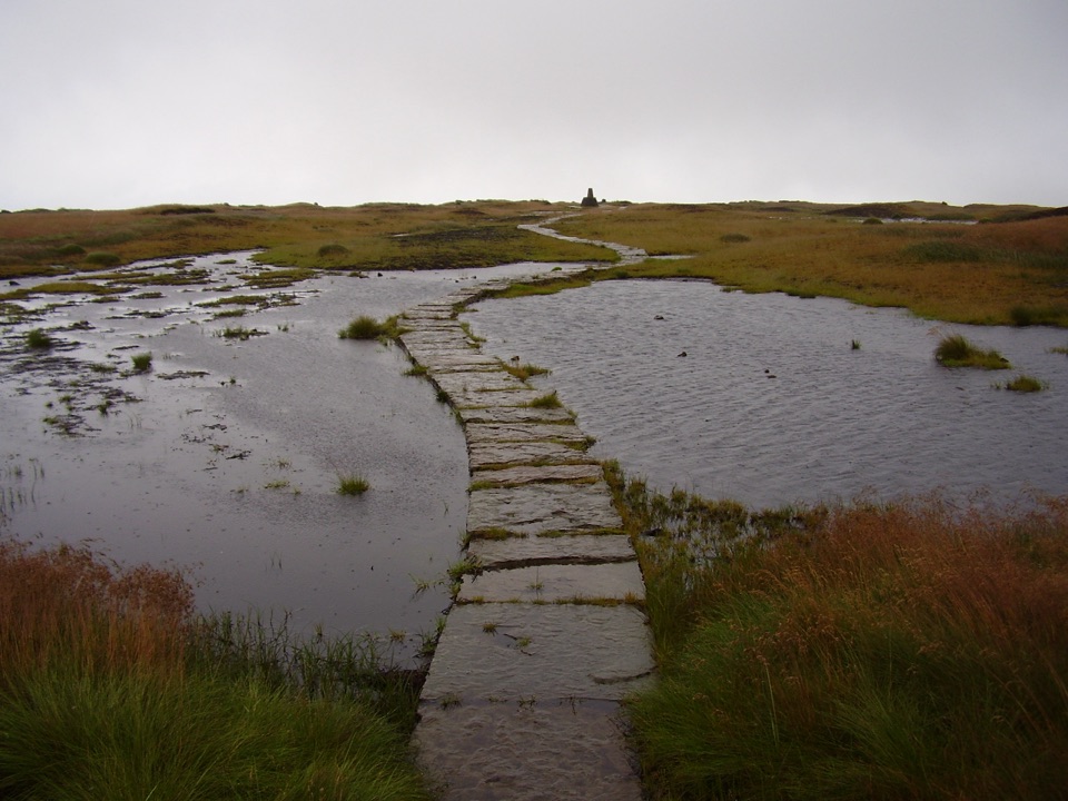
This is an exposed moorland valley, so wind and low cloud can arrive quickly and strip out the views that make the stop worthwhile; a clear, settled day rewards you most. Early morning and the last hours of daylight give the best light across the water and the quietest trail. Weekends and school holidays bring the most people to the car park and the accessible section, so weekday visits feel considerably calmer. In winter, plan around short daylight hours and start your walk with time to spare, and in any season allow for variable ground underfoot away from the surfaced trail.


Getting there and getting on the trail

Start at Torside Car Park, reached from the B6105 via Glossop or from the A628. It is a surfaced car park with three disabled spaces, and payment is by app, contactless or card. From the car park you join the Longdendale Trail, a 6.5 mile (10.4 km) traffic-free route that forms part of the wider Trans Pennine Trail running from Liverpool to Hull and on into Europe.

The section at Torside has been enhanced for accessibility, with a good surface suitable for walkers, wheelchairs, pushchairs, cyclists and horse riders, though you will meet staggered barriers along the way. The Torside toilets include the National Park's first accessible Changing Place.

5 active Peak District alerts

  • ClosureA54 Cat and Fiddle road closureThe A54 Macclesfield Main Road (Cat and Fiddle) is fully closed to all traffic from 27 July through 30 October 2026 during phase 1 improvement works.Official details
  • ClosureHooks Carr (Stanage Popular) car park closureHooks Carr (Stanage Popular) car park will be partially or fully closed from 6 October for four weeks.Official details
See all 5 alerts
A park ranger sits on a dash-mounted phone, talking, as Parkwolf’s Tour Guide plays “Army Cutworm Moths: A Grizzly Bear Buffet” on Grand Loop Road below Dunraven Pass in Yellowstone
Parkwolf Tour GuideThe highest, rockiest slopes around here are a summer buffet for grizzly bears.

Peak District Tour Guide

Your drive to Torside Reservoir, narrated.

Parkwolf is a GPS audio tour guide for Peak District National Park. As you drive, it chimes in with what’s ahead: hidden gems, upcoming stops, history, geology, and wildlife, right through your car’s speakers.

Recorded for this place

Torside Reservoir and Longdendale Trail
0:00 / 0:29
“You're nearing Torside Reservoir, where a short walk from the car park reaches a ramped platform looking over the water and moors.”

Plays as you drive up to Torside Reservoir in the Parkwolf Peak District Tour Guide.

More stories near here in the app

  • The Water Beneath Manchester's Taps
  • Crowden Horseshoe and Laddow Rocks
  • Rivers in the Gritstone
  • A First Day over Two Moors
  • 298 audio storiesacross Peak District’s roads, triggered by GPS as you drive
  • Wildlife heatmapsfor Red Deer, Red Fox, Eurasian Otter, and 13 more
  • Works offlinemaps, 88 trails, 76 places, and audio download before you lose signal
  • CarPlay readysimple controls built for the drive
★★★★★
“Fantastic app with many points of information… It’s great to just turn on while you’re driving and it gives you an audio tour of the national Park. We love it!!!!”
JMJamesApp Store review
Download Parkwolf on the App StoreGet Parkwolf on Google Play

4.7 from 8,600+ ratings

Guide

More about Torside Reservoir

What you'll see and doMany visitors come for a short there-and-back stroll, others link sections into longer loops.

Many visitors come for a short there-and-back stroll, others link sections into longer loops. Be aware that visitor reports describe the waterside route as incomplete or uneven in places, so plan a walk out and back rather than assuming you can follow the shoreline the whole way round.

  • A viewing platform looking out over the water, the main reason this counts as a proper sight and not just a path.
  • Ponds and a memorial wood along the enhanced section of the trail.
  • A picnic area and information point at Torside, making this a natural short stop rather than a full day out.
  • Open moorland, woodland edges and the pylon lines that cross the valley, all part of the working landscape here.
Practical adviceFacilities are concentrated at Torside.
  • Facilities are concentrated at Torside. The verified toilets, picnic area and information point are all at the car park end, so sort out what you need before setting off and plan accordingly.
  • Surfaces vary. The enhanced section is good, but visitors regularly note rougher, unpaved stretches and some steeper pitches once you move away from it. Wear proper footwear if you intend to explore beyond the accessible part.
  • The B6105 crossing matters. To continue down Longdendale you must cross the Glossop road at Torside. It carries fast traffic including lorries, so cross with care and keep children and dogs close.
  • Road noise is part of the experience along the stretch beside the reservoir, since the valley road runs close to the water.
  • Ground conditions change with the weather, so check what you are wearing against what the sky is doing before you commit to a longer walk.
Why stop hereThe reservoir system was built to serve local industry, powering cotton and paper mills, and…

The reservoir system was built to serve local industry, powering cotton and paper mills, and the water here now supplies close to a quarter of Greater Manchester's needs. Locals will also tell you about the Longdendale Lights, unexplained lights reported over these hills for generations; treat it as valley folklore rather than something to plan an evening around.

Wildlife

Wildlife in Peak District

All Peak District wildlife maps

Sighting maps show where each species has been reported across Peak District. Wildlife moves, so no sighting is guaranteed.

Parkwolf’s Peak District ranking

Top sights in Peak District

All 76 places
  1. 1Chatsworth HouseSight
  2. 2Mam TorSight
  3. 3Dovedale Stepping StonesSight
  4. 4Ladybower ReservoirSight
  5. 5Stanage EdgeSight
  6. 6Kinder ScoutSight

Take Parkwolf to Peak District.

The audio tour guide for the drive, plus offline maps, trails, and wildlife heatmaps for when the signal drops.

4.7 from 8,600+ ratings

Download Parkwolf on the App StoreGet Parkwolf on Google Play