Edith Cavell Bridge in Queenstown-Lakes District, New Zealand

Sight · Queenstown-Lakes District, New Zealand

Edith Cavell Bridge

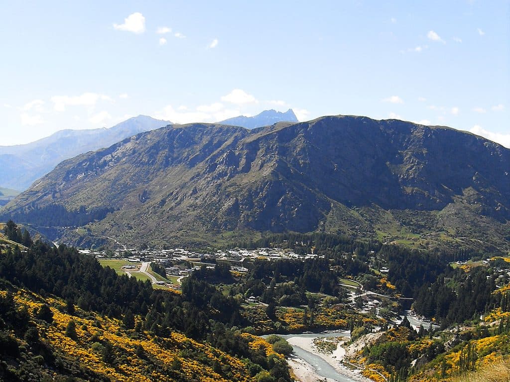
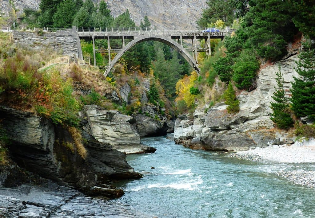
Historic one-lane arch with turquoise canyon views and jet boats

Photo: Wikimedia Commons
Type
Sight
Nearest trail
0.9 km
Audio stories
4 nearby
  • Parking
  • Scenic viewpoint

Hear the audio tour

Edith Cavell Bridge: River Views and a WWI Tribute

Overview

About Edith Cavell Bridge

A graceful single‑lane concrete arch over the Shotover River, the Edith Cavell Bridge is a quick, rewarding stop for canyon views and the spectacle of Shotover Jet boats zipping beneath you. It’s open access, free, and recognized on the national heritage list, so you’re getting a slice of history with your scenery.

Why stop

  • Front‑row views of the turquoise Shotover River and jet boats
  • Quick, free stop with a small lookout and parking

Heads up

  • No onsite facilities and limited amenities nearby
  • Small car park and active one‑lane traffic can feel hectic
Vivid, glacial‑tinted water framed by steep canyon walls.
Parkwolf’s verdictWhy go

Map

Where it is

Loading the Queenstown-Lakes District map
Full map
SightEdith Cavell Bridge-44.98829, 168.67192
Keep this map with you offline in the Parkwolf app

Local know-how

Tips for visiting Edith Cavell Bridge

  1. Use the east‑side lookout for the best arch‑and‑canyon composition.

  2. Walk down to the riverfront opposite the tunnels for low‑angle shots.

  3. Avoid peak midday glare unless you want the brightest turquoise color.

  4. Expect brief closures around ANZAC Day (April 25) for a remembrance ceremony.

  5. Watch for moving vehicles on the one‑lane bridge and keep well off the roadway.

Plan your stop

Before you go

Best time to visit

Daylight hours show the color best. Early morning or late afternoon softens the light and thins the crowds. On ANZAC Day (April 25) the bridge is typically closed briefly for a local piper’s remembrance ceremony—plan around short traffic disruptions.

Getting there & parking

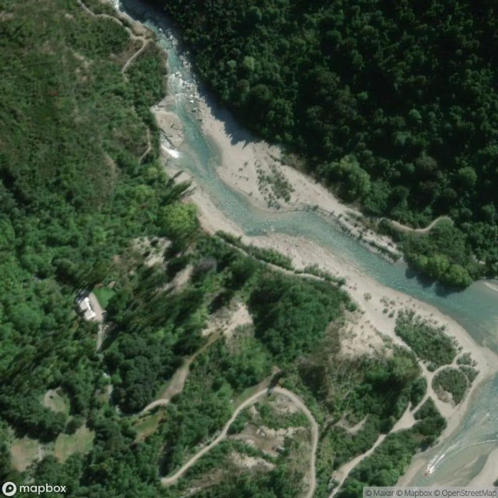
You’ll find it at Arthur’s Point, a short drive from Queenstown. There’s a small public car park and lookout on the east side of the river. Public transport is limited; driving, taxi, or rideshare is simplest.

A park ranger sits on a dash-mounted phone, talking, as Parkwolf’s Tour Guide plays “Army Cutworm Moths: A Grizzly Bear Buffet” on Grand Loop Road below Dunraven Pass in Yellowstone
Parkwolf Tour GuideThe highest, rockiest slopes around here are a summer buffet for grizzly bears.

Queenstown-Lakes District Tour Guide

Your drive to Edith Cavell Bridge, narrated.

Parkwolf is a GPS audio tour guide for Queenstown-Lakes District, New Zealand. As you drive, it chimes in with what’s ahead: hidden gems, upcoming stops, history, geology, and wildlife, right through your car’s speakers.

See the Queenstown-Lakes District audio tour

Recorded for this place

Edith Cavell Bridge: River Views and a WWI Tribute
Listen
“You're now approaching the Edith Cavell Bridge in Arthur's Point. It’s a graceful, single-lane arch and a fantastic, free spot to watch the Shotover Jet boats race through the canyon right underneath.”

Plays as you drive up to Edith Cavell Bridge in the Parkwolf Queenstown-Lakes District Tour Guide.

More stories near here in the app

  • Oxenbridge Tunnel: A Gold Miner's Failed Gamble
  • Moonlight Track: A Backcountry Gold Rush Route
  • Hamilton Jet: The Kiwi Speedboat Invention
  • Queenstown Hill: A Rewarding Local's Hike
  • 164 audio storiesacross Queenstown-Lakes District’s roads, triggered by GPS as you drive
  • Wildlife heatmapsfor Kea, Kākā, Kererū, and 13 more
  • Works offlinemaps, 37 trails, 111 places, and audio download before you lose signal
  • CarPlay readysimple controls built for the drive
★★★★★
“Fantastic app with many points of information… It’s great to just turn on while you’re driving and it gives you an audio tour of the national Park. We love it!!!!”
JMJamesApp Store review
Download Parkwolf on the App StoreGet Parkwolf on Google Play

4.7 from 8,600+ ratings

Guide

More about Edith Cavell Bridge

What you’ll seeExpect sweeping views up and down the Shotover Gorge, with jet boats threading the narrows…

Expect sweeping views up and down the Shotover Gorge, with jet boats threading the narrows below. Short informal paths lead down to the riverfront opposite the Oxenbridge tunnels for low‑angle shots and a different perspective. Supervise kids near the steep banks and keep clear of moving traffic on the bridge.

Photography tipsBring a wide‑angle for the arch and canyon, plus a short telephoto (around 70–135 mm) to frame…

Bring a wide‑angle for the arch and canyon, plus a short telephoto (around 70–135 mm) to frame boats between the cliffs. From the east lookout, use the arch as a foreground frame; from river level, shoot upstream for reflections. Midday light is harsher but can intensify the turquoise hue. Drones are subject to local council rules—check before you fly.

History noteBuilt between November 1917 and February 1919 as a concrete parabolic arch, the bridge took…

Built between November 1917 and February 1919 as a concrete parabolic arch, the bridge took over from an 1875 wooden structure. Local miner Jack Clark painted the name of Edith Cavell— the British WWI nurse—on the new bridge, and the tribute stuck. It’s now recognized by Heritage New Zealand.

PracticalitiesOpen access, no admission fee.
  • Open access, no admission fee.
  • No restrooms at the bridge; cafés and facilities are in Arthur’s Point.
  • Close to the Shotover Jet base if you want to pair the viewpoint with a ride.
  • It’s a one‑lane road bridge—be alert, step well off the carriageway for photos.
Geology at a glanceThat striking blue‑green color comes from fine glacial sediments suspended in the water, with…

That striking blue‑green color comes from fine glacial sediments suspended in the water, with the narrow canyon carved over millennia—perfect conditions for dramatic scenery and fast boat runs.

Why goEasy roadside viewpoint that punches above its weight for photos.
  • Easy roadside viewpoint that punches above its weight for photos.
  • Watch the Shotover Jet boats carve past the bridge without buying a ticket for the ride.

Wildlife

Wildlife in Queenstown-Lakes District

All Queenstown-Lakes District wildlife maps

Sighting maps show where each species has been reported across Queenstown-Lakes District. Wildlife moves, so no sighting is guaranteed.

Keep exploring

Near Edith Cavell Bridge

See it all on the map

Trails nearby

More stops nearby

Parkwolf’s Queenstown-Lakes District ranking

Top sights in Queenstown-Lakes District

All 111 places
  1. 1Lake WakatipuSight
  2. 2Ben LomondSight
  3. 3Bob’s Peak – Queenstown Gondola LookoutSight
  4. 4Lake WānakaSight
  5. 5TSS EarnslawSight
  6. 6Ben Lomond SaddleSight

Take Parkwolf to Queenstown-Lakes District.

The audio tour guide for the drive, plus offline maps, trails, and wildlife heatmaps for when the signal drops.

4.7 from 8,600+ ratings

Download Parkwolf on the App StoreGet Parkwolf on Google Play