Gold Bluffs Beach Section of the Coastal Trail in Redwood National Park

Redwood National Park, CA

Gold Bluffs Beach Section of the Coastal Trail

Rugged coastal walk with a steep beach drop and scattered sea stacks.

Photo: CC BY 2.0
Length
4.8mi
Time
3hr
Elev. change
591ft
Difficulty
Moderate
  • No dogs
  • High point 591 ft

Hear the audio tour

Carruthers Cove

Overview

About Gold Bluffs Beach Section of the Coastal Trail

Why go

  • The steep forest descent opens onto a quiet beach beneath dramatic coastal bluffs.
  • Sea stacks, coastal prairie, and a hidden waterfall add variety to the shoreline walk.

Heads up

  • Point-to-point logistics need a pickup or a long return walk.
  • Tides and waterlogged meadow tread can disrupt the beach-to-inland route.

Map & elevation

The route

Loading the Redwood map
Full map
Elevation0–591 ft
TrailheadGold Bluffs Beach Section north access on Coastal Drive41.46611, -124.05599
Keep this map with you offline in the Parkwolf app

Plan your hike

Before you go

Parking

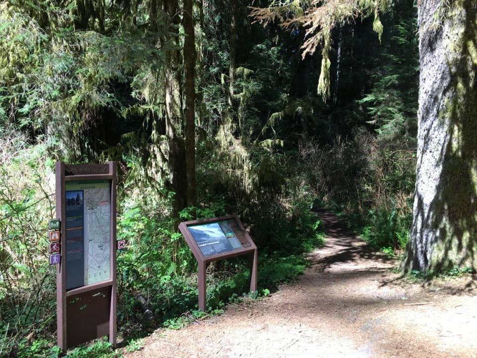
Use the signed north access on Coastal Drive, about 1.5 miles from the Newton B. Drury Scenic Parkway junction. The marked south access is on Davison Road just past the Gold Bluffs Beach entrance station. This is a point-to-point walk, so stage a vehicle at each end or arrange a pickup; do not expect a loop back to the start.

Safety

Check tide tables before the beach section; water and rocks can narrow the passage. Inland meadow tread may be flooded or indistinct, so confirm route continuity before setting up a one-way shuttle. Davison Road has stream crossings that can be difficult after rain. Pets are prohibited on park trails.

6 active Redwood alerts

  • CautionU.S. 101 construction traffic controlsExpect construction-related traffic stops and one-way controlled traffic on U.S. 101; allow extra time and drive cautiously. - NPS reports multiple stops between Orick and Crescent City; delays vary.Official details
  • CautionU.S. 199 construction traffic controlsExpect 24/7 one-way controlled traffic on three U.S. 199 segments because of construction. - 6–6.2 miles north of Gasquet: through 6:00 p.m. December 15, 2026; delays up to 10 minutes. - 9.6–9.Official details
See all 6 alerts
A park ranger sits on a dash-mounted phone, talking, as Parkwolf’s Tour Guide plays “Army Cutworm Moths: A Grizzly Bear Buffet” on Grand Loop Road below Dunraven Pass in Yellowstone
Parkwolf Tour GuideThe highest, rockiest slopes around here are a summer buffet for grizzly bears.

Redwood Tour Guide

Your drive to Gold Bluffs Beach Section of the Coastal Trail, narrated.

Parkwolf is a GPS audio tour guide for Redwood National Park. As you drive, it chimes in with what’s ahead: hidden gems, upcoming stops, history, geology, and wildlife, right through your car’s speakers.

See the Redwood audio tour

Recorded for this trailhead

Carruthers Cove
0:00 / 0:23
“You're approaching the Coastal Drive access for Carruthers Cove, a beach reached on foot farther along the road.”

Plays as you drive up to this trailhead in the Parkwolf Redwood Tour Guide.

More stories near here in the app

  • How Cold Water Feeds the Coast
  • Ah-Pah Interpretive Trail
  • Tallest and Largest
  • The Anemone Under the Shells
  • 85 audio storiesacross Redwood’s roads, triggered by GPS as you drive
  • Wildlife heatmapsfor Black Bear, Elk, California Condor, and 13 more
  • Works offlinemaps, 83 trails, 48 places, and audio download before you lose signal
  • CarPlay readysimple controls built for the drive
★★★★★
“Fantastic app with many points of information… It’s great to just turn on while you’re driving and it gives you an audio tour of the national Park. We love it!!!!”
JMJamesApp Store review
Download Parkwolf on the App StoreGet Parkwolf on Google Play

4.7 from 8,600+ ratings

Trail guide

Hiking Gold Bluffs Beach Section of the Coastal Trail

A coastal point-to-pointThe Gold Bluffs Beach Section is a 4.

The Gold Bluffs Beach Section is a 4.8-mile, one-way walk from the signed access on Coastal Drive near Carruthers Cove to Davison Road. It drops steeply from the bluff to the beach, follows the coast, then turns inland through prairie beside the Gold Bluffs. This is a half-day route, not a loop. The published distance is 4.8 miles; the connected mapped line between those access points measures about 5.5 miles, so allow extra time. Plan a pickup at the far end or turn around for a much longer walk back.

Down to Carruthers CoveThe opening descent follows an old roadbed through Sitka spruce and alder.

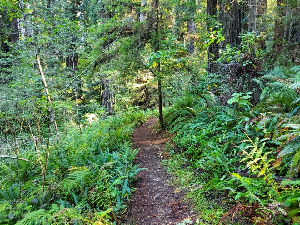
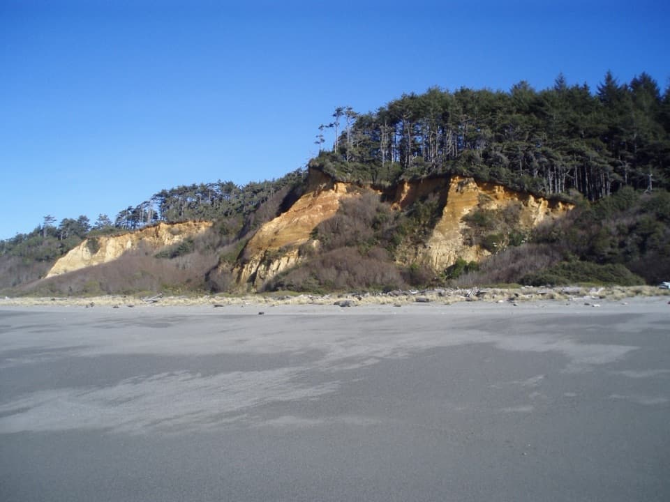
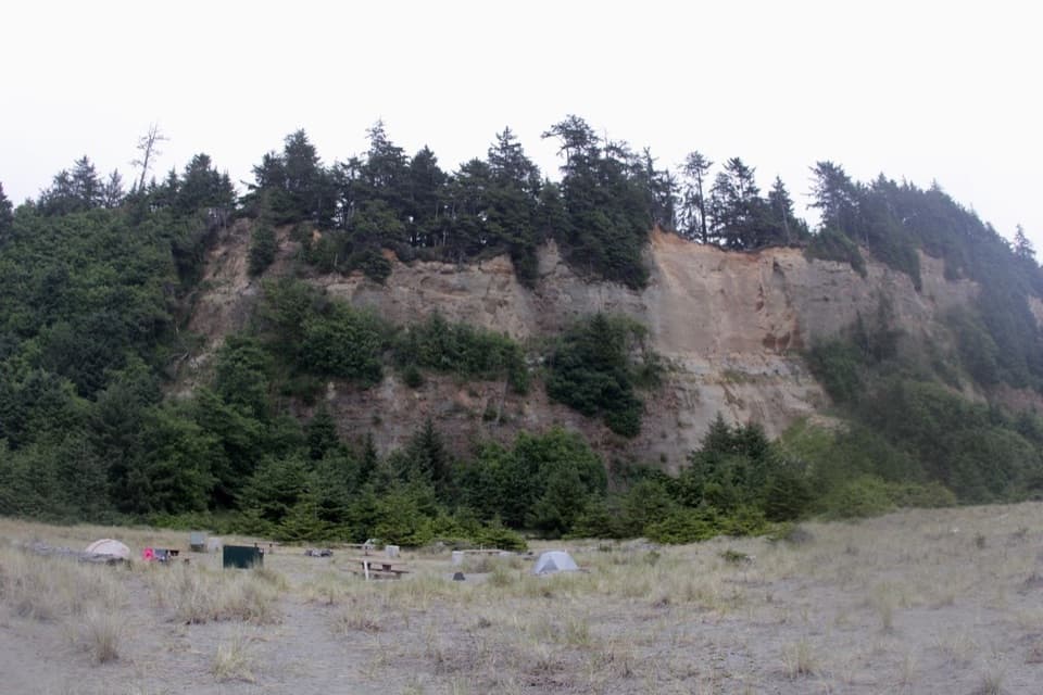
The opening descent follows an old roadbed through Sitka spruce and alder. The coast stays hidden for much of the way, then the path drops across driftwood onto sand at Carruthers Cove. Here the bluffs rise close above the beach and a large rock outcrop marks the cove. The steep drop is the hardest part in either direction; returning to Coastal Drive means climbing it.

Beach and bluff countrySouth of the cove, the route crosses a broad stretch of sand with sea stacks and the dark,…

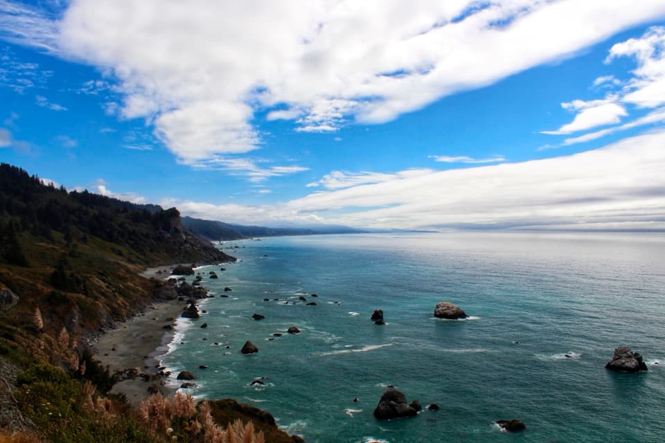
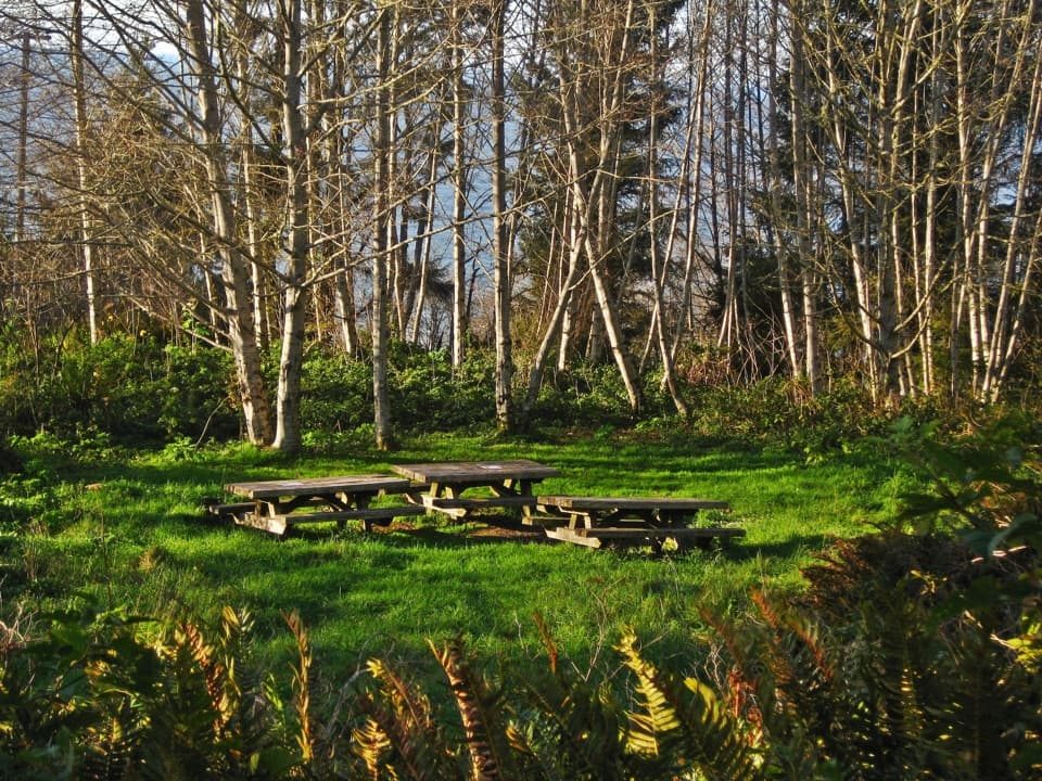
South of the cove, the route crosses a broad stretch of sand with sea stacks and the dark, wave-worn rocks around Ossagon Creek. Watch the tide before committing to the beach: constrictions between the water and rocks can make a passage difficult or impassable. Near Ossagon Creek the route leaves the shore for the coastal tread, crossing open prairie and alder at the foot of the bluffs. A short spur reaches Gold Dust Falls, a fern-lined grotto in the woods. The Gold Bluffs were a site of nineteenth-century gold mining. Elk use the coastal meadows, and seabirds gather on offshore rocks.

Conditions and nearby walksSections of the inland meadow tread have been reported flooded, muddy and hard to follow,…

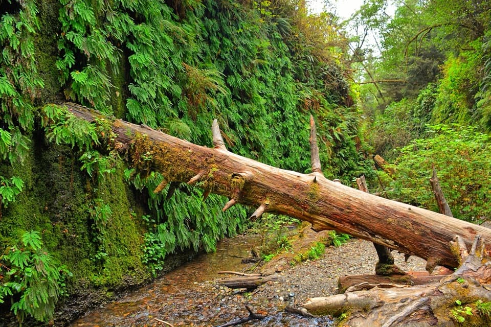
Sections of the inland meadow tread have been reported flooded, muddy and hard to follow, especially in the wet season. Check that the through route is passable before arranging a one-way vehicle shuttle. There are no services at the north access, so bring what you need for the walk. Fern Canyon is a separate short walk from the Davison Road area, not part of this mapped section; check its separate vehicle access rules if adding it. Pets are not allowed on park trails.

Wildlife

Wildlife in Redwood

All Redwood wildlife maps

Sighting maps show where each species has been reported across Redwood. Wildlife moves, so no sighting is guaranteed.

Keep exploring

Near Gold Bluffs Beach Section of the Coastal Trail

See it all on the map

Trails that start nearby

Places near the trailhead

Parkwolf’s Redwood ranking

Top-rated trails in Redwood

All 83 trails
  1. 1Fern Canyon Loop TrailModerate · 1 mi
  2. 2Miners Ridge and James Irvine LoopChallenging · 12 mi
  3. 3Boy Scout Tree TrailModerate · 5.6 mi
  4. 4Stout Memorial Grove TrailEasy · 0.6 mi
  5. 5Grove of Titans TrailEasy · 1.8 mi
  6. 6Tall Trees TrailChallenging · 3.7 mi

Take Parkwolf to Redwood.

The audio tour guide for the drive, plus offline maps, trails, and wildlife heatmaps for when the signal drops.

4.7 from 8,600+ ratings

Download Parkwolf on the App StoreGet Parkwolf on Google Play