Congress Trail

Paved sequoia loop past the President, House, and Senate

LENGTH
2.7 mi
TIME
1.5 hr
DIFFICULTY
Easy
DOGS
Not allowed
Congress Trail, Sequoia National Park
Image credit: Flickr

Pros & cons

PROS

  • Dense concentration of named giant sequoias in a short loop
  • Crowds drop quickly after the Sherman area, especially early or late

CONS

  • Finish includes a noticeable uphill back to the main lot
  • Stairs and steeper grades limit accessibility despite pavement
PARKING

Primary parking at the General Sherman Tree lot (fills early). An accessible parking area along the Generals Highway provides a gentler paved approach (placard required). Seasonal shuttle service can drop at the Sherman area to avoid the uphill return.

CAUTION

Paved doesn’t mean flat—expect grades and some stairs; altitude makes exertion feel harder. Winter brings ice/snow on pavement; microspikes help. Parking and crowds peak mid‑day. Stay on the paved path to protect sequoia roots and give any bears wide space.

Overview

If you want maximum giant-sequoia payoff for minimal effort, this is it. Congress Trail is a paved loop through the heart of the Giant Forest, weaving past named titans like the President and the House and Senate clusters. The loop itself is about 2.7 miles total; most visitors starting from the main General Sherman parking add a short connector, making the outing closer to 2.9 miles. Expect around 480 feet of total gain, mostly the climb back from the Sherman area to the upper lot.

What You’ll See

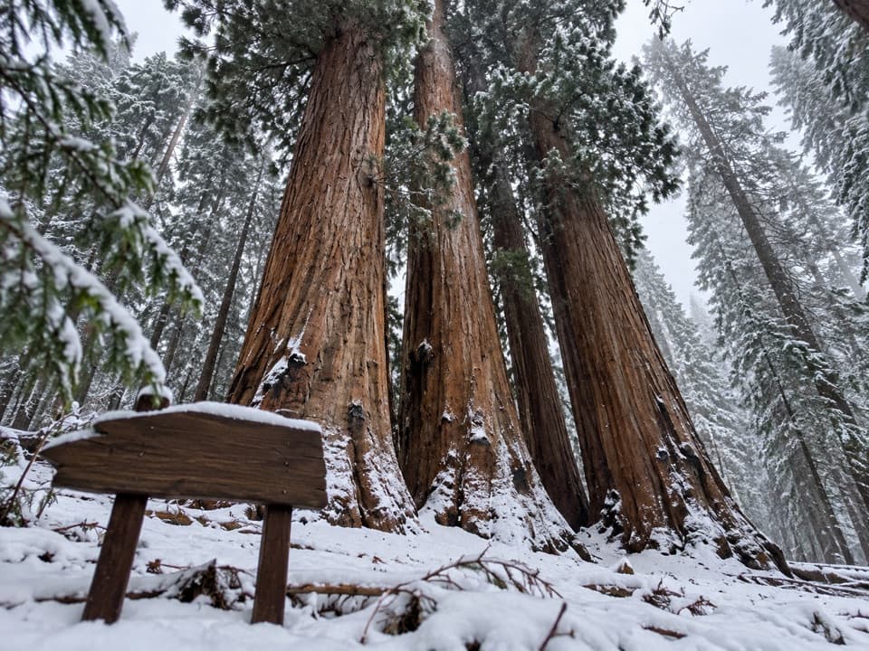
The first stretch shares the bustle near the General Sherman Tree, then the crowd thins and the grove magic kicks in—massive cinnamon trunks, fire-scarred bark, and a surprisingly open forest floor (that sparse understory is normal here). Highlights include the President Tree and the photogenic House and Senate groups. Keep an eye out for interpretive pullouts and a few “tunnel” features where you can walk through old sequoia wood. A short, worthwhile side trip from a multi-way junction reaches the Lincoln Tree and a small meadow.

Route Notes

Start near General Sherman, then pick up Congress Trail to form the lollipop-shaped loop. It’s paved the whole way with gentle rollers, benches sprinkled along the route, and a moderate climb to finish if you’re returning to the upper lot. The loop is easy to follow with clear signs at key junctions.

Accessibility & Difficulty

While paved, parts of the main loop include stairs and grades above 8%, so it’s not fully accessible for many mobility devices. There’s an accessible parking area along the Generals Highway that leads to a paved approach with up to a 5% incline and benches. Altitude (around 7,000 feet) and that final uphill can make the “easy” label feel more like easy‑moderate.

Best Times to Hike

Go early morning or late afternoon for softer light and fewer people; the area around Sherman can be shoulder-to-shoulder mid‑day, but the loop itself stays relatively calm once you commit past the first half‑mile. The trail is enjoyable year‑round. In winter, expect packed snow or ice—microspikes make the paved surface much safer if it’s slick. Summer is busiest; spring and fall are cooler and quieter.

Logistics & Tips

Park at the signed General Sherman Tree lot (fills early in peak season). If parking is tight, use the seasonal shuttle or the accessible lot (placard required). There are restrooms and water at the trailhead, but none on the loop. In summer, shuttles can save you the steep walk back to the upper lot. Bring water, sun protection (some sections feel exposed), and be ready for cool mornings and warm afternoons. Keep food secured and give any bears plenty of space.

Etiquette & Nearby Alternatives

Stay on the paved path—stepping off damages delicate roots and soils. No dogs on trails. If you want an even flatter family stroll, the nearby Big Trees Trail is a great backup plan.

Elevation

2.7 mi · 1.5 hr
Start · 2111 mHigh point · 2191 mEnd · 2111 m

Where it starts

36.5810, -118.7503
Congress Trail

Wildlife on this trail

Near Congress Trail

All places →All trails →

More about Congress Trail

PARKWOLF TOUR GUIDE

Like a tour guide in your car.

Bring Sequoia trail research into the car, with offline maps and stories that play as you drive.
Download Parkwolf on the App StoreGet Parkwolf on Google Play
The Parkwolf tour guide sitting on a phone mounted in a car
Get the Audio Tour Guide for your drive through SequoiaOpen Parkwolf