John & May Burfiend Barn in Sleeping Bear Dunes National Lakeshore

Sight · Sleeping Bear Dunes National Lakeshore

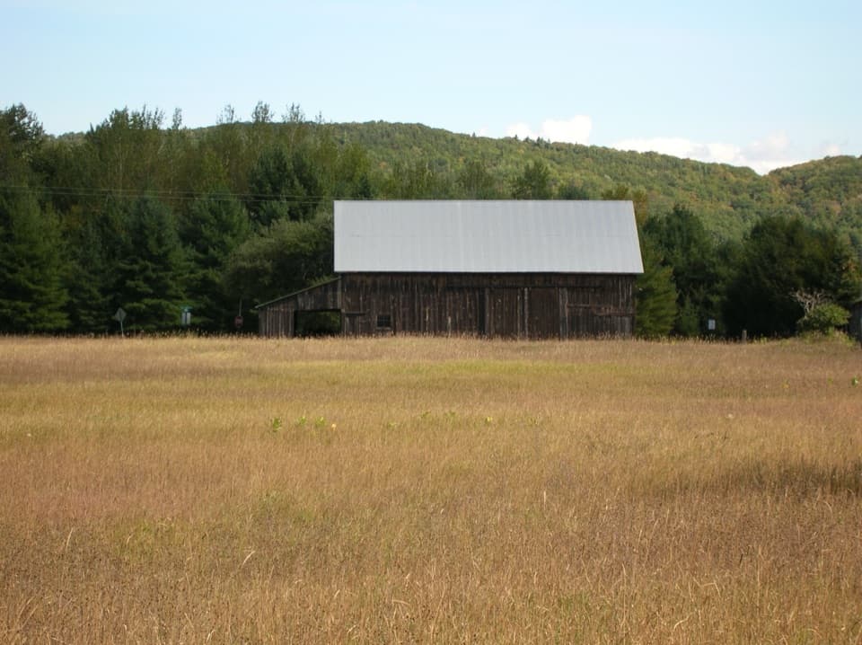
John & May Burfiend Barn

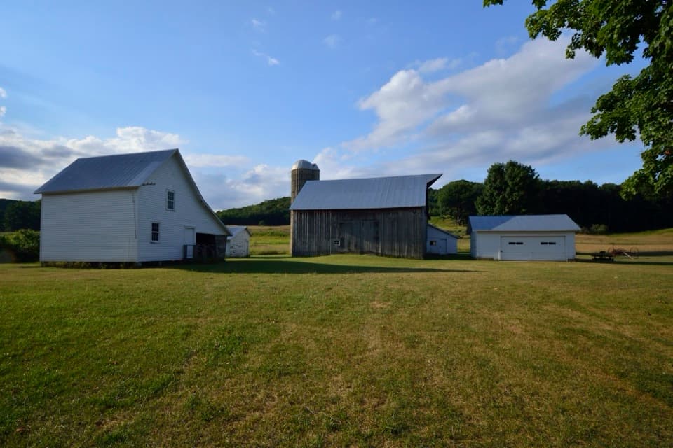
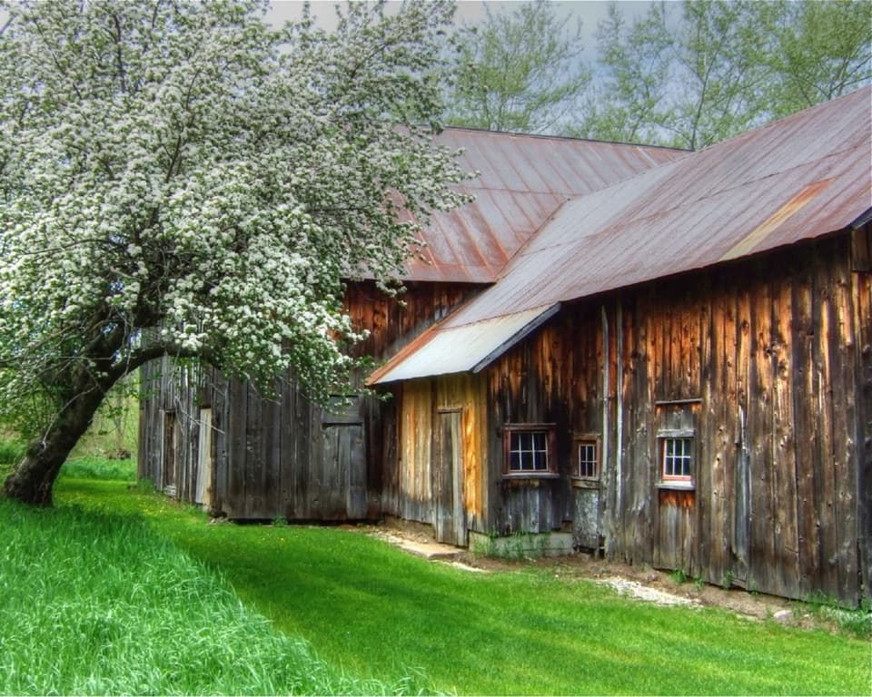
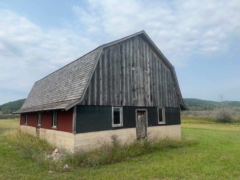
An 1890s barn with the machinery behind Port Oneida’s farm history.

Photo: National Park Service
Type
Sight
Nearest trail
0.7 mi
Audio stories
14 nearby

Hear the audio tour

Miller Road: The Werner Farm's Forced Move

Overview

About John & May Burfiend Barn

Why stop

  • Its original layout makes the farm history concrete.

Heads up

  • Interior access and site parking are unconfirmed.

Map

Where it is

Loading the Sleeping Bear Dunes map
Full map
SightJohn & May Burfiend Barn44.94084, -85.93885
Keep this map with you offline in the Parkwolf app

Plan your stop

Before you go

1 active Sleeping Bear Dunes alert

  • ClosureManitou Islands access closures during 2026 constructionNorth and South Manitou Islands have limited visitor access throughout the 2026 season: all facilities, docks, and utilities on both islands remain closed during major construction.Official details

Sleeping Bear Dunes alerts
A park ranger sits on a dash-mounted phone, talking, as Parkwolf’s Tour Guide plays “Army Cutworm Moths: A Grizzly Bear Buffet” on Grand Loop Road below Dunraven Pass in Yellowstone
Parkwolf Tour GuideThe highest, rockiest slopes around here are a summer buffet for grizzly bears.

Sleeping Bear Dunes Tour Guide

Your drive to John & May Burfiend Barn, narrated.

Parkwolf is a GPS audio tour guide for Sleeping Bear Dunes National Lakeshore. As you drive, it chimes in with what’s ahead: hidden gems, upcoming stops, history, geology, and wildlife, right through your car’s speakers.

Recorded for this place

Miller Road: The Werner Farm's Forced Move
0:00 / 0:25
“You're approaching Miller Road, the access to the Werner Barn in Port Oneida. The barn sits at the road's end, and I'd make this a short detour if the area's farm history interests you.”

Plays as you drive up to John & May Burfiend Barn in the Parkwolf Sleeping Bear Dunes Tour Guide.

More stories near here in the app

  • Kelderhouse Farm and Port Oneida School: Community Life
  • Port Oneida Farms Heritage Center: A Modern Farmhouse
  • Dechow Farm: Maple Syrup during Rationing
  • Bay View Trails: Farms or the Longer Ridge Loop
  • 73 audio storiesacross Sleeping Bear Dunes’s roads, triggered by GPS as you drive
  • Wildlife heatmapsfor Piping Plover, Bald Eagle, White-tailed Deer, and 13 more
  • Works offlinemaps, 34 trails, 89 places, and audio download before you lose signal
  • CarPlay readysimple controls built for the drive
★★★★★
“Fantastic app with many points of information… It’s great to just turn on while you’re driving and it gives you an audio tour of the national Park. We love it!!!!”
JMJamesApp Store review
Download Parkwolf on the App StoreGet Parkwolf on Google Play

4.7 from 8,600+ ratings

Guide

More about John & May Burfiend Barn

A quick stop in Port OneidaJohn & May Burfiend Barn is a four-bay English-style ground barn at Port Oneida and Miller…

John & May Burfiend Barn is a four-bay English-style ground barn at Port Oneida and Miller roads, in Sleeping Bear Dunes’ historic farming district. It’s a short roadside stop for a closer look at the buildings behind the area’s farm history. Most Port Oneida farmsteads are close to the road and take little walking; this barn’s hours, parking, and current interior access aren’t specified.

A barn built to threshThe barn dates to the 1890s.

The barn dates to the 1890s. Its wooden threshing floor was used to beat wheat and oats free of their stalks, and the structure contains an early mechanized thresher along with an overhead track and hayfork for moving loose hay. The four-bay layout let a wagon pass through one side and out the other. Treat the interior details as history rather than guaranteed exhibits: public entry isn’t confirmed.

The dock that gave the district its namePort Oneida’s name comes from the steamship Oneida.

Port Oneida’s name comes from the steamship Oneida. In 1861, Carsten Burfiend sold land to Thomas Kelderhouse for one dollar on the condition that Kelderhouse build a dock; the ship’s first visit to that dock gave the community its name. Farms in this area worked sandy glacial soil, growing potatoes as a cash crop and grain for small dairy herds.

Wildlife

Wildlife in Sleeping Bear Dunes

All Sleeping Bear Dunes wildlife maps

Sighting maps show where each species has been reported across Sleeping Bear Dunes. Wildlife moves, so no sighting is guaranteed.

Parkwolf’s Sleeping Bear Dunes ranking

Top sights in Sleeping Bear Dunes

All 89 places
  1. 1Dune ClimbSight
  2. 2Lake Michigan OverlookSight
  3. 3Pyramid Point OverlookSight
  4. 4Empire Bluff OverlookSight
  5. 5South Manitou Lighthouse ComplexSight
  6. 6North Bar BeachBeach

Take Parkwolf to Sleeping Bear Dunes.

The audio tour guide for the drive, plus offline maps, trails, and wildlife heatmaps for when the signal drops.

4.7 from 8,600+ ratings

Download Parkwolf on the App StoreGet Parkwolf on Google Play