Parking
Sherbrooke Lake parking lot, north side of Highway 1, 11 km east of Field; access is westbound only. If approaching eastbound, continue 2 km to Lake O’Hara Road, turn around and return west.

Yoho National Park, BC
A steep climb to an old lookout above three valleys.
Overview
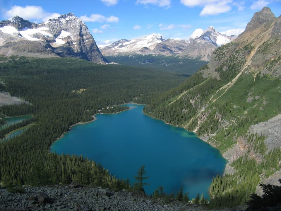
Paget Lookout is a 7 km out-and-back from Sherbrooke Lake parking lot, climbing 3.5 km each way to an old fire lookout. Parks Canada lists 525 m of ascent and estimates three hours for the return. This is a short but sustained mountain climb, not a gentle lake stroll; the payoff is the lookout and broad views across the Bow, Cataract Brook and Kicking Horse valleys.
 Parkwolf’s verdictIs this the climb for you?
Map & elevation
Plan your hike

The highest, rockiest slopes around here are a summer buffet for grizzly bears.
Yoho Tour Guide
Parkwolf is a GPS audio tour guide for Yoho National Park. As you drive, it chimes in with what’s ahead: hidden gems, upcoming stops, history, geology, and wildlife, right through your car’s speakers.
See the Yoho audio tourRecorded for this trailhead
Sherbrooke Lake and Paget Lookout: Choose Your Climb“You're coming up on the trailhead for Sherbrooke Lake and Paget Lookout. For turquoise water beneath Mount Ogden, choose the lake, about three hours return with a forest climb.”
Plays as you drive up to this trailhead in the Parkwolf Yoho Tour Guide.
More stories near here in the app
“Fantastic app with many points of information… It’s great to just turn on while you’re driving and it gives you an audio tour of the national Park. We love it!!!!”


Trail guide
The first 1.4 km follows the Sherbrooke Lake trail through forest to the signed Paget junction. At the early fork, stay on the Sherbrooke Lake route rather than turning toward Great Divide Lodge; at the Paget junction, follow the lookout branch. The lookout is the turnaround for this hike. A separate, much steeper route continues from there toward Paget Peak, and its extra distance and scramble are not included here.
Past the junction, the track crosses open forest before a sharp left into the climb. Higher up, the trees thin into subalpine vegetation and the trail gains the slope through six switchbacks beside the cliffs. Expect steep, rocky footing through much of the ascent; the moderate label on the park map understates how continuously uphill the walk feels.
A short side path at the fifth switchback reaches a cliff-edge viewpoint. It looks across to Paget Peak’s pale rock and the saw-like ridge of Mount Ogden, with a glimpse of Sherbrooke Lake below. It is a good place to pause before the final climb. Return to the main trail for the lookout rather than continuing onto the peak route.
The white fire lookout is the destination, with open views west over Kicking Horse Pass and the surrounding valleys. The structure was staffed into the 1970s. Look for small telephone-line insulators on trees beside the climb, remnants of the old connection to a warden station.
Wildlife
 21 sightingsGrizzly BearMost seen around 6 AMSighting map
 55 sightingsMountain GoatMost seen around 8 AMSighting map
 61 sightingsBlack BearMost seen around 8 PMSighting map
 66 sightingsElkMost seen around 7 PMSighting map
 26 sightingsMooseMost seen around 6 AMSighting map
 10 sightingsBald EagleMost seen around 7 AMSighting map
Sighting maps show where each species has been reported across Yoho. Wildlife moves, so no sighting is guaranteed.
Keep exploring
 ModerateSherbrooke Lake Trail8.6 km · 3 hr · At the trailheadA wooded climb opens onto a turquoise lake beneath three peaks
 ChallengingNiles Meadow Trail19.8 km · 7.8 hr · 0.3 km awayA long, rough climb ends in an open meadow below Mount Niles.
 ModerateRoss Lake Trail6.4 km · 2 hr · 1.4 km awayA forested out-and-back to a lake below Narao Peak
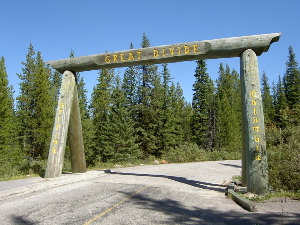 EasyGreat Divide Trail to Lake Louise9.8 km · 3.5 hr · 2 km awayA timber arch marks this paved Continental Divide crossing.
 EasyCentennial Trail2 km · 45 min · 5.9 km awayA shaded river walk with wildflowers and mountain views.
 ModerateDuchesnay Basin Trail4.4 km · 2.5 hr · 8 km awayKettle ponds beneath Odaray’s towering rock wall
 ChallengingCathedral Basin to Monica Lake15.6 km · 7 hr · 8.8 km awayA steep, faint climb to a larch-ringed lake under Cathedral Mountain.
 ModerateLake Oesa Trail6.4 km · 2.5 hr · 9.3 km awayStone steps, copper cliffs and a turquoise lake in its rock basin.
 Sight · 1.3 km awayPaget LookoutA steep climb to Yoho's historic fire lookout and open valley views.Sight · 2.9 km awaySherbrooke LakeA turquoise mountain lake after a steady climb through fir forest.
 Sight · 3.5 km awayLower Spiral Tunnel ViewpointSee why trains vanish into one mountain and reappear 15 metres higher.
 Sight · 3.7 km awayRoss LakeA forest lake below Narao Peak's rocky headwall.
 Sight · 4.5 km awayMeeting of the WatersA shifting colour line where two rivers meet.
 Sight · 4.7 km awayUpper Spiral Tunnel ViewpointA train may seem to climb through the mountain in stacked loops.Sight · 5 km awayGreat Divide ArchA timber gateway on the old road at the continental divide.
 Campground · 5.8 km awayKicking Horse CampgroundA forested river camp with easy access to Yoho's headline sights.
Parkwolf’s Yoho ranking
The audio tour guide for the drive, plus offline maps, trails, and wildlife heatmaps for when the signal drops.