Parking
Start at the Lake O’Hara parking lot and follow the Great Divide route toward the forest trail for Ross Lake. The optional return via Lake O’Hara Road is a separate loop choice and is not part of the mapped out-and-back.

Yoho National Park, BC
A forested out-and-back to a lake below Narao Peak
Overview
Map & elevation
Plan your hike

The highest, rockiest slopes around here are a summer buffet for grizzly bears.
Yoho Tour Guide
Parkwolf is a GPS audio tour guide for Yoho National Park. As you drive, it chimes in with what’s ahead: hidden gems, upcoming stops, history, geology, and wildlife, right through your car’s speakers.
See the Yoho audio tourRecorded for this trailhead
Lake O’Hara: Arrange the Access First“You're nearing the Lake O'Hara access road, but the lake is eleven kilometres beyond the highway parking lot.”
Plays as you drive up to this trailhead in the Parkwolf Yoho Tour Guide.
More stories near here in the app
“Fantastic app with many points of information… It’s great to just turn on while you’re driving and it gives you an audio tour of the national Park. We love it!!!!”


Trail guide
Ross Lake Trail is a moderate out-and-back from Lake O’Hara parking, about 6.4 km (4 mi) return. Allow around 2 hours. Begin on the Great Divide route; after about 2 km, turn onto a forested trail to Ross Lake. Expect a mixed road and woodland approach, then the same corridor back to the parking area.
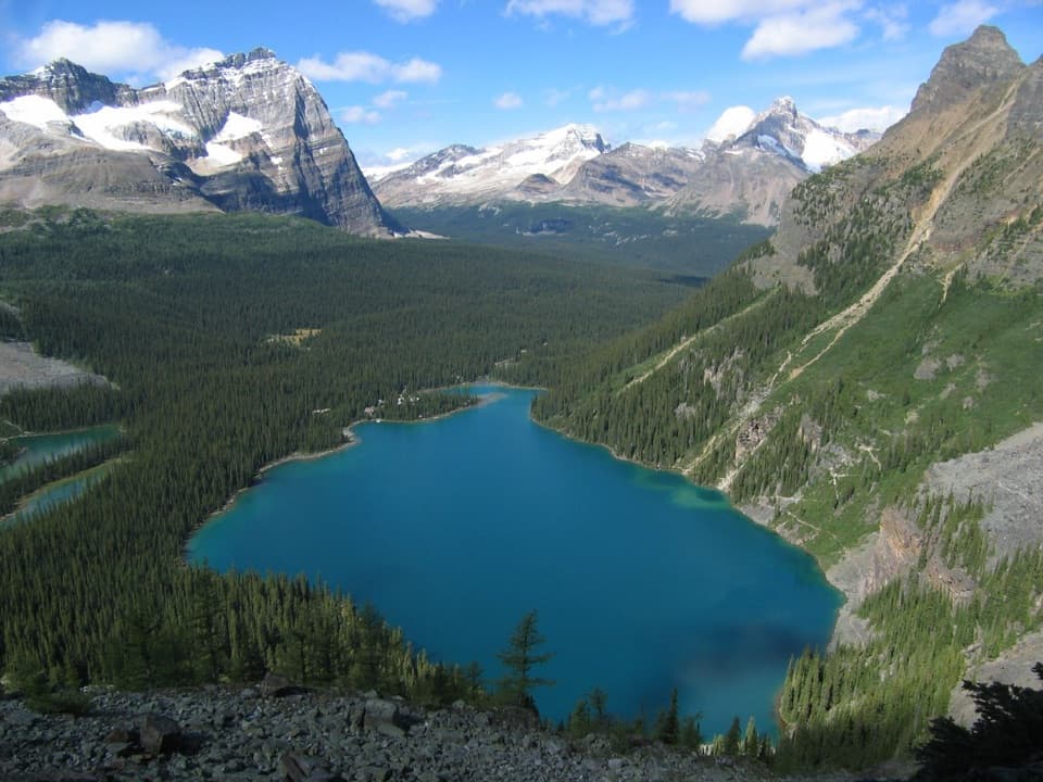
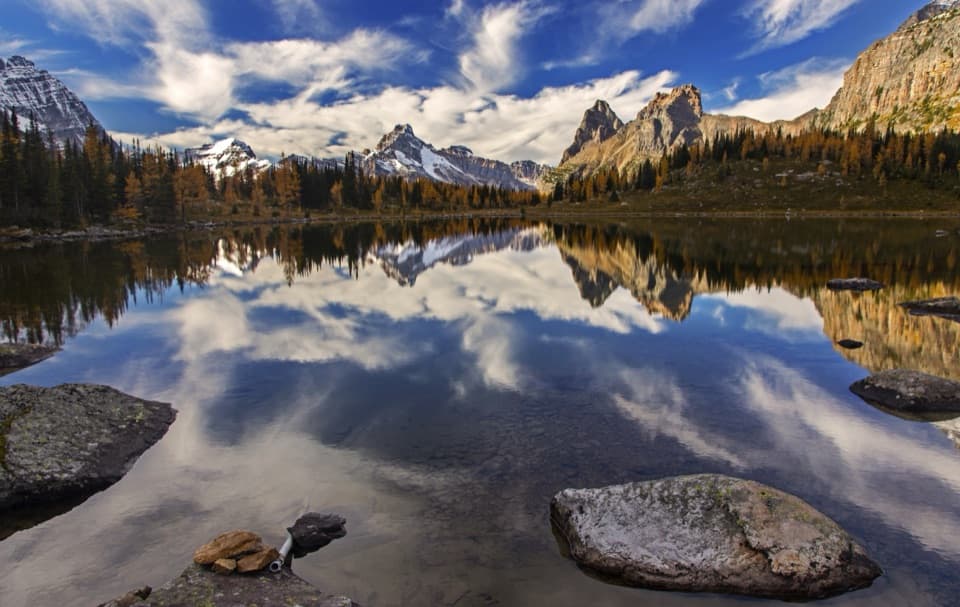
Ross Lake sits beneath the headwall of Narao Peak. The turquoise water, steep rock face and conifer shore are the walk’s main payoff. There are no route-side facilities confirmed in the trail information, so bring what you need from the start.
The current listed distance is 2.9 km one way, while the connected line from the parking access to the lake measures about 3.2 km. This record uses the mapped corridor in both directions, about 6.4 km total. Parks Canada also describes an optional return via Lake O’Hara Road; that changes the route and is not included in this out-and-back line or mileage.
Dogs may accompany hikers but must remain leashed and under control. Stay on the designated paths where the forest trail branches from the Great Divide route. Check the park’s current conditions before setting out; trail surfaces and access can change with the season.
Wildlife
 21 sightingsGrizzly BearMost seen around 6 AMSighting map
 55 sightingsMountain GoatMost seen around 8 AMSighting map
 61 sightingsBlack BearMost seen around 8 PMSighting map
 66 sightingsElkMost seen around 7 PMSighting map
 26 sightingsMooseMost seen around 6 AMSighting map
 10 sightingsBald EagleMost seen around 7 AMSighting map
Sighting maps show where each species has been reported across Yoho. Wildlife moves, so no sighting is guaranteed.
Keep exploring
 ChallengingNiles Meadow Trail19.8 km · 7.8 hr · 1.3 km awayA long, rough climb ends in an open meadow below Mount Niles.
 ModeratePaget Lookout Trail7 km · 3 hr · 1.4 km awayA steep climb to an old lookout above three valleys.
 ModerateSherbrooke Lake Trail8.6 km · 3 hr · 1.4 km awayA wooded climb opens onto a turquoise lake beneath three peaks
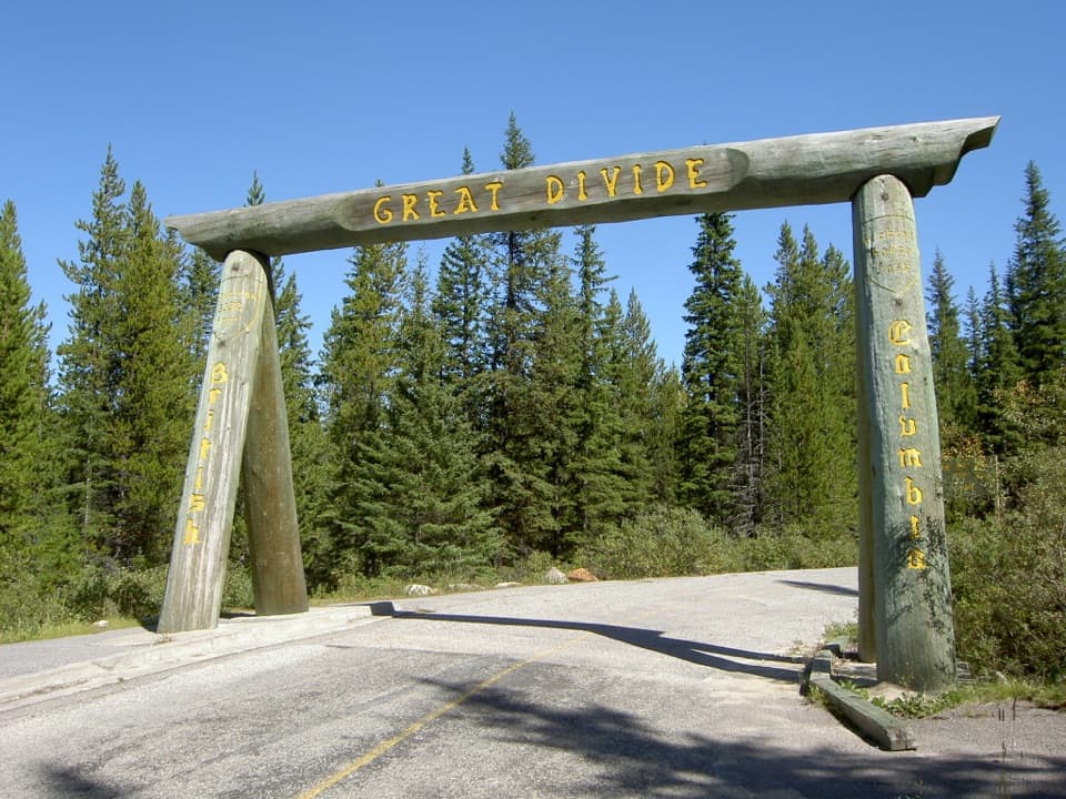 EasyGreat Divide Trail to Lake Louise9.8 km · 3.5 hr · 1.9 km awayA timber arch marks this paved Continental Divide crossing.
 EasyCentennial Trail2 km · 45 min · 6.5 km awayA shaded river walk with wildflowers and mountain views.
 ModerateDuchesnay Basin Trail4.4 km · 2.5 hr · 7.2 km awayKettle ponds beneath Odaray’s towering rock wall
 ChallengingCathedral Basin to Monica Lake15.6 km · 7 hr · 7.6 km awayA steep, faint climb to a larch-ringed lake under Cathedral Mountain.
 EasyLake O’Hara Shoreline Trail2.8 km · 1 hr · 8.1 km awayA short lakeside loop to pink quartzite and Seven Veils Falls.
 Sight · 2.7 km awayPaget LookoutA steep climb to Yoho's historic fire lookout and open valley views.
 Sight · 2.9 km awayRoss LakeA forest lake below Narao Peak's rocky headwall.
 Sight · 4.2 km awayLower Spiral Tunnel ViewpointSee why trains vanish into one mountain and reappear 15 metres higher.Sight · 4.3 km awaySherbrooke LakeA turquoise mountain lake after a steady climb through fir forest.Sight · 4.6 km awayGreat Divide ArchA timber gateway on the old road at the continental divide.
 Sight · 5.4 km awayMeeting of the WatersA shifting colour line where two rivers meet.
 Sight · 5.4 km awayUpper Spiral Tunnel ViewpointA train may seem to climb through the mountain in stacked loops.
 Campground · 6.4 km awayKicking Horse CampgroundA forested river camp with easy access to Yoho's headline sights.
Parkwolf’s Yoho ranking

The audio tour guide for the drive, plus offline maps, trails, and wildlife heatmaps for when the signal drops.