Clapham in Yorkshire Dales National Park

Sight · Yorkshire Dales National Park

Clapham

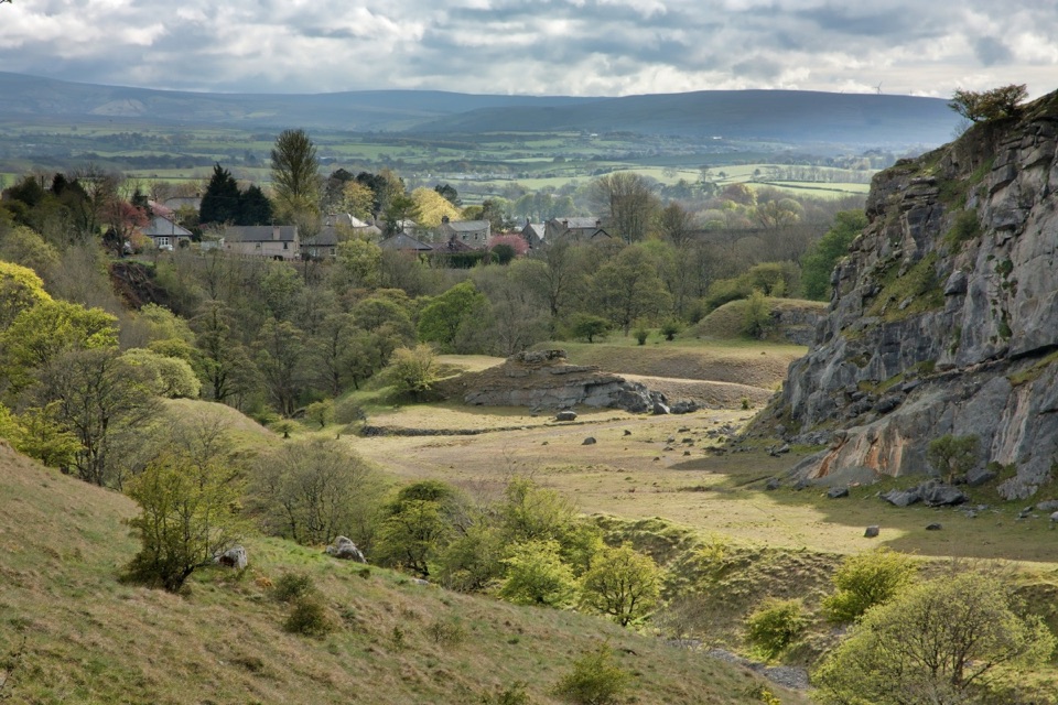
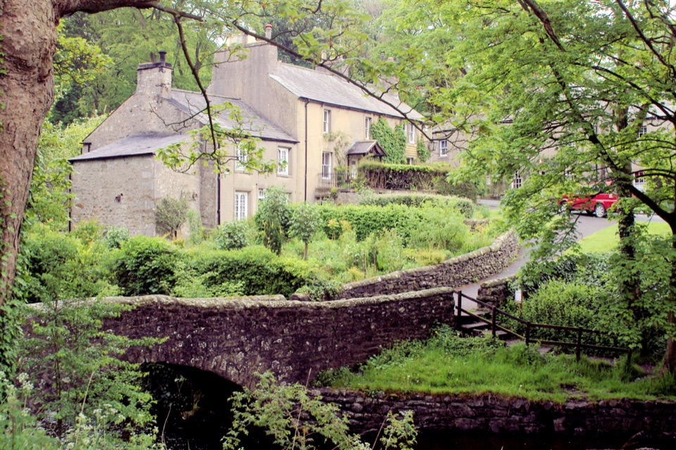
Stone cottages along a beck, with cave country up the lane

Photo: Wikimedia Commons
Type
Sight
Nearest trail
0.1 km
Audio stories
5 nearby
  • Parking
  • Restrooms
  • Food
  • Store

Hear the audio tour

Clapham and Ingleborough Cave

Overview

About Clapham

Why stop

  • Stone bridges, beck and estate woodland
  • Strong base for cave and fell walks

Heads up

  • Busy on fine weekends
  • Longer walks turn muddy and rocky
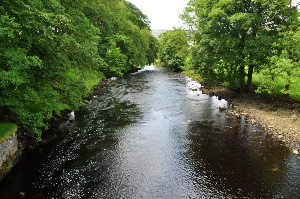
A pretty linear village strung along both sides of its own stream, with cottages facing each other across the water and bridges linking the two sides. It once sat on the main road between Kendal and Skipton; the bypass took the traffic away and left an unusually calm, atmospheric place. Most people come because it is the gateway to Ingleborough's limestone country, but the village itself rewards a slow twenty minutes on foot.
Parkwolf’s verdictWhy it's worth a stop

Map

Where it is

Loading the Yorkshire Dales map
Full map
SightClapham54.11736, -2.39219
Keep this map with you offline in the Parkwolf app

Plan your stop

Before you go

Best time to go

Morning or late afternoon gives the softest light on the beck and the cottage frontages, which is when the village photographs best. Early spring is the connoisseur's choice, when Farrer's rhododendrons come into flower around the estate. Summer brings the most people and the tightest parking; autumn gives the best woodland colour on the trail with fewer walkers about.


Getting there and getting around

Use the National Park car park in the village centre, which is also where the toilets are. Charges apply to everyone. Do not go hunting for a space on the village lanes; they are narrow and residential, and parking is the one real friction here on a fine weekend. Buses between Skipton and Kirkby Lonsdale call at the village, with extra services in summer. The railway station is just over a mile away, so allow for the walk in. The Pennine Bridleway passes through, which is why you'll often see cyclists and riders.

1 active Yorkshire Dales alert

  • ClosureTemporary closures on public rights of wayAvoid the listed sections of public rights of way while their temporary closures or pedestrian prohibition are in force. - Public Bridleway No. 52 (05.Official details
Yorkshire Dales alerts
A park ranger sits on a dash-mounted phone, talking, as Parkwolf’s Tour Guide plays “Army Cutworm Moths: A Grizzly Bear Buffet” on Grand Loop Road below Dunraven Pass in Yellowstone
Parkwolf Tour GuideThe highest, rockiest slopes around here are a summer buffet for grizzly bears.

Yorkshire Dales Tour Guide

Your drive to Clapham, narrated.

Parkwolf is a GPS audio tour guide for Yorkshire Dales National Park. As you drive, it chimes in with what’s ahead: hidden gems, upcoming stops, history, geology, and wildlife, right through your car’s speakers.

Recorded for this place

Clapham and Ingleborough Cave
0:00 / 0:34
“You're approaching Clapham, a stone village divided by a beck and a good base for Ingleborough's cave country.”

Plays as you drive up to Clapham in the Parkwolf Yorkshire Dales Tour Guide.

More stories near here in the app

  • The Shotgun Garden
  • Washing the Tar out of Wool
  • Norber Erratics
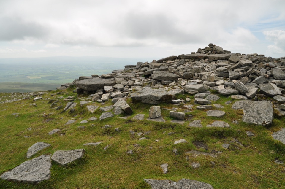
  • The Summit That May Not Be a Fort
  • 298 audio storiesacross Yorkshire Dales’s roads, triggered by GPS as you drive
  • Wildlife heatmapsfor Eurasian Otter, Atlantic Salmon, Short-eared Owl, and 13 more
  • Works offlinemaps, 99 trails, 63 places, and audio download before you lose signal
  • CarPlay readysimple controls built for the drive
★★★★★
“Fantastic app with many points of information… It’s great to just turn on while you’re driving and it gives you an audio tour of the national Park. We love it!!!!”
JMJamesApp Store review
Download Parkwolf on the App StoreGet Parkwolf on Google Play

4.7 from 8,600+ ratings

Guide

More about Clapham

What you'll see and doThe village stream and estate buildings are the heart of it.
  • The village stream and estate buildings are the heart of it. Ingleborough Hall was home to the Edwardian botanist and plant collector Reginald Farrer, and his plantings still survive around the estate lake, which continues to generate hydro-electric power for the estate wood-yard.
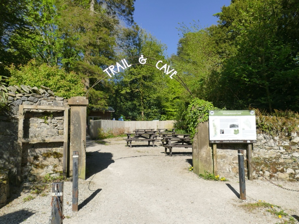
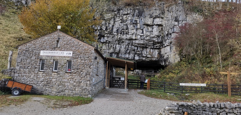
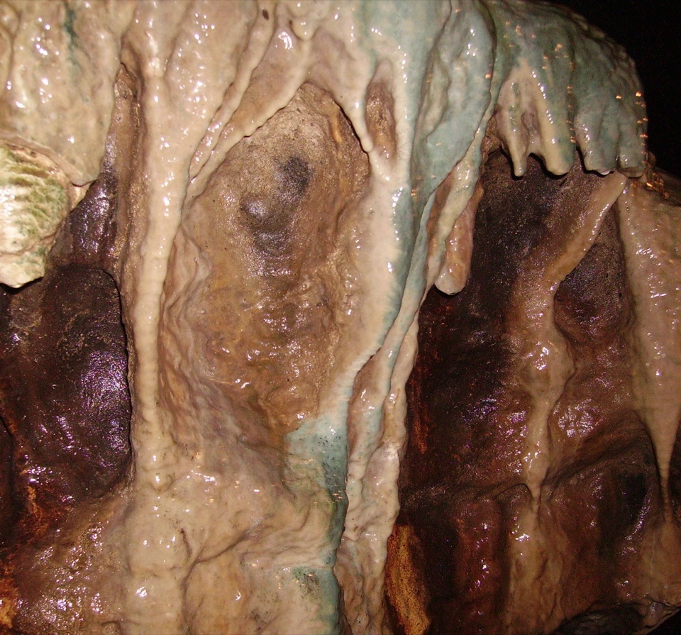
  • The Ingleborough Estate Nature Trail starts at the head of the village, a dog-friendly 1.3-mile woodland walk past the lake to Ingleborough Cave, a show cave open to visitors since 1837 with lit passages, laid concrete paths and a guide at the entrance.
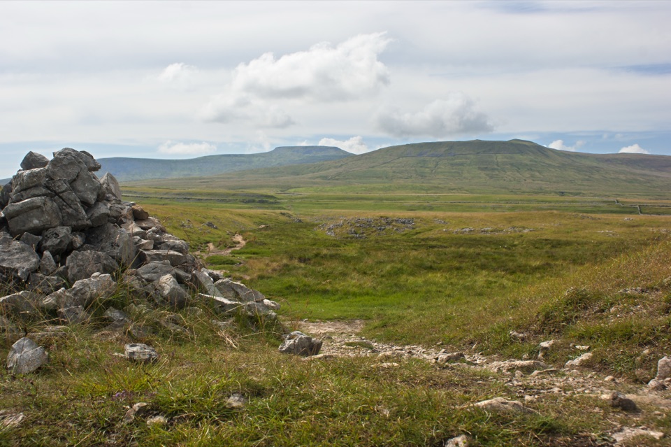
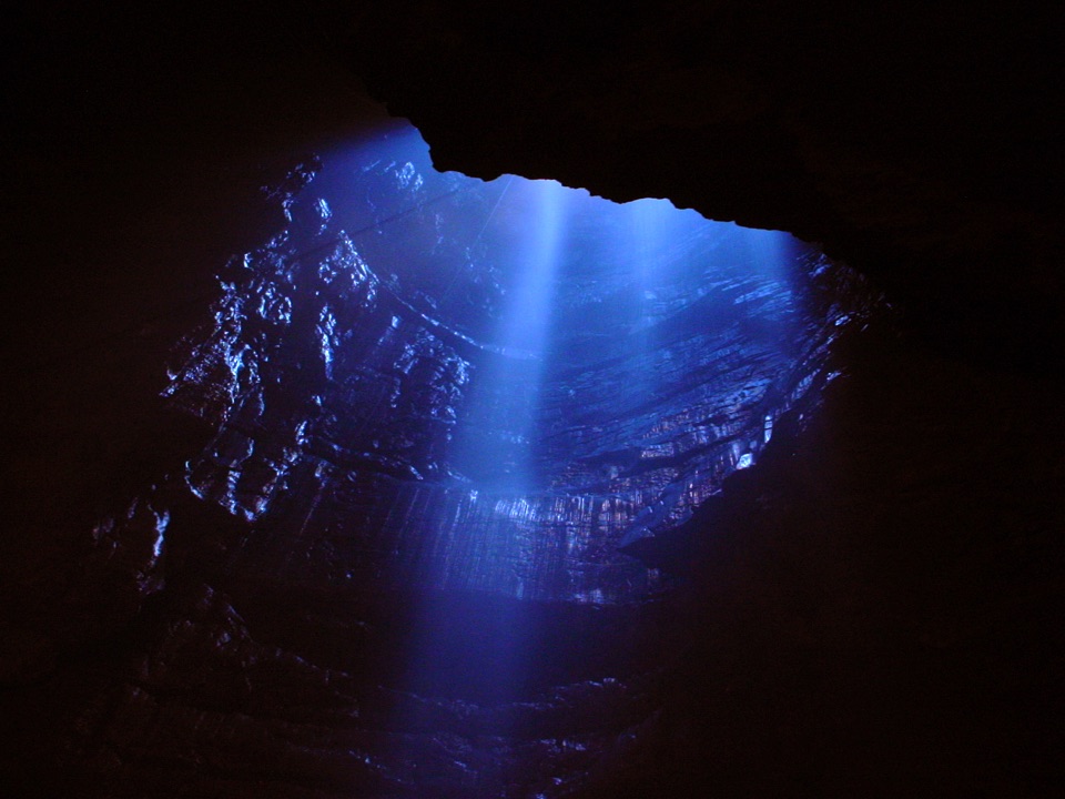
  • Beyond the cave the landscape opens up: the ravine of Trow Gill, then Gaping Gill, a 98m pothole with an unbroken waterfall and a chamber big enough to hold York Minster. Its entrance is unfenced, so keep well back and keep children and dogs close. Winch descents happen only at organised meets.
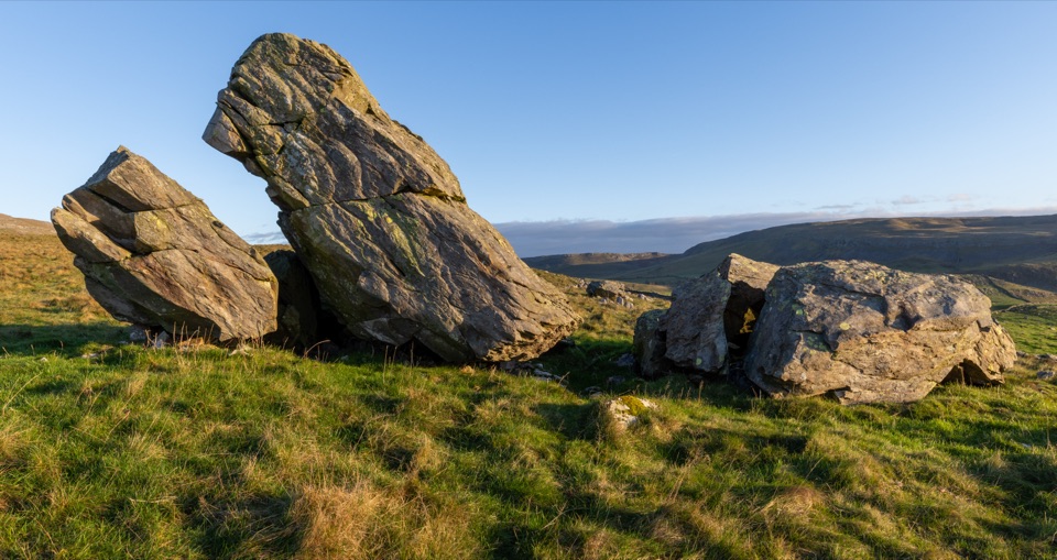
  • Norber Erratics, a striking scatter of boulders carried into Crummackdale by glaciers, are reached on foot up Thwaite Lane from the village.
  • Food and provisions are genuinely good for a place this size: the Old Sawmill Cafe at the trail entrance is a former working sawmill with its heritage intact, the Croft Cafe is a favourite with riders on the Way of the Roses and the Yorkshire Dales Cycle Way, and the New Inn is an eighteenth-century coaching inn with bars and a restaurant. The community-owned village store and post office covers groceries, sandwiches and seasonal produce.
Practical tips and honest drawbacksArrive earlier in the day on busy weekends and holidays, both for parking and for a quieter…
  • Arrive earlier in the day on busy weekends and holidays, both for parking and for a quieter walk on the nature trail.
  • The trail itself is well made, but the longer paths beyond the cave get muddy and rocky. Waterproof footwear is the difference between a good day and a grim one, and the scramble up Trow Gill towards Gaping Gill suits fit walkers only.
  • Set expectations correctly: this is a small village with a handful of cafes, a pub and a shop. The drama is all up the valley. If you want a full day out, treat the village as your base and walk.

Wildlife

Wildlife in Yorkshire Dales

All Yorkshire Dales wildlife maps

Sighting maps show where each species has been reported across Yorkshire Dales. Wildlife moves, so no sighting is guaranteed.

Keep exploring

Near Clapham

See it all on the map

Trails nearby

More stops nearby

Parkwolf’s Yorkshire Dales ranking

Top sights in Yorkshire Dales

All 63 places
  1. 1Malham CoveSight
  2. 2Aysgarth FallsSight
  3. 3Ribblehead ViaductSight
  4. 4Gordale ScarSight
  5. 5Bolton CastleSight
  6. 6Janet's FossSight

Take Parkwolf to Yorkshire Dales.

The audio tour guide for the drive, plus offline maps, trails, and wildlife heatmaps for when the signal drops.

4.7 from 8,600+ ratings

Download Parkwolf on the App StoreGet Parkwolf on Google Play