
Place · 0 mi away
Easy

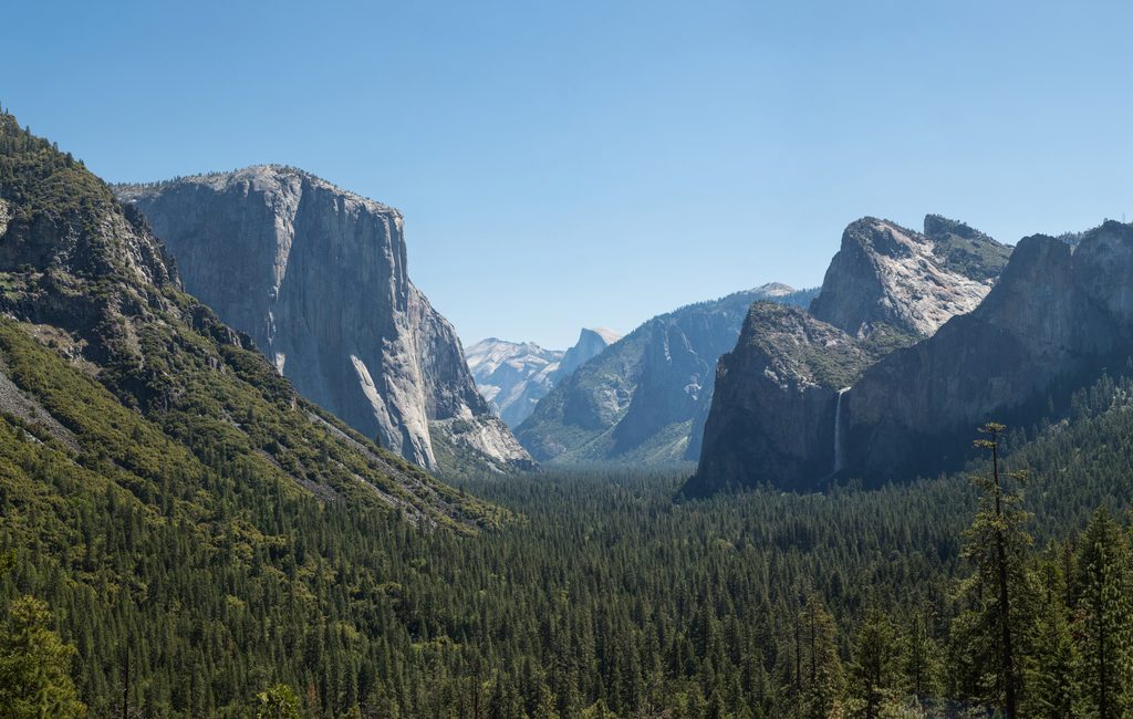
Artist Point serves up the classic Yosemite Valley tableau—El Capitan, Bridalveil Fall, a slice of the Merced River, and even Clouds Rest—from a quieter, slightly different angle than Tunnel View. The hike is short but punchy: about 2.0 miles total (out and back) with a steep opening climb and a gentler second half. If you want that postcard scene without the bus-tour bustle, this is your move.
Start from the Tunnel View parking area and hop on the Pohono Trail. The first ~0.5 miles climb steeply through rocky switchbacks, gaining roughly 500 feet. At a clear junction with the old stagecoach (Old Wawona) road, turn left and descend just under another half mile. Watch for an opening with low manzanita and a natural rock “bench”—that’s Artist Point. If you reach Artist Creek, you’ve gone a touch too far; backtrack a short distance to the opening.
Surface is rocky and uneven on the climb, then transitions to an old roadbed with occasional downed trees to step over or duck under. Expect light route-finding since “Artist Point” itself isn’t signed—an offline map helps.
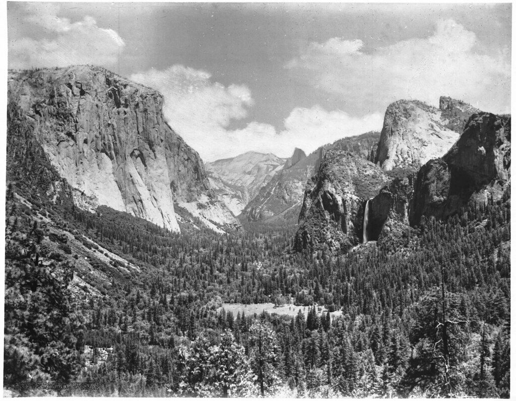
You’ll see a Tunnel View–like panorama from a slightly higher, more secluded perch: El Capitan dominates the left wall, Bridalveil Fall plunges on the right, and you get a broader look at Bridalveil Meadow and the river corridor. You’ll see less of Half Dome than from Tunnel View, but the overall composition is superb—and without the constant shuffle of crowd noise.
Prefer a steadier climb? You can approach via the old stagecoach road from Highway 41 above Bridalveil Fall (similar distance and net gain) with two small stream crossings. Photographers weighing viewpoints: many hikers find Artist Point more pleasant than Inspiration Point thanks to the view angle and solitude, while Inspiration Point is higher and more strenuous.
Dawn offers soft side-light and valley mist with almost guaranteed solitude. Late afternoon into sunset can be dramatic, especially with clouds; arrive early as Tunnel View parking fills near golden hour. Spring brings peak flow at Bridalveil Fall; shoulder seasons are great for quiet. In winter, expect icy patches—traction helps—and plowing can limit parking.
Park at Tunnel View (expect turnover, but prime times can still fill). Food storage lockers are at the trailhead. The nearest restrooms are pit toilets at the Bridalveil Fall lot about two miles east; flush toilets and snacks are in Yosemite Village farther east.
Small patches of poison oak appear on lower sections—wear long pants if you’re sensitive and learn to ID it. Mosquitoes can be pesky if you linger; pack repellent. The initial climb is steep and rocky; sturdy footwear recommended. Fallen trees along the old road are common. In winter, bring microspikes. No pets on this dirt trail.
Yes—this is the smarter way to get Yosemite’s signature view without the human traffic jam. Short, efficient, and surprisingly quiet for the payoff.
Park at Tunnel View on Wawona Road; the trail starts from the lot on the signed Pohono Trail.
Steep, rocky first half-mile; unmarked viewpoint; small amounts of poison oak; mosquitoes in warmer months; downed trees on the old road; icy patches in winter. No pets allowed on this trail.
Place · 0 mi away
Place · 0.1 mi away
Place · 0.4 mi away
Place · 0.6 mi away
Challenging · 0.1 mi away
Easy · 1.5 mi away
Challenging · 3.2 mi away
Challenging · 4 mi away

Parkwolf Tour Guide
