Four Mile and Panorama Loop in Yosemite National Park

#15 of 141 trails in Yosemite

Yosemite National Park, CA

Four Mile and Panorama Loop

A full-day Yosemite loop from Four Mile to Glacier Point and back.

Photo: Wikimedia Commons
Length
16.7mi
Time
10.5hr
Elev. change
3,251ft
Difficulty
Challenging
  • Loop
  • No dogs
  • High point 7,208 ft

Hear the audio tour

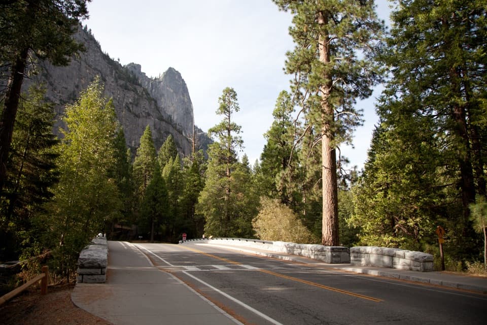
Swinging Bridge and Four Mile Trail

Overview

About Four Mile and Panorama Loop

Why go

  • One long hike links Four Mile, Glacier Point and Panorama Trail views.
  • Union Point and the Panorama traverse keep opening new Valley views.
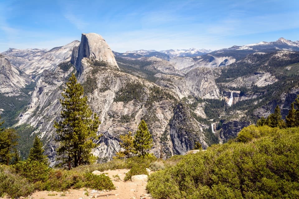
  • Illilouette, Nevada and Vernal Falls add several waterfall viewpoints.

Heads up

  • The complete walking loop adds about three Valley miles after a demanding descent.
  • There is no drinking water on the Four Mile climb.

Map & elevation

The route

Loading the Yosemite map
Full map
Elevation3,957–7,208 ft
TrailheadFour Mile Trailhead, Southside Drive37.73385, -119.60182
Keep this map with you offline in the Parkwolf app

Plan your hike

Before you go

Parking

Start at Four Mile Trailhead on Southside Drive near Sentinel Rock. Parking there is very limited; free Valleywide Shuttle stop 11 serves the trailhead. The nearest vault toilets are at Swinging Bridge Picnic Area. This mapped loop walks back from Happy Isles by Valley paths; no free shuttle runs between Glacier Point and Yosemite Valley.

Best time to go

The route passes Illilouette Falls and the Nevada and Vernal Falls area. Their strongest flow is usually in spring and early summer, then often drops by August. Four Mile Trail normally opens in May; significant snow can close the upper part below Union Point, usually by November or December, and a major storm can close the whole trail. Check current trail conditions before setting out.

Safety

A strenuous all-day route with a continuous steep climb, loose sand over partly paved tread, nearby ledges and drop-offs, and heat by midday. There is no drinking water on Four Mile. Significant snow can close the upper trail, usually by November or December; check current trail conditions before starting.

4 active Yosemite alerts

  • CautionMist Trail access limited during October repairsMentions Mist Trail, referenced in this guideThe Mist Trail between its John Muir Trail junction above the Vernal Fall footbridge and the top of Vernal Fall has limited access through October for repair work.Official details
  • ClosureDome Fire closes Glacier Point Road and trailsGlacier Point Road is temporarily closed because Dome Fire smoke reduces visibility and to allow firefighting operations; some trails south of the road are also closed.Official details
See all 4 alerts
The Parkwolf Tour Guide on a dash-mounted phone, driving into Yosemite Valley

“You're coming up on the Four Mile Trailhead, with Swinging Bridge Picnic Area nearby. For an easy break, choose the picnic area: mostly level paths reach the Merced River and a view of Yosemite Falls.”

Yosemite Tour Guide

Yosemite, narrated.

Parkwolf is a GPS audio tour guide for Yosemite National Park. As you drive, it chimes in with what’s ahead: hidden gems, upcoming stops, history, geology, and wildlife, right through your car’s speakers.

See the Yosemite audio tour

Recorded for this trailhead

Swinging Bridge and Four Mile Trail
0:00 / 0:30
“You're coming up on the Four Mile Trailhead, with Swinging Bridge Picnic Area nearby. For an easy break, choose the picnic area: mostly level paths reach the Merced River and a view of Yosemite Falls.”

Plays as you drive up to this trailhead in the Parkwolf Yosemite Tour Guide.

More stories near here in the app

  • Camp 4 and Yosemite Falls Trailhead
  • Yosemite Falls and the Lower Fall Loop
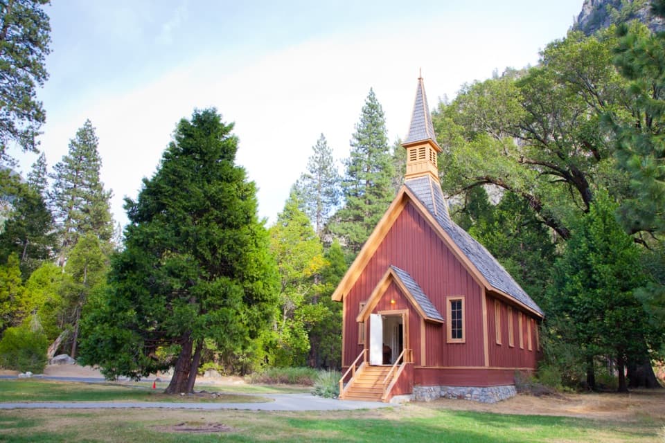
  • Sentinel Bridge, Cook's Meadow and Yosemite Chapel
  • El Capitan Picnic Area and Horsetail Fall
  • 125 audio storiesacross Yosemite’s roads, triggered by GPS as you drive
  • Wildlife heatmapsfor Black Bear, Peregrine Falcon, Mule Deer, and 13 more
  • Works offlinemaps, 141 trails, 99 places, and audio download before you lose signal
  • CarPlay readysimple controls built for the drive
★★★★★
“We just drove through Yosemite and it made our trip listening to this app as we drove through. Like having a tour guide in the car with you.”
Roddy 3210App Store review
Download Parkwolf on the App StoreGet Parkwolf on Google Play

4.7 from 8,600+ ratings

Trail guide

Hiking Four Mile and Panorama Loop

The circuitThis is a 16.

This is a 16.7-mile loop from the Four Mile Trailhead on Southside Drive: climb Four Mile Trail to Glacier Point, follow Panorama Trail to the John Muir Trail near Nevada Fall, descend to Happy Isles, then walk a Valley connector back to the start. It links three named routes into one day hike, with a roughly three-mile return across the Valley floor. The mapped version uses the John Muir Trail descent and includes the foot miles back to the car. Allow 9–12 hours; 10½ is a sensible planning point. This is a full day with little room to dawdle.

The climbFour Mile Trail goes 4.

Four Mile Trail goes 4.8 miles one way to Glacier Point and gains 3,200 feet on a steady, steep grade. The name comes from its old toll-road days; the present route is closer to five miles. Parts of the tread are paved, with loose sand over the surface that can slide underfoot. Ledges and drop-offs sit close to the trail in places, so stay on the path and don't cut switchbacks. Start early: the climb can get hot by midday. There is no drinking water on Four Mile, and Glacier Point's fountain and snack shop are seasonal.

Union Point and the topA little over two-thirds of the way up, a short side trip reaches Union Point, an open view…

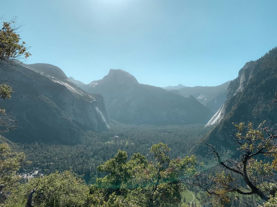
A little over two-thirds of the way up, a short side trip reaches Union Point, an open view over Yosemite Valley. Keep going to Glacier Point for the broad look across Half Dome, Yosemite Falls and the high country. For a photo that says something about the climb, include the trail in the foreground with Half Dome and the waterfalls beyond it. Glacier Point has vault toilets; the shop and water fountain are useful only during their operating season.

Panorama's extra climbPanorama Trail leaves Glacier Point and drops toward Illilouette Creek and Falls.

Panorama Trail leaves Glacier Point and drops toward Illilouette Creek and Falls. After you cross the creek, the route climbs about 700 feet over roughly 1.5 miles. It feels like a surprise after the long ascent and descent, so save some energy for it. An unsigned side path leads to Panorama Point, where Glacier Point, Royal Arches and Half Dome line up across the Valley. The old lookout lost its guardrails after rockfalls; the main route has been moved away from the edge.

Down to Happy IslesNear Nevada Fall, this route follows the John Muir Trail down to Happy Isles.

Near Nevada Fall, this route follows the John Muir Trail down to Happy Isles. The longer descent is gentler than the Mist Trail's steep stair sections, and gives a view of Nevada Fall and Liberty Cap. The Mist Trail is another way to finish the Panorama hike, but it changes the route and mileage; the line saved here follows John Muir Trail.

The Valley returnHappy Isles is not the end of this loop.

Happy Isles is not the end of this loop. Walk about three more miles on Valley paths and paved bike paths to get back to Four Mile Trailhead. That connector is mostly about closing the loop after the big climb and descent, so count it in your time. Parking at Four Mile is very limited. Valleywide Shuttle stop 11 serves the trailhead, but no free shuttle runs between Glacier Point and Yosemite Valley.

A toll trail with a storyFour Mile was completed as a toll trail in 1872, when it offered a steep way up to Glacier…

Four Mile was completed as a toll trail in 1872, when it offered a steep way up to Glacier Point. Its name stayed even as the route stretched to 4.8 miles. In 1903, President Theodore Roosevelt and John Muir made a three-day trip that included Sentinel Dome, Glacier Point and Yosemite Valley. Buffalo Soldiers of the Ninth Cavalry had been asked to clear Four Mile Trail for Roosevelt's visit; Muir and Roosevelt used the assignment as a chance to leave the escort behind. The story was reported later that year.

Wildlife

Wildlife in Yosemite

All Yosemite wildlife maps

Sighting maps show where each species has been reported across Yosemite. Wildlife moves, so no sighting is guaranteed.

Keep exploring

Near Four Mile and Panorama Loop

See it all on the map

Trails that start nearby

Places near the trailhead

Parkwolf’s Yosemite ranking

Top-rated trails in Yosemite

All 141 trails
  1. 1Half Dome TrailChallenging · 14.3 mi
  2. 2Clouds Rest TrailChallenging · 14 mi
  3. 3Nevada Fall Loop via Mist and John Muir TrailsChallenging · 6.4 mi
  4. 4Yosemite Falls TrailChallenging · 7.2 mi
  5. 5Panorama TrailChallenging · 8.2 mi
  6. 6Four Mile TrailChallenging · 4.8 mi

Take Parkwolf to Yosemite.

The audio tour guide for the drive, plus offline maps, trails, and wildlife heatmaps for when the signal drops.

4.7 from 8,600+ ratings

Download Parkwolf on the App StoreGet Parkwolf on Google Play