Great Head Trail in Acadia National Park

#9 of 142 trails in Acadia

Acadia National Park, ME

Great Head Trail

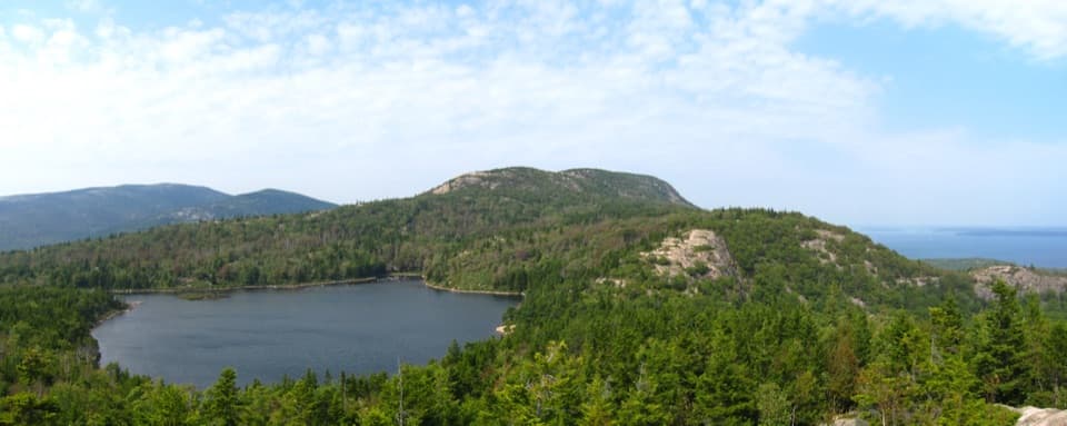
Rocky coastal ledges, a 1915 tea house ruin, and Sand Beach views.

Photo: Wikimedia Commons
Length
1.9mi
Time
3hr
Elev. change
129ft
Difficulty
Moderate
  • Loop
  • Dogs allowed
  • High point 138 ft

Hear the audio tour

Sand Beach’s Shell-Rich Shore

Overview

About Great Head Trail

Why go

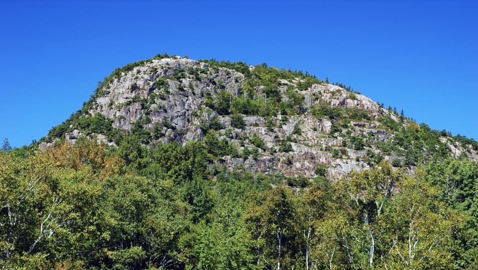
  • Open ledges pair ocean views with a clear look back at Sand Beach and The Beehive.
  • A 1915 tea house ruin and historic millstone add depth to a short loop.

Heads up

  • Rocky, uneven footing and short exposed scrambles make this more than a casual stroll.
  • The route crosses busy Sand Beach twice; summer parking can bottleneck the visit.

Map & elevation

The route

Loading the Acadia map
Full map
Elevation10–138 ft
TrailheadSand Beach west access44.32936, -68.18347
Keep this map with you offline in the Parkwolf app

Plan your hike

Before you go

Parking

Use the Sand Beach parking areas or the designated right-hand roadside lane. The trail access is at the far end of the beach, so the route crosses the sand to and from the granite steps. Parking is congested and limited in July and August, especially from 9 a.m. to 3 p.m.

Best time to go

Use the Sand Beach parking areas or the designated right-hand roadside lane. Parking is often congested and limited from July through August, especially between 9 a.m. and 3 p.m.; accessible restrooms are at the parking area, not along the loop. The Park Loop Road closes from mid-December to mid-April, when trail access shifts to Schooner Head Road. Dogs may hike the trail on a leash no longer than six feet. From May 15 through September 15, dogs may cross Sand Beach only to reach the trailhead.

Safety

Expect uneven rock, short steep scrambles, and open ledges above steep ocean-side drops. A small stream may cross the beach-end approach depending on tide and season. From May 15 through September 15, dogs may cross Sand Beach only to reach the trail and must remain on a leash no longer than six feet.

3 active Acadia alerts

  • ClosureSouthern Ocean Path section closed for repairsThe southern section of Ocean Path is closed for repairs from the trailhead across from the Otter Point parking lot to the trail’s southern terminus.Official details
  • ClosureSchoodic Mountain Road closed for repairsSchoodic Mountain Road is closed for repairs from Schoodic Loop Road to the summit of Schoodic Head.Official details
See all 3 alerts
A park ranger sits on a dash-mounted phone, talking, as Parkwolf’s Tour Guide plays “Army Cutworm Moths: A Grizzly Bear Buffet” on Grand Loop Road below Dunraven Pass in Yellowstone
Parkwolf Tour GuideThe highest, rockiest slopes around here are a summer buffet for grizzly bears.

Acadia Tour Guide

Your drive to Great Head Trail, narrated.

Parkwolf is a GPS audio tour guide for Acadia National Park. As you drive, it chimes in with what’s ahead: hidden gems, upcoming stops, history, geology, and wildlife, right through your car’s speakers.

See the Acadia audio tour

Recorded for this trailhead

Sand Beach’s Shell-Rich Shore
0:00 / 0:30
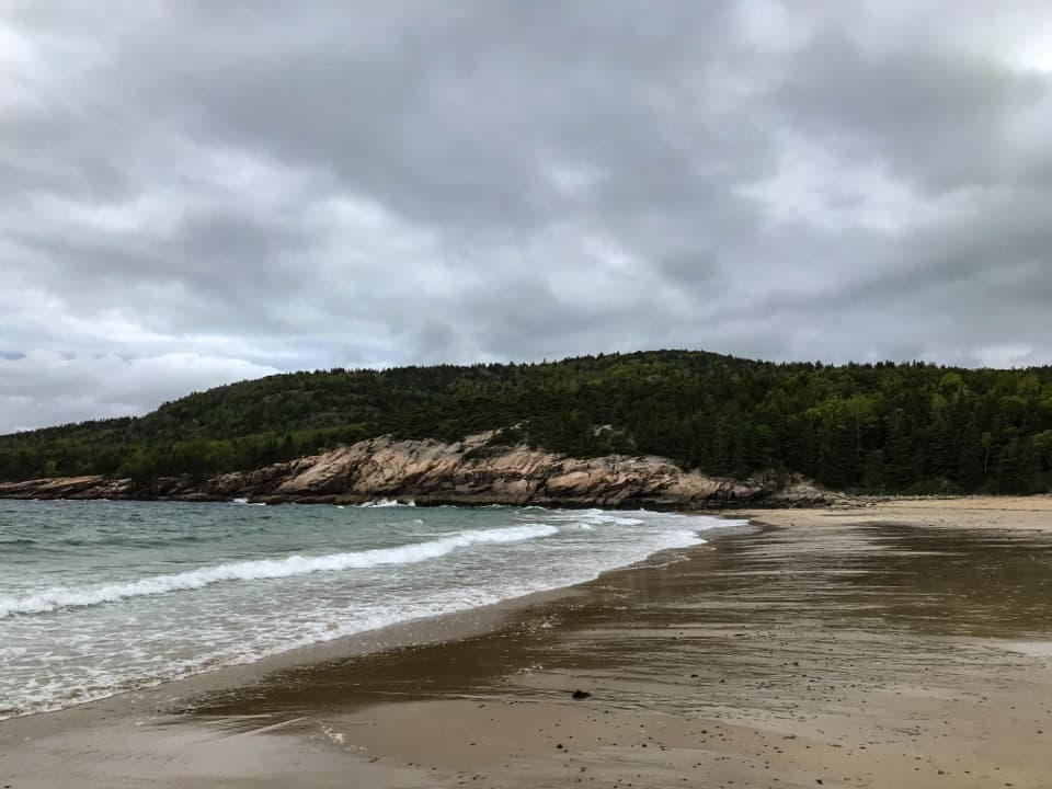
“You're coming up on Sand Beach, a pocket of sand between wooded granite headlands. I'd stop for a walk along the shore, even if swimming isn't on your list.”

Plays as you drive up to this trailhead in the Parkwolf Acadia Tour Guide.

More stories near here in the app

  • The Beehive’s Rung Climb
  • Thunder Hole’s Unpredictable Boom
  • Schooner Head Overlook and the Shore Below
  • Keeping the Alewife's Route Open
  • 116 audio storiesacross Acadia’s roads, triggered by GPS as you drive
  • Wildlife heatmapsfor Bald Eagle, Peregrine Falcon, White-tailed Deer, and 13 more
  • Works offlinemaps, 142 trails, 72 places, and audio download before you lose signal
  • CarPlay readysimple controls built for the drive
★★★★★
“…As we drove through Acadia it gave us a tour, which was really cool. Lots of great info about the parks and how to avoid the crowds. It’s a great travel companion!”
MyMysteryChicaApp Store review
Download Parkwolf on the App StoreGet Parkwolf on Google Play

4.7 from 8,600+ ratings

Trail guide

Hiking Great Head Trail

The full loopGreat Head Trail is a 1.

Great Head Trail is a 1.9-mile loop from Sand Beach, across the beach to granite steps, around the open headland, and back to those steps. This is the longer option; the distance includes walking across Sand Beach in both directions, not just the rocky circuit. Allow two to four hours. The mileage is short, but the uneven footing, scrambles, exposed viewpoints, and photo stops slow the walk. Choose it for a compact coastal hike that shifts from sand to open rock to woods; it is a poor match if you want a flat stroll or dislike exposed ledges.

Sand Beach and the first climbStart along the beach with the ocean on your right.

Start along the beach with the ocean on your right. Granite steps at the far end lead up to the trail; depending on tide and season, a small stream can cross the beach-end approach. Near the top of the steps, look left for a millstone nearly seven feet across. Turn right above the steps for the open ledge ascent. For the signature view, pause where the beach first opens below you and frame Sand Beach with The Beehive behind it.

Open ledges on Great HeadThe path crosses uneven granite and continues around the seaward side of the headland.

The path crosses uneven granite and continues around the seaward side of the headland. The first climb looks back over Sand Beach, then the views open onto the coastline and ocean. Expect short, steep scrambles and rocky footing; several exposed stretches run near steep drops toward the water without a barrier. The exposed terrain, rather than distance, is the main commitment here. Take your time on the rock and leave room to stop at viewpoints without stepping toward the edge.

A small summit with a long backstoryGreat Head rises to about 145 feet above sea level.

Great Head rises to about 145 feet above sea level. At the high point, the stone ruins are from a tower built by the Satterlee family in the early 1900s, with a tea room and observatory. The tea house dates to 1915. A bronze plaque there commemorates David Phillips McKinney, who died at this location in 1969. The ruins and memorial sit within a short loop, giving the headland a layer of human history alongside the sea views.

Pick the return branchBeyond the high point, the path turns inland and descends through forest.

Beyond the high point, the path turns inland and descends through forest. A cedar post marks the choice: turn left for the shorter 1.3-mile loop, which climbs steeply before leveling toward Sand Beach, or continue straight for this 1.9-mile loop. The longer branch angles back toward the ocean with only occasional views, then turns left at the next junction for an easier return to the granite steps. The stored route follows this long branch.

Wildlife

Wildlife in Acadia

All Acadia wildlife maps

Sighting maps show where each species has been reported across Acadia. Wildlife moves, so no sighting is guaranteed.

Keep exploring

Near Great Head Trail

See it all on the map

Trails that start nearby

Places near the trailhead

Parkwolf’s Acadia ranking

Top-rated trails in Acadia

All 142 trails
  1. 1Beehive Loop TrailChallenging · 1.4 mi
  2. 2Precipice TrailChallenging · 2.1 mi
  3. 3Jordan Pond PathModerate · 3.3 mi
  4. 4Bubbles TrailModerate · 1.5 mi
  5. 5Ocean PathEasy · 2.2 mi
  6. 6Cadillac Mountain South Ridge TrailChallenging · 7.8 mi

Take Parkwolf to Acadia.

The audio tour guide for the drive, plus offline maps, trails, and wildlife heatmaps for when the signal drops.

4.7 from 8,600+ ratings

Download Parkwolf on the App StoreGet Parkwolf on Google Play