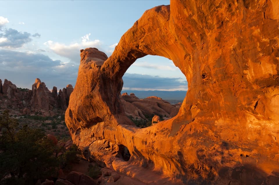
Delicate Arch Trail in Arches National Park

#1 of 28 trails in Arches

Arches National Park, UT

Delicate Arch Trail

A steep slickrock climb to Arches’ signature arch.

Length
3mi
Time
2.5hr
Elev. change
502ft
Difficulty
Challenging
  • No dogs
  • High point 4,787 ft

Hear the audio tour

Delicate Arch and Wolfe Ranch

Overview

About Delicate Arch Trail

Why go

  • A close approach to the park’s defining free-standing arch, with open slickrock scenery along the way.
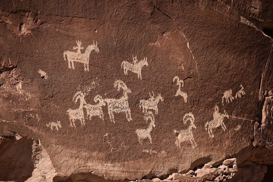
  • The accessible Wolfe Ranch cabin and Ute petroglyph panel add a worthwhile stop before the climb.

Heads up

  • The steep slickrock climb is exposed, mostly unshaded, and has no drinking water.
  • Parking can fill, and sunset crowds gather at the arch.

Map & elevation

The route

Loading the Arches map
Full map
Elevation4,285–4,787 ft
TrailheadWolfe Ranch Trailhead38.73546, -109.52067
Keep this map with you offline in the Parkwolf app

Plan your hike

Before you go

Parking

Start at Wolfe Ranch Trailhead for the standard 3-mile round trip. Parking can fill on busy days. When full, use Delicate Arch Viewpoint parking and add about one mile of road walking each way to Wolfe Ranch, for roughly five miles round trip.

Safety

The climb crosses exposed slickrock without shade; avoid midday summer heat and carry at least 2 L of water per person because there is no drinking water at the trailhead. Follow cairns and signs across the bare rock, especially in low light. The narrow final ledge is exposed and can be icy in winter. Dogs are prohibited except service animals.

A park ranger sits on a dash-mounted phone, talking, as Parkwolf’s Tour Guide plays “Army Cutworm Moths: A Grizzly Bear Buffet” on Grand Loop Road below Dunraven Pass in Yellowstone
Parkwolf Tour GuideThe highest, rockiest slopes around here are a summer buffet for grizzly bears.

Arches Tour Guide

Your drive to Delicate Arch Trail, narrated.

Parkwolf is a GPS audio tour guide for Arches National Park. As you drive, it chimes in with what’s ahead: hidden gems, upcoming stops, history, geology, and wildlife, right through your car’s speakers.

See the Arches audio tour

Recorded for this trailhead

Delicate Arch and Wolfe Ranch
0:00 / 0:32
“You're approaching Wolfe Ranch and the trail to Delicate Arch. Choose the hike for a close look at the freestanding arch, which stays hidden until the final approach.”

Plays as you drive up to this trailhead in the Parkwolf Arches Tour Guide.

More stories near here in the app

  • The Dark Streaks on Sandstone
  • Delicate Arch Viewpoints
  • Shrimp Waiting for Rain
  • The Desert's Living Skin
  • 35 audio storiesacross Arches’s roads, triggered by GPS as you drive
  • Wildlife heatmapsfor Bighorn Sheep, Pronghorn, Raven, and 13 more
  • Works offlinemaps, 28 trails, 41 places, and audio download before you lose signal
  • CarPlay readysimple controls built for the drive
★★★★★
“I can’t believe how helpful this app is and how interesting the information is for each highlight along the Arches Scenic Drive! This is the first park I’ve used it in.”
ThisismylifeniloveitApp Store review
Download Parkwolf on the App StoreGet Parkwolf on Google Play

4.7 from 8,600+ ratings

Trail guide

Hiking Delicate Arch Trail

Is this the hike to do?Delicate Arch Trail is a 3-mile out-and-back from Wolfe Ranch to the largest free-standing arch…

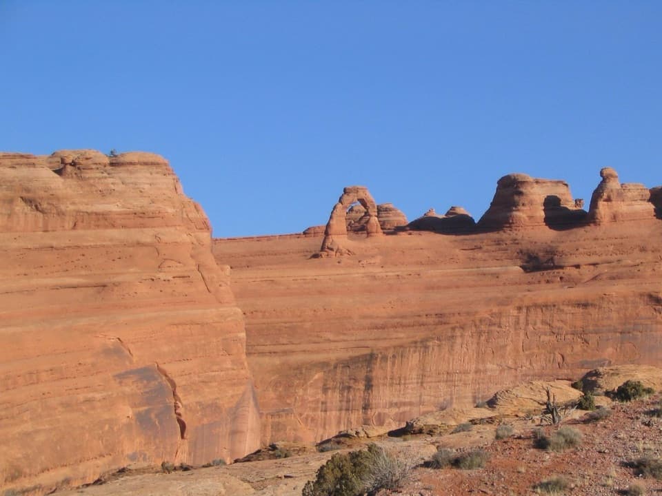
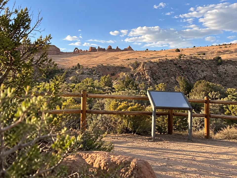
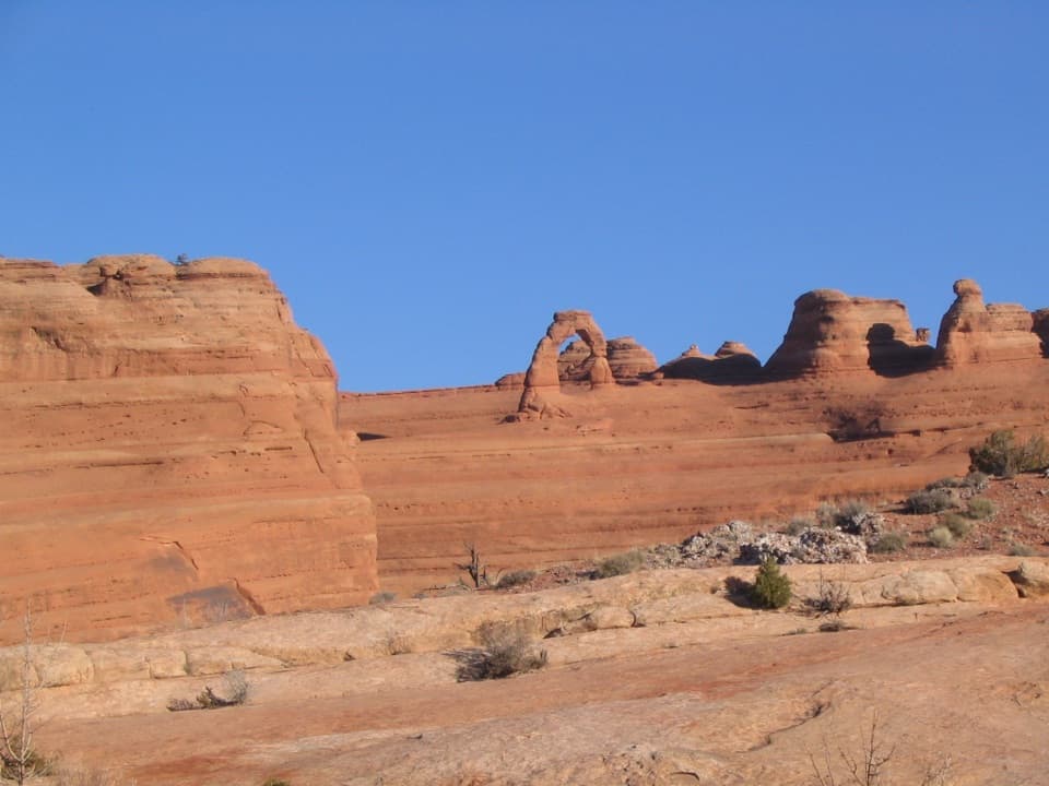
Delicate Arch Trail is a 3-mile out-and-back from Wolfe Ranch to the largest free-standing arch in Arches National Park. It climbs about 538 feet and usually takes two to three hours. This is the close-up version of the park’s best-known sandstone landmark, but it is a strenuous walk over exposed rock. If you want only a distant view or have less time, the separate lower Delicate Arch Viewpoint is a 100-yard stroll; the upper viewpoint is a half-mile round trip with stairs.

Start before the heatWolfe Ranch Trailhead is the direct starting point.

Wolfe Ranch Trailhead is the direct starting point. Its parking can fill on busy days, and sunset brings large crowds at the arch. Go early for a cooler, quieter climb. The trailhead has a vault or composting toilet but no drinking water; carry at least 2 liters per person. Avoid the midday summer heat, wear grippy closed shoes, and bring a headlamp if you plan to come down after dark. Dogs aren’t allowed, though service animals are. If Wolfe Ranch is full, parking at Delicate Arch Viewpoint is the alternative; walking the road between it and Wolfe Ranch adds a mile each way, turning the hike into about five miles round trip.

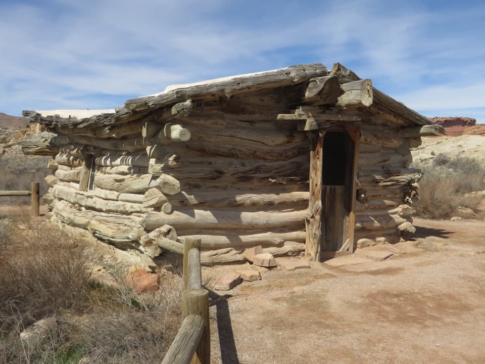
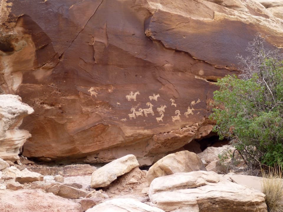
The first stopThe short walk to Wolfe Ranch cabin and the nearby Ute petroglyph panel is accessible for…

The short walk to Wolfe Ranch cabin and the nearby Ute petroglyph panel is accessible for wheelchairs. Take in the cabin and rock art before the strenuous climb starts; they’re part of this trail’s opening, not something at the arch. Stay on the established route around the panel and across the slickrock to protect the living soil crust that supports desert plants.

A climb across bare rockBeyond the ranch, the route climbs steeply onto open slickrock.

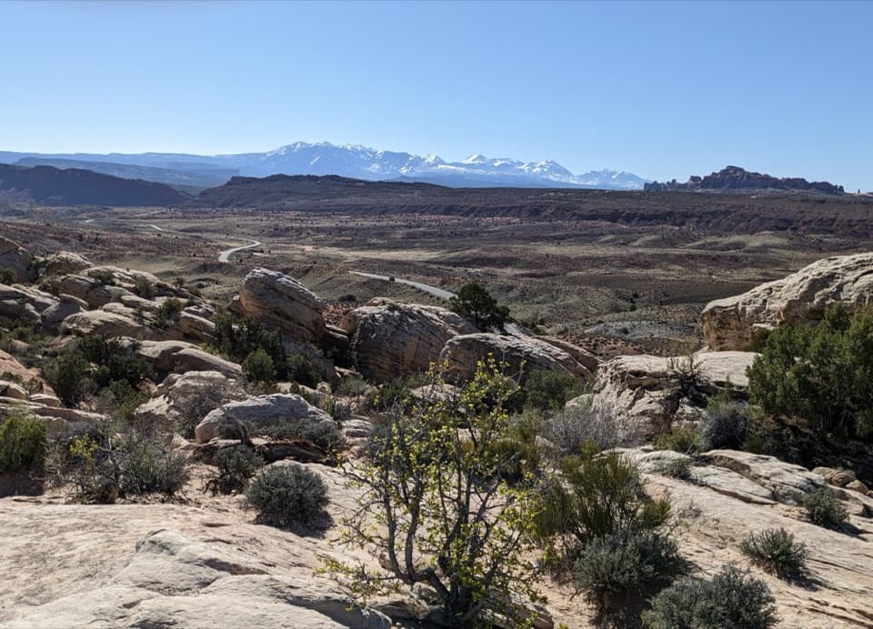
Beyond the ranch, the route climbs steeply onto open slickrock. Cairns and signs mark the line across broad, smooth sandstone; they’re easy to miss in low light, and the surface has no shade. A rocky and sandy stretch follows the main slickrock climb, then firmer footing crosses steeper edges. Follow the marked line rather than crossing the surrounding soil crust. The arch stays out of sight until near the end, so the climb feels longer than a walk toward a visible landmark.

The last ledge and the archThe final approach narrows to an exposed rock ledge about 200 yards long.

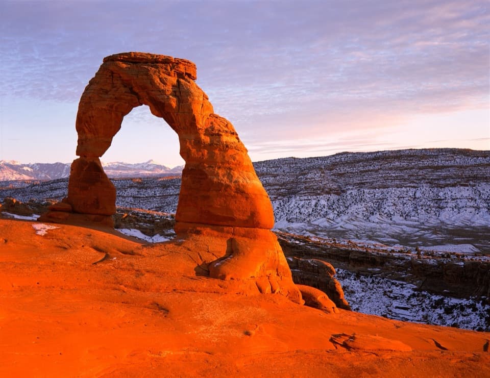
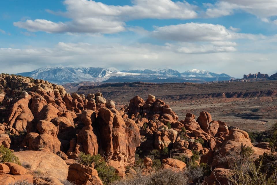
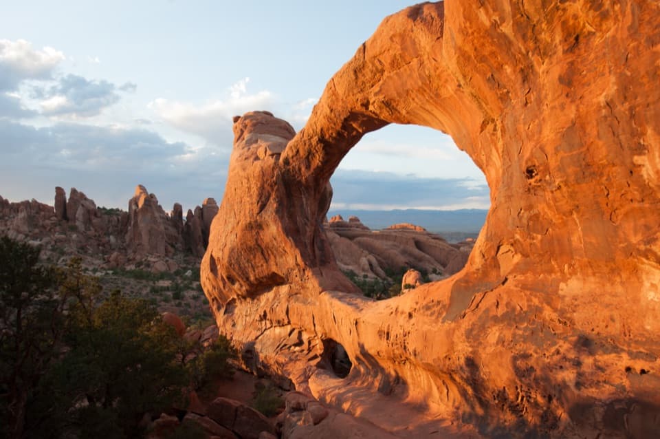
The final approach narrows to an exposed rock ledge about 200 yards long. It can be icy in winter, and some hikers report that the last approach is easy to misread in darkness. Stay on the marked way and don’t climb on the arch. The opening is about 46 feet tall and 32 feet wide, and the arch is the park’s largest free-standing one. From established ground, the La Sal Mountains can be framed through the opening; at sunset, sometimes hundreds of people gather around it.

How the arch formedDelicate Arch is cut into Entrada Sandstone, originally laid down as desert dunes.

Delicate Arch is cut into Entrada Sandstone, originally laid down as desert dunes. A softer layer of Carmel rock above it traps water. Water dissolves the sandstone’s cement, while freezing and thawing widen cracks; erosion gradually thins walls into fins and openings like this one. The surrounding desert crust is alive, so stepping off the marked route damages more than a few plants.

A name that stuckEarlier names included “Cowboy’s Chaps,” “Old Maid’s Bloomers” and “Salt Wash Arch.”

Earlier names included “Cowboy’s Chaps,” “Old Maid’s Bloomers” and “Salt Wash Arch.” The name “Delicate” appeared in a January 1934 article about the Arches expedition. The Wolfe Ranch cabin and Ute petroglyph panel make the trail’s start as historically interesting as the arch is visually striking, so leave a few minutes for them on the way in or out.

Wildlife

Wildlife in Arches

All Arches wildlife maps

Sighting maps show where each species has been reported across Arches. Wildlife moves, so no sighting is guaranteed.

Keep exploring

Near Delicate Arch Trail

See it all on the map

Trails that start nearby

Places near the trailhead

Parkwolf’s Arches ranking

Top-rated trails in Arches

All 28 trails
  1. 2Devils Garden TrailChallenging · 7.9 mi
  2. 3Landscape Arch TrailEasy · 1.9 mi
  3. 4Fiery Furnace LoopChallenging · 1.2 mi
  4. 5Double O Arch TrailChallenging · 4.1 mi
  5. 6The Windows TrailEasy · 1 mi
  6. 7Double Arch Viewpoint and TrailEasy · 0.6 mi

Take Parkwolf to Arches.

The audio tour guide for the drive, plus offline maps, trails, and wildlife heatmaps for when the signal drops.

4.7 from 8,600+ ratings

Download Parkwolf on the App StoreGet Parkwolf on Google Play