Watzmannhaus via Rinnkendl- und Falzsteig in Berchtesgaden National Park

Berchtesgaden National Park, BY

Watzmannhaus via Rinnkendl- und Falzsteig

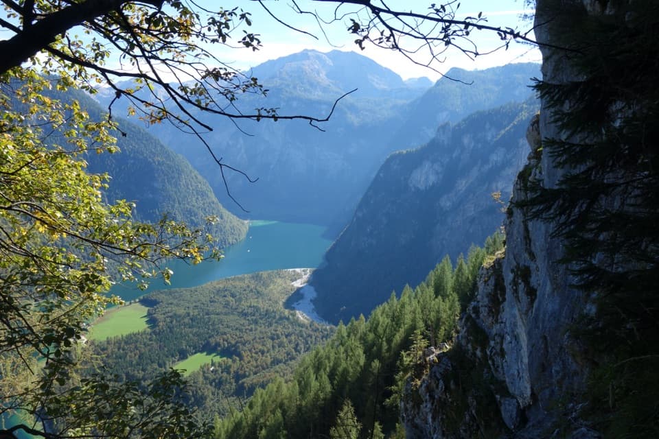
Cable-secured ledges above Königssee lead to a high mountain hut

Photo: Wikimedia Commons
Length
8.5km
Time
5.5hr
Elev. change
1,290m
Difficulty
Challenging
  • Dogs allowed
  • High point 1,892 m
Parkwolf audio tour25 stories across Berchtesgaden’s roads

Overview

About Watzmannhaus via Rinnkendl- und Falzsteig

Why go

  • A dramatic climb above Königssee with the Archenkanzel view
  • A staffed mountain hut makes a memorable high-alpine destination

Heads up

  • Exposed cable and foothold sections with rockfall risk
  • Boat access and a one-way finish need overnight or descent logistics
This is the one-way, 8.5 km (5.28-mile) climb from St. Bartholomä to Watzmannhaus, gaining 1,290 m in about 5½ hours of hiking. A boat crossing of Königssee gets you to the start; allow extra time for the crossing and breaks. This is a very hard alpine approach for fit, sure-footed hikers who are comfortable with exposure. The distance covers the ascent only, so arrange an overnight stay or a separate descent before you start.
Parkwolf’s verdictIs this the hike for you?

Map & elevation

The route

Loading the Berchtesgaden map
Full map
Elevation602–1,892 m
TrailheadSt. Bartholomä, Königssee landing47.54462, 12.97211
Keep this map with you offline in the Parkwolf app

Plan your hike

Before you go

Parking

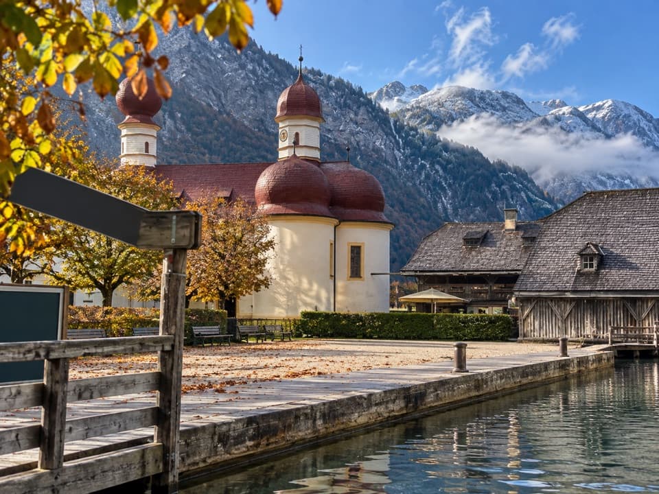
Use the Königssee Seelände public car park; the pier is about a five-minute walk through the pedestrian area. Cross by boat to St. Bartholomä, then follow the lakeshore path to the route start. The route ends at Watzmannhaus, so arrange your onward descent or overnight plan separately.


Safety

The Rinnkendlsteig has steep, exposed sections with fixed cables and metal footholds over roughly 100 m of ascent, plus rockfall risk. The route is recommended for experienced hikers with excellent fitness, sure footing and a head for heights. This is a one-way hut approach. Dogs must be leashed in the park; the boat requires a muzzle or suitable carrier.

3 active Berchtesgaden alerts

  • ClosureKlausbachtal trails closed for bridge and flood-protection workAvoid the closed Klausbachtal trail sections; the Klausbach cannot be crossed at the affected bridges. - Trail No.Official details
  • ClosureKönigsbach Waterfall Gumpen area closedDo not enter the area around the “Gumpen” pools at the Königsbach Waterfall on Königssee.Official details
See all 3 alerts
A park ranger sits on a dash-mounted phone, talking, as Parkwolf’s Tour Guide plays “Army Cutworm Moths: A Grizzly Bear Buffet” on Grand Loop Road below Dunraven Pass in Yellowstone
Parkwolf Tour GuideThe highest, rockiest slopes around here are a summer buffet for grizzly bears.

Berchtesgaden Tour Guide

Your drive to Watzmannhaus via Rinnkendl- und Falzsteig, narrated.

Parkwolf is a GPS audio tour guide for Berchtesgaden National Park. As you drive, it chimes in with what’s ahead: hidden gems, upcoming stops, history, geology, and wildlife, right through your car’s speakers.

More stories near here in the app

  • Jennerbahn: Ride Up for Königsblick
  • Königssee by Boat or on Foot
  • Reading the Ice’s Past
  • Hinterbrand: Pasture Walk or Alpine Circuit
  • 25 audio storiesacross Berchtesgaden’s roads, triggered by GPS as you drive
  • Wildlife heatmapsfor Bearded Vulture, Golden Eagle, Red Deer, and 13 more
  • Works offlinemaps, 71 trails, 57 places, and audio download before you lose signal
  • CarPlay readysimple controls built for the drive
★★★★★
“Fantastic app with many points of information… It’s great to just turn on while you’re driving and it gives you an audio tour of the national Park. We love it!!!!”
JMJamesApp Store review
Download Parkwolf on the App StoreGet Parkwolf on Google Play

4.7 from 8,600+ ratings

Trail guide

Hiking Watzmannhaus via Rinnkendl- und Falzsteig

The Rinnkendlsteig climbFrom the landing, follow the level lakeshore path past the church and turn left at Eiswinkel…

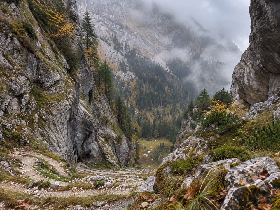
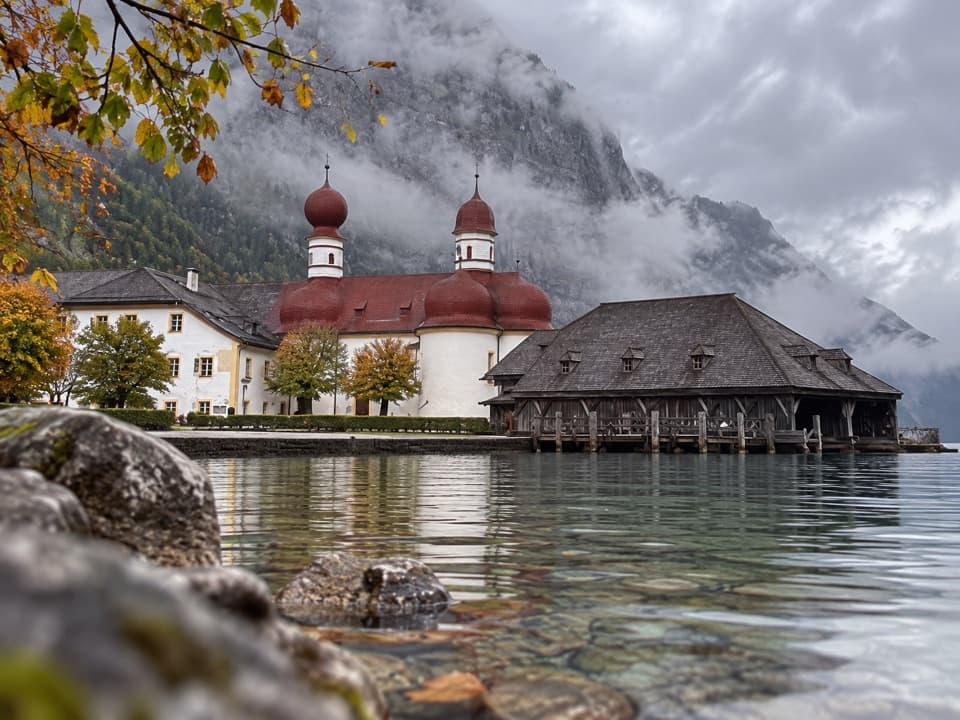
From the landing, follow the level lakeshore path past the church and turn left at Eiswinkel into the forest. The path changes quickly to steep switchbacks on the eastern side of Kleiner Watzmann; a short cable section comes early. Higher up, fixed cables and metal footholds protect roughly 100 m of climbing across exposed ground. The route crosses a broad gully, traverses a shoulder, then climbs the narrow Rinnkendl gully toward Kühroint. Rockfall is a stated hazard, and this is the section that makes the route unsuitable for anyone uneasy on steep, exposed ground.

Stop at ArchenkanzelNear Kühroint, take the short spur to Archenkanzel, about ten minutes each way.

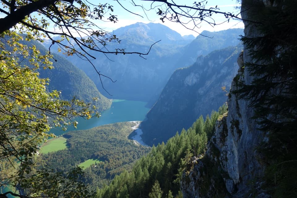
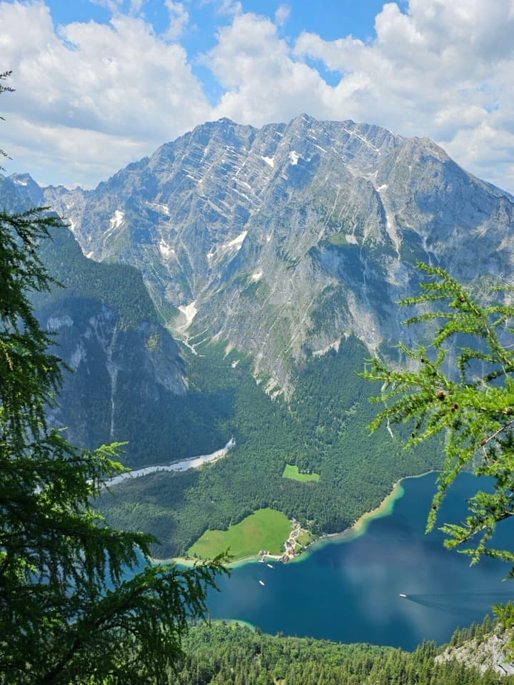
Near Kühroint, take the short spur to Archenkanzel, about ten minutes each way. The natural overlook drops away above Königssee, with St. Bartholomä on the green peninsula below. This is the route’s signature view; frame the lake and peninsula from a safe place to stop, rather than from a narrow section of trail.

Across to FalzalmKührointalm is a useful place to pause and find refreshments when its seasonal service is…

Kührointalm is a useful place to pause and find refreshments when its seasonal service is operating. From there the approach continues below Watzmannkar to Falzsteig, crosses a rocky wall to Falzalm, then climbs the established path to the hut. Keep this sequence clear in your plans: the separate Rinnkendlsteig circuit turns back toward Königssee and is a different hike.

The hut is the endpointWatzmannhaus stands at 1,930 m and serves meals and overnight guests during its operating…

Watzmannhaus stands at 1,930 m and serves meals and overnight guests during its operating season. It began in 1888 as a base for climbers heading onto Watzmann. This route ends at the hut; it does not include Hocheck or the Watzmann ridge traverse. Dogs must be leashed in the national park, and dogs on the Königssee boat need a muzzle or a suitable carrier if they cannot wear one.

Wildlife

Wildlife in Berchtesgaden

All Berchtesgaden wildlife maps

Sighting maps show where each species has been reported across Berchtesgaden. Wildlife moves, so no sighting is guaranteed.

Keep exploring

Near Watzmannhaus via Rinnkendl- und Falzsteig

See it all on the map

Trails that start nearby

Places near the trailhead

Parkwolf’s Berchtesgaden ranking

Top-rated trails in Berchtesgaden

All 71 trails
  1. 1Kleine ReibnChallenging · 18.7 km
  2. 2Obersee – Fischunkelalm – RöthbachfallModerate · 8 km
  3. 3Malerwinkel-RundwegEasy · 3.4 km
  4. 4Wimbachklamm-RundwegModerate · 2.1 km
  5. 5Blaueishütte via SchärtenalmChallenging · 10.5 km
  6. 6Gotzenalm via Hochbahn TrailChallenging · 22.8 km

Take Parkwolf to Berchtesgaden.

The audio tour guide for the drive, plus offline maps, trails, and wildlife heatmaps for when the signal drops.

4.7 from 8,600+ ratings

Download Parkwolf on the App StoreGet Parkwolf on Google Play