Rainbow Point in Bryce Canyon National Park

#7 of 29 sights in Bryce Canyon

Sight · Bryce Canyon National Park

Rainbow Point

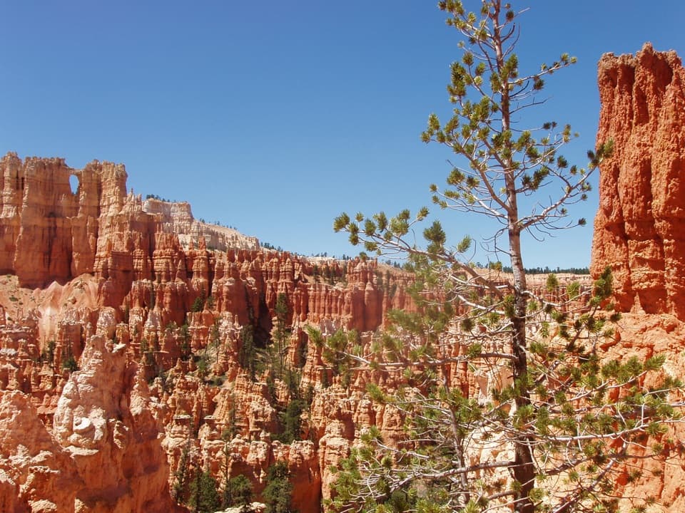
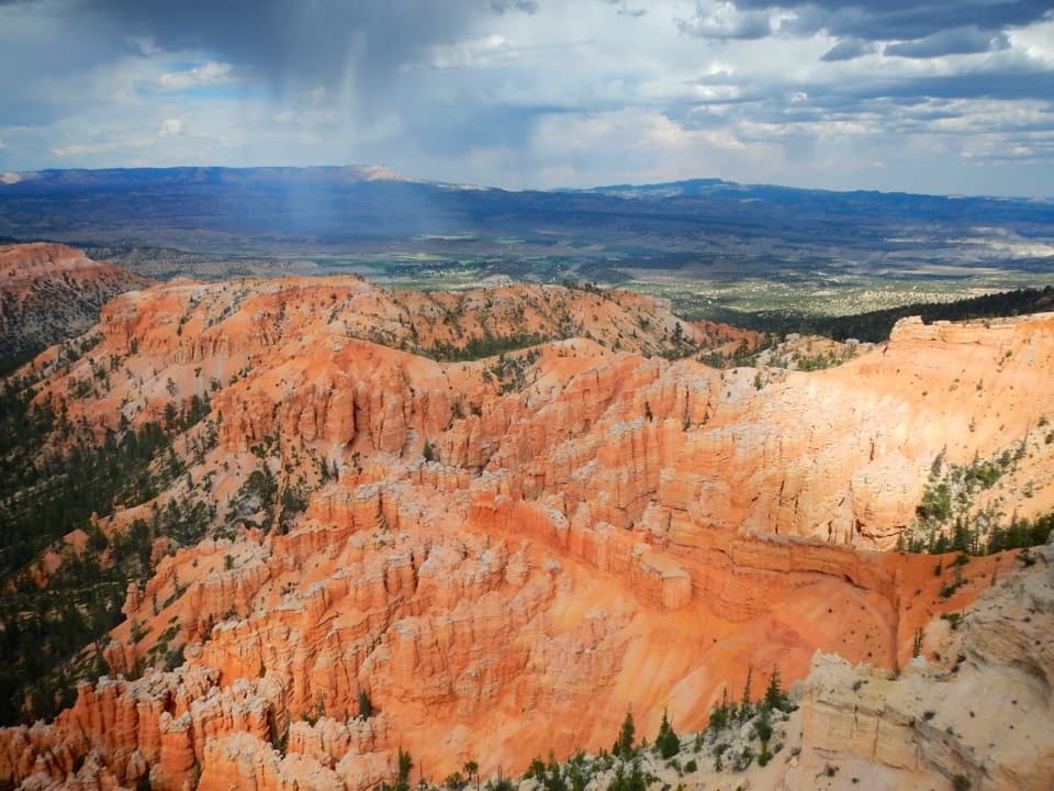
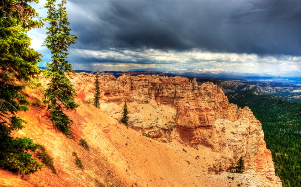
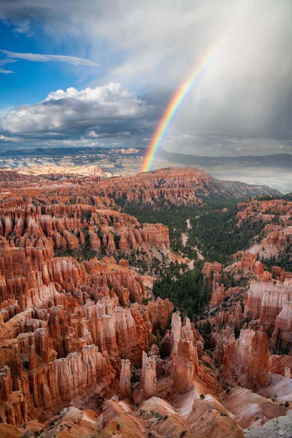
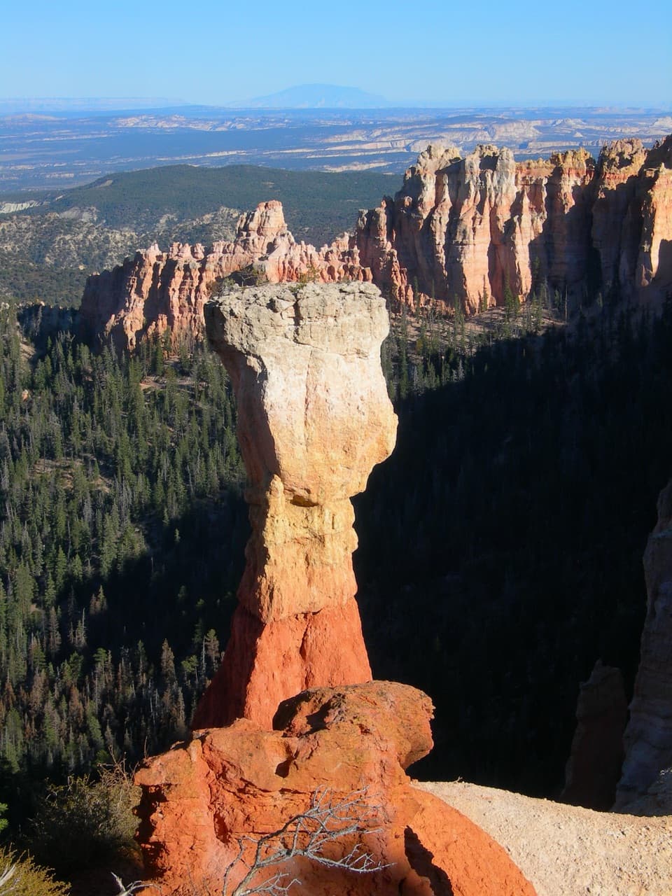
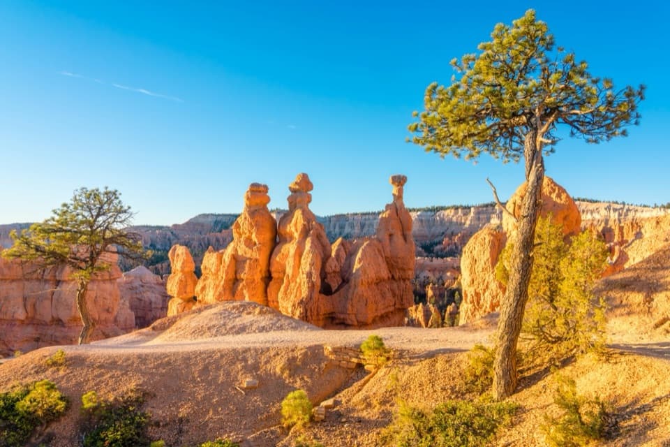
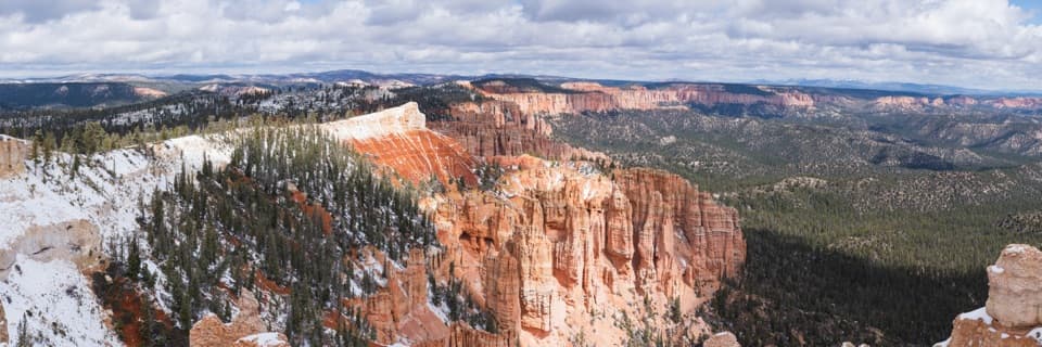
Layered plateau views and bristlecones at Bryce’s high southern overlook.

Photo: Wikimedia Commons
Type
Sight
Nearest trail
0.1 mi
Audio stories
3 nearby
  • Scenic viewpoint
  • Parking
  • Restrooms
  • Picnic tables

Hear the audio tour

Rainbow and Yovimpa: Two Directions to Look

Overview

About Rainbow Point

Why stop

  • Wide views over the Paunsaugunt Plateau and colored cliff bands
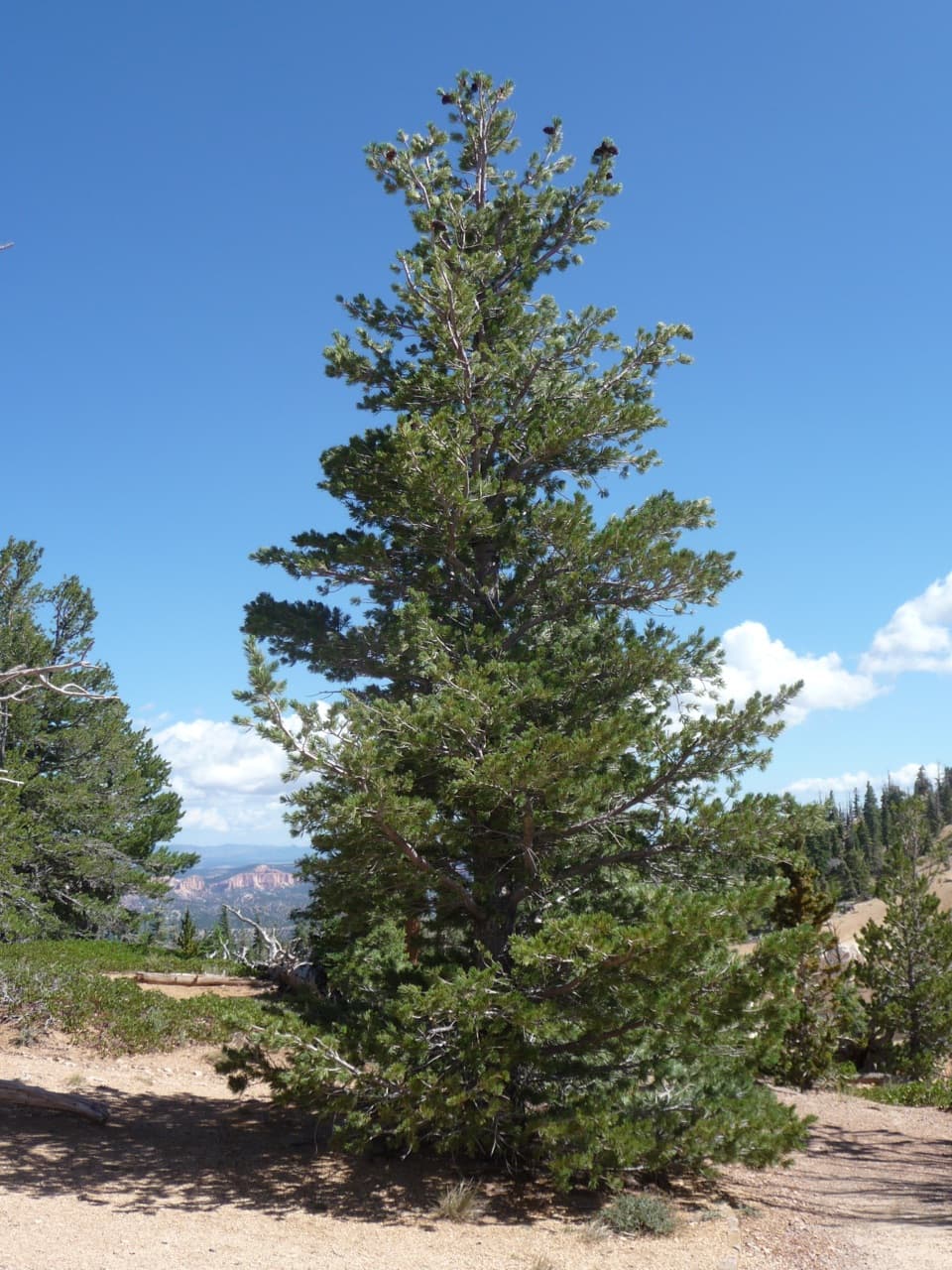
  • A one-mile loop reaches ancient bristlecones beside the overlook

Heads up

  • The drive continues well beyond the Bryce Amphitheater

Map

Where it is

Loading the Bryce Canyon map
Full map
SightRainbow Point37.47602, -112.24064
Keep this map with you offline in the Parkwolf app

Plan your stop

Before you go

3 active Bryce Canyon alerts

  • CautionUnder-the-Rim Trail damage and hiker advisoryMentions Under-the-Rim Trail, referenced in this guideUnder-the-Rim Trail conditions are deteriorated in many places; hike at your own risk. - Use a map and be able to navigate in the backcountry; strong wayfinding skills are essential.Official details
  • ClosureWall Street closed after recent rainsWall Street is closed until further notice because of recent rains. - Other park trails are open, but hikers are urged to use caution. Check current park conditions before hiking.Official details
See all 3 alerts
A park ranger sits on a dash-mounted phone, talking, as Parkwolf’s Tour Guide plays “Army Cutworm Moths: A Grizzly Bear Buffet” on Grand Loop Road below Dunraven Pass in Yellowstone
Parkwolf Tour GuideThe highest, rockiest slopes around here are a summer buffet for grizzly bears.

Bryce Canyon Tour Guide

Your drive to Rainbow Point, narrated.

Parkwolf is a GPS audio tour guide for Bryce Canyon National Park. As you drive, it chimes in with what’s ahead: hidden gems, upcoming stops, history, geology, and wildlife, right through your car’s speakers.

See the Bryce Canyon audio tour

Recorded for this place

Rainbow and Yovimpa: Two Directions to Look
0:00 / 0:31
“Rainbow Point and Yovimpa Point are coming up at the end of the park road. Make time for both: Rainbow looks north along Bryce's rim, while a short paved walk to Yovimpa opens the view south across the Grand Staircase.”

Plays as you drive up to Rainbow Point in the Parkwolf Bryce Canyon Tour Guide.

More stories near here in the app

  • A Bristlecone's Living Strip
  • Black Birch Canyon: A Likely Tree Mix-Up
  • Ponderosa Canyon: Pines Far Below
  • Agua Canyon: Trees on the Hunter
  • 30 audio storiesacross Bryce Canyon’s roads, triggered by GPS as you drive
  • Wildlife heatmapsfor Wapiti, Utah Prairie Dog, Mule Deer, and 13 more
  • Works offlinemaps, 24 trails, 41 places, and audio download before you lose signal
  • CarPlay readysimple controls built for the drive
★★★★★
“Super fun and useful app! We especially enjoyed the guide as we drove through Bryce Canyon National Park.”
Rae607App Store review
Download Parkwolf on the App StoreGet Parkwolf on Google Play

4.7 from 8,600+ ratings

Guide

More about Rainbow Point

Make the southern drive for a different viewRainbow Point is a high, open overlook at the southern end of Bryce Canyon’s main park road,…

Rainbow Point is a high, open overlook at the southern end of Bryce Canyon’s main park road, set on the rim of the Paunsaugunt Plateau. At 9,115 feet, it’s one of the park’s highest viewpoints. I’d make the drive if you have time for the nearby Bristlecone Loop: the views here are broad and layered, a change from the close hoodoos around the amphitheater. If you only have a short visit, stay near the central overlooks.

Get the full viewYou can see the main overlook from beside the parking area.

You can see the main overlook from beside the parking area. For the south-facing panorama, cross the lot to Yovimpa Point or follow the short path toward Bristlecone Loop; those give a better view south. The overlook is photo-worthy without a hike, while the loop adds trees to the foreground.

Visitors report more wind and cold up here than around the amphitheater, and snow can linger on the high trails. Check road and trail conditions before driving all the way south in winter. The park lists parking, a picnic table and a restroom at Rainbow Point, but doesn’t list a food outlet or water-fill station here, so pick up what you need before the drive.

Walk the Bristlecone LoopA short path from the overlook reaches the 1-mile Bristlecone Loop, an easy circuit with about…

A short path from the overlook reaches the 1-mile Bristlecone Loop, an easy circuit with about 200 feet of elevation change. NPS gives it a typical time of one to two hours, especially if you stop to look at the trees. The trail has a hard surface, but several grades don’t meet accessibility standards; it may take assistance to use. NPS lists the overlook itself as wheelchair accessible.

A very old forestBristlecone pines on the loop can be up to 1,600 years old.

Bristlecone pines on the loop can be up to 1,600 years old. They grow on dolomitic limestone near cliff edges, where harsh conditions can slow growth to about an inch per century. Some keep their needles for as long as 40 years. The surrounding forest also gives grouse, woodpeckers, owls, squirrels and chipmunks habitat; look for signs of wildlife rather than expecting a sighting.

Read the plateauRain and melting snow have carved the Paunsaugunt Plateau’s rim into bowl-shaped amphitheaters…

Rain and melting snow have carved the Paunsaugunt Plateau’s rim into bowl-shaped amphitheaters that drain toward the Paria River and then the Colorado. To the east, the Pink Cliffs give way to the Grey and White Cliffs across the valley; the opposite Pink Cliffs rise to about 10,000 feet. To the west, the plateau edge is a watershed: water flows toward the Sevier River and Great Basin rather than the Colorado River.

The landscape was lifted from sea level over roughly 20 million years and then cut by tributaries. That long erosion has left undercut cliffs along this rim, older and more open than the hoodoo amphitheater farther north.

A small CCC landmarkThe open-air museum-shelter at Rainbow Point was completed in 1940 as part of Bryce Canyon’s…

The open-air museum-shelter at Rainbow Point was completed in 1940 as part of Bryce Canyon’s Civilian Conservation Corps legacy. The park’s NP-3 camp operated from 1934 to 1943 and worked on roads, trails and structures here, including the Under-the-Rim Trail. The shelter was added to the National Register of Historic Places in 1995.

Wildlife

Wildlife in Bryce Canyon

All Bryce Canyon wildlife maps

Sighting maps show where each species has been reported across Bryce Canyon. Wildlife moves, so no sighting is guaranteed.

Parkwolf’s Bryce Canyon ranking

Top sights in Bryce Canyon

All 41 places
  1. 1Bryce PointSight
  2. 2Sunset PointSight
  3. 3Inspiration PointSight
  4. 4Thor’s HammerSight
  5. 5Sunrise PointSight
  6. 6Natural BridgeSight

Take Parkwolf to Bryce Canyon.

The audio tour guide for the drive, plus offline maps, trails, and wildlife heatmaps for when the signal drops.

4.7 from 8,600+ ratings

Download Parkwolf on the App StoreGet Parkwolf on Google Play