Inspiration Point in Bryce Canyon National Park

#3 of 29 sights in Bryce Canyon

Sight · Bryce Canyon National Park

Inspiration Point

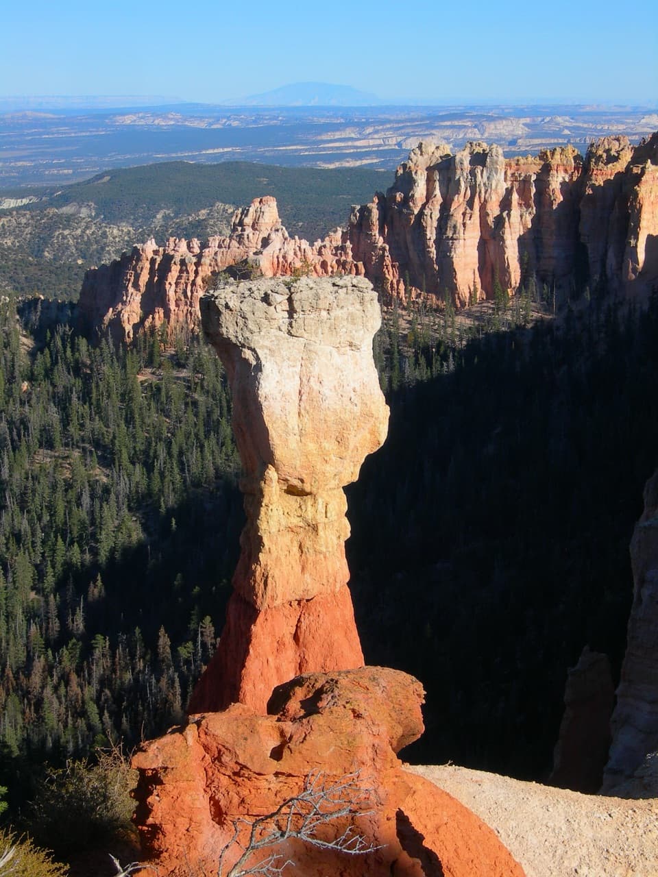
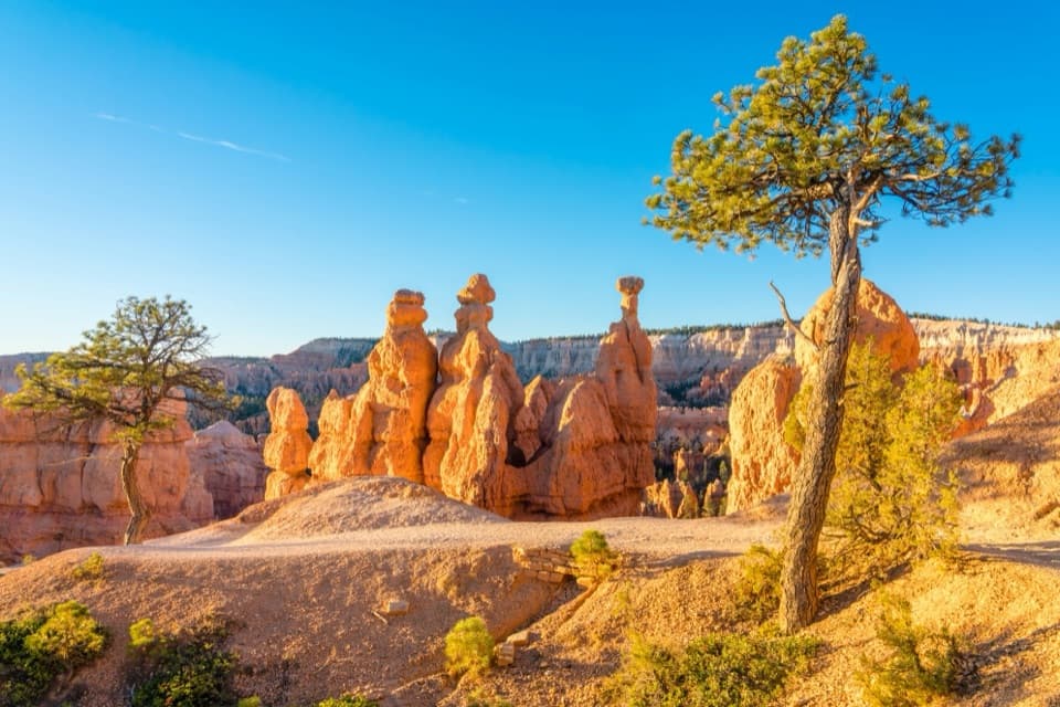
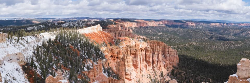
Three levels offer different angles over the hoodoo amphitheater.

Photo: National Park Service
Type
Sight
Nearest trail
0.5 mi
Audio stories
11 nearby
  • Scenic viewpoint
  • Parking
  • Restrooms
  • Exhibit

Hear the audio tour

Inspiration Point: Three Levels of Views

Overview

About Inspiration Point

Why stop

  • The upper level looks toward Bryce Point and the Wall of Windows.

Heads up

  • Reaching the higher platforms means a short but steep uphill climb.

Map

Where it is

Loading the Bryce Canyon map
Full map
SightInspiration Point37.61605, -112.17035
Keep this map with you offline in the Parkwolf app

Plan your stop

Before you go

3 active Bryce Canyon alerts

  • ClosureWall Street closed after recent rainsWall Street is closed until further notice because of recent rains. - Other park trails are open, but hikers are urged to use caution. Check current park conditions before hiking.Official details
  • CautionUnder-the-Rim Trail damage and hiker advisoryUnder-the-Rim Trail conditions are deteriorated in many places; hike at your own risk. - Use a map and be able to navigate in the backcountry; strong wayfinding skills are essential.Official details
See all 3 alerts
A park ranger sits on a dash-mounted phone, talking, as Parkwolf’s Tour Guide plays “Army Cutworm Moths: A Grizzly Bear Buffet” on Grand Loop Road below Dunraven Pass in Yellowstone
Parkwolf Tour GuideThe highest, rockiest slopes around here are a summer buffet for grizzly bears.

Bryce Canyon Tour Guide

Your drive to Inspiration Point, narrated.

Parkwolf is a GPS audio tour guide for Bryce Canyon National Park. As you drive, it chimes in with what’s ahead: hidden gems, upcoming stops, history, geology, and wildlife, right through your car’s speakers.

See the Bryce Canyon audio tour

Recorded for this place

Inspiration Point: Three Levels of Views
0:00 / 0:32
“Inspiration Point is coming up, and I'd go beyond the first railing if you're comfortable with a short, steep climb.”

Plays as you drive up to Inspiration Point in the Parkwolf Bryce Canyon Tour Guide.

More stories near here in the app

  • Sunset Campground: A Base Near the Rim
  • Sunset Point and Thor's Hammer
  • Bryce Canyon Lodge: History and a Meal
  • Sunrise Point: Pines Above the Hoodoos
  • 30 audio storiesacross Bryce Canyon’s roads, triggered by GPS as you drive
  • Wildlife heatmapsfor Wapiti, Utah Prairie Dog, Mule Deer, and 13 more
  • Works offlinemaps, 24 trails, 41 places, and audio download before you lose signal
  • CarPlay readysimple controls built for the drive
★★★★★
“Super fun and useful app! We especially enjoyed the guide as we drove through Bryce Canyon National Park.”
Rae607App Store review
Download Parkwolf on the App StoreGet Parkwolf on Google Play

4.7 from 8,600+ ratings

Guide

More about Inspiration Point

Take time for all three levelsInspiration Point is a three-level overlook just before mile 3 on the main park road, looking…

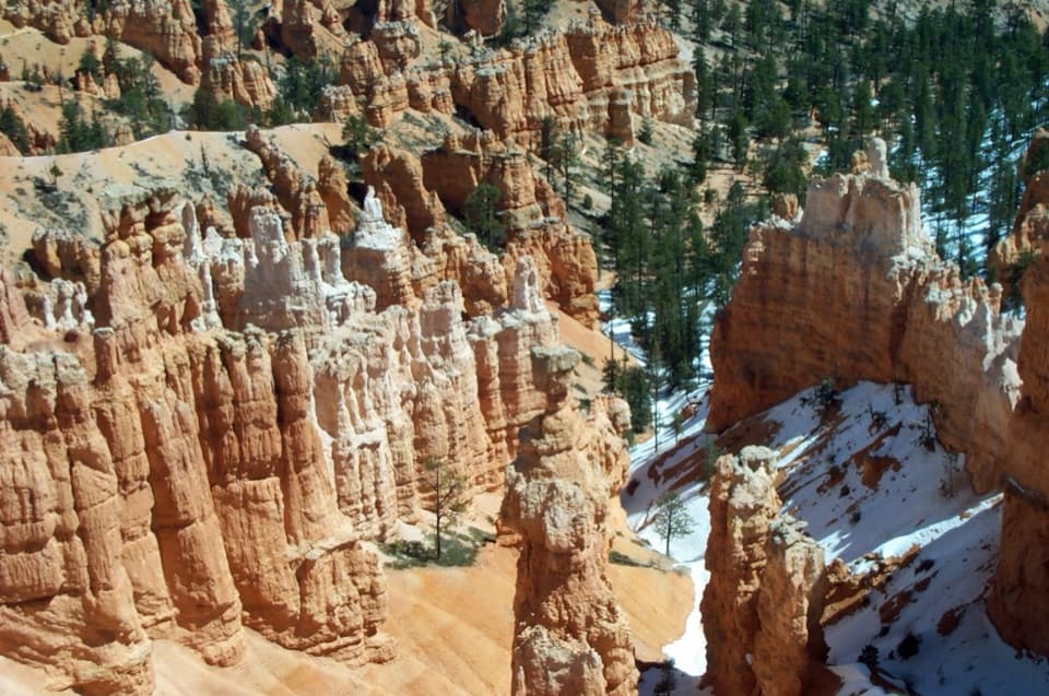
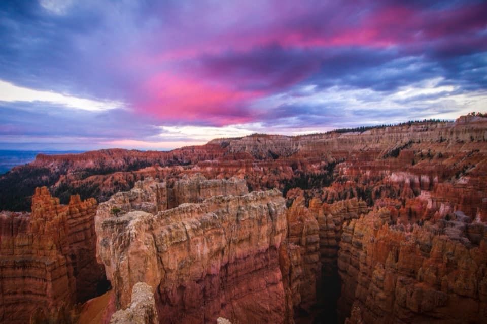
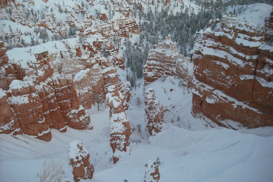
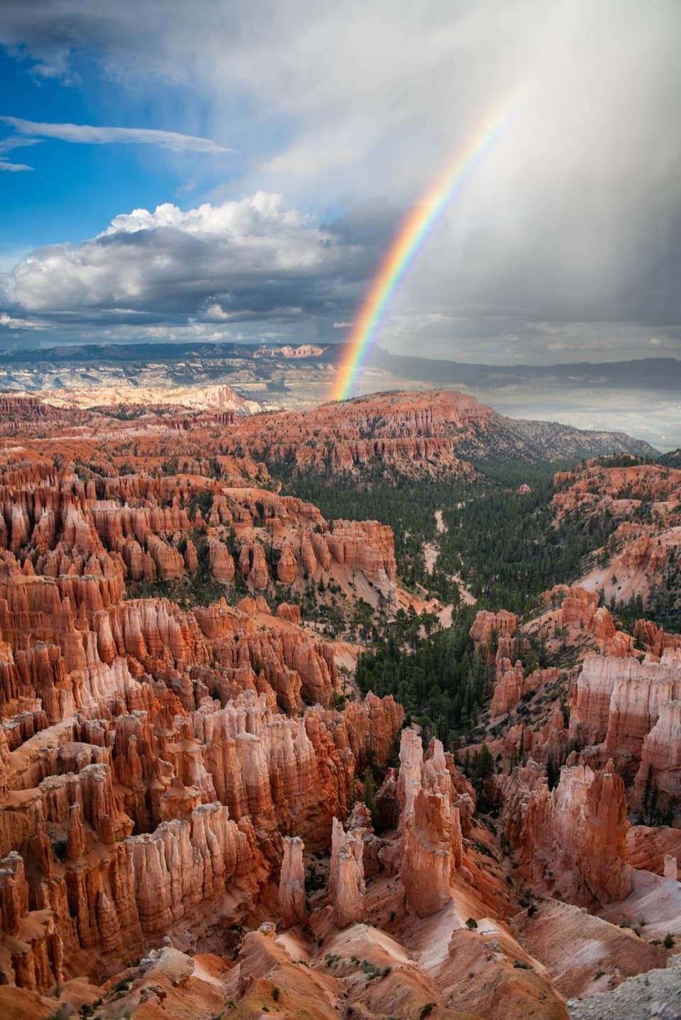
Inspiration Point is a three-level overlook just before mile 3 on the main park road, looking down into the hoodoo-filled Bryce Amphitheater. It is one of the park's four main Amphitheater viewpoints. The different heights are the point of the stop, so go beyond the first railing and make your way to the upper platform if you can.

Reach the upper platformThe climb is short but noticeably uphill, and the higher platforms take more effort.

The climb is short but noticeably uphill, and the higher platforms take more effort. The park lists the viewpoint as wheelchair accessible, while visitors describe the climb to the upper levels as steep. Its access information does not say which levels that covers. A restroom, interpretive information, a bike rack and a shuttle stop serve the area. I found no listed food or drinking-water service at the overlook, so plan around it as a scenic stop rather than a meal break.

Park or ride the shuttleThe overlook sits just before mile 3 of the park road.

The overlook sits just before mile 3 of the park road. Seasonal shuttle stop 9 serves it; the shuttle generally runs from April to mid-October. The park recommends using it because parking at the Amphitheater viewpoints is limited, and lots can close temporarily when full.

The Rim Trail passes the overlook, with Sunset Point 0.7 mile north and Bryce Point 1.5 miles south. The southern stretch closes in winter because of narrow trail and snow cornices. Check the park's current access information before planning a longer walk.

Look south from the topThe uppermost platform gives the clearest southern view, toward Bryce Point with the Wall of…

The uppermost platform gives the clearest southern view, toward Bryce Point with the Wall of Windows below it. Lower down, you can see the Peekaboo Loop trail emerging near the Cathedral formation. For a photo that gives the hoodoos a sense of scale, work up to the highest level and include the wall of formations below the rim; early light can bring out stronger shadows and texture, though the effect depends on conditions.

Follow the northern rimTo the north, the view runs along the eroded edge of the Paunsaugunt Plateau.

To the north, the view runs along the eroded edge of the Paunsaugunt Plateau. Dense ranks of spires form the Silent City south of Sunset Point. Beyond are Sunrise Point, Campbell Canyon and the flat top of Boat Mesa, with ponderosa forest and meadows farther across the plateau.

Read the pink and white layersThe hoodoos are cut into the Claron Formation.

The hoodoos are cut into the Claron Formation. Its lower Pink Member contains sand, silt and iron mixed into limestone, giving the rock its rusty color. The upper White Member is purer freshwater limestone. You can see it below the overlook; its softer rock forms fewer hoodoos.

A fault changed the skylineBristlecone Point and Sinking Ship show the tilt associated with the Paunsaugunt Fault.

Bristlecone Point and Sinking Ship show the tilt associated with the Paunsaugunt Fault. Movement along it dropped the plateau about 2,000 feet below the rocks to the east, bringing the park's limestone layers level with the softer marine shales in the Grey Cliffs. That shift helps explain the height contrast with Table Cliffs across the valley, about 13 miles away. On a clear day, the horizon reaches Navajo Mountain, roughly 80 miles distant. The Black Mountains and, farther northwest, the Tushar Mountains also show evidence of volcanic activity about 20 million years ago.

Follow Bryce Creek belowBryce Creek is the amphitheater's main drainage, but it is usually a dry wash.

Bryce Creek is the amphitheater's main drainage, but it is usually a dry wash. Water moves through it after summer storms or winter snowmelt. On the 1.5-mile Rim Trail stretch toward Bryce Point, moisture-loving Douglas fir grows below the rim.

Wildlife

Wildlife in Bryce Canyon

All Bryce Canyon wildlife maps

Sighting maps show where each species has been reported across Bryce Canyon. Wildlife moves, so no sighting is guaranteed.

Keep exploring

Near Inspiration Point

See it all on the map

Trails nearby

More stops nearby

Parkwolf’s Bryce Canyon ranking

Top sights in Bryce Canyon

All 41 places
  1. 1Bryce PointSight
  2. 2Sunset PointSight
  3. 4Thor’s HammerSight
  4. 5Sunrise PointSight
  5. 6Natural BridgeSight
  6. 7Rainbow PointSight

Take Parkwolf to Bryce Canyon.

The audio tour guide for the drive, plus offline maps, trails, and wildlife heatmaps for when the signal drops.

4.7 from 8,600+ ratings

Download Parkwolf on the App StoreGet Parkwolf on Google Play