Parking
Use the Linn of Dee car park; parking is chargeable for nonmembers. The route leaves the road before the Linn of Dee bridge.
Cairngorms National Park, SC
Two Munros, a pathless ridge and the long walk back.
Overview
Map & elevation
Plan your hike

The highest, rockiest slopes around here are a summer buffet for grizzly bears.
Cairngorms Tour Guide
Parkwolf is a GPS audio tour guide for Cairngorms National Park. As you drive, it chimes in with what’s ahead: hidden gems, upcoming stops, history, geology, and wildlife, right through your car’s speakers.
See the Cairngorms audio tourRecorded for this trailhead
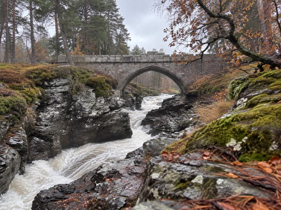
Linn of Dee and the Gorge“You're approaching Linn of Dee, where the river squeezes through a narrow rocky gorge beneath a granite bridge. This is worth a short stop even if you're not heading into the mountains.”
Plays as you drive up to this trailhead in the Parkwolf Cairngorms Tour Guide.
More stories near here in the app
“Fantastic app with many points of information… It’s great to just turn on while you’re driving and it gives you an audio tour of the national Park. We love it!!!!”


Trail guide
This is a remote hill round from Linn of Dee to Càrn an Fhidhleir (994m) and An Sgarsoch (1006m), with a long walk up Glen Geldie, an upper ridge loop and a shared return to the glen track. The published 26 miles (42km) includes the full walk-in and walk-back; allow 11–12 hours and about 1,059m of ascent. It suits experienced hillwalkers who are comfortable with a very long day, river crossings and navigation over pathless ground. A continuous path does not cross the upper moor.
From the Linn of Dee car park, leave the road before the stone bridge and follow the main track through old pines and the remains of earlier glen settlements. Just short of 5km, keep to the main track rather than taking the right-hand branch for Corrour; cross White Bridge and continue toward Red House. Ruighe Ealasaid, the Red House, was restored in 2022 and is open as a Mountain Bothies Association shelter.
The glen track passes the ruins of Geldie Lodge after several burns. Allt Dhaidh Beag has a footbridge just to the side of its ford. Allt Dhaidh Mòr has no bridge, and the River Geldie must also be forded; either can be dangerous or impassable after heavy rain. Check the water before committing to these crossings. Beyond the lodge, a well-made stalkers’ path heads west to Allt a’Chaorainn. Cross the burn and turn onto the open moor.
A faint track soon fades into boggy ground as the route works toward the north ridge. The climb gets firmer and stonier on the ridge itself, which leads to the broad, fairly level summit area and its cairn. This stretch is easy to lose in cloud: keep track of the ridge and the intended summit rather than relying on a continuous path.
From Càrn an Fhidhleir, follow the ridge southeast toward the 906m bump. The line traverses its steep grassy flank, though continuing over the top is another option before the descent. Drop to the 702m bealach, a peat bog, then climb through heather and onto more open ground. An Sgarsoch’s large cairn stands beyond a rocky outcrop, with wide views toward the main Cairngorms range when visibility allows.
Descend north from An Sgarsoch; one short section is steeper, then the slopes open toward the bealach with Sgarsoch Bheag. A path skirts the hillock on its west side, swings north and eventually peters out. Continue to the earlier stalkers’ path and retrace the long glen approach to the car park. The summit circuit does not remove the shared walk back, so keep enough time and energy for the return.
Wildlife
 159 sightingsRed DeerMost seen around 7 AMSighting map
 63 sightingsReindeerMost seen around 6 PMSighting map
 102 sightingsOspreyMost seen around 5 PMSighting map
 37 sightingsBlack GrouseMost seen around 4 AMSighting map
 72 sightingsRed GrouseMost seen around 6 PMSighting map
 82 sightingsPine MartenMost seen around 9 PMSighting map
Sighting maps show where each species has been reported across Cairngorms. Wildlife moves, so no sighting is guaranteed.
Keep exploring
 ModerateGlen Lui Trail2.8 km · 1.3 hr · At the trailheadA blue loop links a river gorge, pinewoods and waterfalls.
 ChallengingCàrn a’ Mhàim from Linn of Dee22.5 km · 7.5 hr · At the trailheadA full Munro day with a striking narrow ridge above the glen.
 ChallengingGlen Tilt Through-Walk33.8 km · 10 hr · At the trailheadA remote 21-mile crossing with a serious river ford
 EasyDerry Lodge from Linn of Dee10.9 km · 3 hr · At the trailheadA Victorian lodge at the end of a gentle Glen Lui walk.
 ChallengingBeinn Mheadhoin and Derry Cairngorm Circuit31 km · 9.5 hr · At the trailheadTwo Munros, granite tors and a remote Glen Derry return.
 ModerateCreag Bhalg from Claybokie6 km · 2.3 hr · 2.3 km awayA short climb, with a faint heather path to open summit views.
 ModerateThe Colonel’s Bed Walk4.8 km · 1.5 hr · 2.7 km awayA short Glen Ey walk to a gorge-side hideaway with a story.
 ChallengingBeinn Iutharn Mhòr and Càrn Bhac Loop32.2 km · 9.5 hr · 2.7 km awayTwo remote Munros, linked by a hard day over bog and scree.
 Sight · 0.2 km awayLinn of DeeA Victorian granite bridge over a river squeezed through stone.
 Sight · 5.4 km awayLinn of QuoichFollow Quoich Water to its granite Punchbowl and restored cottage.
 Visitor center · 8.6 km awayThe Duke of Rothesay Highland Games PavilionMeet the Gathering’s story beside the field where it unfolds.
 Lodging · 8.9 km awayThe Fife ArmsStop for a pub meal inside Braemar’s Victorian landmark hotel.
 Sight · 8.9 km awayKindrochit CastleA small Braemar ruin with a royal story worth a short stop.
 Store · 9 km awayBraemar Chocolate ShopScottish-inspired handmade chocolates in a Braemar village shop.
 Campground · 9.1 km awayBraemar Caravan Park & Camping PodsA practical base near Braemar village and Invercauld Estate walks.
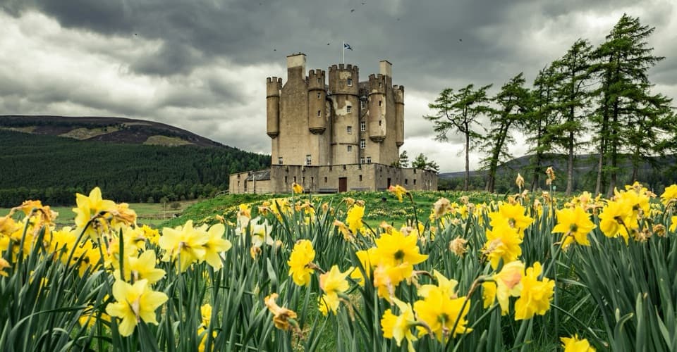 Sight · 9.6 km awayBraemar CastleA lively 1628 castle tour with a garden and a thatched folly.
Parkwolf’s Cairngorms ranking

The audio tour guide for the drive, plus offline maps, trails, and wildlife heatmaps for when the signal drops.





