Lower South Desert Overlook Trail in Capitol Reef National Park

Capitol Reef National Park, UT

Lower South Desert Overlook Trail

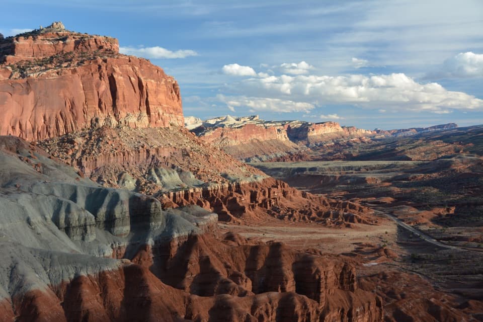
A short rim walk for a broad look at Jailhouse Rock.

Photo: National Park Service
Length
0.6mi
Time
20min
Elevation
Flat
Difficulty
Easy
  • No dogs
  • High point 5,806 ft

Hear the audio tour

Lower South Desert Overlook

Overview

About Lower South Desert Overlook Trail

Why go

  • Broad Jailhouse Rock views from a short rim walk
  • Temple Rock and the Waterpocket Fold share the panorama

Heads up

  • Remote, rough-road access for a very short hike

Map & elevation

The route

Loading the Capitol Reef map
Full map
Elevation5,771–5,806 ft
TrailheadLower South Desert Overlook spur-road parking area38.40444, -111.20332
Keep this map with you offline in the Parkwolf app

Plan your hike

Before you go

Parking

From Highway 24, follow Hartnet Road toward Cathedral Valley, then take the signed Lower South Desert spur to the parking area at the road end. The long approach is on unpaved backcountry roads; high clearance is necessary and four-wheel drive is recommended.

Safety

The rutted two-track and rim viewpoint are unmarked, and the track drops steeply beyond the overlook. Hartnet and Cathedral Valley roads can become impassable when wet; the Fremont River ford may be unsafe at high water. Pets are prohibited on trails and off-trail in the backcountry.

2 active Capitol Reef alerts

  • CautionE. coli advisory for Fremont River and Sulphur CreekMentions Fremont River, referenced in this guideDo not swim in the Fremont River or Sulphur Creek or get water in your mouth: NPS reports elevated E. coli in both waterways, and Utah DEQ has issued a warning advisory. - DEQ reports Sulphur Creek E.Official details
  • CautionFlash-flood hazard in canyons and washesHeavy rains can cause sudden flooding in Capitol Reef’s canyons and washes; do not hike or drive through floodwater.Official details
Capitol Reef alerts
A park ranger sits on a dash-mounted phone, talking, as Parkwolf’s Tour Guide plays “Army Cutworm Moths: A Grizzly Bear Buffet” on Grand Loop Road below Dunraven Pass in Yellowstone
Parkwolf Tour GuideThe highest, rockiest slopes around here are a summer buffet for grizzly bears.

Capitol Reef Tour Guide

Your drive to Lower South Desert Overlook Trail, narrated.

Parkwolf is a GPS audio tour guide for Capitol Reef National Park. As you drive, it chimes in with what’s ahead: hidden gems, upcoming stops, history, geology, and wildlife, right through your car’s speakers.

See the Capitol Reef audio tour

Recorded for this trailhead

Lower South Desert Overlook
0:00 / 0:30
“Lower South Desert Overlook is coming up, with Jailhouse Rock standing about five hundred feet above the valley floor.”

Plays as you drive up to this trailhead in the Parkwolf Capitol Reef Tour Guide.

More stories near here in the app

  • Mountains Pushed Up from Below
  • A Cactus Works the Night Shift
  • Rain That Never Reaches the Ground
  • Lower Cathedral Valley Overlooks
  • 116 audio storiesacross Capitol Reef’s roads, triggered by GPS as you drive
  • Wildlife heatmapsfor Bighorn Sheep, Mule Deer, Marmot, and 13 more
  • Works offlinemaps, 48 trails, 52 places, and audio download before you lose signal
  • CarPlay readysimple controls built for the drive
★★★★★
“Fantastic app with many points of information… It’s great to just turn on while you’re driving and it gives you an audio tour of the national Park. We love it!!!!”
JMJamesApp Store review
Download Parkwolf on the App StoreGet Parkwolf on Google Play

4.7 from 8,600+ ratings

Trail guide

Hiking Lower South Desert Overlook Trail

The short walkLower South Desert Overlook is a roughly 0.

Lower South Desert Overlook is a roughly 0.6-mile out-and-back from the road-end parking area to an unmarked rim viewpoint. Follow an old, rutted two-track about 0.29 mile each way; allow about 20 minutes for the return walk and a look around. It is an easy walk once you are there, but getting there is a much bigger commitment. Turn back at the overlook: continuing down the old track becomes the separate 4.5-mile Jailhouse Rock and Temple Rock hike.

The viewJailhouse Rock rises above the sandy South Desert, with smaller Temple Rock beyond it and the…

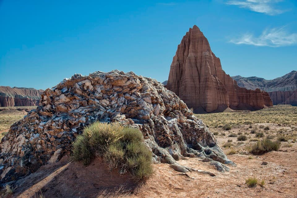
Jailhouse Rock rises above the sandy South Desert, with smaller Temple Rock beyond it and the Waterpocket Fold curving behind and to the left. From the rim, keep a little of the pale ledge in the foreground to show the drop and the scale of the desert below.

Read the rock layersThe gray-green Curtis Formation caps Jailhouse Rock.

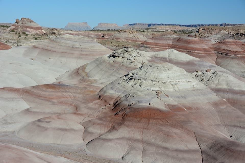
The gray-green Curtis Formation caps Jailhouse Rock. Weathering has rounded it into bubbled, mushroom-like shapes you can spot near the viewpoint. Red-orange Entrada sandstone forms the rocks below, including Jailhouse Rock and Temple Rock; the Waterpocket Fold behind them is dominated here by Navajo sandstone.

The approach mattersThis is a remote backcountry stop, not a signed, maintained park trail.

This is a remote backcountry stop, not a signed, maintained park trail. The short track is rutted and the overlook is unmarked; the old road drops steeply beyond it. Hartnet and Cathedral Valley roads are unpaved, maintained infrequently and can become impassable when wet. The Fremont River ford can be unsafe during high water. High-clearance is necessary for the access roads, and four-wheel drive is recommended. Pets are not allowed on trails or off-trail in the backcountry.

Wildlife

Wildlife in Capitol Reef

All Capitol Reef wildlife maps

Sighting maps show where each species has been reported across Capitol Reef. Wildlife moves, so no sighting is guaranteed.

Keep exploring

Near Lower South Desert Overlook Trail

See it all on the map

Trails that start nearby

Places near the trailhead

Parkwolf’s Capitol Reef ranking

Top-rated trails in Capitol Reef

All 48 trails
  1. 1Hickman Bridge TrailModerate · 1.8 mi
  2. 2Cassidy Arch TrailChallenging · 3.4 mi
  3. 3Grand Wash TrailEasy · 4.4 mi
  4. 4Capitol Gorge TrailEasy · 2 mi
  5. 5Navajo Knobs TrailChallenging · 9.4 mi
  6. 6Rim Overlook TrailChallenging · 4.6 mi

Take Parkwolf to Capitol Reef.

The audio tour guide for the drive, plus offline maps, trails, and wildlife heatmaps for when the signal drops.

4.7 from 8,600+ ratings

Download Parkwolf on the App StoreGet Parkwolf on Google Play