Oak Creek Canyon in Capitol Reef National Park

Capitol Reef National Park, UT

Oak Creek Canyon

A rugged 2.2-mile creek walk through sculpted sandstone narrows

Length
2.2mi
Time
1.5hr
Elev. change
197ft
Difficulty
Moderate
  • High point 5,847 ft
Parkwolf audio tour116 stories across Capitol Reef’s roads

Overview

About Oak Creek Canyon

Why go

  • Sculpted sandstone narrows, water and small waterfalls
  • A short route with a real canyon scramble

Heads up

  • Four-mile rough access spur from Notom-Bullfrog Road
  • Informal route with variable, sometimes deep wading

Map & elevation

The route

Loading the Capitol Reef map
Full map
Elevation5,651–5,847 ft
TrailheadOak Creek Canyon Hikers Trailhead38.08142, -111.12784
Keep this map with you offline in the Parkwolf app

Plan your hike

Before you go

Parking

From Notom-Bullfrog Road, take the signed Oak Creek Canyon spur for about four miles to the Hikers Trailhead. High clearance is needed; four-wheel drive is recommended for the final two miles. The last mile is narrow and deeply rutted. Parking about three miles in and walking the last mile adds roughly two miles round trip.

Safety

This is an unmaintained route with a steep, pathless descent and two dryfalls before the creek. Expect slick wading, variable depth that has reached waist-high, and reported quicksand. Flash floods can surge through narrow canyons during storms; do not enter if storms threaten. Public access along the full route and the applicable pet rule are not confirmed, so check before setting out or bringing a dog.

2 active Capitol Reef alerts

  • CautionFlash-flood hazard in canyons and washesHeavy rains can cause sudden flooding in Capitol Reef’s canyons and washes; do not hike or drive through floodwater.Official details
  • CautionE. coli advisory for Fremont River and Sulphur CreekDo not swim in the Fremont River or Sulphur Creek or get water in your mouth: NPS reports elevated E. coli in both waterways, and Utah DEQ has issued a warning advisory. - DEQ reports Sulphur Creek E.Official details
Capitol Reef alerts
A park ranger sits on a dash-mounted phone, talking, as Parkwolf’s Tour Guide plays “Army Cutworm Moths: A Grizzly Bear Buffet” on Grand Loop Road below Dunraven Pass in Yellowstone
Parkwolf Tour GuideThe highest, rockiest slopes around here are a summer buffet for grizzly bears.

Capitol Reef Tour Guide

Your drive to Oak Creek Canyon, narrated.

Parkwolf is a GPS audio tour guide for Capitol Reef National Park. As you drive, it chimes in with what’s ahead: hidden gems, upcoming stops, history, geology, and wildlife, right through your car’s speakers.

See the Capitol Reef audio tour

More stories near here in the app

  • Hummingbirds at the Claret Cups
  • The Primrose Changes Color
  • A Partnership on the Rock
  • Milkweed in a Life Jacket
  • 116 audio storiesacross Capitol Reef’s roads, triggered by GPS as you drive
  • Wildlife heatmapsfor Bighorn Sheep, Mule Deer, Marmot, and 13 more
  • Works offlinemaps, 48 trails, 52 places, and audio download before you lose signal
  • CarPlay readysimple controls built for the drive
★★★★★
“Fantastic app with many points of information… It’s great to just turn on while you’re driving and it gives you an audio tour of the national Park. We love it!!!!”
JMJamesApp Store review
Download Parkwolf on the App StoreGet Parkwolf on Google Play

4.7 from 8,600+ ratings

Trail guide

Hiking Oak Creek Canyon

Is this your kind of hike?Oak Creek Canyon is a 2.

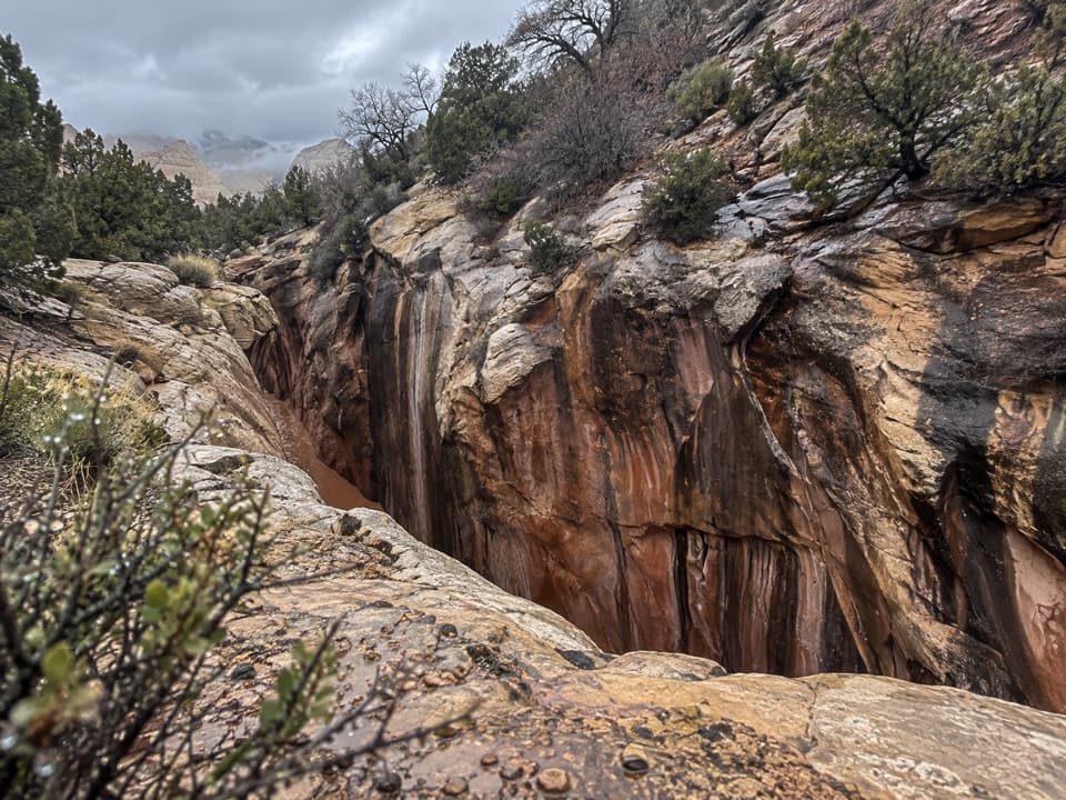
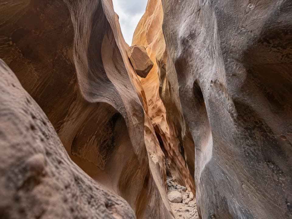
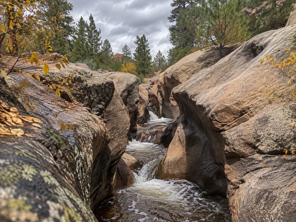
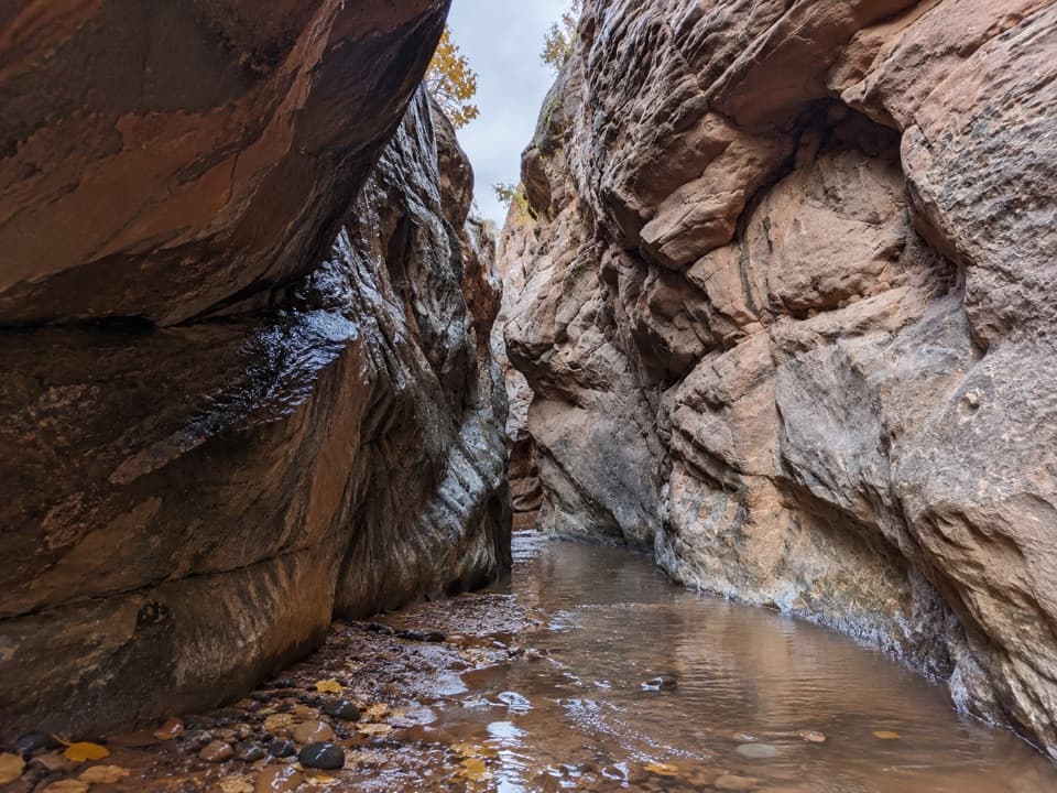
Oak Creek Canyon is a 2.2-mile out-and-back from the signed hikers’ trailhead to the narrows’ diversion structure. A steep drop into a dry wash leads to Oak Creek, then to a creek-side walk through sculpted sandstone and small falls. Allow about 1.5 hours, with extra time if you want to work through the water-worn obstacles. I’d choose it if you’re comfortable scrambling and finding your own way; the short distance makes it sound easier than it is. This is an informal route, not an official built trail, and public access along the whole creek walk has not been confirmed by a land manager. Check access before leaving the road.

Finding the creekThere’s little built tread from the parking area.

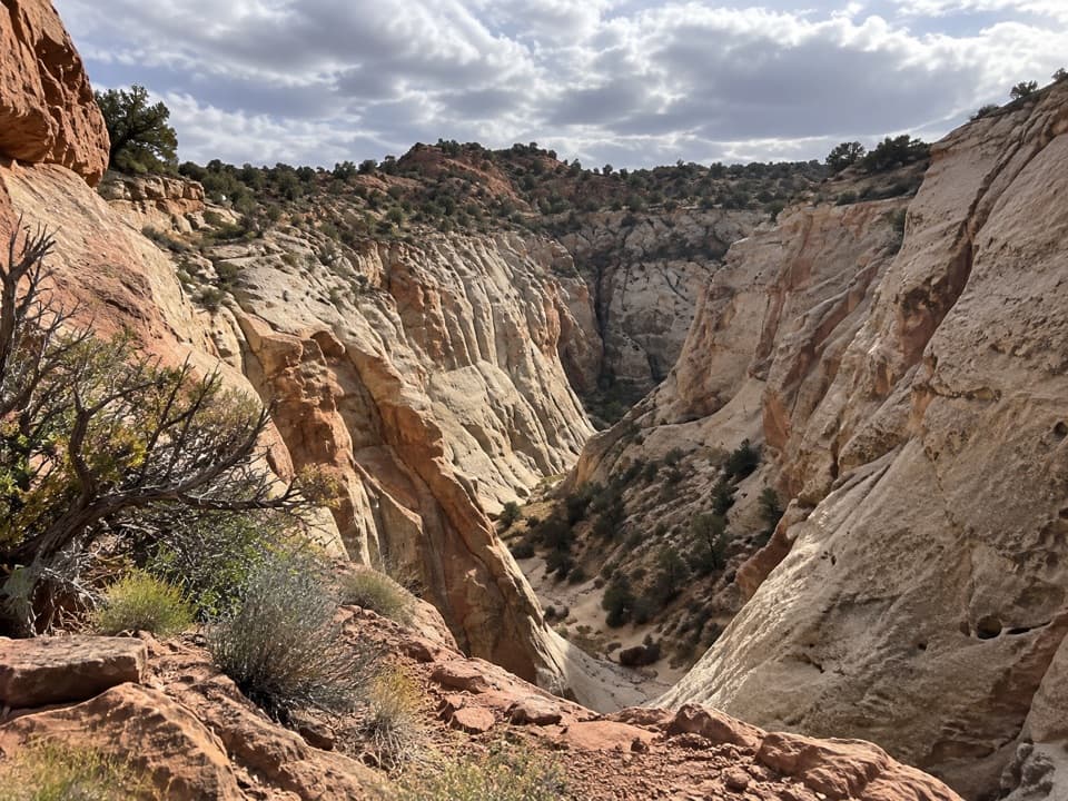
There’s little built tread from the parking area. The approach drops down a short, steep slope into a dry wash, then follows it south for about a third of a mile to Oak Creek. Two blocky dryfalls interrupt the descent. They’re described as straightforward to down-climb, but they still call for careful footing and comfort on rough terrain. At the creek, rock-hop to the opposite bank. A topographic map helps here because the route is not signed through the wash.

Water and narrow wallsA rough track reaches a roughly 7-foot waterfall within about ten minutes of the creek crossing.

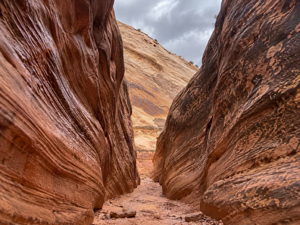
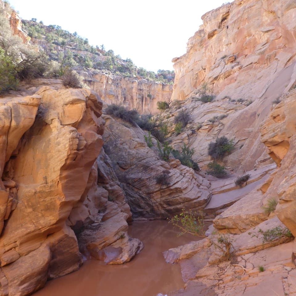
A rough track reaches a roughly 7-foot waterfall within about ten minutes of the creek crossing. The boulder pass is on its left. Farther in, the gorge squeezes to as little as 8–10 feet, with rapids and smaller falls. A bypass track climbs to a bench above the canyon floor; exploring the slot from below means wading over slick obstacles. Water depth varies widely, from mostly knee-deep reports to waist-deep sections, and the creek can run low or dry. Quicksand has also been reported in the narrows.

Where to turnThe diversion structure marks the end of the narrows-only version stored here.

The diversion structure marks the end of the narrows-only version stored here. Beyond it, the canyon opens into a wider creek corridor with repeated crossings, so continuing is a separate, open-ended walk and is not part of the 2.2-mile distance. The lower canyon’s layered Kayenta gives way to pale Navajo sandstone in the narrows; the change in color and texture is part of the payoff.

Reaching the trailheadFrom Notom-Bullfrog Road, follow the signed Oak Creek Canyon spur about four miles to the…

From Notom-Bullfrog Road, follow the signed Oak Creek Canyon spur about four miles to the hikers’ trailhead. The dirt track is rough: high clearance is needed, and four-wheel drive is recommended for the last two miles. The final mile is narrow and deeply rutted; if you park about three miles in, walking the spur adds roughly two miles round trip. The dirt roads are weather-sensitive, so check their status before setting out. Spring and fall are milder for hiking. Don’t enter the narrow canyon when storms threaten; flash floods can surge through slots.

Wildlife

Wildlife in Capitol Reef

All Capitol Reef wildlife maps

Sighting maps show where each species has been reported across Capitol Reef. Wildlife moves, so no sighting is guaranteed.

Keep exploring

Near Oak Creek Canyon

See it all on the map

Trails that start nearby

Places near the trailhead

Parkwolf’s Capitol Reef ranking

Top-rated trails in Capitol Reef

All 48 trails
  1. 1Hickman Bridge TrailModerate · 1.8 mi
  2. 2Cassidy Arch TrailChallenging · 3.4 mi
  3. 3Grand Wash TrailEasy · 4.4 mi
  4. 4Capitol Gorge TrailEasy · 2 mi
  5. 5Navajo Knobs TrailChallenging · 9.4 mi
  6. 6Rim Overlook TrailChallenging · 4.6 mi

Take Parkwolf to Capitol Reef.

The audio tour guide for the drive, plus offline maps, trails, and wildlife heatmaps for when the signal drops.

4.7 from 8,600+ ratings

Download Parkwolf on the App StoreGet Parkwolf on Google Play