Sheets Gulch in Capitol Reef National Park

Capitol Reef National Park, UT

Sheets Gulch

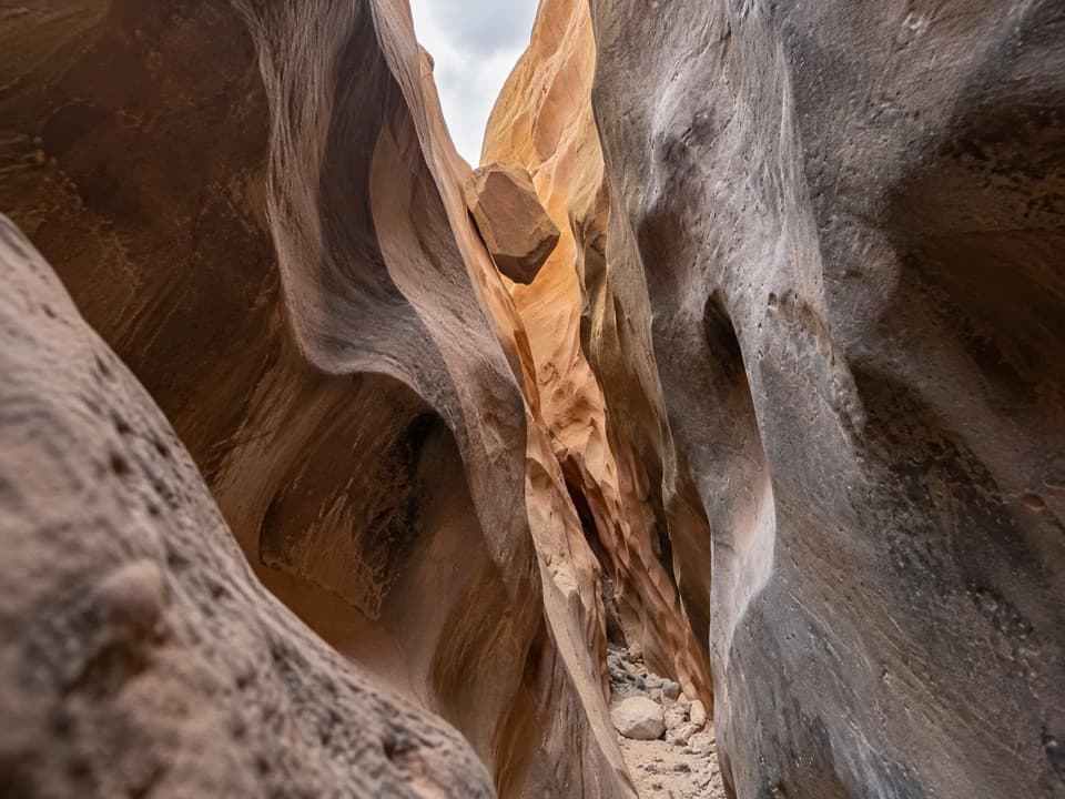
A long sandstone slot with chockstones and a cottonwood turnaround.

Length
13.4mi
Time
7hr
Elev. change
606ft
Difficulty
Challenging
  • No dogs
  • High point 5,813 ft
  • #21 of 48 in Capitol Reef

Hear the audio tour

Sheets Gulch

Overview

About Sheets Gulch

Why go

  • Long sandstone narrows and a distinct arch reward the approach.
  • Cottonwoods at the seep give the day hike a clear endpoint.

Heads up

  • Chockstones, pools and route-finding make this a demanding canyon hike.
  • The 13.4-mile out-and-back takes most of a day.

Map & elevation

The route

Loading the Capitol Reef map
Full map
Elevation5,207–5,813 ft
TrailheadSheets Gulch Trailhead38.11609, -111.07129
Keep this map with you offline in the Parkwolf app

Plan your hike

Before you go

Parking

Use the designated Sheets Gulch parking area on Notom–Bullfrog Road; the signed route starts just north of the wash crossing. The final stretch of road is unpaved and can become impassable after mud or flood damage, so check current road conditions before driving out. Do not drive into the wash.

Safety

Unmaintained and largely unmarked: bring a map and strong route-finding skills. Chockstones and dryfalls require scrambling; most hikers may need help at the largest chockstone, and pools can require deep wading or a short swim. Flash floods are dangerous; avoid the canyon if rain is possible. Water sources are unreliable.

2 active Capitol Reef alerts

  • CautionFlash-flood hazard in canyons and washesHeavy rains can cause sudden flooding in Capitol Reef’s canyons and washes; do not hike or drive through floodwater.Official details
  • CautionE. coli advisory for Fremont River and Sulphur CreekDo not swim in the Fremont River or Sulphur Creek or get water in your mouth: NPS reports elevated E. coli in both waterways, and Utah DEQ has issued a warning advisory. - DEQ reports Sulphur Creek E.Official details
Capitol Reef alerts
A park ranger sits on a dash-mounted phone, talking, as Parkwolf’s Tour Guide plays “Army Cutworm Moths: A Grizzly Bear Buffet” on Grand Loop Road below Dunraven Pass in Yellowstone
Parkwolf Tour GuideThe highest, rockiest slopes around here are a summer buffet for grizzly bears.

Capitol Reef Tour Guide

Your drive to Sheets Gulch, narrated.

Parkwolf is a GPS audio tour guide for Capitol Reef National Park. As you drive, it chimes in with what’s ahead: hidden gems, upcoming stops, history, geology, and wildlife, right through your car’s speakers.

See the Capitol Reef audio tour

Recorded for this trailhead

Sheets Gulch
0:00 / 0:27
“You're approaching the Sheets Gulch trailhead, the start of a long sandstone slot hike for experienced canyon hikers.”

Plays as you drive up to this trailhead in the Parkwolf Capitol Reef Tour Guide.

More stories near here in the app

  • A Partnership on the Rock
  • A Porcupine’s Winter Meal
  • The Primrose Changes Color
  • Five Mile Wash
  • 116 audio storiesacross Capitol Reef’s roads, triggered by GPS as you drive
  • Wildlife heatmapsfor Bighorn Sheep, Mule Deer, Marmot, and 13 more
  • Works offlinemaps, 48 trails, 52 places, and audio download before you lose signal
  • CarPlay readysimple controls built for the drive
★★★★★
“Fantastic app with many points of information… It’s great to just turn on while you’re driving and it gives you an audio tour of the national Park. We love it!!!!”
JMJamesApp Store review
Download Parkwolf on the App StoreGet Parkwolf on Google Play

4.7 from 8,600+ ratings

Trail guide

Hiking Sheets Gulch

A long walk into the foldSheets Gulch is a 13.

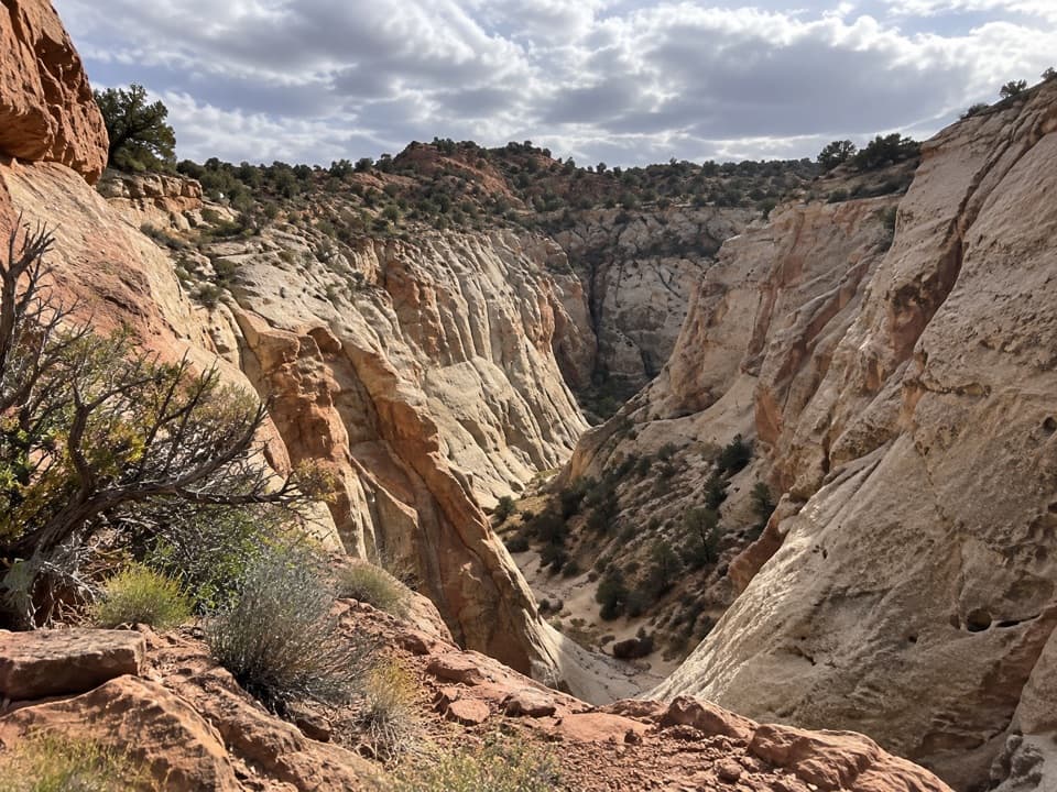
Sheets Gulch is a 13.4-mile out-and-back from Notom–Bullfrog Road to an intermittent seep with cottonwoods. The first 6.7 miles go west up the wash from open sandy ground into tight slots, then toward red Wingate walls and a wider canyon. It is a difficult day hike for experienced canyon hikers; allow about five to seven hours and treat the seep as a full-day turnaround, not a quick taste of slot canyon.

Finding the washThe signed access begins just north of the road crossing.

The signed access begins just north of the road crossing. The route drops from low ground into the broad wash, then follows its sandy bottom. At about a mile, stay left of the major drainage entering from the right (north); shortly afterward, stay right at the next drainage. Much of the route is unmarked, and cairns may be missing or point the wrong way, so bring a map and be comfortable navigating without a maintained trail.

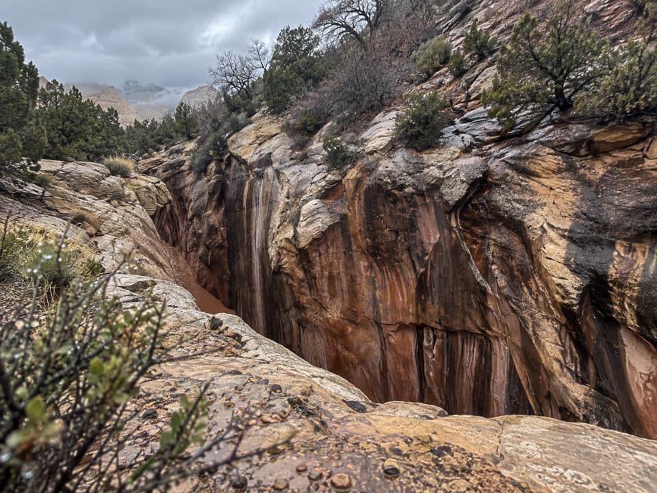
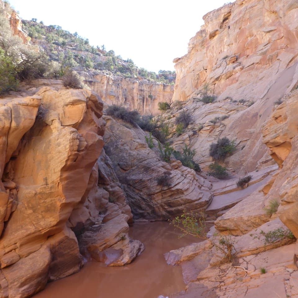
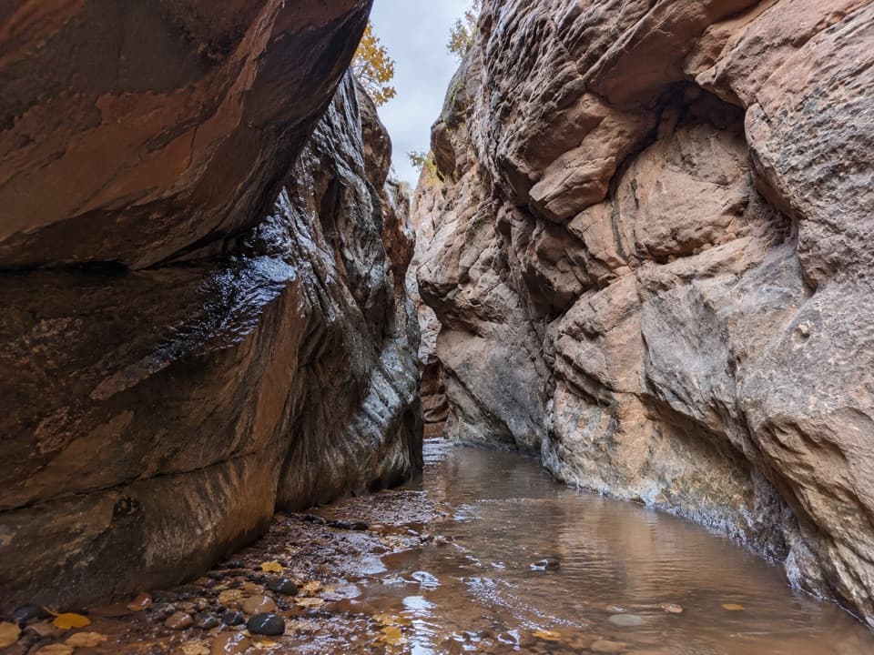
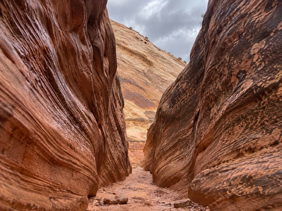
Slots, sandstone and an archFarther in, the wash tightens into sandstone narrows with small chockstones and pools.

Farther in, the wash tightens into sandstone narrows with small chockstones and pools. A particularly tall section shows cross-bedded rock and honeycomb weathering, with a few bends that catch the sun. Sheets Gulch Arch sits on a north-side bench around 3½ miles in. Reaching its base involves a short scramble up slickrock beside the wash; it is an optional detour, not part of the mapped route.

Obstacles set the paceAt about 4.

At about 4.1 miles, a chockstone and pool form the route’s most difficult obstacle; most hikers may need a partner’s help. Pools elsewhere can mean deep wading or a short swim. Around 5.3 miles, a high pour-off blocks the wash in a cave-like chamber. The described bypass backtracks roughly 100 yards, then climbs out on the left (north) side before dropping back to the wash. Expect the obstacles to take longer than the mileage suggests.

Turn around at the seepPast the pour-off, Douglas firs appear on cool north-facing slopes and the canyon walls shift…

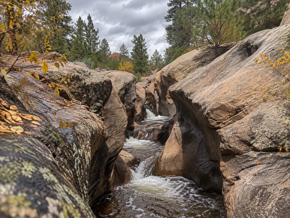
Past the pour-off, Douglas firs appear on cool north-facing slopes and the canyon walls shift from white Navajo sandstone toward red Wingate. At about 6.7 miles, an intermittent seep with cottonwoods marks the recommended day-hike turnaround; the canyon soon widens. Retrace the same wash to the road. Continuing onward to South Draw Road and Tantalus Flats makes a separate, roughly 11.6-mile one-way through-hike, with different vehicle and overnight logistics.

Water, weather and rulesWater sources are unreliable, so carry what you need for the entire walk.

Water sources are unreliable, so carry what you need for the entire walk. Flash floods are a serious canyon hazard; avoid the route whenever rain is possible. This is an unmaintained route with tight slots, dryfalls, chockstones and sometimes deep pools, not a casual wash stroll. Pets are not allowed on trails or in backcountry areas. Overnight trips require a free backcountry permit.

Wildlife

Wildlife in Capitol Reef

All Capitol Reef wildlife maps

Sighting maps show where each species has been reported across Capitol Reef. Wildlife moves, so no sighting is guaranteed.

Keep exploring

Near Sheets Gulch

See it all on the map

Trails that start nearby

Places near the trailhead

Parkwolf’s Capitol Reef ranking

Top-rated trails in Capitol Reef

All 48 trails
  1. 1Hickman Bridge TrailModerate · 1.8 mi
  2. 2Cassidy Arch TrailChallenging · 3.4 mi
  3. 3Grand Wash TrailEasy · 4.4 mi
  4. 4Capitol Gorge TrailEasy · 2 mi
  5. 5Navajo Knobs TrailChallenging · 9.4 mi
  6. 6Rim Overlook TrailChallenging · 4.6 mi

Take Parkwolf to Capitol Reef.

The audio tour guide for the drive, plus offline maps, trails, and wildlife heatmaps for when the signal drops.

4.7 from 8,600+ ratings

Download Parkwolf on the App StoreGet Parkwolf on Google Play