Pros & cons
PROS
- Highest publicly accessible summit on Santa Cruz Island
- Big 360-degree ocean-and-island views with real solitude
CONS
- Sustained climb with 1,700–2,000 feet of gain and little shade
- No water or services on the route; strict time window for return boat
Overview
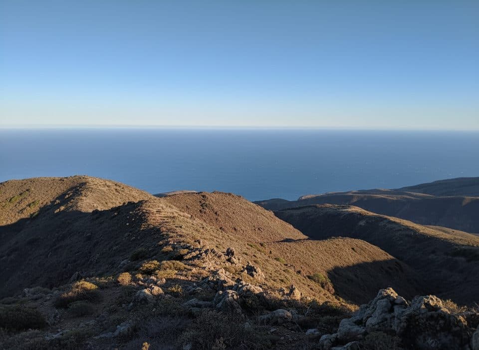
Often called El Montañon, this summit crowns the eastern half of Santa Cruz Island and is the highest peak open to the public. From the top you get sweeping, 360-degree views across Santa Cruz and Anacapa, out to the Pacific, and back toward the California mainland on clear days. It’s the island hike to do if you want a big payoff and don’t mind earning it.
The Hike
You’ll start at Scorpion Ranch/Anchorage and climb steadily onto Montañon Ridge via signed trails and old roads. Expect roughly 8–9 miles round-trip (either a loop or an out‑and‑back) with about 1,700–2,000 feet of total elevation gain. The upper ridge is exposed, with sections of loose gravel and rock as you approach the summit. Strong hikers sometimes tag the nearby High Mount benchmark along the same ridge if time allows.
What You’ll See
- Ridge walking with constant ocean-and-island panoramas
- Rugged canyons, grassy slopes, and coastal hillsides
- Seasonal spring wildflowers painting the ridges
Wildlife
Keep an eye out for the island fox around Scorpion and along the lower trails, plus raptors riding thermals over the ridge. In spring, you may even spot whales in the channel from high vantage points.
Planning & Logistics
- Access is by scheduled passenger boat; reserve early—weekend seats can sell out.
- Day trippers must manage time carefully to make the return boat—build a buffer.
- The western half of Santa Cruz Island is a restricted Nature Conservancy area; stay within public-access boundaries on the east side.
- No pets; service animals require a permit.
Trail Conditions and Gear
This is a remote, exposed ridge hike. Bring 2–3 liters of water per person, sun protection, sturdy footwear for loose gravel, layers for summit winds, and a map or GPS. There are no amenities on the route; restrooms and other facilities are back at Scorpion.
Best Time to Visit
Spring brings wildflowers and potential whale sightings from the ridge. Start early year-round to beat heat and wind on the exposed climbs and to keep a comfortable cushion for your boat check‑in. Weekdays typically feel even quieter than weekends.

Is It Worth It?
If you’re up for a real climb, absolutely—Montañon is the east end’s signature adventure: airy, scenic, and blissfully uncrowded.
Where it is
34.0181, -119.5749Tips for Montañon Peak
- 01Catch the earliest boat and start hiking right away to bank time.
- 02Carry 2–3 liters of water per person; there are no sources on the route.
- 03Download an offline map or GPX; use trails branch on the ridge.
- 04Pack wind layers—summit gusts can be sharp even on sunny days.
- 05If time allows, add nearby High Mount’s benchmark as a quick ridge bonus.
Near Montañon Peak
All places →All trails →
1.9 mi awaySmuggler’s Cove Overlook (Santa Cruz Island)Remote blufftop views over a turquoise, pebbly coveRestroom · Scenic Viewpoint
1.9 mi awaySmugglers Ranch HouseRestored 1889 ranch house tucked above secluded Smugglers CoveRestroom
1.9 mi awaySmugglers CoveRemote cove with big views at the end of a stout hikeRestroom · Picnic Table
2 mi awayScorpion Canyon CampgroundSheltered island basecamp with water spigots, beach access, and fox cameosTrailhead · Restroom
2.3 mi awayPotato Harbor TrailClifftop stroll to a turquoise cove you can only admire from aboveModerate · 5.2 mi · 2.2 hr
2.3 mi awayCavern Point LoopShort bluff-top loop with huge ocean views and a steep kickoffModerate · 2 mi · 1.5 hr
2.4 mi awayMontañon Ridge TrailBig ocean views on a rugged, exposed island ridgeline loopChallenging · 9 mi · 6.5 hr
2.4 mi awayNorth Bluff TrailBluff-top walk to Potato Harbor’s big ocean views from ScorpionEasy · 3.8 mi · 2 hr