Surprise Canyon to Panamint City in Death Valley National Park

Death Valley National Park, CA · NV

Surprise Canyon to Panamint City

A wet canyon climb ends at a remote mining ghost town.

Photo: Photo by Bob Wick, Bureau of Land Management, CC BY 2.0, via Rivers.gov/U.S. Fish and Wildlife Service

Length
10.6mi
Time
12hr
Elev. change
3,606ft
Difficulty
Challenging
  • No dogs
  • High point 6,306 ft
  • #22 of 57 in Death Valley
Parkwolf audio tour228 stories across Death Valley’s roads

Overview

About Surprise Canyon to Panamint City

Why go

  • A spring-fed creek, narrow cascades and a rare green canyon corridor.
  • The climb ends among Panamint City’s historic mining remains.

Heads up

  • Wet brush and waterfall scrambling slow the lower canyon.
  • The 4,000-foot climb and rough 4WD approach make this a major commitment.

Map & elevation

The route

Loading the Death Valley map
Full map
Elevation2,700–6,306 ft
TrailheadChris Wicht Camp36.11226, -117.17557
Keep this map with you offline in the Parkwolf app

Plan your hike

Before you go

Parking

Chris Wicht Camp at the end of Surprise Canyon Road, reached from Ballarat by Indian Ranch Road. Parking is a small area at the road terminus. The final two miles require high-clearance 4WD; storms can damage the road and force an earlier roadside start.

Safety

A strenuous, remote climb with wet creek sections, brush and rock scrambling. Carry all drinking water because springs may be dry or contaminated. High-clearance 4WD is required for the final two road miles. Pets are not allowed on park trails or in wilderness.

4 active Death Valley alerts

  • ClosureRoad closures and hazardous conditionsSeveral park roads are closed or hazardous; follow closures and vehicle restrictions.Official details
  • ClosureSaline Valley Lower Springs closed after wildfireLower Springs pools at Saline Valley Warm Springs remain closed because the September 15 wildfire left safety hazards, including potential hazardous chemicals; do not enter the closed area.Official details
See all 4 alerts
A park ranger sits on a dash-mounted phone, talking, as Parkwolf’s Tour Guide plays “Army Cutworm Moths: A Grizzly Bear Buffet” on Grand Loop Road below Dunraven Pass in Yellowstone
Parkwolf Tour GuideThe highest, rockiest slopes around here are a summer buffet for grizzly bears.

Death Valley Tour Guide

Your drive to Surprise Canyon to Panamint City, narrated.

Parkwolf is a GPS audio tour guide for Death Valley National Park. As you drive, it chimes in with what’s ahead: hidden gems, upcoming stops, history, geology, and wildlife, right through your car’s speakers.

See the Death Valley audio tour
  • 228 audio storiesacross Death Valley’s roads, triggered by GPS as you drive
  • Wildlife heatmapsfor Bighorn Sheep, Desert Tortoise, Coyote, and 13 more
  • Works offlinemaps, 57 trails, 81 places, and audio download before you lose signal
  • CarPlay readysimple controls built for the drive
★★★★★
“Fantastic app with many points of information… It’s great to just turn on while you’re driving and it gives you an audio tour of the national Park. We love it!!!!”
JMJamesApp Store review
Download Parkwolf on the App StoreGet Parkwolf on Google Play

4.7 from 8,600+ ratings

Trail guide

Hiking Surprise Canyon to Panamint City

The full canyon climbSurprise Canyon to Panamint City follows the old canyon road and creek up the west side of the…

Surprise Canyon to Panamint City follows the old canyon road and creek up the west side of the Panamint Range to an abandoned mining settlement. The mapped corridor is about 5.3 miles one way, or 10.6 miles out and back. The park rounds the uphill distance to five miles and calls the hike strenuous, with roughly 4,000 feet of gain to Panamint City at about 6,300 feet. Give it a full day: a steady hiker should allow 10 to 12 hours for the return, and many visitors make it an overnight. If that is too much, a shorter out-and-back to the large lower waterfall and grotto is described at about half the full distance, though it still involves difficult scrambling.

The wet lower canyonThe route begins at Chris Wicht Camp and follows Surprise Canyon Creek through the remains of a…

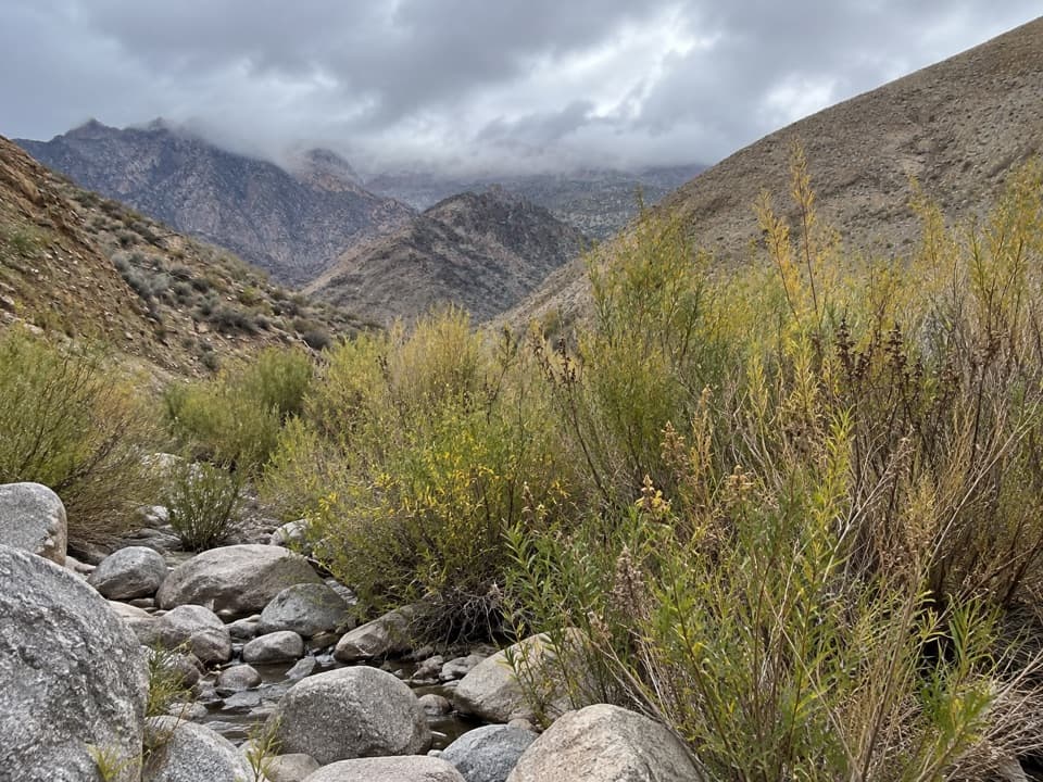
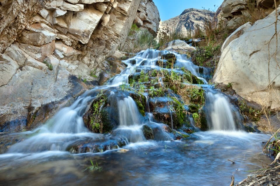
The route begins at Chris Wicht Camp and follows Surprise Canyon Creek through the remains of a washed-out jeep road. It is often a creek walk rather than a dry, well-built tread: water spreads over parts of the line, brush crowds the stream, and old vehicle wreckage lies along the former road. Expect soaked boots within the first mile: water can cover parts of the route. The canyon walls tighten around small waterfalls and boulders, where you will need to pick a careful way through and scramble over rock. Expect to move slowly here; the wet, narrow lower section is a major part of the hike, not a brief approach to the climb.

Past Brewery SpringAround 3.5 miles in, Brewery Spring is a useful landmark.

Around 3.5 miles in, Brewery Spring is a useful landmark. Brush grows thick around the water, then the canyon dries and the old roadbed becomes wider and easier to recognize. The grade keeps climbing toward the ghost town. The separate side climb to a high point on the wilderness boundary adds substantial distance and elevation; it is not part of this route. The continuation over the pass toward Johnson Canyon is mostly trailless and is a different undertaking altogether.

Panamint CityThe old settlement sits at roughly 6,300 feet.

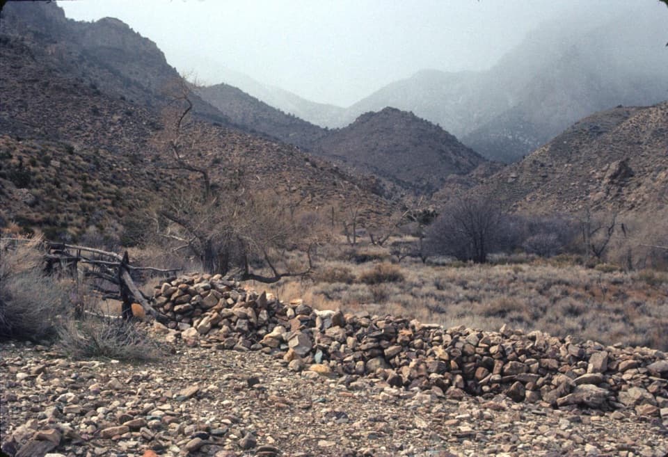
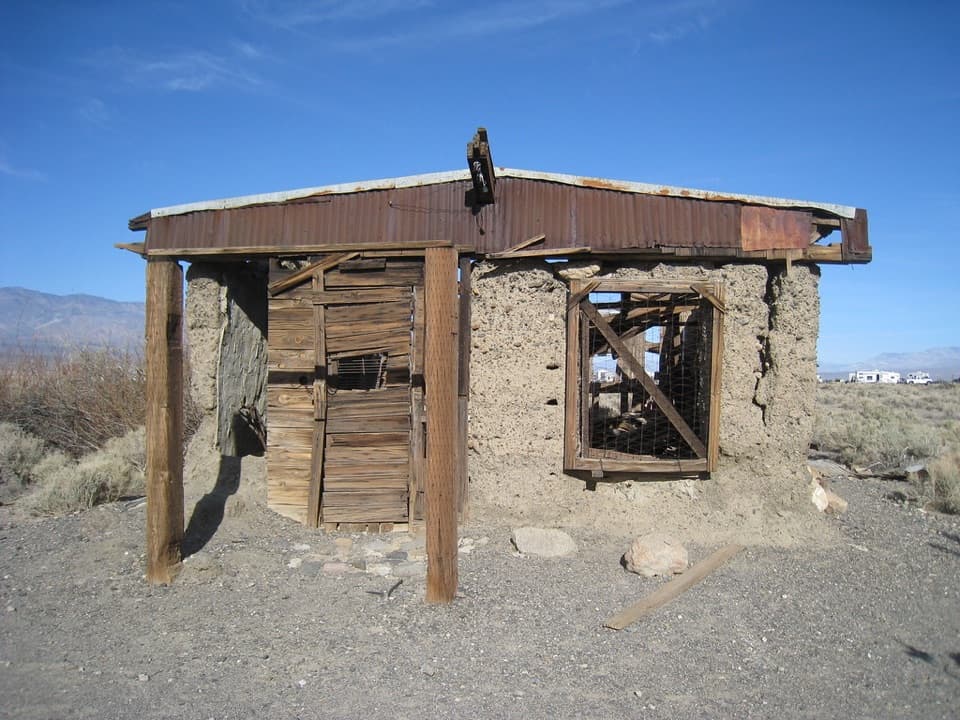
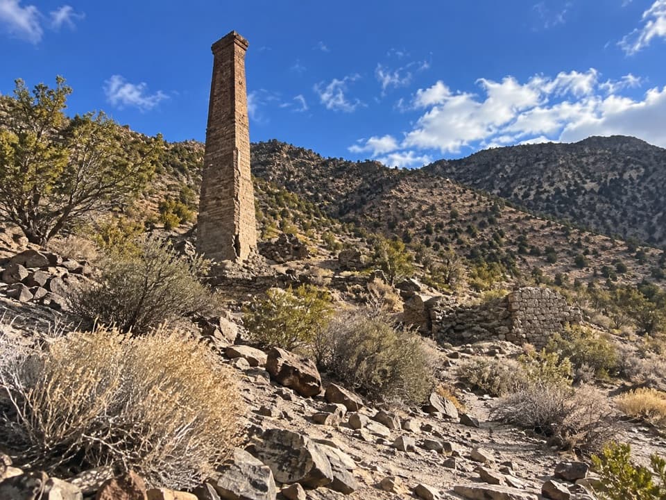
The old settlement sits at roughly 6,300 feet. Its brick smelter stack is a useful landmark on the final approach, visible from nearly a mile away, with old buildings and mine remains on the slope around town. Panamint City is the payoff for a long climb through the canyon, rather than a developed attraction with services. Stay outside mine workings and old structures.

A green corridor in the PanamintsWater from the canyon springs makes a narrow riparian strip through otherwise dry mountain…

Water from the canyon springs makes a narrow riparian strip through otherwise dry mountain country. Cottonwoods and willows grow lower down; piñon and juniper appear higher on the route. The canyon is important bighorn sheep habitat and supports the rare Panamint daisy, though neither wildlife nor flowers are guaranteed on a given walk. Seven miles of Surprise Canyon Creek were designated a Wild and Scenic River in 2019, and the surrounding Surprise Canyon Wilderness was designated in 1994. When the creek is flowing, the pale narrows, greenery and cascades make the route’s signature view; frame a cascade with some of the light canyon wall to show both the water and its setting.

Getting there and carrying what you needThe trailhead is Chris Wicht Camp at the end of Surprise Canyon Road, reached from Ballarat by…

The trailhead is Chris Wicht Camp at the end of Surprise Canyon Road, reached from Ballarat by Indian Ranch Road. Parking is a small area at the road terminus. The last two miles require a high-clearance four-wheel-drive vehicle, and storms can damage the approach enough to force an earlier roadside start, so check road conditions before the drive. Do not count on food or potable water at the road-end camp; pack what you need. Carry all drinking water: park guidance warns that springs can be dry or contaminated and recommends a gallon or more per person per day in hot months. Backcountry permits are recommended but not required for this area; pets are prohibited on park trails and in wilderness. The route is described as accessible year-round, with late spring and early summer favored, but creek and road conditions vary.

Wildlife

Wildlife in Death Valley

All Death Valley wildlife maps

Sighting maps show where each species has been reported across Death Valley. Wildlife moves, so no sighting is guaranteed.

Parkwolf’s Death Valley ranking

Top-rated trails in Death Valley

All 57 trails
  1. 1Badwater Salt FlatEasy · 1.9 mi
  2. 2Mosaic CanyonModerate · 4 mi
  3. 3Golden Canyon to Red CathedralModerate · 3 mi
  4. 4Telescope Peak TrailChallenging · 12.2 mi
  5. 5Golden Canyon Complete CircuitChallenging · 7.8 mi
  6. 6Gower Gulch LoopModerate · 4.3 mi

Take Parkwolf to Death Valley.

The audio tour guide for the drive, plus offline maps, trails, and wildlife heatmaps for when the signal drops.

4.7 from 8,600+ ratings

Download Parkwolf on the App StoreGet Parkwolf on Google Play