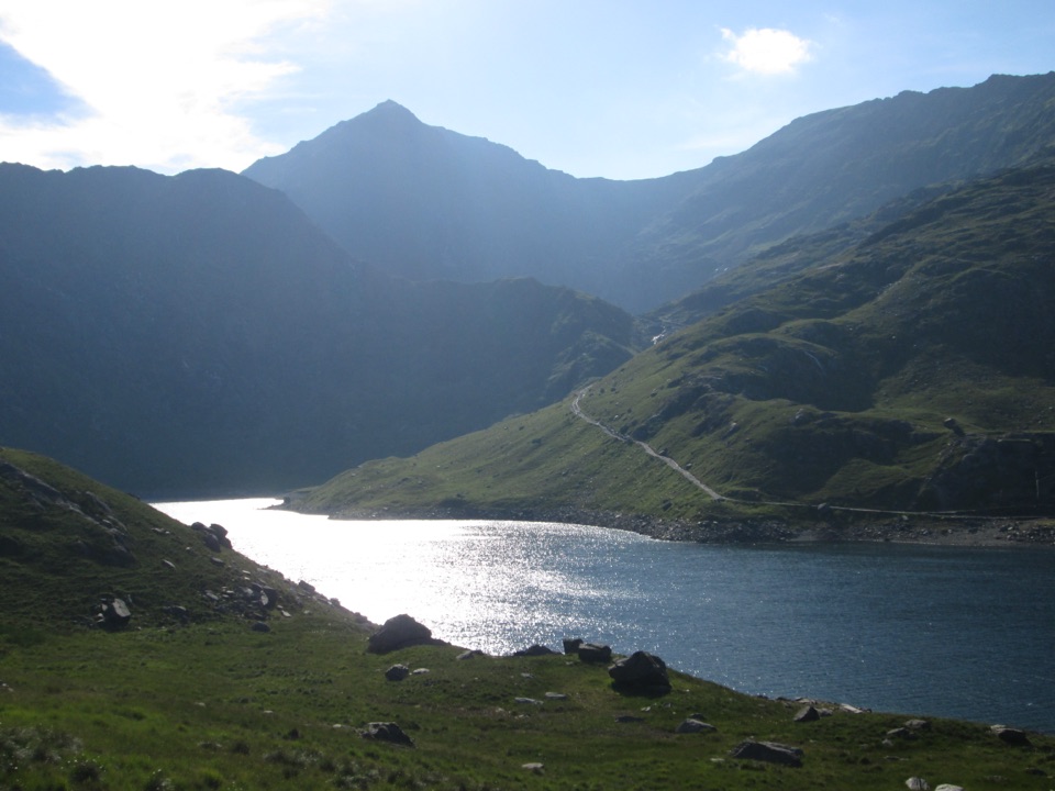
Llyn Llydaw in Eryri National Park

Sight · Eryri National Park

Llyn Llydaw

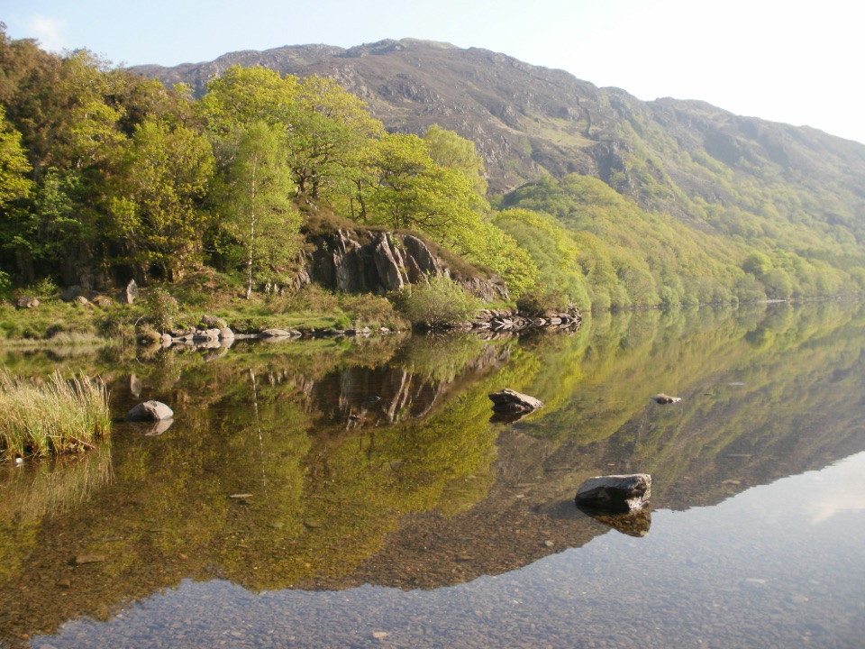
Mountain lake crossed by a stone causeway below Yr Wyddfa

Photo: Wikimedia Commons
Type
Sight
Nearest trail
2.2 km
Audio stories
5 nearby

Hear the audio tour

Pen y Pass and Yr Wyddfa

Overview

About Llyn Llydaw

Why stop

  • Historic causeway and mine remains in one mountain scene

Heads up

  • A long, exposed walk for a lake
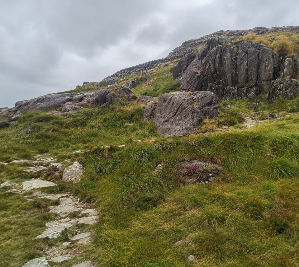
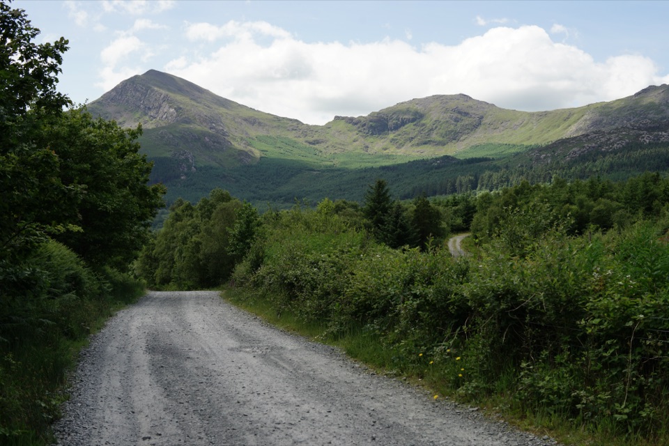
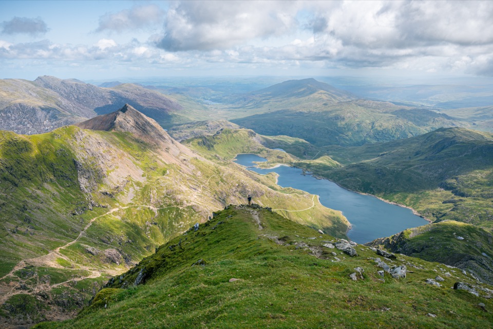
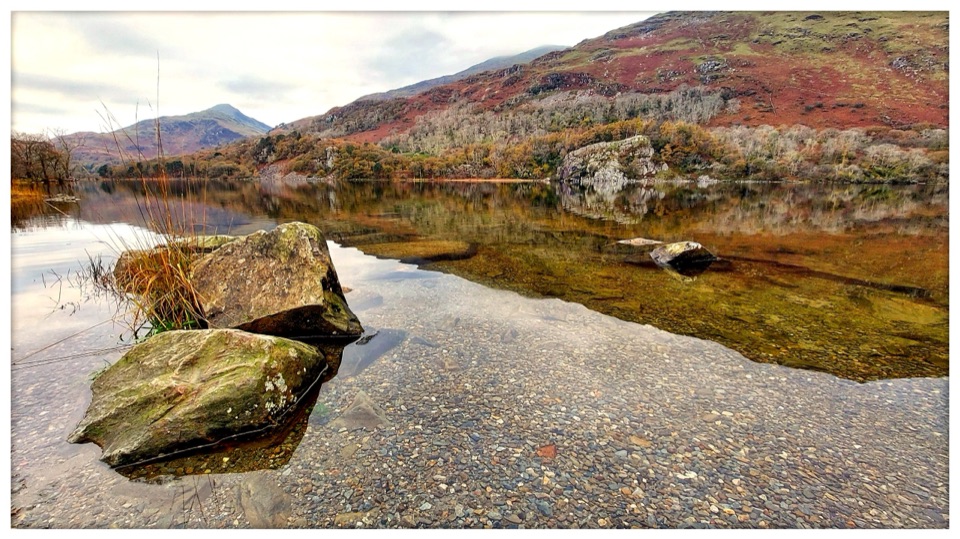
This is the big set piece of the Miners' Track, a long dark sheet of water held in a bowl of crags with a stone causeway carrying the path straight across it. Walkers regularly single it out for striking scenery and photography, and it makes a natural turning point if you don't fancy the full climb.
Parkwolf’s verdictWhy it's worth the walk

Map

Where it is

Loading the Eryri map
Full map
SightLlyn Llydaw53.06887, -4.04899
Keep this map with you offline in the Parkwolf app

Plan your stop

Before you go

Getting there

Access is on foot only, starting from Pen y Pass and following the Miners' Track, which passes Llyn Teyrn first and then reaches the lake and its causeway. Quoted lake-only distances vary between sources, so treat any single figure as a rough guide rather than an official one.


A park ranger sits on a dash-mounted phone, talking, as Parkwolf’s Tour Guide plays “Army Cutworm Moths: A Grizzly Bear Buffet” on Grand Loop Road below Dunraven Pass in Yellowstone
Parkwolf Tour GuideThe highest, rockiest slopes around here are a summer buffet for grizzly bears.

Eryri Tour Guide

Your drive to Llyn Llydaw, narrated.

Parkwolf is a GPS audio tour guide for Eryri National Park. As you drive, it chimes in with what’s ahead: hidden gems, upcoming stops, history, geology, and wildlife, right through your car’s speakers.

Recorded for this place

Pen y Pass and Yr Wyddfa
0:00 / 0:35
“You're approaching Pen y Pass, the starting point for the Pyg and Miners' tracks up Yr Wyddfa. Both are serious, roughly six-hour mountain walks, despite the Miners' Track's gentle opening beside the lakes.”

Plays as you drive up to Llyn Llydaw in the Parkwolf Eryri Tour Guide.

More stories near here in the app

  • The Corner Above the Pass
  • The Ocean Traveler in Llyn Gwynant
  • Llyn Gwynant and its lakeside campsite
  • The Crowd at Gladstone Rock
  • 298 audio storiesacross Eryri’s roads, triggered by GPS as you drive
  • Wildlife heatmapsfor Grey Heron, Tawny Owl, Common Raven, and 9 more
  • Works offlinemaps, 120 trails, 82 places, and audio download before you lose signal
  • CarPlay readysimple controls built for the drive
★★★★★
“Fantastic app with many points of information… It’s great to just turn on while you’re driving and it gives you an audio tour of the national Park. We love it!!!!”
JMJamesApp Store review
Download Parkwolf on the App StoreGet Parkwolf on Google Play

4.7 from 8,600+ ratings

Guide

More about Llyn Llydaw

What you'll seeOpen water, steep slopes rising on either side, and the remains of the Britannia Copper Mine…

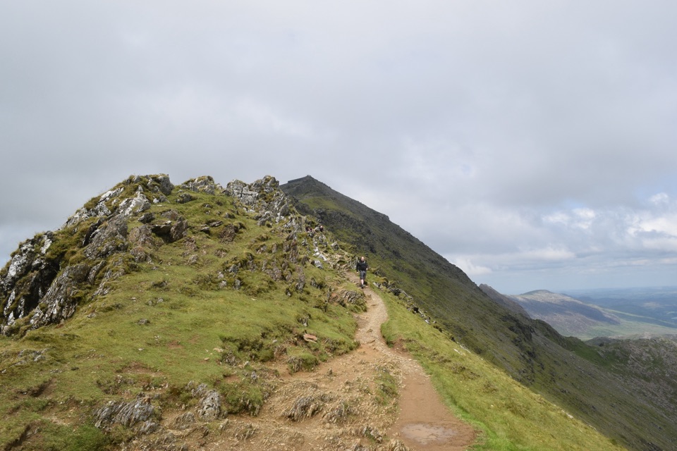
Open water, steep slopes rising on either side, and the remains of the Britannia Copper Mine scattered along the shore and hillside. The path continues uphill from here to Glaslyn, the smaller lake tucked higher in the cwm, and the Pyg Track overlooks Llyn Llydaw from above if you're on that route instead.

Make sure you've got the right LlydawThere is a reservoir sharing the same name, and some maps may point to the nearby reservoir…

There is a reservoir sharing the same name, and some maps may point to the nearby reservoir rather than the lake. The natural lake is the one on the Miners' Track, at roughly 53.0689, -4.0490, between Llyn Teyrn and Glaslyn.

Difficulty and honest drawbacksThe full route from Pen y Pass to the summit is officially rated hard and strenuous, about 13…

The full route from Pen y Pass to the summit is officially rated hard and strenuous, about 13 km return, around 6 hours, with 723 m of ascent, and it calls for good fitness and navigation skills. There's loose rock and scree higher up beyond the lake. Even the lower section is tiring, and the terrain is exposed open mountain with no shade.

The mining storyThe causeway was built in 1853, which avoided the need to use boats on the lake.

The causeway was built in 1853, which avoided the need to use boats on the lake. On the shore stood a crushing mill, powered by water piped from Glaslyn through an overhead pipe onto a Pelton wheel, with ore delivered by an aerial cableway. The workings closed in 1916, and what you see now are the leftovers of that industry.

Weather, crowds and lightThe summit route is officially popular, so expect company on the path, especially in fine…

The summit route is officially popular, so expect company on the path, especially in fine weather. Cloud frequently sits low and can hide the surrounding tops entirely. The walk is open mountain with no shade along this stretch, so plan your layers and sun cover accordingly, and low sun on the water is the reward for an early start.

What to bringProper walking boots, waterproofs and a warm layer for the wind off the water, plus all your…

Proper walking boots, waterproofs and a warm layer for the wind off the water, plus all your own water and food for the day. Add sun protection, a map or downloaded route with a compass, and a charged phone, and turn back at the lake or Glaslyn if the weather closes in above you.

Wildlife

Wildlife in Eryri

All Eryri wildlife maps

Sighting maps show where each species has been reported across Eryri. Wildlife moves, so no sighting is guaranteed.

Keep exploring

Near Llyn Llydaw

See it all on the map

Trails nearby

More stops nearby

Parkwolf’s Eryri ranking

Top sights in Eryri

All 82 places
  1. 1Yr Wyddfa (Snowdon)Sight
  2. 2Snowdon Mountain RailwaySight
  3. 3Cader IdrisSight
  4. 4Harlech CastleSight
  5. 5Betws-y-CoedSight
  6. 6LlanberisSight

Take Parkwolf to Eryri.

The audio tour guide for the drive, plus offline maps, trails, and wildlife heatmaps for when the signal drops.

4.7 from 8,600+ ratings

Download Parkwolf on the App StoreGet Parkwolf on Google Play