Akokala Lake Trail in Glacier National Park

Glacier National Park, MT

Akokala Lake Trail

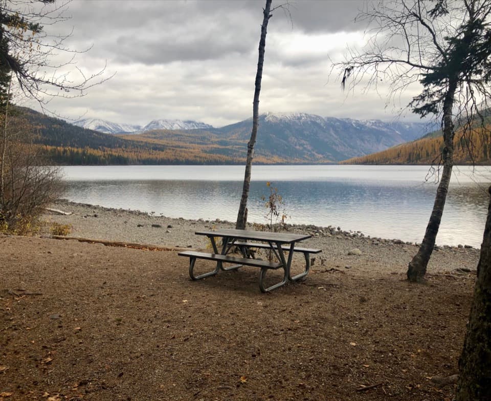
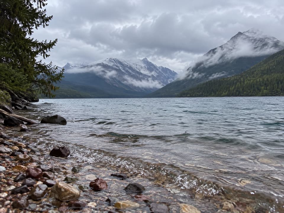
A long forest walk ends at a small lakeside beach under peaks.

Length
11.6mi
Time
6.5hr
Elev. change
774ft
Difficulty
Moderate
  • No dogs
  • High point 4,921 ft
  • #65 of 157 in Glacier

Hear the audio tour

Bowman Lake

Overview

About Akokala Lake Trail

Why go

  • A remote lake in a high peak-ringed basin
  • A destination with a distinctive native-fish conservation story

Heads up

  • Long, mostly forested approach with few open views
  • Rough North Fork roads and no cell service add to the commitment
Akokala is also an important native-fish lake. In 2015, the park described it as one of the few west-side lakes still supporting bull trout and not yet invaded by non-native lake trout, and approved a downstream fish-passage barrier to help protect bull trout and westslope cutthroat trout. That conservation story belongs to this lake, not just to Glacier in general.
Parkwolf’s verdictA lake worth protecting

Map & elevation

The route

Loading the Glacier map
Full map
Elevation4,147–4,921 ft
TrailheadBowman Lake Ranger Station48.83016, -114.20438
Keep this map with you offline in the Parkwolf app

Plan your hike

Before you go

Parking

Start at Bowman Lake Ranger Station in the North Fork. Use the Bowman Lake day-use area and follow the signed access to the Akokala Lake Trailhead. The approach is over rough, unpaved roads; the park recommends AWD or 4WD and the ability to change a tire. Vehicles over 21 feet and trailers are not permitted on North Fork roads.

Safety

This is a long, remote out-and-back with no cell signal in the North Fork. The clearer south-shore view may require a rough path over logs and soggy ground, not a maintained extension. Mosquitoes can be heavy near the lake in early summer. Dogs are not allowed on park trails.

1 active Glacier alert

  • ClosureTwo Medicine Campground closed for 2026 constructionTwo Medicine Campground is closed throughout 2026 because of construction in the Two Medicine developed area.Official details
Glacier alerts
A park ranger sits on a dash-mounted phone, talking, as Parkwolf’s Tour Guide plays “Army Cutworm Moths: A Grizzly Bear Buffet” on Grand Loop Road below Dunraven Pass in Yellowstone
Parkwolf Tour GuideThe highest, rockiest slopes around here are a summer buffet for grizzly bears.

Glacier Tour Guide

Your drive to Akokala Lake Trail, narrated.

Parkwolf is a GPS audio tour guide for Glacier National Park. As you drive, it chimes in with what’s ahead: hidden gems, upcoming stops, history, geology, and wildlife, right through your car’s speakers.

See the Glacier audio tour

Recorded for this trailhead

Bowman Lake
0:00 / 0:30
“You’re nearing Bowman Lake, an eight-mile stretch of water framed by forest and mountain ridges. You don’t need a long hike here: head to the shore for the view, then settle in for a picnic or a little lakeside walking.”

Plays as you drive up to this trailhead in the Parkwolf Glacier Tour Guide.

More stories near here in the app

  • From Beaver Pond to Meadow
  • Why a Loon Needs a Runway
  • Why Bull Trout Need Streams
  • Polebridge Ranger Station and Covey Meadow
  • 204 audio storiesacross Glacier’s roads, triggered by GPS as you drive
  • Wildlife heatmapsfor Grizzly Bear, Wolverine, Mountain Goat, and 13 more
  • Works offlinemaps, 157 trails, 91 places, and audio download before you lose signal
  • CarPlay readysimple controls built for the drive
★★★★★
“Our first time to glacier and we used the audio portion for Going to the Sun Road. Wonderful information with perfect advice of what to see and do along the road.”
PaisleyParkFanApp Store review
Download Parkwolf on the App StoreGet Parkwolf on Google Play

4.7 from 8,600+ ratings

Trail guide

Hiking Akokala Lake Trail

The long walk to the lakeAkokala Lake Trail is an 11.

Akokala Lake Trail is an 11.6-mile out-and-back from Bowman Lake Ranger Station to the outlet-side shore of Akokala Lake. The full route is about 5.8 miles each way; allow six to seven hours. This is a long forest hike with a steep early climb, not a route with open views the whole way. The payoff is a remote lake beneath steep peaks. Plan for the drive as well as the walk: the North Fork has no cell service or food service, and the nearest services are in Polebridge.

The climb comes earlyThe first 1.6 miles climb about 722 feet through Douglas fir, larch and lodgepole pine.

The first 1.6 miles climb about 722 feet through Douglas fir, larch and lodgepole pine. Around mile 2.5 the trail crests near Numa Ridge, then descends toward Akokala Creek. Most of this approach stays in forest; the first broader openings come by the brushy creek drainage. Published gain estimates vary. Expect the hard climb early, followed by rolling ground, rather than one smooth ascent.

Follow the lake branchCross the footbridge at Akokala Creek and take the Akokala Lake branch.

Cross the footbridge at Akokala Creek and take the Akokala Lake branch. The West Lakes Trail continues toward Inside North Fork Road, a different and longer outing. Follow the signed destination rather than relying on an exact junction mile marker: route accounts place the split a little differently. Beyond the creek, the grade eases for roughly 2.2 miles through younger lodgepole pine and pockets of taller surviving trees.

Reaching the shoreThe main tread ends at a small landing by the lake outlet, where trees can screen part of the…

The main tread ends at a small landing by the lake outlet, where trees can screen part of the water. A more open lake-and-peak view is described from the south shore, but reaching it may mean crossing logs and soggy ground on a rough social path. Treat that as an uncertain spur, not a maintained extension. The main landing is the reliable destination; from a safe opening, the water in front of the forested ridges makes the clearest picture.

A forest growing backPart of the route crosses ground burned in the 1988 North Fork Fire.

Part of the route crosses ground burned in the 1988 North Fork Fire. Young lodgepole pine fills the reopened area, while older stands remain elsewhere along the creek-to-lake stretch. The change from dense timber to brush and regrowth also marks where the surrounding peaks begin to show.

Getting to the startStart at Bowman Lake Ranger Station; use the Bowman Lake day-use area and follow the signed…

Start at Bowman Lake Ranger Station; use the Bowman Lake day-use area and follow the signed access to the trailhead. The drive is on rough, unpaved North Fork roads. The park recommends AWD or 4WD and the ability to change a tire; vehicles over 21 feet and trailers are not permitted on North Fork roads. There is no food service or cell signal in the area. Dogs are not allowed on park trails. Overnight camping at the lake requires a wilderness-use permit; this day hike does not.

Wildlife

Wildlife in Glacier

All Glacier wildlife maps

Sighting maps show where each species has been reported across Glacier. Wildlife moves, so no sighting is guaranteed.

Keep exploring

Near Akokala Lake Trail

See it all on the map

Trails that start nearby

Places near the trailhead

Parkwolf’s Glacier ranking

Top-rated trails in Glacier

All 157 trails
  1. 1Highline TrailChallenging · 11.8 mi
  2. 2Grinnell Glacier TrailChallenging · 10 mi
  3. 3Iceberg Lake TrailModerate · 9.6 mi
  4. 4Hidden Lake Overlook TrailModerate · 2.6 mi
  5. 5Avalanche Lake TrailModerate · 5 mi
  6. 6Trail of the CedarsEasy · 0.9 mi

Take Parkwolf to Glacier.

The audio tour guide for the drive, plus offline maps, trails, and wildlife heatmaps for when the signal drops.

4.7 from 8,600+ ratings

Download Parkwolf on the App StoreGet Parkwolf on Google Play