Bowman Lake Trail to Bowman Lake Head in Glacier National Park

Glacier National Park, MT

Bowman Lake Trail to Bowman Lake Head

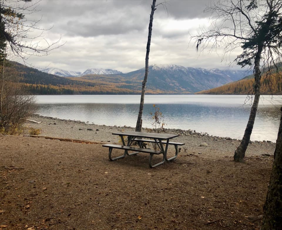
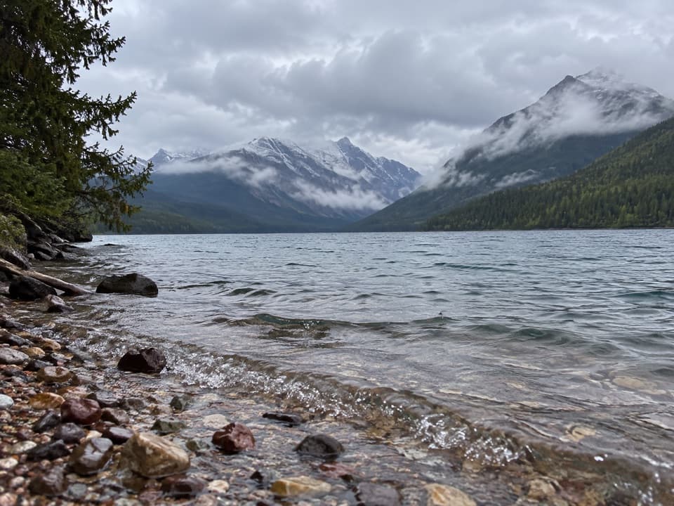
A long return walk follows Bowman Lake's shore to its head.

Photo: CC BY 2.0
Length
14.2mi
Time
8hr
Elev. change
69ft
Difficulty
Moderate
  • No dogs
  • High point 4,106 ft
  • #66 of 157 in Glacier

Hear the audio tour

Bowman Lake

Overview

About Bowman Lake Trail to Bowman Lake Head

Why go

  • Long lakeshore route with views toward three named peaks
  • Rolling hills instead of a sustained pass climb

Heads up

  • 14.2 miles round trip over the same corridor
  • Long, narrow gravel access road; large vehicles are not recommended

Map & elevation

The route

Loading the Glacier map
Full map
Elevation4,037–4,106 ft
TrailheadBowman Lake Ranger Station48.83070, -114.20235
Keep this map with you offline in the Parkwolf app

Plan your hike

Before you go

Parking

Use Bowman Lake Ranger Station, the listed trailhead beside the campground. Bowman Lake Road is long, narrow, winding gravel; RVs and truck-and-trailer combinations are not recommended, and turnarounds can be difficult. A day-use picnic area is nearby. Parking capacity and fees were not confirmed.

Safety

This is a 14.2-mile round trip into a remote area, with the same shore corridor retraced on the return. Pets are prohibited on trails and in the backcountry. No on-route food stop was identified.

1 active Glacier alert

  • ClosureTwo Medicine Campground closed for 2026 constructionTwo Medicine Campground is closed throughout 2026 because of construction in the Two Medicine developed area.Official details
Glacier alerts
A park ranger sits on a dash-mounted phone, talking, as Parkwolf’s Tour Guide plays “Army Cutworm Moths: A Grizzly Bear Buffet” on Grand Loop Road below Dunraven Pass in Yellowstone
Parkwolf Tour GuideThe highest, rockiest slopes around here are a summer buffet for grizzly bears.

Glacier Tour Guide

Your drive to Bowman Lake Trail to Bowman Lake Head, narrated.

Parkwolf is a GPS audio tour guide for Glacier National Park. As you drive, it chimes in with what’s ahead: hidden gems, upcoming stops, history, geology, and wildlife, right through your car’s speakers.

See the Glacier audio tour

Recorded for this trailhead

Bowman Lake
0:00 / 0:30
“You’re nearing Bowman Lake, an eight-mile stretch of water framed by forest and mountain ridges. You don’t need a long hike here: head to the shore for the view, then settle in for a picnic or a little lakeside walking.”

Plays as you drive up to this trailhead in the Parkwolf Glacier Tour Guide.

More stories near here in the app

  • From Beaver Pond to Meadow
  • Why a Loon Needs a Runway
  • Why Bull Trout Need Streams
  • Polebridge Ranger Station and Covey Meadow
  • 204 audio storiesacross Glacier’s roads, triggered by GPS as you drive
  • Wildlife heatmapsfor Grizzly Bear, Wolverine, Mountain Goat, and 13 more
  • Works offlinemaps, 157 trails, 91 places, and audio download before you lose signal
  • CarPlay readysimple controls built for the drive
★★★★★
“Our first time to glacier and we used the audio portion for Going to the Sun Road. Wonderful information with perfect advice of what to see and do along the road.”
PaisleyParkFanApp Store review
Download Parkwolf on the App StoreGet Parkwolf on Google Play

4.7 from 8,600+ ratings

Trail guide

Hiking Bowman Lake Trail to Bowman Lake Head

What you are signing up forThis is a 14.

This is a 14.2-mile round-trip out-and-back from Bowman Lake Ranger Station to Bowman Lake Head, following the lake's north shore over rolling hills. The payoff is the far end of the lake, where a campground sits beside the water, with views across Bowman Lake toward Square Peak, Rainbow Peak and Mount Carter. This entry turns around at the lake head; the route toward Brown Pass is a different, longer mountain hike.

Budget the dayAllow roughly 7–9 hours with pauses for the long return.

Allow roughly 7–9 hours with pauses for the long return. The trail is described as relatively flat with a few rises, so distance is the main commitment rather than a sustained climb. You can make a shorter out-and-back by choosing a turn-around before the lake head, but you will return over the same ground.

Along the north shoreThe route follows the north side of Bowman Lake from the ranger station toward its head.

The route follows the north side of Bowman Lake from the ranger station toward its head. Expect gentle ups and downs rather than a steady ascent. The shore walk alternates wooded stretches with views across the water; on clear openings, the named peaks on the far side give the long walk a sense of scale.

At Bowman Lake HeadThe endpoint is a campground close to the shore, not a summit or waterfall.

The endpoint is a campground close to the shore, not a summit or waterfall. Bowman Lake is about eight miles long, so reaching its head makes a satisfying destination after the lakeside approach. If you continue beyond the campground toward Brown Pass, you are taking on a separate backcountry objective rather than the day hike described here.

Access and rulesStart at Bowman Lake Ranger Station.

Start at Bowman Lake Ranger Station. Bowman Lake Road is long, narrow and gravel; RVs and truck-and-trailer combinations are not recommended, and turning around can be difficult. A day-use picnic area is near the campground. Polebridge Mercantile is the only nearby store identified, so make that a separate stop before driving to the lake. Pets are not allowed on park trails or in the backcountry.

Wildlife

Wildlife in Glacier

All Glacier wildlife maps

Sighting maps show where each species has been reported across Glacier. Wildlife moves, so no sighting is guaranteed.

Keep exploring

Near Bowman Lake Trail to Bowman Lake Head

See it all on the map

Trails that start nearby

Places near the trailhead

Parkwolf’s Glacier ranking

Top-rated trails in Glacier

All 157 trails
  1. 1Highline TrailChallenging · 11.8 mi
  2. 2Grinnell Glacier TrailChallenging · 10 mi
  3. 3Iceberg Lake TrailModerate · 9.6 mi
  4. 4Hidden Lake Overlook TrailModerate · 2.6 mi
  5. 5Avalanche Lake TrailModerate · 5 mi
  6. 6Trail of the CedarsEasy · 0.9 mi

Take Parkwolf to Glacier.

The audio tour guide for the drive, plus offline maps, trails, and wildlife heatmaps for when the signal drops.

4.7 from 8,600+ ratings

Download Parkwolf on the App StoreGet Parkwolf on Google Play