Hole in the Wall Trail in Glacier National Park

Glacier National Park, MT

Hole in the Wall Trail

A long backpacking route ends at a waterfall-lined hanging basin

Photo: Wikimedia Commons
Length
30.8mi
Time
20hr
Elev. change
2,720ft
Difficulty
Challenging
  • No dogs
  • High point 6,811 ft
  • #46 of 157 in Glacier

Hear the audio tour

Bowman Lake

Overview

About Hole in the Wall Trail

Why go

  • The route ends in a tucked-away basin framed by cliffs and waterfalls
  • The lakeshore, high pass, and alpine basin give the long approach real variety

Heads up

  • About 31 miles round trip with no quick day-hike version
  • Remote road access and a wilderness permit itinerary add planning

Map & elevation

The route

Loading the Glacier map
Full map
Elevation4,091–6,811 ft
TrailheadBowman Lake Ranger Station48.83011, -114.20174
Keep this map with you offline in the Parkwolf app

Plan your hike

Before you go

Parking

Start at Bowman Lake Ranger Station at the end of Bowman Lake Road. Reach it from Polebridge by private vehicle over unpaved North Fork roads; the drive is rough and slow, and AWD or 4WD is recommended. Vehicles over 21 feet and trailers are not allowed on North Fork roads. Polebridge is the nearest service stop.

Safety

This is a remote, 30.8-mile high-country trip with no cell service and a sustained climb to Brown Pass. Snow and swift, cold water crossings are recurring early- and late-season hazards; seasonal bridges are removed by late September. Backcountry camping requires a permit and campsite itinerary.

1 active Glacier alert

  • ClosureTwo Medicine Campground closed for 2026 constructionTwo Medicine Campground is closed throughout 2026 because of construction in the Two Medicine developed area.Official details
Glacier alerts
A park ranger sits on a dash-mounted phone, talking, as Parkwolf’s Tour Guide plays “Army Cutworm Moths: A Grizzly Bear Buffet” on Grand Loop Road below Dunraven Pass in Yellowstone
Parkwolf Tour GuideThe highest, rockiest slopes around here are a summer buffet for grizzly bears.

Glacier Tour Guide

Your drive to Hole in the Wall Trail, narrated.

Parkwolf is a GPS audio tour guide for Glacier National Park. As you drive, it chimes in with what’s ahead: hidden gems, upcoming stops, history, geology, and wildlife, right through your car’s speakers.

See the Glacier audio tour

Recorded for this trailhead

Bowman Lake
0:00 / 0:30
“You’re nearing Bowman Lake, an eight-mile stretch of water framed by forest and mountain ridges. You don’t need a long hike here: head to the shore for the view, then settle in for a picnic or a little lakeside walking.”

Plays as you drive up to this trailhead in the Parkwolf Glacier Tour Guide.

More stories near here in the app

  • From Beaver Pond to Meadow
  • Why a Loon Needs a Runway
  • Why Bull Trout Need Streams
  • Polebridge Ranger Station and Covey Meadow
  • 204 audio storiesacross Glacier’s roads, triggered by GPS as you drive
  • Wildlife heatmapsfor Grizzly Bear, Wolverine, Mountain Goat, and 13 more
  • Works offlinemaps, 157 trails, 91 places, and audio download before you lose signal
  • CarPlay readysimple controls built for the drive
★★★★★
“Our first time to glacier and we used the audio portion for Going to the Sun Road. Wonderful information with perfect advice of what to see and do along the road.”
PaisleyParkFanApp Store review
Download Parkwolf on the App StoreGet Parkwolf on Google Play

4.7 from 8,600+ ratings

Trail guide

Hiking Hole in the Wall Trail

The commitmentHole in the Wall Trail is an out-and-back backcountry route from Bowman Lake Ranger Station to…

Hole in the Wall Trail is an out-and-back backcountry route from Bowman Lake Ranger Station to Hole in the Wall Campground, following Bowman Lake Trail over Brown Pass and then west on Boulder Pass Trail. It is about 30.8 miles round trip, or 15.4 miles each way; plan for nearly 16 miles on each leg. Allow roughly 20 hours of walking over at least two days. This is a remote overnight backpack, not a day hike.

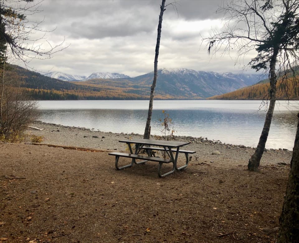
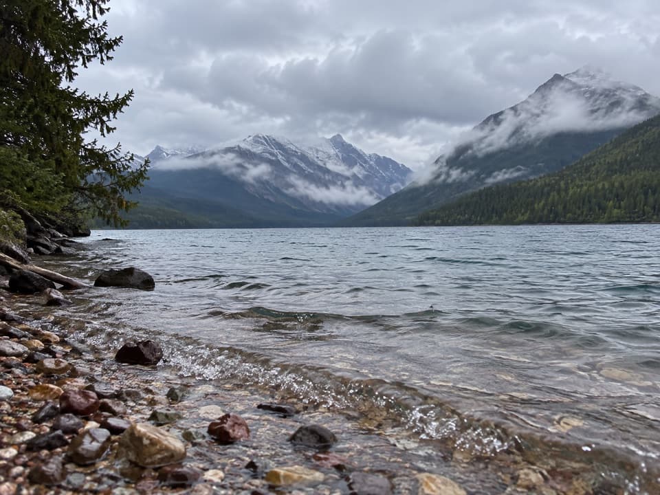
Along Bowman LakeThe first 7.1 miles follow Bowman Lake’s north shore over rolling ground.

The first 7.1 miles follow Bowman Lake’s north shore over rolling ground. Across the water are Square Peak, Rainbow Peak, and Mount Carter. Bowman Lake Head campground is the first backcountry site and a natural stopping point, but the route continues well beyond it.

Climbing to Brown PassFrom Bowman Lake Head, the route gains about 2,200 feet over the next 6.

From Bowman Lake Head, the route gains about 2,200 feet over the next 6.7 miles to Brown Pass, with most of that climb in the last two miles. The trail changes from lakeshore walking to a long high-country ascent. At Brown Pass, turn west onto Boulder Pass Trail; continuing beyond the Hole in the Wall junction leads into a different, longer trip toward Boulder Pass and Kintla.

Into Hole in the WallThe final stretch follows Mount Chapman’s south side, wraps around its west flank, and descends…

The final stretch follows Mount Chapman’s south side, wraps around its west flank, and descends on a short branch to the Hole in the Wall campground. The basin is a hanging canyon beneath a high cliff wall, with waterfalls dropping into the green amphitheater. It’s the payoff for the long approach. From the trail, frame a piece of the path with the headwall and falls so the basin’s scale reads in the picture.

Access and permitsThe trailhead is at Bowman Lake Ranger Station, reached from Polebridge over rough, unpaved…

The trailhead is at Bowman Lake Ranger Station, reached from Polebridge over rough, unpaved North Fork roads. Polebridge is the only service stop in the area; there is no cell service in the North Fork. Backcountry camping requires a wilderness permit and a campsite itinerary, so arrange the overnight before starting. Pets aren’t allowed on trails or in the backcountry. Early- and late-season snow and swift, cold crossings can change how passable the high route feels; seasonal bridges are removed by late September.

Wildlife

Wildlife in Glacier

All Glacier wildlife maps

Sighting maps show where each species has been reported across Glacier. Wildlife moves, so no sighting is guaranteed.

Keep exploring

Near Hole in the Wall Trail

See it all on the map

Trails that start nearby

Places near the trailhead

Parkwolf’s Glacier ranking

Top-rated trails in Glacier

All 157 trails
  1. 1Highline TrailChallenging · 11.8 mi
  2. 2Grinnell Glacier TrailChallenging · 10 mi
  3. 3Iceberg Lake TrailModerate · 9.6 mi
  4. 4Hidden Lake Overlook TrailModerate · 2.6 mi
  5. 5Avalanche Lake TrailModerate · 5 mi
  6. 6Trail of the CedarsEasy · 0.9 mi

Take Parkwolf to Glacier.

The audio tour guide for the drive, plus offline maps, trails, and wildlife heatmaps for when the signal drops.

4.7 from 8,600+ ratings

Download Parkwolf on the App StoreGet Parkwolf on Google Play