Parking
Park at the end of Mather Drive, then follow the old road down toward the river.

Glacier National Park, MT
A level riverside walk to the old entrance bridge.
Overview
Map & elevation
Plan your hike

The highest, rockiest slopes around here are a summer buffet for grizzly bears.
Glacier Tour Guide
Parkwolf is a GPS audio tour guide for Glacier National Park. As you drive, it chimes in with what’s ahead: hidden gems, upcoming stops, history, geology, and wildlife, right through your car’s speakers.
See the Glacier audio tourRecorded for this area
Belton Chalet and Historic Depot“You're nearing Belton Chalet in West Glacier, a good choice for a sit-down dinner in a railway-era building. Great Northern opened it in nineteen ten for visitors arriving by train at the depot across Highway Two.”
Plays on the road 0.3 mi from the trailhead in the Parkwolf Glacier Tour Guide.
More stories near here in the app
“Our first time to glacier and we used the audio portion for Going to the Sun Road. Wonderful information with perfect advice of what to see and do along the road.”


Trail guide
Belton Bridge Trail is a 1-mile round-trip out-and-back from the end of Mather Drive to Belton Bridge, about half a mile each way along the Middle Fork of the Flathead River. The gravel riverside path is level, and the bridge is the payoff: an old crossing with a remarkable story in the park’s west-side history. Allow about 30 minutes, or longer if you want time at the bridge.
Park at the end of Mather Drive and follow the old road down toward the river. Turn around at the bridge and return the same way.
This is a short walk rather than a strenuous hike. The route follows the old road and the start of South Boundary Trail along the river; it does not continue up the longer South Boundary route. The trail begins in the headquarters district, a working area with staff vehicles and private residences. Stay on the path, walk facing traffic where the route uses a road, and do not approach the residences. Pets are not allowed on Glacier trails.
Belton Bridge was built in 1920 to carry visitors across the Middle Fork and served as the park’s main entrance until 1938. Its 110-foot reinforced-concrete arch supports a timber trestle and wooden deck. The 1964 flood destroyed the newer highway bridge and severely damaged Belton Bridge; after repairs, the old bridge carried traffic again while the replacement highway crossing was built. At the river, take a moment to look at the arch and its reflection; a side-on view keeps the concrete span and timber deck together.
Wildlife
 404 sightingsGrizzly BearMost seen around 6 AMSighting map
 11 sightingsWolverineMost seen around 8 PMSighting map
 1,173 sightingsMountain GoatMost seen around 6 AMSighting map
 1,000 sightingsBighorn SheepMost seen around 6 AMSighting map
 395 sightingsMooseMost seen around 6 AMSighting map
 506 sightingsBlack BearMost seen around 8 PMSighting map
Sighting maps show where each species has been reported across Glacier. Wildlife moves, so no sighting is guaranteed.
Keep exploring
 ChallengingSouth Boundary Trail11.5 mi · 5.3 hr · 0.5 mi awayFollow the Middle Fork through an old ranger route to Lincoln Creek.
 EasyOld Flathead Ranger Station Trail6.9 mi · 3 hr · 1.7 mi awayA gentle old road leads to the Flathead River confluence.
 EasyApgar Bike Path3 mi · 1.2 hr · 1.8 mi awayFlat, shaded pavement links Apgar Village with Park Headquarters.
 ChallengingApgar Lookout Trail7.2 mi · 4.5 hr · 1.9 mi awaySteep switchbacks through the 2003 burn climb to a fire lookout.
 ChallengingSnyder Ridge Trail12.6 mi · 9 hr · 2.7 mi awayHard miles in the trees, with Fish Lake waiting near the end.
 EasyFish Creek Bike Path1.2 mi · 30 min · 2.8 mi awayA short, mostly level path through the woods to Fish Creek.
 EasyRocky Point Nature Trail1.8 mi · 1.3 hr · 3.6 mi awayA lakeside loop to Rocky Point and its mountain views.
 ModerateLincoln Creek Trail6.7 mi · 4.5 hr · 4.6 mi awayA remote creek connector with three fords and open burn views.
 Lodging · 0.3 mi awayBelton ChaletA 1910 railway chalet still serving dinner beneath its timber gables.
 Sight · 0.3 mi awayHistoric Belton DepotA 1910 rail depot turned bookstore, with park passport stamps.
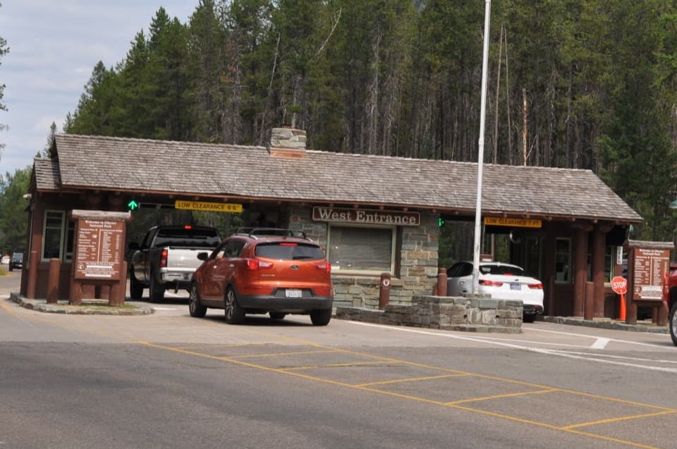 Entrance station · 0.5 mi awayWest Entrance StationA CCC-built 1941 checkpoint with a distinctive rustic tollbooth design.
 Visitor center · 1.6 mi awayApgar Visitor CenterSort out your west-side plan, then hop on the park shuttle.
 Campground · 1.7 mi awayApgar CampgroundSleep in the pines, then walk to Lake McDonald for sunset.
 Sight · 1.9 mi awayApgar Wilderness Permit CenterA practical planning stop before a backcountry overnight trip.
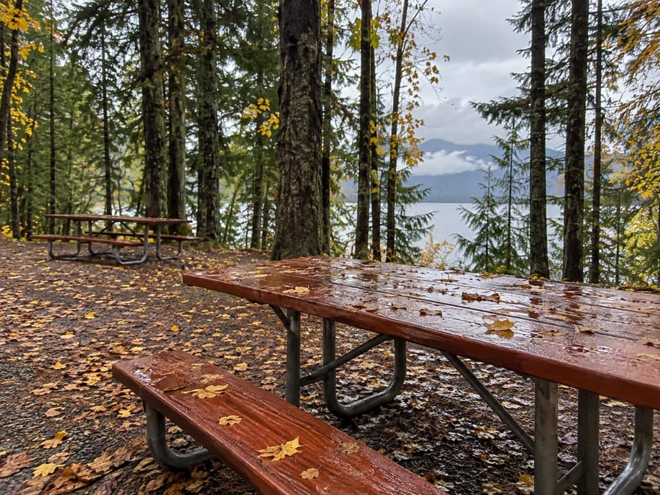 Picnic area · 1.9 mi awayApgar Picnic AreaA shaded picnic stop with Lake McDonald in front.
 Sight · 2 mi awayApgar Nature CenterTouch animal pelts and build mountains in a 1929 Apgar cabin.
Parkwolf’s Glacier ranking

The audio tour guide for the drive, plus offline maps, trails, and wildlife heatmaps for when the signal drops.





