Arizona Trail Passage 39: Grand Canyon – North Rim in Grand Canyon National Park

Grand Canyon National Park, AZ

Arizona Trail Passage 39: Grand Canyon – North Rim

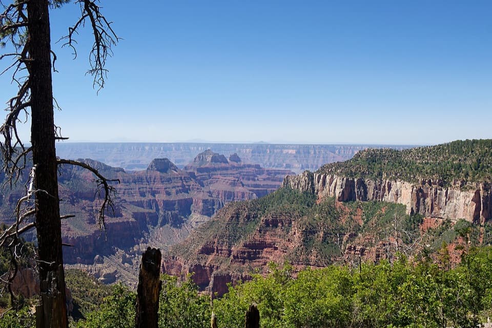
A high forest traverse with a canyon overlook at the North Rim

Length
12mi
Time
6.5hr
Elev. change
1,102ft
Difficulty
Moderate
  • High point 9,157 ft

Hear the audio tour

North Kaibab Trailhead

Overview

About Arizona Trail Passage 39: Grand Canyon – North Rim

Why go

  • Rim view into Roaring Springs Canyon near the start
  • Long walk through high forest and meadows

Heads up

  • 12 miles one way with remote pickup logistics
  • Water is scarce and unreliable

Map & elevation

The route

Loading the Grand Canyon map
Full map
Elevation8,054–9,157 ft
TrailheadNorth Kaibab Trailhead36.21722, -112.05686
Keep this map with you offline in the Parkwolf app

Plan your hike

Before you go

Parking

Start at North Kaibab Trailhead parking on the east side of AZ-67, with the trailhead at the lot’s south end. The north pickup access is a remote pullout reached via Forest Road 611 and Forest Road 610; its published coordinate is about half a mile from the mapped route endpoint, so confirm the connection before planning a one-way trip.

Safety

Water is scarce and unreliable above 8,000 feet; carry your supply and purify any water you collect. Snow can remain into early summer.

4 active Grand Canyon alerts

  • ClosureInner Canyon and North Rim trail closuresMentions this trailDo not enter the closed trails, bridges, campgrounds, and inner-canyon areas.Official details
  • ClosureNorth Rim scenic roads closed for repairsMentions North Rim, referenced in this guideCape Royal Road and Point Imperial Road are closed from sunset October 15 through sunrise November 3, 2026. - The roads are closed to accommodate critical road repair and rehabilitation work.Official details
See all 4 alerts
A park ranger sits on a dash-mounted phone, talking, as Parkwolf’s Tour Guide plays “Army Cutworm Moths: A Grizzly Bear Buffet” on Grand Loop Road below Dunraven Pass in Yellowstone
Parkwolf Tour GuideThe highest, rockiest slopes around here are a summer buffet for grizzly bears.

Grand Canyon Tour Guide

Your drive to Arizona Trail Passage 39: Grand Canyon – North Rim, narrated.

Parkwolf is a GPS audio tour guide for Grand Canyon National Park. As you drive, it chimes in with what’s ahead: hidden gems, upcoming stops, history, geology, and wildlife, right through your car’s speakers.

See the Grand Canyon audio tour

Recorded for this trailhead

North Kaibab Trailhead
0:00 / 0:27
“You're approaching North Kaibab Trailhead, where steep switchbacks descend through fir and aspen into Roaring Springs Canyon.”

Plays as you drive up to this trailhead in the Parkwolf Grand Canyon Tour Guide.

More stories near here in the app

  • North Rim Campground and Transept Walks
  • Widforss Trail’s Forest and Canyon
  • The Bird with a Seed Stash
  • Bright Angel Point’s Ridge Walk
  • 79 audio storiesacross Grand Canyon’s roads, triggered by GPS as you drive
  • Wildlife heatmapsfor California Condor, Bighorn Sheep, American Bison, and 13 more
  • Works offlinemaps, 73 trails, 96 places, and audio download before you lose signal
  • CarPlay readysimple controls built for the drive
★★★★★
“Fantastic app with many points of information… It’s great to just turn on while you’re driving and it gives you an audio tour of the national Park. We love it!!!!”
JMJamesApp Store review
Download Parkwolf on the App StoreGet Parkwolf on Google Play

4.7 from 8,600+ ratings

Trail guide

Hiking Arizona Trail Passage 39: Grand Canyon – North Rim

The North Rim passageThis is a 12-mile, one-way stretch of the Arizona Trail from North Kaibab Trailhead north to…

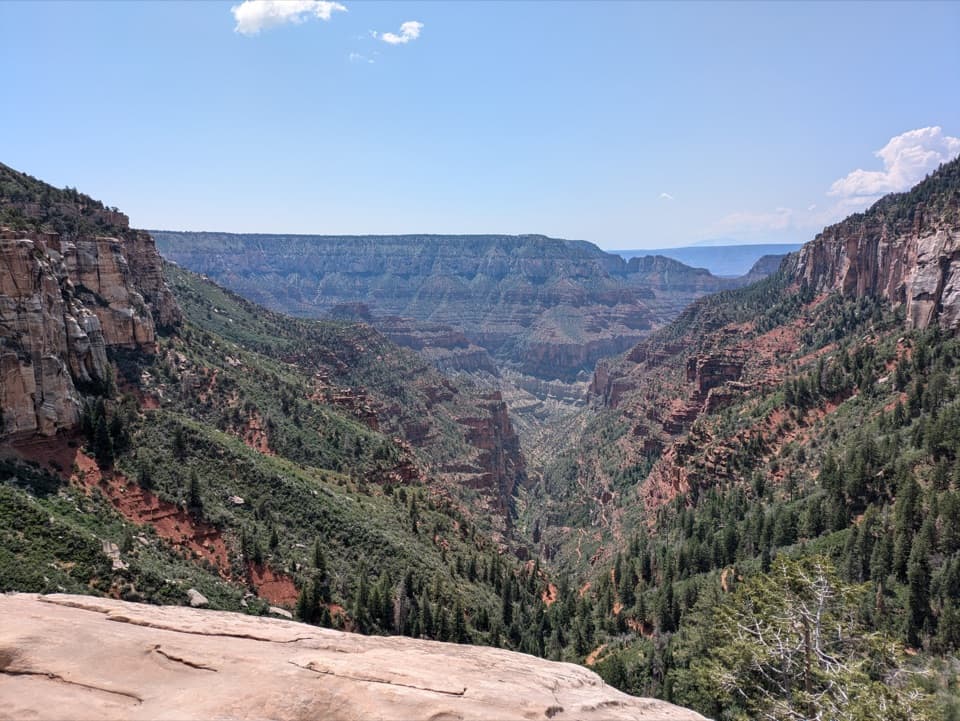
This is a 12-mile, one-way stretch of the Arizona Trail from North Kaibab Trailhead north to the Kaibab National Forest boundary. It crosses high country through conifer forest and open meadows, with a short spur near the start to a view into Roaring Springs Canyon. It is a point-to-point walk, not a loop, so arrange a pickup at the remote north access or plan for the full return distance.

Plan for a long walkAllow about 6–7 hours including short breaks.

Allow about 6–7 hours including short breaks. The route rolls across the plateau, staying above 8,000 feet and climbing toward roughly 9,100 feet before ending near 9,000 feet. The mapped route endpoint is about half a mile from the published north road access, so confirm that connection before relying on a pickup.

From rim to meadowAt the beginning, a short walk through pine and fir reaches a view into red limestone Roaring…

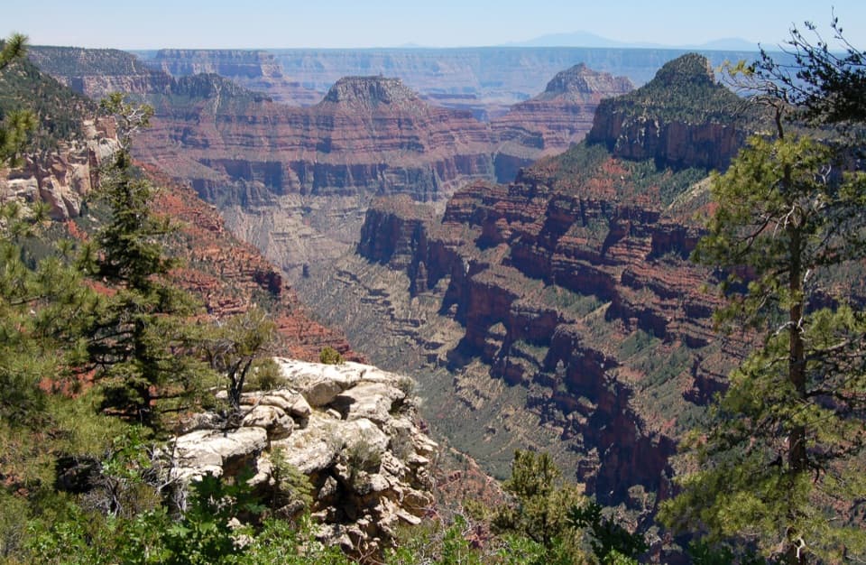
At the beginning, a short walk through pine and fir reaches a view into red limestone Roaring Springs Canyon. The trail then leaves the rim and heads through Harvey Meadow, mixed conifer forest and open meadows. Expect a mix of dirt road and singletrack, rolling grades, and a few short steep pitches rather than a continuous canyon-edge path.

Old routes and namesParts of the passage and nearby North Kaibab Trail follow an older route developed by Edwin…

Parts of the passage and nearby North Kaibab Trail follow an older route developed by Edwin Wooley and his son-in-law David Rust. Rust extended the route toward the Colorado River by 1907. Harvey Meadow recalls Professor Harvey DeMotte, who traveled through the area with John Wesley Powell’s 1872 expedition; nearby Thompson Canyon is named for the expedition’s topographic mapper Almon Thompson.

High-country conditionsWater is scarce and unreliable on the Kaibab Plateau, so carry what you need and purify any…

Water is scarce and unreliable on the Kaibab Plateau, so carry what you need and purify any water you collect. Snow can linger into early summer above 8,000 feet. There are no identified food, water or toilet facilities along this remote point-to-point stretch.

Wildlife

Wildlife in Grand Canyon

All Grand Canyon wildlife maps

Sighting maps show where each species has been reported across Grand Canyon. Wildlife moves, so no sighting is guaranteed.

Keep exploring

Near Arizona Trail Passage 39: Grand Canyon – North Rim

See it all on the map

Trails that start nearby

Places near the trailhead

Parkwolf’s Grand Canyon ranking

Top-rated trails in Grand Canyon

All 73 trails
  1. 1Rim-to-Rim: North Kaibab to Bright AngelChallenging · 23.5 mi
  2. 2South Kaibab TrailChallenging · 6.3 mi
  3. 3Bright Angel TrailChallenging · 7.8 mi
  4. 4Rim TrailModerate · 12.8 mi
  5. 5Rim-to-Rim: South Kaibab to North KaibabChallenging · 21 mi
  6. 6Cape Royal TrailEasy · 0.8 mi

Take Parkwolf to Grand Canyon.

The audio tour guide for the drive, plus offline maps, trails, and wildlife heatmaps for when the signal drops.

4.7 from 8,600+ ratings

Download Parkwolf on the App StoreGet Parkwolf on Google Play