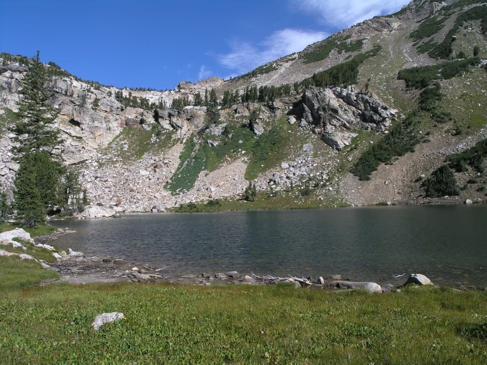
Holly Lake in Grand Teton National Park

Sight · Grand Teton National Park

Holly Lake

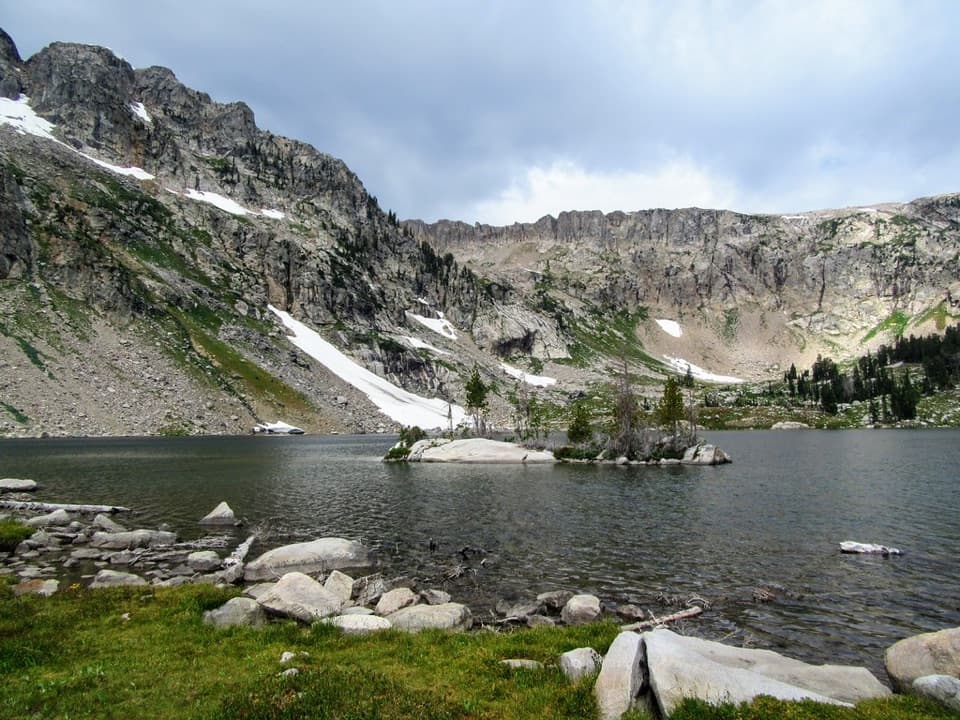
A high alpine lake at the end of a long, strenuous day.

Photo: National Park Service
Type
Sight
Nearest trail
3.2 mi
  • #35 of 80 sights
Parkwolf audio tour118 stories across Grand Teton’s roads

Overview

About Holly Lake

Why stop

  • Rocky alpine scenery and broad views down Paintbrush Canyon.

Heads up

  • Steep, rocky footing and lingering high-elevation snow.

Map

Where it is

Loading the Grand Teton map
Full map
SightHolly Lake43.79229, -110.79900
Keep this map with you offline in the Parkwolf app

Plan your stop

Before you go

2 active Grand Teton alerts

  • ClosureJackson Lake boat ramps closed; Signal launch riskMentions Jackson Lake, referenced in this guideColter Bay and Leeks boat ramps are closed; Signal Mountain Boat Ramp is open, but water is below the ramp edge and loose cobbles make launching risky.Official details
  • ClosureConstruction closures and delaysConstruction is causing current road and area closures and delays across Grand Teton; use the signed Taggart Trail detour. - Moose-Wilson Road is closed between Moose and Laurance S.Official details

Grand Teton alerts
A park ranger sits on a dash-mounted phone, talking, as Parkwolf’s Tour Guide plays “Army Cutworm Moths: A Grizzly Bear Buffet” on Grand Loop Road below Dunraven Pass in Yellowstone
Parkwolf Tour GuideThe highest, rockiest slopes around here are a summer buffet for grizzly bears.

Grand Teton Tour Guide

Your drive to Holly Lake, narrated.

Parkwolf is a GPS audio tour guide for Grand Teton National Park. As you drive, it chimes in with what’s ahead: hidden gems, upcoming stops, history, geology, and wildlife, right through your car’s speakers.

See the Grand Teton audio tour

More stories near here in the app

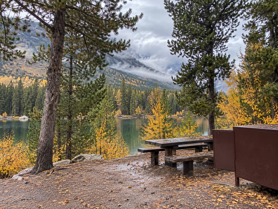
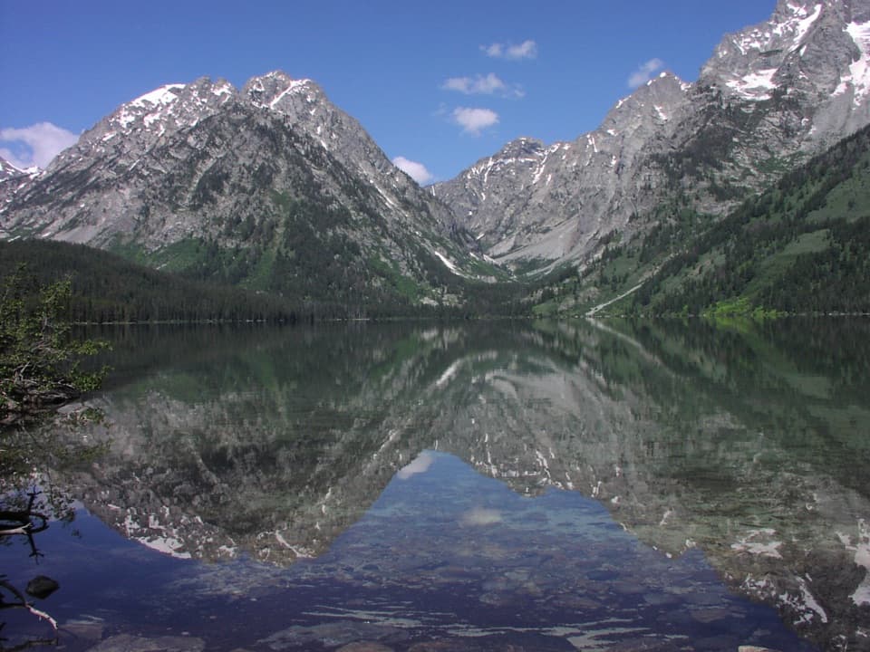
  • String and Leigh Lakes: Picnic, Paddle or Walk
  • Jenny Lake Lodge: A Meal Among the Cabins
  • Cathedral Group: Spires and Earthquake Scars
  • Jenny Lake Overlook and Its Namesake
  • 118 audio storiesacross Grand Teton’s roads, triggered by GPS as you drive
  • Wildlife heatmapsfor Grizzly Bear, Brown Bear, Gray Wolf, and 13 more
  • Works offlinemaps, 70 trails, 121 places, and audio download before you lose signal
  • CarPlay readysimple controls built for the drive
★★★★★
“…We have been driving around with the audio tour and it has been informational and spot on. The whole family has been impressed. We used it for Yellowstone and Grand Teton.”
KWaz1122App Store review
Download Parkwolf on the App StoreGet Parkwolf on Google Play

4.7 from 8,600+ ratings

Guide

More about Holly Lake

Plan this as a full-day hikeHolly Lake is a small glacial lake in a rocky high basin in Paintbrush Canyon, at about 9,416…

Holly Lake is a small glacial lake in a rocky high basin in Paintbrush Canyon, at about 9,416 feet. Reaching it is a strenuous 12.8-mile round trip with 2,840 feet of climbing from String and Leigh Lakes Trailhead. This is a destination for a long mountain day, not a quick stop between valley viewpoints.

Follow Paintbrush CanyonFrom the String and Leigh Lakes Trailhead, cross the bridge over String Lake’s outlet and…

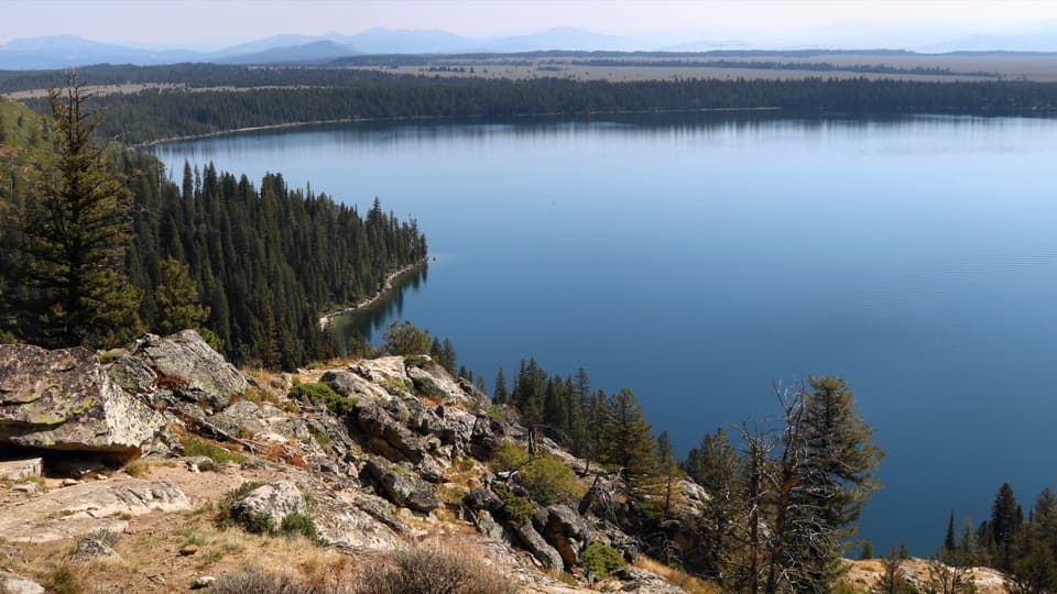
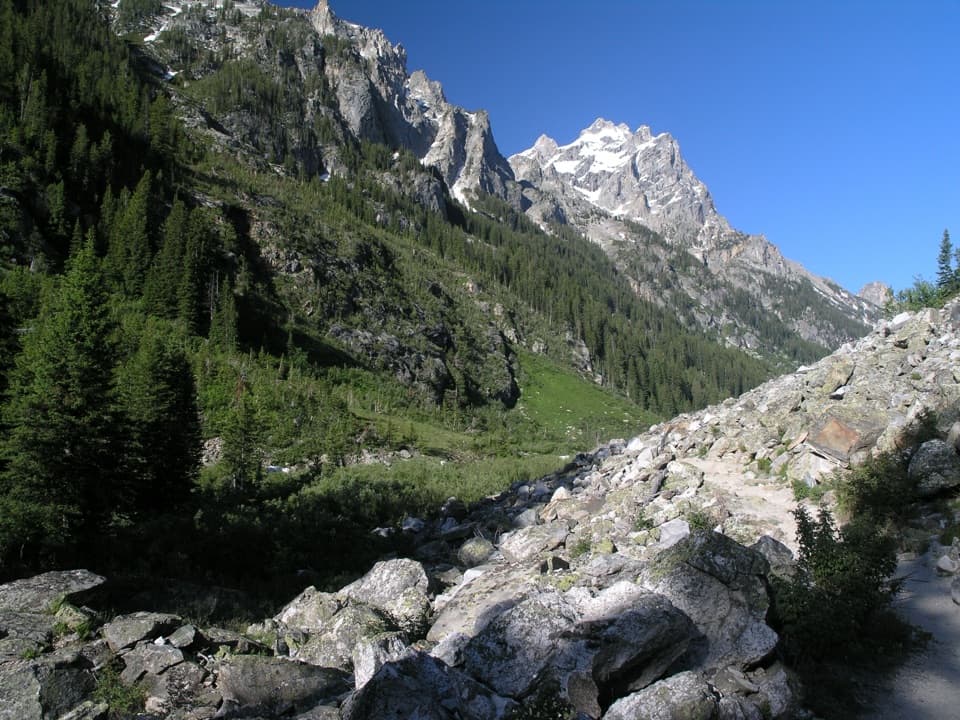
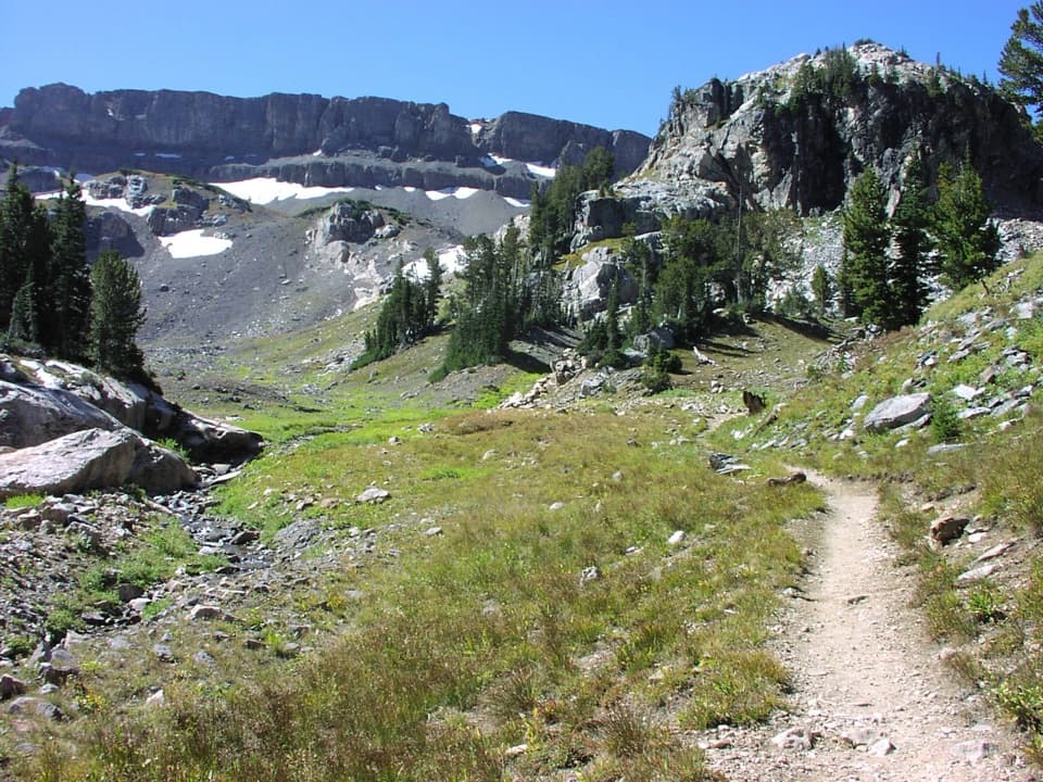
From the String and Leigh Lakes Trailhead, cross the bridge over String Lake’s outlet and follow the lakeshore before climbing Paintbrush Canyon. At the Holly Lake junction, the final half-mile leads to the lake. Expect exposed roots and rocks, bridge crossings and steep, narrow sections; the route averages an 11% slope. The approach is part of the experience, with broad views down Paintbrush Canyon toward Leigh and Jackson Lakes.

Pick a snow-free windowThe high route is best after the snow melts in summer and before the first snow returns in fall.

The high route is best after the snow melts in summer and before the first snow returns in fall. Snow can linger on mountain trails into late summer, and the NPS does not update the Paintbrush Canyon trail-condition entries in winter. Check current snow and weather before setting out. Bring food and water for a strenuous backcountry day.

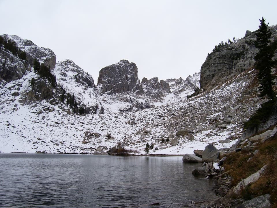
A lake in a glacial basinThe lake is roughly a tenth of a mile across and sits at 9,416 feet.

The lake is roughly a tenth of a mile across and sits at 9,416 feet. The rocky slopes and cirque walls rise directly behind the water, with scattered conifers and low vegetation around the shore. From the bank, include the near-shore grass and stones in the foreground to show the lake against the cliffs.

Wildlife along the routeHikers have reported pika, deer, moose and black bear along the approach.

Hikers have reported pika, deer, moose and black bear along the approach. Treat sightings as a bonus rather than a promise, and give wildlife plenty of room.

For an overnight tripThree designated backcountry camping zones are within a quarter-mile of the lake.

Three designated backcountry camping zones are within a quarter-mile of the lake. Overnight stays require a backcountry permit; the lake is also a strenuous day-hike destination for visitors who return to the trailhead.

Wildlife

Wildlife in Grand Teton

All Grand Teton wildlife maps

Sighting maps show where each species has been reported across Grand Teton. Wildlife moves, so no sighting is guaranteed.

Keep exploring

Near Holly Lake

See it all on the map

Trails nearby

More stops nearby

Parkwolf’s Grand Teton ranking

Top sights in Grand Teton

All 121 places
  1. 1Grand TetonSight
  2. 2Schwabacher LandingSight
  3. 3Oxbow Bend TurnoutSight
  4. 4Mormon Row Historic DistrictSight
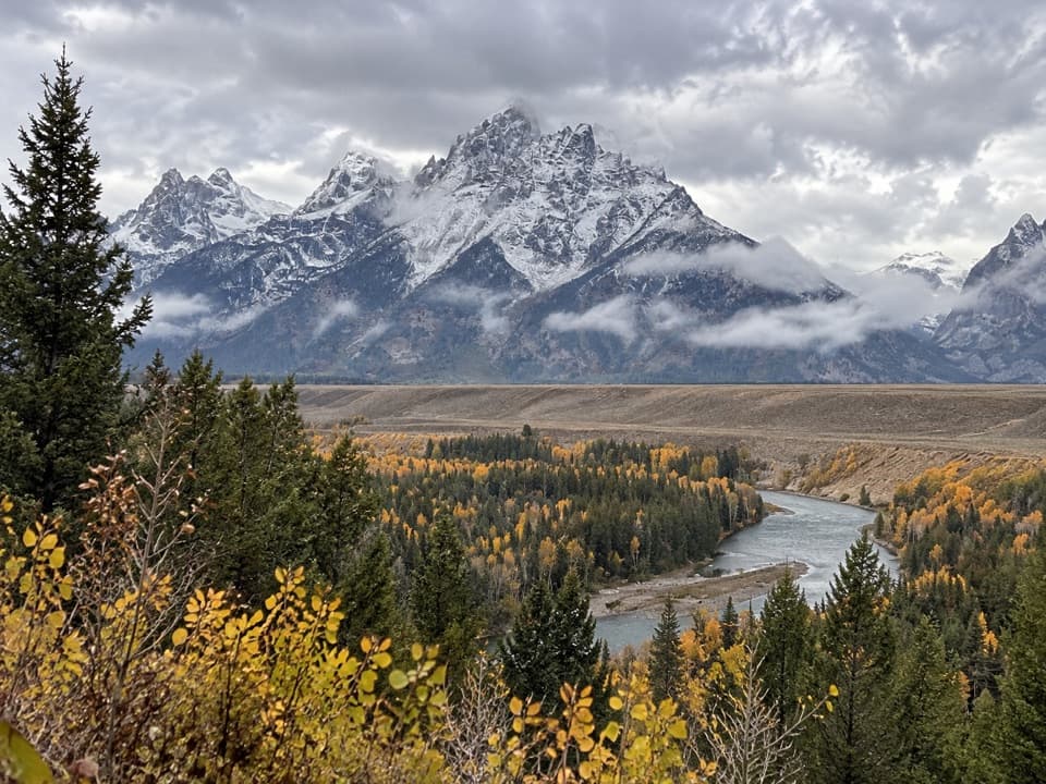
  5. 5Snake River OverlookSight
  6. 6Hidden FallsSight

Take Parkwolf to Grand Teton.

The audio tour guide for the drive, plus offline maps, trails, and wildlife heatmaps for when the signal drops.

4.7 from 8,600+ ratings

Download Parkwolf on the App StoreGet Parkwolf on Google Play