Cape Otway to Aire River Walk in Great Ocean Road

Great Ocean Road, VIC

Cape Otway to Aire River Walk

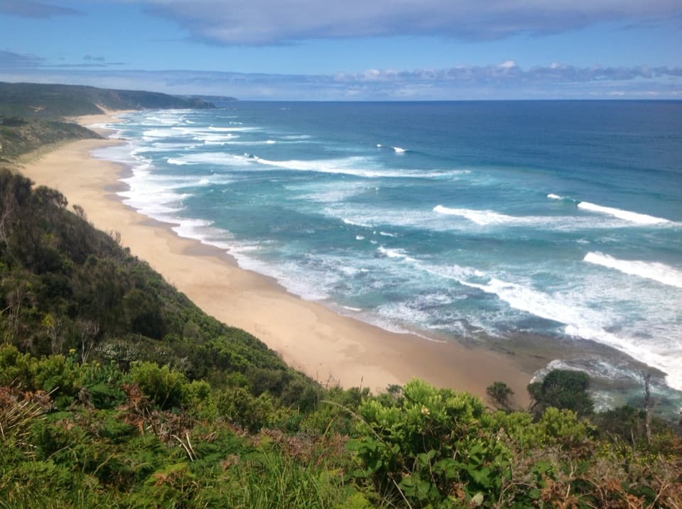
Follow coastal heath and cliff tops from the Lightstation to Aire River.

Photo: Wikimedia Commons
Length
9.6km
Time
3.8hr
Elev. change
106m
Difficulty
Moderate
  • No dogs
  • High point 107 m
  • #22 of 109 in Great Ocean Road

Hear the audio tour

Cape Otway Lightstation

Overview

About Cape Otway to Aire River Walk

Why go

  • Clifftop ocean views and Escarpment Lookout
  • A choice of inland walking or a conditional beach option

Heads up

  • Point-to-point transport needs planning
  • Soft sand slows the Aire River approach

Map & elevation

The route

Loading the Great Ocean Road map
Full map
Elevation1–107 m
TrailheadCape Otway Lightstation car park / Great Ocean Walk trailhead-38.85424, 143.51519
Keep this map with you offline in the Parkwolf app

Plan your hike

Before you go

Parking

Begin at the Cape Otway Lightstation car park and Great Ocean Walk trailhead. Arrange transport for the Aire River bridge-side finish; it is a point-to-point walk, and the nearby hike-in campground is not the separate roadside Aire River West campground.

Safety

Station Beach and river-crossing options depend on tide and surf; high water or rough seas can make them unsafe. No water refill was confirmed along the stage. The route follows eroded coastal cliffs, so keep to the marked line.

7 active Great Ocean Road alerts

  • ClosureAire River campground sites closed through 30 OctoberMentions Aire River, referenced in this guideSeasonal closures affect all Aire River East campsites and Aire River West sites 24–40 through 30 October 2026; do not camp on those sites. They reopen from 31 October 2026.Official details
  • ClosureLorne-area walking trails closed after flood and storm damageSeveral walking trails near Lorne remain closed; do not enter closed tracks. - Phantom Falls Walk is temporarily closed because flood and storm damage affected the trail and structures.Official details
See all 7 alerts
A park ranger sits on a dash-mounted phone, talking, as Parkwolf’s Tour Guide plays “Army Cutworm Moths: A Grizzly Bear Buffet” on Grand Loop Road below Dunraven Pass in Yellowstone
Parkwolf Tour GuideThe highest, rockiest slopes around here are a summer buffet for grizzly bears.

Great Ocean Road Tour Guide

Your drive to Cape Otway to Aire River Walk, narrated.

Parkwolf is a GPS audio tour guide for Great Ocean Road. As you drive, it chimes in with what’s ahead: hidden gems, upcoming stops, history, geology, and wildlife, right through your car’s speakers.

See the Great Ocean Road audio tour

Recorded for this trailhead

Cape Otway Lightstation
0:00 / 0:33
“Up ahead is Cape Otway Lightstation, built around a lighthouse first lit in eighteen forty-eight.”

Plays as you drive up to this trailhead in the Parkwolf Great Ocean Road Tour Guide.

More stories near here in the app

  • The Ship That Became a House
  • A Fairy-wren Without the Blue
  • A Crab Outgrows Its Shell
  • A Koala's Double Grip
  • 181 audio storiesacross Great Ocean Road’s roads, triggered by GPS as you drive
  • Wildlife heatmapsfor Koala, Kangaroo, Little Penguin, and 13 more
  • Works offlinemaps, 109 trails, 99 places, and audio download before you lose signal
  • CarPlay readysimple controls built for the drive
★★★★★
“Fantastic app with many points of information… It’s great to just turn on while you’re driving and it gives you an audio tour of the national Park. We love it!!!!”
JMJamesApp Store review
Download Parkwolf on the App StoreGet Parkwolf on Google Play

4.7 from 8,600+ ratings

Trail guide

Hiking Cape Otway to Aire River Walk

The one-way stageThis is the Cape Otway to Aire River section of the Great Ocean Walk: a 9.

This is the Cape Otway to Aire River section of the Great Ocean Walk: a 9.6 km (about 6 mi) point-to-point hike from the Lightstation to the Aire River bridge and hike-in campground area. It moves from coastal heath to eroded cliff tops above the Southern Ocean, then drops toward the river. Expect roughly 3¼ to 4 hours on the main route; soft sand and stops add time.

Plan the finishStart at the Cape Otway Lightstation trailhead and arrange transport from the Aire River end…

Start at the Cape Otway Lightstation trailhead and arrange transport from the Aire River end before setting out. This is not a loop, and the bridge-side hike-in campground is distinct from the separate roadside Aire River West campground. The saved route follows the main inland and clifftop alignment. It does not include the optional Station Beach beach-walk or the Rainbow Falls detour.

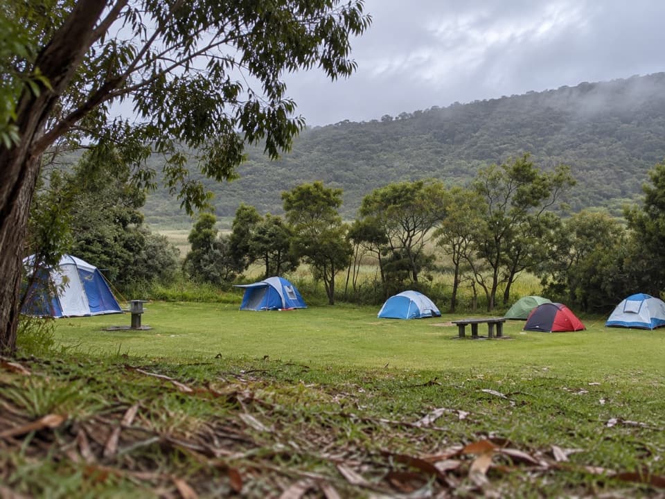
Heath and early landmarksNear the start, the route passes the Great Ocean Walk hikers’ campground and the Lightstation…

Near the start, the route passes the Great Ocean Walk hikers’ campground and the Lightstation cemetery before entering dense coastal beard-heath. For roughly the first couple of kilometres, low scrub keeps the walk sheltered from the open cliff-edge stretches farther on. The cemetery is a short historical stop near the Lightstation precinct; the walk’s main draw is the changing coastline rather than a summit or single destination.

Clifftops and choicesThe route follows undulating, sometimes eroded cliff tops, with broad ocean views opening…

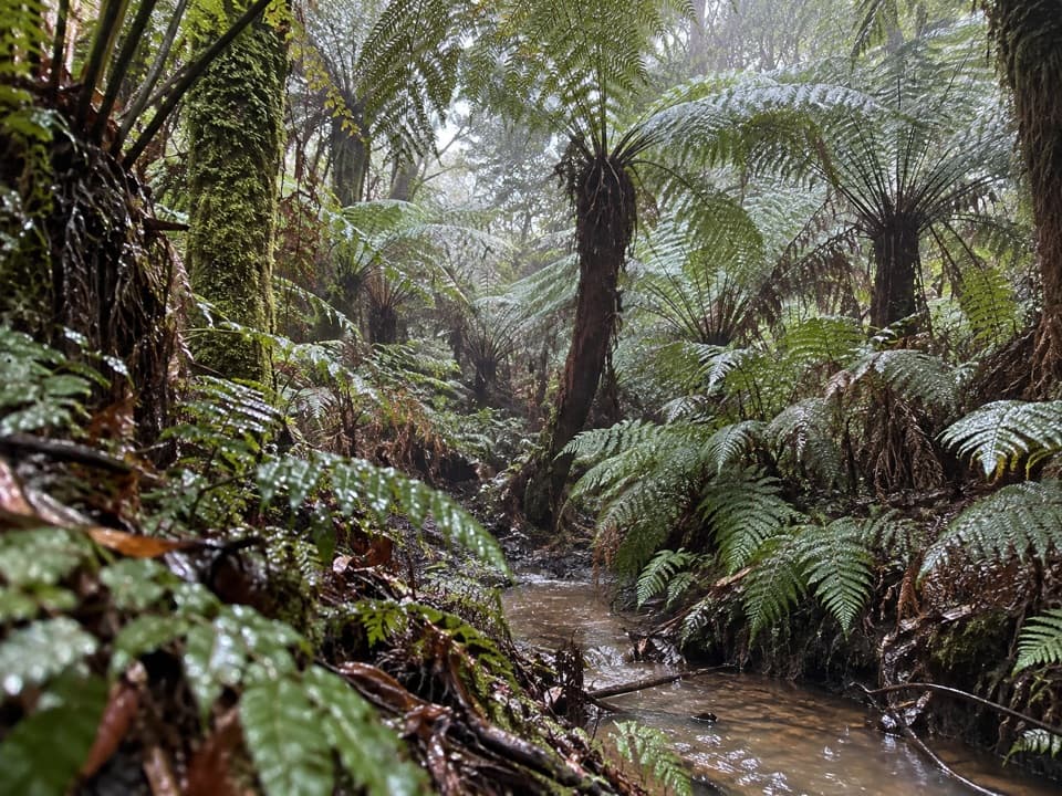
The route follows undulating, sometimes eroded cliff tops, with broad ocean views opening around Escarpment Lookout. At Station Beach, a separate soft-sand option can replace part of the inland line when the tide is low and the sea is calm. It is not part of the 9.6 km stage, and surf or high water can make beach access and river crossings unsafe. Rainbow Falls is another separate option: allow about 2 km return for the spring-fed falls, beyond the stage distance.

The Aire River approachThe last stretch becomes very soft sand as it descends toward Aire River.

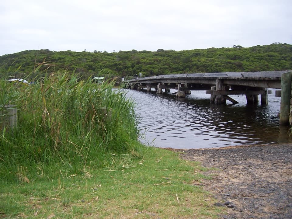
The last stretch becomes very soft sand as it descends toward Aire River. A small river lookout and the bridge mark the finish near the hike-in camping area. The crossing and river edge give the walk a clear endpoint, but do not mistake this riverside finish for the roadside campground farther away.

Access and conditionsDogs are generally not permitted in Great Otway National Park, so leave pets at home.

Dogs are generally not permitted in Great Otway National Park, so leave pets at home. No water refill point was confirmed along this stage; carry what you need for the full walk. Check current park access advice and tide and surf conditions before choosing any beach or river-crossing variation. The route’s coastal cliffs are eroded, so stay on the marked walking line near exposed edges.

Wildlife

Wildlife in Great Ocean Road

All Great Ocean Road wildlife maps

Sighting maps show where each species has been reported across Great Ocean Road. Wildlife moves, so no sighting is guaranteed.

Keep exploring

Near Cape Otway to Aire River Walk

See it all on the map

Trails that start nearby

Places near the trailhead

Parkwolf’s Great Ocean Road ranking

Top-rated trails in Great Ocean Road

All 109 trails
  1. 1Great Ocean WalkChallenging · 100 km
  2. 2Maits Rest Rainforest WalkEasy · 0.8 km
  3. 3Triplet Falls WalkModerate · 2 km
  4. 4Hopetoun Falls WalkModerate · 0.8 km
  5. 5Erskine Falls WalkModerate · 0.7 km
  6. 6Surf Coast WalkChallenging · 41.5 km

Take Parkwolf to Great Ocean Road.

The audio tour guide for the drive, plus offline maps, trails, and wildlife heatmaps for when the signal drops.

4.7 from 8,600+ ratings

Download Parkwolf on the App StoreGet Parkwolf on Google Play