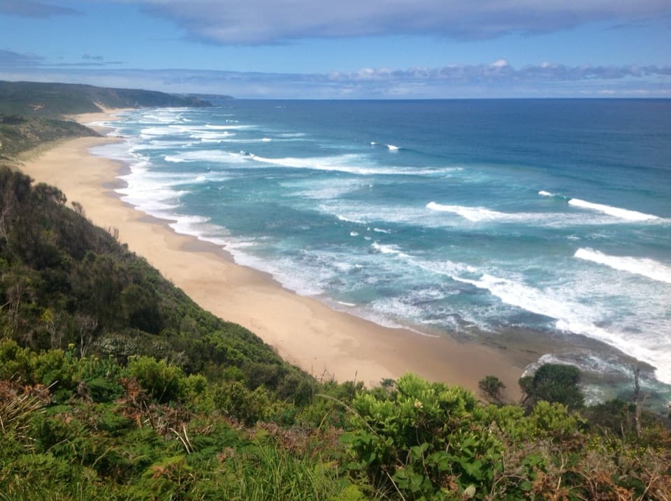
Aire River to Johanna Beach in Great Otway National Park

Great Otway National Park, VIC

Aire River to Johanna Beach

Cliff views, Castle Cove fossils and a beach finish.

Photo: Wikimedia Commons
Length
14km
Time
5.3hr
Elev. change
124m
Difficulty
Moderate
  • No dogs
  • High point 124 m
  • #20 of 83 in Great Otway

Hear the audio tour

Aire River: A Picnic by the Wetlands

Overview

About Aire River to Johanna Beach

Why go

  • Spinifex, heath and cliff-top coast give the stage real variety.
  • Castle Cove’s fossil cliffs and Johanna Beach make a memorable finish.

Heads up

  • One-way logistics need a pickup or a second vehicle.
  • The Johanna River crossing depends on tide, swell and recent rain.
Aire River to Johanna Beach is a one-way Great Ocean Walk stage of about 14 km, with roughly 5 hours 15 minutes of walking. The mapped line is about 13.5 km; the campground-to-campground itinerary rounds the stage to 14 km. Expect repeated climbs on gravel and uneven ground, around 440 m of total ascent, and a long stretch of coastal scenery. I’d pick it if you want a substantial half-day walk and have transport sorted; it is much more than a quick beach visit.
Parkwolf’s verdictIs this the hike for you?

Map & elevation

The route

Loading the Great Otway map
Full map
Elevation0–124 m
TrailheadAire River West information shelter-38.80207, 143.47753
Keep this map with you offline in the Parkwolf app

Plan your hike

Before you go

Parking

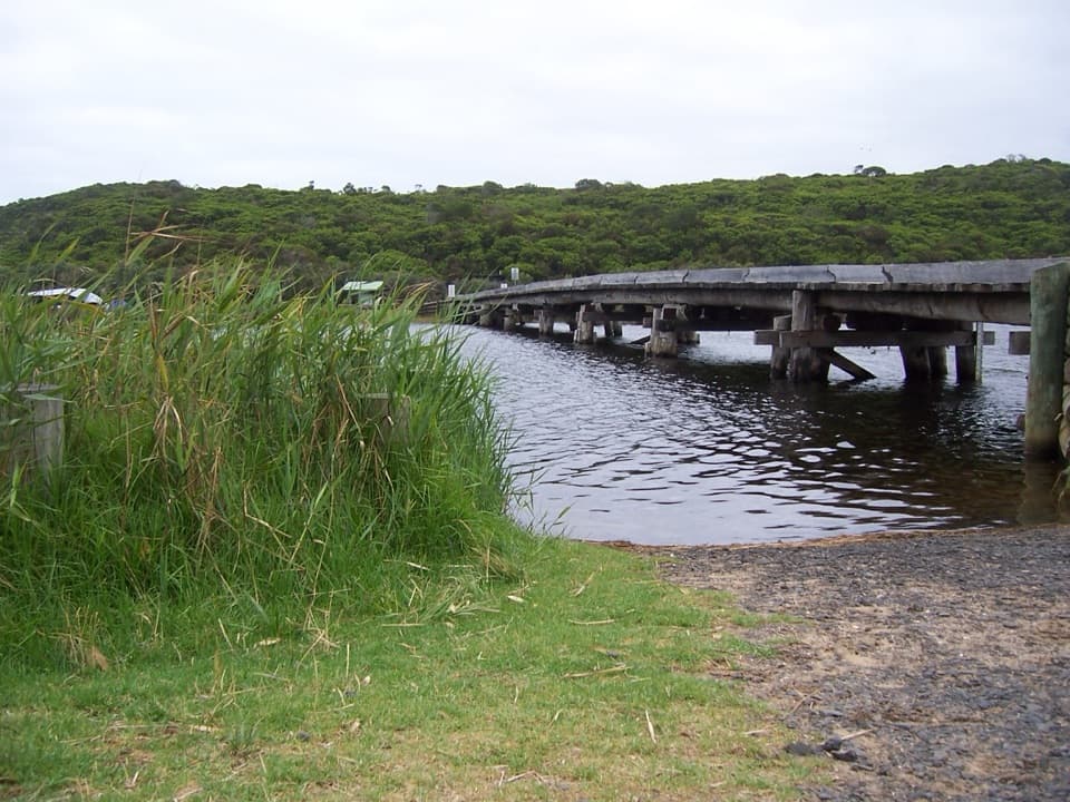
Start at the Aire River West day visitor area beside the information shelter; leave a second vehicle at Johanna Beach or arrange a pickup. The approach on Horden Vale Road has narrow sections and a single-lane timber bridge, so large buses are unsuitable.

Safety

Johanna Beach and its unbridged river crossing can become unsafe at high tide, in large swell or after heavy rain. Attempt the crossing only at low tide with calm seas and low water; wait or turn back if conditions are unsafe. The beach is unpatrolled, with currents and rips, and is not a safe swimming beach.

3 active Great Otway alerts

  • ClosureSeasonal campsite closures at Aire RiverMentions Aire River, referenced in this guideSeasonal closures remain in effect at Aire River through 30 October 2026; do not use the closed sites. - Aire River East: all sites are closed from 29 May to 30 October 2026 and reopen 31 October.Official details
  • ClosureWye Road closed after storm and flood damageWye Road is closed until further notice because recent storm and flood damage requires road maintenance and repair works; plan around the closure.Official details
See all 3 alerts
A park ranger sits on a dash-mounted phone, talking, as Parkwolf’s Tour Guide plays “Army Cutworm Moths: A Grizzly Bear Buffet” on Grand Loop Road below Dunraven Pass in Yellowstone
Parkwolf Tour GuideThe highest, rockiest slopes around here are a summer buffet for grizzly bears.

Great Otway Tour Guide

Your drive to Aire River to Johanna Beach, narrated.

Parkwolf is a GPS audio tour guide for Great Otway National Park. As you drive, it chimes in with what’s ahead: hidden gems, upcoming stops, history, geology, and wildlife, right through your car’s speakers.

See the Great Otway audio tour

Recorded for this trailhead

Aire River: A Picnic by the Wetlands
0:00 / 0:27
“Up ahead is the Aire River day visitor area, a west-bank picnic stop beside Aire River West Campground. Stop here for a riverside break rather than a major sightseeing detour.”

Plays as you drive up to this trailhead in the Parkwolf Great Otway Tour Guide.

More stories near here in the app

  • The Tiny Leaves on a Sheoak
  • The Cracks That Shape a Cliff
  • An Eagle Riding Rising Air
  • One Breeding Season for an Antechinus
  • 252 audio storiesacross Great Otway’s roads, triggered by GPS as you drive
  • Wildlife heatmapsfor Koala, Grey Kangaroo, Echidna, and 13 more
  • Works offlinemaps, 83 trails, 79 places, and audio download before you lose signal
  • CarPlay readysimple controls built for the drive
★★★★★
“Fantastic app with many points of information… It’s great to just turn on while you’re driving and it gives you an audio tour of the national Park. We love it!!!!”
JMJamesApp Store review
Download Parkwolf on the App StoreGet Parkwolf on Google Play

4.7 from 8,600+ ratings

Trail guide

Hiking Aire River to Johanna Beach

Make the point-to-point walk workStart at the Aire River West information shelter and finish at the Johanna Beach hike-in…

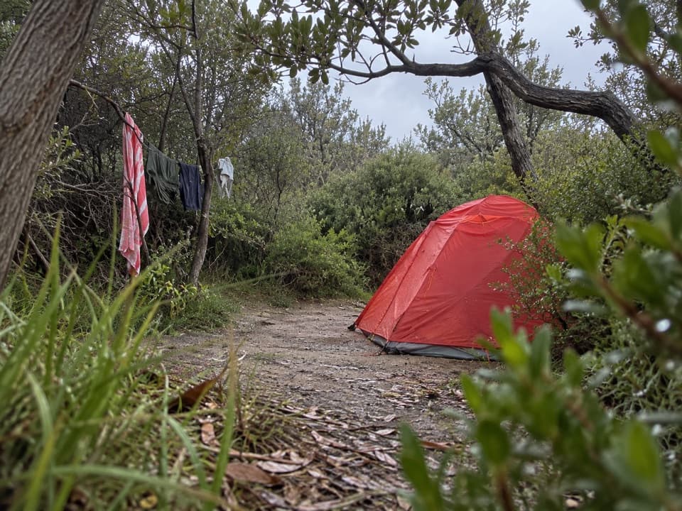
Start at the Aire River West information shelter and finish at the Johanna Beach hike-in campground. Leave a vehicle at each end or arrange a pickup; walking back adds another long stage. Horden Vale Road has narrow sections and a single-lane timber bridge, so it is unsuitable for large buses. Hike-in campsites are limited and need advance booking if you are staying overnight. No food stop is documented on the route, and campground rainwater is untreated and may not be available, so carry enough water for the whole walk.

From Aire River to Castle CoveThe track first heads inland and climbs around a headland through spinifex forest, then returns…

The track first heads inland and climbs around a headland through spinifex forest, then returns to the coast. Before Castle Cove, the route rolls up and down with a few sustained climbs. Most of the mapped coastal path is gravel, but expect uneven footing and sections that can turn wet, muddy or slippery after rain. The walk alternates between scrubby inland stretches and open coast, so it does not feel like a beach walk from end to end.

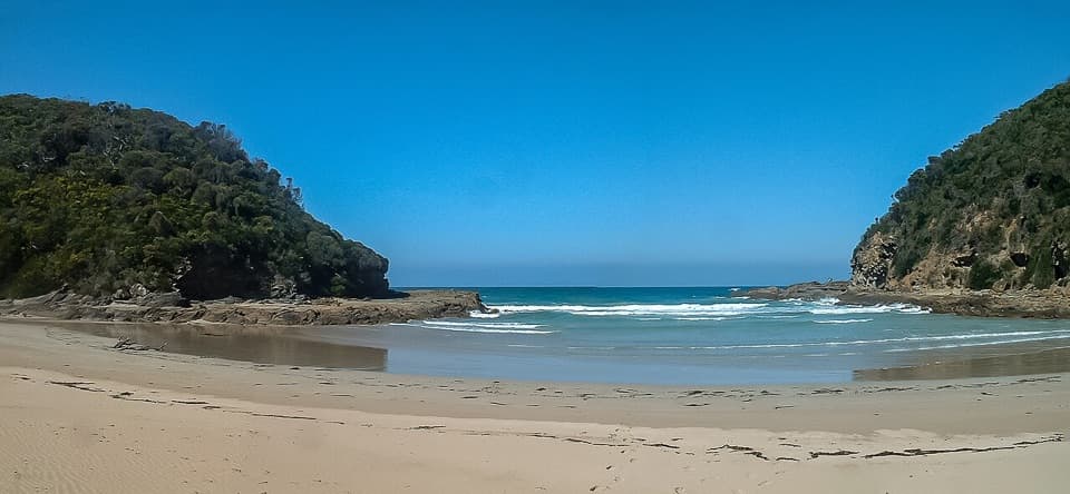
Castle Cove’s fossil cliffsAt Castle Cove, a sandy beach sits beneath high cliffs.

At Castle Cove, a sandy beach sits beneath high cliffs. Dinosaur fossils have been found in the cliffs, giving this bend in the coast a story beyond its dramatic shape. From the route, look for the beach framed below the cliff face; seeing both together makes the scale of the cove clear. Keep the stop to established access rather than scrambling onto unstable edges.

Cliff tops, heath and forestAfter Castle Cove, the Great Ocean Walk follows cliff tops through heath and forest, opening…

After Castle Cove, the Great Ocean Walk follows cliff tops through heath and forest, opening now and then to long views along the rugged coast. Manna gums and grass trees grow along this stretch, and spring brings wildflowers through the heath. Peregrine falcons are worth watching for overhead. The views come in gaps between the vegetation, so expect a changing mix of enclosed track and exposed lookout sections rather than an uninterrupted panorama.

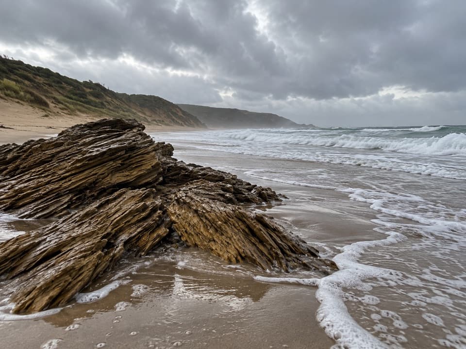
The Johanna Beach finishThe route ends at Johanna Beach, a broad shore with powerful surf.

The route ends at Johanna Beach, a broad shore with powerful surf. The final beach section includes an unbridged Johanna River crossing. Check tide, swell and river level before you start: the beach and crossing should be attempted only at low tide, with calm seas and low water. Heavy rain or large swell can make the crossing unsafe, so wait or turn back if conditions are wrong. The beach is unpatrolled and has currents and rips; do not swim.

Wildlife

Wildlife in Great Otway

All Great Otway wildlife maps

Sighting maps show where each species has been reported across Great Otway. Wildlife moves, so no sighting is guaranteed.

Keep exploring

Near Aire River to Johanna Beach

See it all on the map

Trails that start nearby

Places near the trailhead

Parkwolf’s Great Otway ranking

Top-rated trails in Great Otway

All 83 trails
  1. 1Great Ocean WalkChallenging · 100 km
  2. 2Maits Rest Rainforest WalkEasy · 0.8 km
  3. 3Triplet Falls WalkModerate · 1.8 km
  4. 4Hopetoun Falls WalkModerate · 0.8 km
  5. 5Madsen’s Track Nature WalkModerate · 1.4 km
  6. 6Lake Elizabeth Loop WalkEasy · 4.7 km

Take Parkwolf to Great Otway.

The audio tour guide for the drive, plus offline maps, trails, and wildlife heatmaps for when the signal drops.

4.7 from 8,600+ ratings

Download Parkwolf on the App StoreGet Parkwolf on Google Play