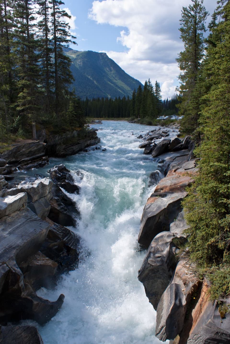
Sinclair Canyon in Kootenay National Park

#8 of 15 sights in Kootenay

Sight · Kootenay National Park

Sinclair Canyon

Watch Highway 93 thread the red cliffs at the southern gateway.

Photo: Wikimedia Commons
Type
Sight
Nearest trail
Right here
Audio stories
5 nearby
  • Parking
  • Pullout
  • Scenic viewpoint

Hear the audio tour

Sinclair Canyon: Through the Red Cliffs

Overview

About Sinclair Canyon

Why stop

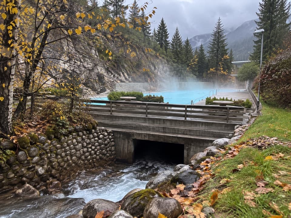
  • The creek and bridge add detail to the dramatic road cut.

Heads up

  • The elevated view takes a separate 6 km return walk.

Map

Where it is

Loading the Kootenay map
Full map
SightSinclair Canyon50.63270, -116.05711
Keep this map with you offline in the Parkwolf app

Plan your stop

Before you go

5 active Kootenay alerts

  • ClosureSinclair Canyon construction closures and delaysMentions this placeRepairs to the Sinclair Creek Rock Tunnel and rehabilitation of the retaining wall at Sinclair Canyon require construction closures; expect alternating single-lane traffic on Highway 93S and…Official details
  • CautionFour-person minimum on Sinclair Creek and Kindersley Pass trailsMentions Sinclair Creek, referenced in this guideHiking parties on Sinclair Creek and Kindersley Pass trails must have at least four people because grizzly bears are in the area.Official details

See all 5 alerts
A park ranger sits on a dash-mounted phone, talking, as Parkwolf’s Tour Guide plays “Army Cutworm Moths: A Grizzly Bear Buffet” on Grand Loop Road below Dunraven Pass in Yellowstone
Parkwolf Tour GuideThe highest, rockiest slopes around here are a summer buffet for grizzly bears.

Kootenay Tour Guide

Your drive to Sinclair Canyon, narrated.

Parkwolf is a GPS audio tour guide for Kootenay National Park. As you drive, it chimes in with what’s ahead: hidden gems, upcoming stops, history, geology, and wildlife, right through your car’s speakers.

See the Kootenay audio tour

Recorded for this place

Sinclair Canyon: Through the Red Cliffs
0:00 / 0:29
“You're nearing Sinclair Canyon, where Highway ninety-three threads between steep reddish cliffs at the park's southern gateway.”

Plays as you drive up to Sinclair Canyon in the Parkwolf Kootenay Tour Guide.

More stories near here in the app

  • Redstreak Campground: A Base Above Radium
  • Radium Hot Springs: A Soak in the Canyon
  • Redstreak Road Lookout: Radium and the Valley
  • Kootenay Visitor Centre: Local Advice and Displays
  • 49 audio storiesacross Kootenay’s roads, triggered by GPS as you drive
  • Wildlife heatmapsfor Grizzly Bear, Gray Wolf, Moose, and 13 more
  • Works offlinemaps, 38 trails, 29 places, and audio download before you lose signal
  • CarPlay readysimple controls built for the drive
★★★★★
“Fantastic app with many points of information… It’s great to just turn on while you’re driving and it gives you an audio tour of the national Park. We love it!!!!”
JMJamesApp Store review
Download Parkwolf on the App StoreGet Parkwolf on Google Play

4.7 from 8,600+ ratings

Guide

More about Sinclair Canyon

The drive-through canyonSinclair Canyon is a narrow roadside gorge at Kootenay National Park’s southern gateway.

Sinclair Canyon is a narrow roadside gorge at Kootenay National Park’s southern gateway. Highway 93 passes between steep reddish walls known as the Redwall Fault. It’s a quick, memorable look at the road cutting through rock. Keep it on your drive if you enjoy dramatic road scenery; the higher view takes a separate walk.

What to noticeLook up at the cliffs and down toward Sinclair Creek, where the water runs beneath the highway…

Look up at the cliffs and down toward Sinclair Creek, where the water runs beneath the highway crossing. The tight walls make the road feel small by comparison. For a photo, include a slice of Highway 93 or a vehicle below the cliffs; that gives the rock faces a sense of scale. Use the designated public viewpoint when it is open.

A road with a long historyThe Banff-Windermere Highway opened in 1923.

The Banff-Windermere Highway opened in 1923. Today its 94-kilometre route through Kootenay links this southern gateway with valleys and two mountain passes farther north. Sinclair Canyon is an early reminder that this drive is about the road’s close encounter with the landscape, as much as the views beyond the windshield.

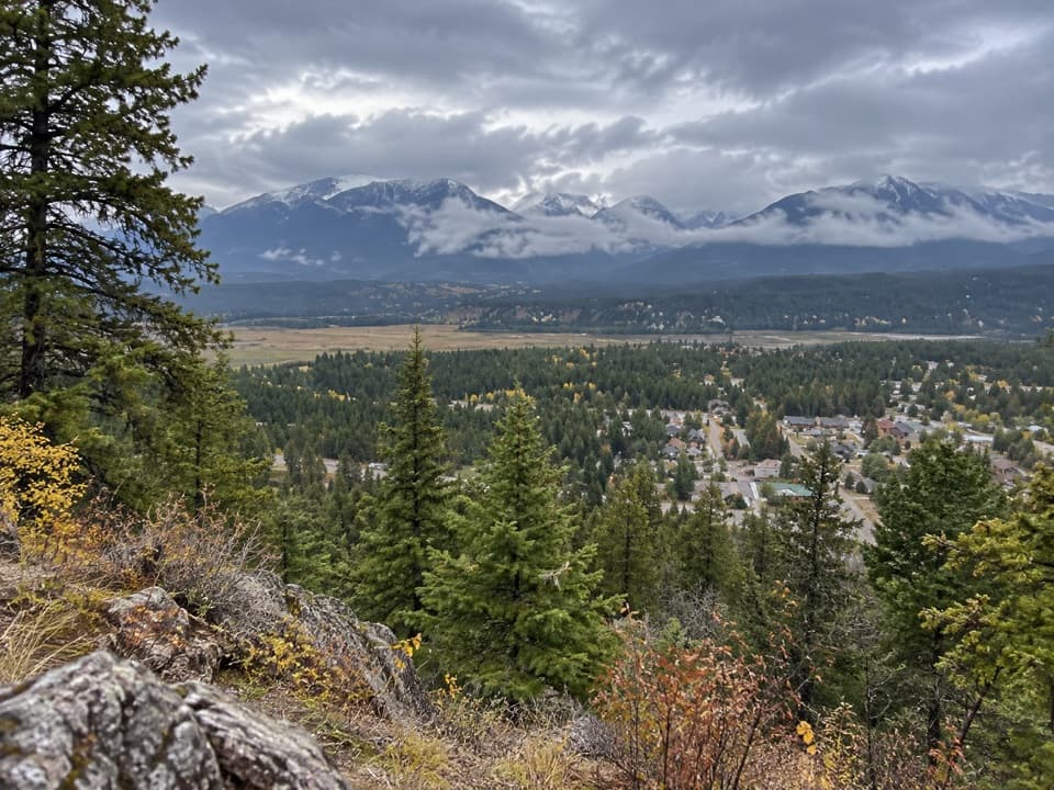
A higher view takes timeThe Juniper/Sinclair route is a 6-kilometre return walk for a bird’s-eye view of the canyon.

The Juniper/Sinclair route is a 6-kilometre return walk for a bird’s-eye view of the canyon. It’s a dedicated outing rather than a quick add-on to the drive, so decide whether you want the brief roadside look or the longer perspective from above.

Wildlife

Wildlife in Kootenay

All Kootenay wildlife maps

Sighting maps show where each species has been reported across Kootenay. Wildlife moves, so no sighting is guaranteed.

Parkwolf’s Kootenay ranking

Top sights in Kootenay

All 29 places
  1. 1Radium Hot SpringsSight
  2. 2Marble CanyonSight
  3. 3Paint PotsSight
  4. 4Floe LakeSight
  5. 5Numa FallsSight
  6. 6Kootenay Valley ViewpointSight

Take Parkwolf to Kootenay.

The audio tour guide for the drive, plus offline maps, trails, and wildlife heatmaps for when the signal drops.

4.7 from 8,600+ ratings

Download Parkwolf on the App StoreGet Parkwolf on Google Play