Stock Ghyll Force in Lake District National Park

Sight · Lake District National Park

Stock Ghyll Force

A short woodland walk to a 70-foot cascade above Ambleside

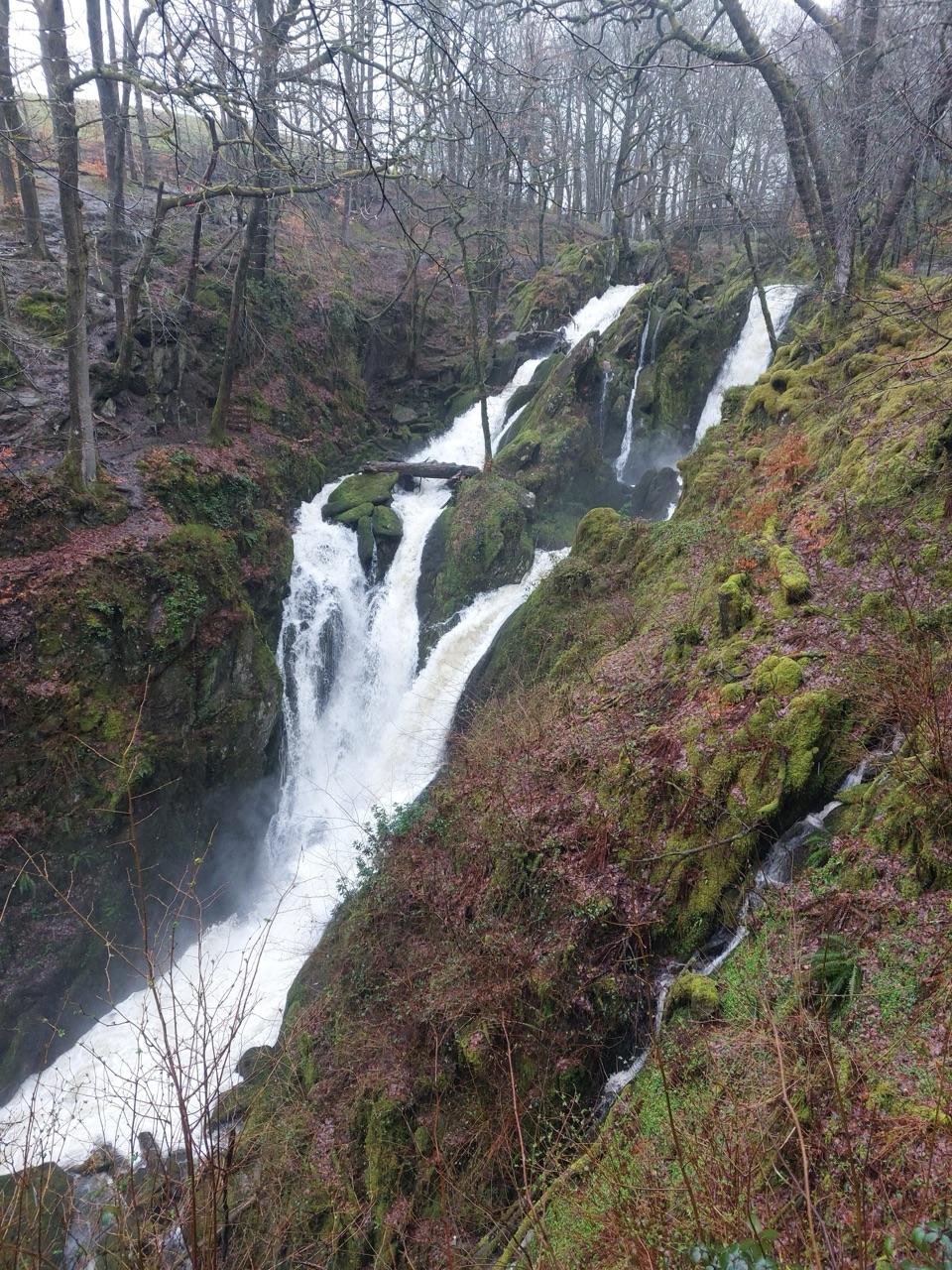
Photo: Graham Robson / Geograph Britain and Ireland, CC BY-SA 2.0

Type
Sight
Nearest trail
0.7 km
Audio stories
8 nearby
  • Trailhead
  • Scenic viewpoint

Hear the audio tour

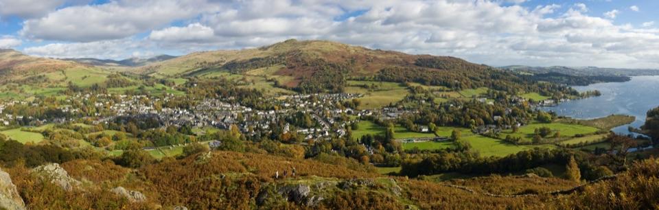
Ambleside and Stock Ghyll Force
Download Parkwolf on the App StoreGet Parkwolf on Google Play

4.7 from 8,600+ ratings

Overview

About Stock Ghyll Force

Why stop

  • Walkable from Ambleside with multiple views of the falls

Heads up

  • Mud and slippery roots after rain
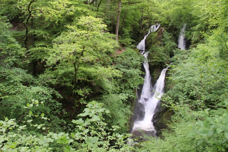
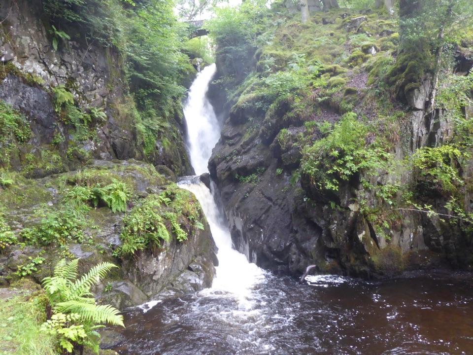
Stock Ghyll Force is a 70-foot, multi-tiered waterfall tucked into woodland just east of Ambleside. The falls are less about one clean drop than the way Stock Ghyll keeps changing character as it tumbles through mossy rock, trees, and narrow chutes. For a short walk from town, it feels surprisingly secluded.
Parkwolf’s verdictWhy stop

Map

Where it is

Loading the Lake District map
Full map
SightStock Ghyll Force54.43269, -2.95121
Keep this map with you offline in the Parkwolf app

Plan your stop

Before you go

Best time to go

The falls are most forceful after rainfall, which is also when the path is at its slickest. Visit early in the day or outside the busiest holiday periods if you want more space at the viewpoints. The walk is popular and short, so weekend and school-holiday traffic is normal even when there is no formal wait.

Take your time on the rougher side of the loop and stay on the paths and viewing platforms rather than trying to get closer to the water.


8 active Lake District alerts

  • ClosureAnglers’ Crag path closes intermittently for repairsFootpath 407024 and the adjoining unrecorded way over Anglers’ Crag on Ennerdale Water’s southern shore close intermittently for repairs; follow signs to check whether the path is open.Official details
  • ClosureWhinlatter paths close intermittently for forestry workSections of Bridleway 201006 in Thornthwaite Forest and Footpath 201044 at Beckstones Gill close intermittently for forestry thinning; follow signs, as the paths are open when closures are not in…Official details
See all 8 alerts
A park ranger sits on a dash-mounted phone, talking, as Parkwolf’s Tour Guide plays “Army Cutworm Moths: A Grizzly Bear Buffet” on Grand Loop Road below Dunraven Pass in Yellowstone
Parkwolf Tour GuideThe highest, rockiest slopes around here are a summer buffet for grizzly bears.

Lake District Tour Guide

Your drive to Stock Ghyll Force, narrated.

Parkwolf is a GPS audio tour guide for Lake District National Park. As you drive, it chimes in with what’s ahead: hidden gems, upcoming stops, history, geology, and wildlife, right through your car’s speakers.

See the Lake District audio tour

Recorded for this place

Ambleside and Stock Ghyll Force
0:00 / 0:37
“You're coming into Ambleside, a useful stop when some of your group want a walk and others would rather browse shops or find a café.”

Plays as you drive up to Stock Ghyll Force in the Parkwolf Lake District Tour Guide.

More stories near here in the app

  • Dragonflies: Before They Fly
  • Ambleside: Fairfield or Loughrigg
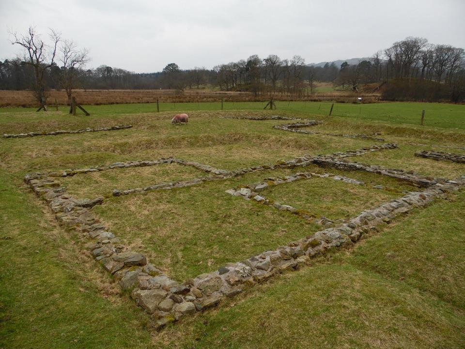
  • Ambleside Roman Fort: Reading the Ruins
  • Stagshaw: The Champion Tree Trail
  • 298 audio storiesacross Lake District’s roads, triggered by GPS as you drive
  • Wildlife heatmapsfor Red Deer, Eurasian Otter, Osprey, and 13 more
  • Works offlinemaps, 265 trails, 90 places, and audio download before you lose signal
  • CarPlay readysimple controls built for the drive
★★★★★
“Fantastic app with many points of information… It’s great to just turn on while you’re driving and it gives you an audio tour of the national Park. We love it!!!!”
JMJamesApp Store review
Download Parkwolf on the App StoreGet Parkwolf on Google Play

4.7 from 8,600+ ratings

Guide

More about Stock Ghyll Force

What to expectAllow roughly 30 to 45 minutes from Ambleside for the short loop, plus longer if you stop for…

Allow roughly 30 to 45 minutes from Ambleside for the short loop, plus longer if you stop for photographs. The approach is uphill but straightforward. Expect compact earth, exposed roots, steps or rougher patches, and a wetter, muddier section on the opposite side of the beck. Proper walking shoes are worthwhile after rain.

From Ambleside, follow Stockghyll Lane uphill to the southern entrance, then the signposted path to the viewing platforms. There is a separate access point to the top viewing platform, but do not assume that the full woodland loop has the same accessibility. The waterfall is a good fit for a small outing while you are already in Ambleside, rather than a destination that needs a full day.

History and settingStock Ghyll is a tributary of the River Rothay and once powered bobbin mills serving the…

Stock Ghyll is a tributary of the River Rothay and once powered bobbin mills serving the Lancashire cotton trade. Ambleside still retains traces of that water-powered industrial past in old mill buildings below the woods. The stream was also known historically as Rattle Ghyll. John Keats described the waterfall in a letter to his brother Tom during his 1818 walking tour.

Why stopThe circular route follows the beck uphill to viewing platforms, crosses above the falls, and…

The circular route follows the beck uphill to viewing platforms, crosses above the falls, and returns over a lower footbridge. The top bridge is the moment to linger: you can look down into the cascade, then see it from different angles as the path loops back.

Wildlife

Wildlife in Lake District

All Lake District wildlife maps

Sighting maps show where each species has been reported across Lake District. Wildlife moves, so no sighting is guaranteed.

Keep exploring

Near Stock Ghyll Force

See it all on the map

Trails nearby

More stops nearby

Parkwolf’s Lake District ranking

Top sights in Lake District

All 90 places
  1. 1WindermereSight
  2. 2Scafell PikeSight
  3. 3UllswaterSight
  4. 4DerwentwaterSight
  5. 5Wast WaterSight
  6. 6Aira ForceSight

Take Parkwolf to Lake District.

The audio tour guide for the drive, plus offline maps, trails, and wildlife heatmaps for when the signal drops.

4.7 from 8,600+ ratings

Download Parkwolf on the App StoreGet Parkwolf on Google Play