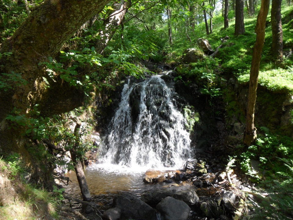
Tom Gill to Tarn Hows Walk in Lake District National Park

Lake District National Park, EN

Tom Gill to Tarn Hows Walk

Scramble beside waterfalls to a Victorian tarn on a steep 1.6-mile loop

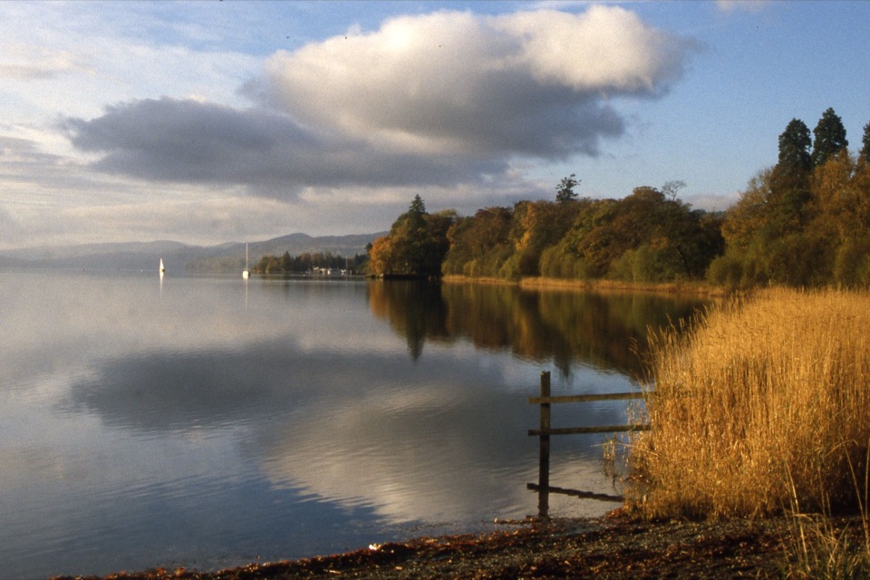
Photo: Wikimedia Commons
Length
2.6km
Time
1.3hr
Elev. change
104m
Difficulty
Challenging
  • Loop
  • Dogs allowed
  • High point 209 m

Hear the audio tour

Tom Gill: Waterfalls from Glen Mary Bridge

Overview

About Tom Gill to Tarn Hows Walk

Why go

  • Tom Gill waterfalls arrive early
  • Big Tarn Hows payoff for a short loop
  • Distinctive Victorian designed landscape

Heads up

  • Two genuine rock scrambles on the opening climb
  • Road, gates and field edges on the return

Map & elevation

The route

Loading the Lake District map
Full map
Elevation105–209 m
TrailheadGlen Mary Bridge National Trust car park54.39003, -3.04592
Keep this map with you offline in the Parkwolf app

Plan your hike

Before you go

Parking

Start at the Glen Mary Bridge National Trust car park near Tom Gill, grid reference SD321998. This is the correct access for this route; do not substitute Tarn Hows car park. It is a small pay-and-display car park, free for National Trust members.


Safety

The initial ascent has uneven ground beside steep drops and two rock scrambles that can be hazardous in wet weather. This is not suitable for novice fell walkers or people with limited mobility. Dogs must be kept on leads.

8 active Lake District alerts

  • ClosureChapel Stile footpath closed for retaining-wall riskPart of Footpath 543030 between Chapel Stile and Baysbrown campsite is closed because a retaining wall beside the path could collapse and material it supports could fall across the footpath.Official details
  • ClosureStanley Ghyll Lower Falls footpath closed for rockfallThe section of Footpath 408037 leading towards Stanley Ghyll Lower Falls is closed because severe rockfall damage has made the path unstable and further rockfall remains a danger.Official details
See all 8 alerts
A park ranger sits on a dash-mounted phone, talking, as Parkwolf’s Tour Guide plays “Army Cutworm Moths: A Grizzly Bear Buffet” on Grand Loop Road below Dunraven Pass in Yellowstone
Parkwolf Tour GuideThe highest, rockiest slopes around here are a summer buffet for grizzly bears.

Lake District Tour Guide

Your drive to Tom Gill to Tarn Hows Walk, narrated.

Parkwolf is a GPS audio tour guide for Lake District National Park. As you drive, it chimes in with what’s ahead: hidden gems, upcoming stops, history, geology, and wildlife, right through your car’s speakers.

Recorded for this trailhead

Tom Gill: Waterfalls from Glen Mary Bridge
0:00 / 0:58
“Up ahead is Glen Mary Bridge, the starting point for the waterfall walk up Tom Gill to Tarn Hows. If you enjoy a bit of scrambling, this packs a wooded ravine and a tarn into a loop of just over a mile and a half.”

Plays as you drive up to this trailhead in the Parkwolf Lake District Tour Guide.

More stories near here in the app

  • Tarn Hows: Lakeside or Fell Walk
  • Tilberthwaite: Cathedral Cavern or Slater’s Bridge
  • Elterwater: Slippers for the Horses
  • Monk Coniston: A Gentle Lakeside Walk
  • 298 audio storiesacross Lake District’s roads, triggered by GPS as you drive
  • Wildlife heatmapsfor Red Deer, Eurasian Otter, Osprey, and 13 more
  • Works offlinemaps, 265 trails, 89 places, and audio download before you lose signal
  • CarPlay readysimple controls built for the drive
★★★★★
“Fantastic app with many points of information… It’s great to just turn on while you’re driving and it gives you an audio tour of the national Park. We love it!!!!”
JMJamesApp Store review
Download Parkwolf on the App StoreGet Parkwolf on Google Play

4.7 from 8,600+ ratings

Trail guide

Hiking Tom Gill to Tarn Hows Walk

The short versionA circular 1.6 mile (2.

A circular 1.6 mile (2.56 km) loop that starts and ends at the Glen Mary Bridge car park near Tom Gill. It is short, but it earns its challenging rating: the climb beside the beck includes two rock scrambles, and the footing stays rough for much of the ascent. Plan on 1 to 1.5 hours, with about 1 hour 15 minutes being a realistic estimate for most walkers who stop to look at the falls.

How the route runsLeave the car park over the wooden bridge and climb through woodland alongside Tom Gill,…

Leave the car park over the wooden bridge and climb through woodland alongside Tom Gill, passing its waterfalls as the beck drops roughly 30 feet (9 m) through the ravine. The path tops out at Tarn Hows, where you follow the route around the water before returning on road and track and along field edges past Tarn Hows Cottage and Yew Tree Farm back down to Glen Mary Bridge. Herdwick sheep are a regular sight on the lower, farmed section.

What you get out of itThe payoff here is water and setting rather than a summit view: a wooded ravine with falls,…

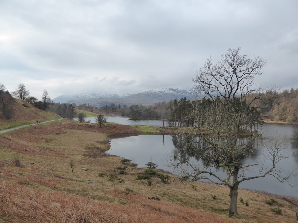
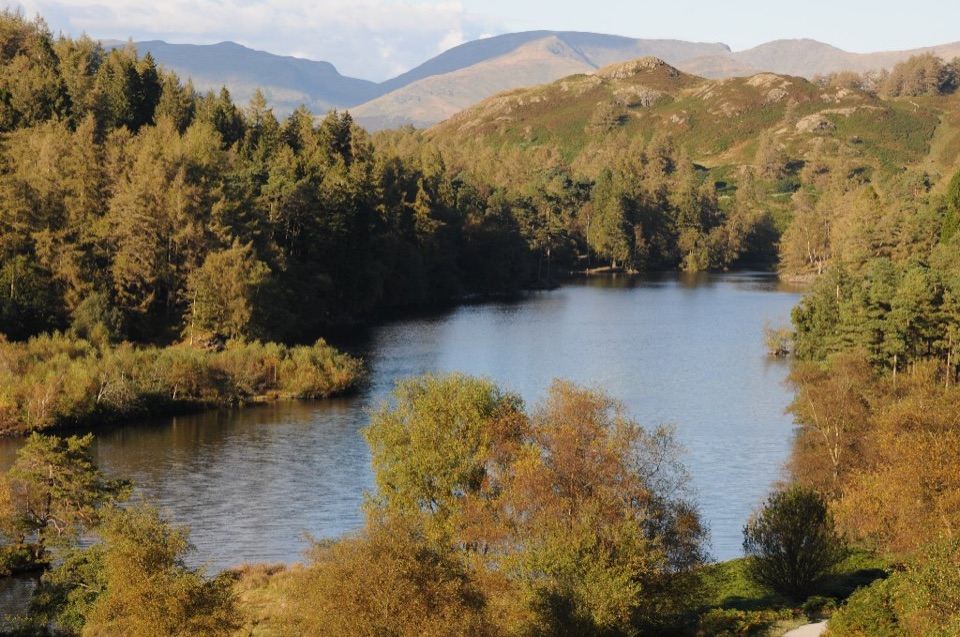
The payoff here is water and setting rather than a summit view: a wooded ravine with falls, then the open tarn. Tarn Hows is a designed Victorian landscape, created by damming the outflow of Tarn Moss, which is why it feels more composed than a natural fell tarn.

Terrain and safetyThe woodland ascent is steep and uneven, with scrambling over rock and sections of path close…

The woodland ascent is steep and uneven, with scrambling over rock and sections of path close to steep drops. Wet weather makes the rock and roots genuinely slippery and raises the risk on the exposed edges. This is not a gentle tarn stroll, and it is not suitable for novice fell walkers or anyone with limited mobility. Wear boots with grip and take your time on the climb.

DogsDogs are welcome, but must be kept on leads for the whole route.

Dogs are welcome, but must be kept on leads for the whole route. Bear in mind the scrambles and the field section with grazing sheep when deciding whether your dog will enjoy it.

Parking and accessStart from the Glen Mary Bridge National Trust car park near Tom Gill, grid reference SD321998.

Start from the Glen Mary Bridge National Trust car park near Tom Gill, grid reference SD321998. The National Trust operates it as pay and display, and it is free for members. Begin here rather than at the Tarn Hows car park, since starting at the tarn skips the gill climb that defines this walk.

Tradeoffs to weighYou get a lot of scenery for a short distance, and that is the main appeal.

You get a lot of scenery for a short distance, and that is the main appeal. The costs are a technical opening climb that is harder than the mileage suggests, and a return that mixes a road section with gates, field edges and uneven ground rather than staying on trail. If you want a longer day around the tarn or up onto Tom Heights, that is a different and more substantial outing.

Wildlife

Wildlife in Lake District

All Lake District wildlife maps

Sighting maps show where each species has been reported across Lake District. Wildlife moves, so no sighting is guaranteed.

Keep exploring

Near Tom Gill to Tarn Hows Walk

See it all on the map

Trails that start nearby

Places near the trailhead

Parkwolf’s Lake District ranking

Top-rated trails in Lake District

All 265 trails
  1. 1Scafell Pike via Hollow Stones from WasdaleChallenging · 9 km
  2. 2Helvellyn via Striding Edge and Swirral EdgeChallenging · 12.4 km
  3. 3CatbellsModerate · 6.6 km
  4. 4The Old Man of ConistonChallenging · 9 km
  5. 5Buttermere CircularEasy · 7.6 km
  6. 6The Fairfield HorseshoeChallenging · 17.2 km

Take Parkwolf to Lake District.

The audio tour guide for the drive, plus offline maps, trails, and wildlife heatmaps for when the signal drops.

4.7 from 8,600+ ratings

Download Parkwolf on the App StoreGet Parkwolf on Google Play